Wandelkaart South Africa: Cape Point and Simon's Town & Fish Hoek | Slingsby Maps

0
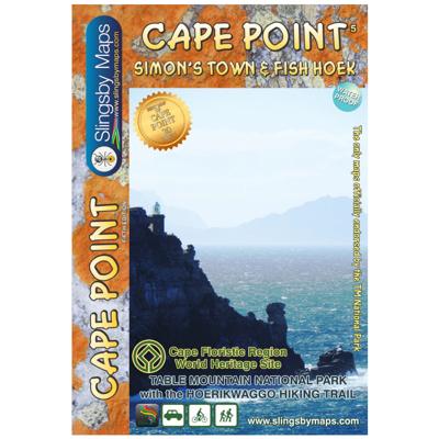
This is map three in our three-map series of Table Mountain National Park. Waterproof and tear resistant in plastic sleeve.   This brand new, fully redrawn and highly detailed map shows all approved paths and includes full GPS information for this historically-fascinating hiking area. The double-sided map with Cape Point on one side and Simon’s To...

Verkopers met dit product

Verkoper
Bezorging
Prijs
DeZwerver.nl logo
DeZwerver.nl
2,95
29,95

Anderen bekeken ook

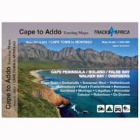
Wegenkaart - landkaart SC1-SC2 Cape Town to Montagu | Tracks4Africa
We start in Cape Town in the west and move along the southern coast through the Overberg, Winelands, Garden Route, Klein Karoo R62, Baviaanskloof to eventually arrive in the Addo National Park up to Gqeberha (Port Elizabeth) in the east.   The maps are highly detailed and well researched. Our map scale is 1:200 000 which allows us to show a lot of detail including minor gravel roads, hiking trails, farm boundaries and points of interest which are relevant to self-drive tourists.   The size of the paper is kept small enough to allow this to be the perfect road tripping map. We use Duraflex paper and print two maps per sheet of A1 paper, making this a four-sheet series. Each map sheet is individually packed in a plastic protective sleeve.   The maps are perfect for day drives, overlanding or just doing road trips in your sedan, 4WD or motorbike along our beautiful southern coast, Klein Karoo and parts of the proper Karoo. Mountain passes form a prominent feature in this area, and these …
29,95
Wegenkaart - landkaart South Africa: Day Drives from Cape Town | Slingsby Maps
Our Day Drives from Cape Town map is the most comprehensive map available of the heartland of the Western Cape. The map shows all the roads, towns and relief of the area from Cape Town north to Citrus- dal, north-east to Laingsburg and east to Stilbaai / Albertinia: all destinations within easy motoring reach of Cape Town.   The most important tourist features are included, with ‘smiling faces’ indicating the most scenic routes. This is a popular general guide.   Waterproof and tear resistant in plastic sleeve.
29,95
Wegenkaart - landkaart SC3-SC4 Swellendam to Mossel Bay | Tracks4Africa
The Cape to Addo map series covers the southern parts of the Western Cape of South Africa in a series of eight highly detailed maps, printed on four sheets of A1 durable paper.   We start in Cape Town in the west and move along the southern coast through the Overberg, Winelands, Garden Route, Klein Karoo R62, Baviaanskloof to eventually arrive in the Addo National Park up to Gqeberha (Port Elizabeth) in the east.   The maps are highly detailed and well researched. Our map scale is 1:200 000 which allows us to show a lot of detail including minor gravel roads, hiking trails, farm boundaries and points of interest which are relevant to self-drive tourists.   The size of the paper is kept small enough to allow this to be the perfect road tripping map. We use Duraflex paper and print two maps per sheet of A1 paper, making this a four-sheet series. Each map sheet is individually packed in a plastic protective sleeve.   The maps are perfect for day drives, overlanding or just doing road tri…
29,95
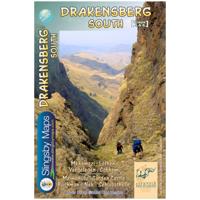
Wandelkaart 5&6 South Africa: Drakensberg South | Slingsby Maps
This double-sided map is the third of three maps in the latest edition of our famous “Slingsby” Drakensberg map series. Side One covers the area from Lotheni southwards through Vergelegen and the Mkhomazi Wilderness to the Sani Pass and Cobham. Side Two continues southwards through the Mzimkhulu Wilderness to Garden Castle, and from there to Bushman’s Nek and the Sehlabathebe National Park.   The map is printed on Duraflex waterproof material, tear resistant and is packaged in a plastic pocket.   We can proudly claim that this is the best and most definitive hiking map of the Southern Drakensberg ever produced.
29,95
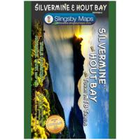
Wandelkaart South Africa: Silvermine & Hout Bay | Slingsby Maps
The map also includes:   The Constantia Winelands All sections of the Hoerikwaggo Trail are shown All approved paths, with detailed DDMMSS GPS coordinates for major junctions, are clearly marked with distances and approximate times for each path section 10 metre contours and delicate colour height shading bring the topography to life Additional info:   Silvermine and Hout Bay areas of the Cape Peninsula at 1:20,000 on a double-sided map printed on water-proof and tear-resistant synthetic paper.   The title is part of a series of high quality, detailed walking maps from Slingsby Maps, with excellent cartog- raphy and plenty of tourist information.   Contour lines are drawn at 10m intervals with additional altitude colouring. Roads indicate restricted access. Footpaths are highlighted and show waymarked routes and sections not recommended or dangerous. Sym- bols indicate information for visitors to the area: car parks, view points, signposts, public toilets, picnic areas, places of inte…
29,95
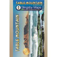
Wandelkaart South Africa: Table Mountain | Slingsby Maps
This highly detailed map shows all approved paths on the mountain and includes full GPS information. The map shows the Hoerikwaggo and the Peoples Trail, and covers the area from Signal Hill to Devils Peak and Llandudno to Constantia Nek and the Vlakkenberg Plateau. This is the only map of the mountain endorsed by the Table Mountain National Park, and approved by the Mountain Club of South Africa.   Distances and estimated times shown for all paths above the Contour Path or Pipe Track Long/Lat grid at 10" intervals as well as the 200 metre square UTM grid; Completely revised vegetation distribution Some vanished paths removed; some new ones added Three Firs, Oudekraal Ravine and Constantia Corner routes upgraded; Clearer depiction of many features, including dangerous routes All approved paths, with DD MM SS GPS coordinates for major junctions 10 metre contours & delicate colour height shading bring the topography to life Forty quality photos of the most prominent mountain flow…
29,95
Reisgids Cape Town, Winelands & Garden Route - Kaapstad | Rough Guides
Zeer goede reisgids voor zowel de georganiseerde maar vooral voor de zelfstandige reiziger. Boordevol informatie over reizen, slapen, eten, maar ook musea en cultuur. Voor veel landen meestal completer en beter dan de Lonely Planet! This Cape Town, the Winelands & the Garden Route guidebook is perfect for independent travellers planning a longer trip. It features all of the must-see sights and a wide range of off-the-beaten-track places. It also provides detailed practical information on preparing for a trip and what to do on the ground. And this Cape Town, the Winelands & the Garden Route travel guidebook is printed on paper from responsible sources, and verified to meet the FSC's strict environmental and social standards.   This Cape Town, the Winelands & the Garden Route guidebook covers: The City Centre; V&A Waterfront, Robben Island and De Waterkant; Table Mountain and the City Bowl, Southern Suburbs and Cape Flats; Atlantic seaboard; The False Bay seaboard to Cape Point; The Win…
22,50
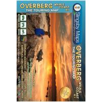
Wegenkaart - landkaart South Africa: Overberg Whale Coast | Slingsby Maps
The Overberg is one of the premier tourist regions of South Africa. Here the Cape Fold Mountains march eastward from Sir Lowry’s Pass, a rugged backdrop to this old Cape landscape of farmsteads, gravel passes and unspoiled views. Delightful towns await you – historic Swellendam, McGregor and the wine farms of the Bonnievale valley, Hermanus and the fishing villages beyond. Missions, beaches littered with shipwreck sites, whales trolling the surf — all kinds of wonders await you!   This double sided, full-relief map covers the whole of the official Overberg Tourism Region.   Side one extends from Somerset West along the coast to Cape Hangklip, Hermanus thence to Cape Agulhas and on eastwards to Port Beaufort/Witsand and the Breede River, then north to Heidelberg, Barrydale and Montagu. From Robertson the map extends west to Villiersdorp and back to Stellenbosch.   Side two includes enlarged inset maps of 24 of the larger towns in the region, at the greatly-enlarged scale of 1:25 000, o…
29,95
Wandelkaart 1&2 South Africa: Drakensberg North | Slingsby Maps
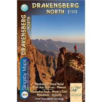
DRAKENSBERG NORTH: This double-sided A1-sized map is the first of three maps in the latest edition of our famous “Slingsby” Drakensberg map series. Side One covers the area from Mpokelana through Royal Natal to the dramatic Mnweni area, while Side Two details the ever-popular section of the Maloti-Drakensberg Park that includes Cathedral Peak, Didima, Monk’s Cowl and Injesuthi.   The map is printed on Duraflex waterproof material, tear resistant and is packaged in a plastic pocket.   We can proudly claim that this is the best and most definitive hiking map of the Northern Drakensberg ever produced.
29,95

Klanten-reviews van Wandelkaart South Africa: Cape Point and Simon's Town & Fish Hoek | Slingsby Maps

Er zijn nog geen beoordelingen voor dit productBen jij de eerste die een review plaatst?

Meer over Wandelkaart South Africa: Cape Point and Simon's Town & Fish Hoek | Slingsby Maps

Productomschrijving

This is map three in our three-map series of Table Mountain National Park. Waterproof and tear resistant in plastic sleeve.   This brand new, fully redrawn and highly detailed map shows all approved paths and includes full GPS information for this historically-fascinating hiking area. The double-sided map with Cape Point on one side and Simon’s Town (including Kommetjie, Glencairn, Fish Hoek and Kalk Bay) on the reverse also highlights the Hoerikwaggo Trail.   The Cape Point side includes the whole Cape Point Nature Reserve: the area south of Miller’s Point and Klaasjagers all the way to Cape Point and the Cape of Good Hope.   The Simon’s Town side covers the area from Kommetjie to Fish Hoek/Kalk Bay and south to Glencairn, Simon’s Town and Miller’s Point, and west to Red Hill, Scarborough and Witsand.

Verken gerelateerde categorieën

Webshop.nl maakt gebruik van cookies. Ga je verder op onze website, ga dan akkoord met het plaatsen van cookies en de verwerking van deze data door ons en vermelde partners.