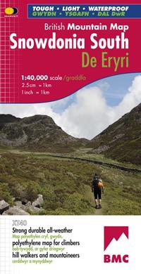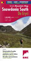
Wandelkaart Snowdonia Zuid | Harvey Maps

0
"The 1:40,000 scale used by British Mountain Maps is excellent for hill walking. These maps provide clear, detailed information." Sir Chris Bonington, mountaineer.   The key mountains of Southern Snowdonia on one map at 1:40,000 scale.   Includes Cadair Idris, the Arans and Arenig Fawr.   Snowdonia South is the latest title in the highly successfu...

Verkopers met dit product

Verkoper
Bezorging
Prijs
DeZwerver.nl logo
DeZwerver.nl
2,95
29,95

Anderen bekeken ook

Wandelkaart Snowdonia Zuid | Harvey Maps
"The 1:40,000 scale used by British Mountain Maps is excellent for hill walking. These maps provide clear, detailed information." Sir Chris Bonington, mountaineer.   The key mountains of Southern Snowdonia on one map at 1:40,000 scale.   Includes Cadair Idris, the Arans and Arenig Fawr.   Snowdonia South is the latest title in the highly successful and innovative British Mountain Map series. It adjoins existing title, Snowdonia and covers the very popular Cadair Idris, the Rhinogs, the Arans and Arenig Fawr. Printed on polyethylene this map is durable, tearproof and 100% waterproof. Colour shading is used for easy identification of the hills and valleys. The map is also less than half of the weight of a laminated map. The reverse side of the map includes a map extension south to Aberdovey, a geological map, mountain incident, first aid and navigation advice. Local phone numbers and website addresses are also listed.
29,95
Wandelkaart Snowdonia Noord | Harvey Maps
"The 1:40,000 scale used by British Mountain Maps is excellent for hill walking. These maps provide clear, detailed information." Sir Chris Bonington, mountaineer.   Snowdonia's key mountains on a single map.   Enlargements of Snowdon and Tryfan.   This map covers Snowdonia's key mountains on a single map. Colour shading is used for easy identification of the hills and valleys and the text is bi-lingual in Welsh and English. The reverse side of the map includes detailed 1:20,000 enlargements of Snowdon & Tryfan, a geological map of the area, mountain incident and first aid advice and useful local phone numbers and website addresses.
29,95
Wandelkaart Snowdonia Noord /Snowdon,Glyders,Carnedds | Harvey Maps
New Revised Edition and Format. More than a map, an essential piece of equipment this new generation HARVEY Superwalker is designed to be the most practical tool for navigation outdoors. The format gives more mapping on the sheet without making the map heavy and bulky. The fold has been developed to allow you to open directly to any part, and either side of the sheet easily, no more struggling in the wind. The Superwalker XT25 is based on original HARVEY mapping with all the information a walker would expect on a map at 1:25,000 scale. Walls and fences on farmland are now shown. The clarity of the mapping has been improved to enable more people to read it without their glasses. The map is uncluttered by information irrelevant to the walker.All the Welsh 3000ft mountains on one sheet, rights of way shown, opens directly to either side of the sheet. Experience the satisfaction of fine navigation with the Superwalker XT25, printed on our 100% waterproof and almost indestructible paper, w…
24,95
Wandelgids Snowdonia Way | Cicerone
Een beschrijving van de Snowdonia Way, goede beschrijving met gedetailleerd kaartmateriaal..Ook praktische informatie en hoogteprofielen per etappe.   This guidebook describes the Snowdonia Way in Wales, a long-distance route through Snowdonia National Park from Machynlleth to Conwy. A low-level route of 97 miles (in 6 stages of between 13 and 21 miles) passes through the heart of Snowdonia’s stunning mountain scenery and includes Pass of Aberglaslyn, Ogwen Valley and Aber Falls. It is suitable for walkers of average fitness and stamina, though days are long. An alternative mountain route covers 122 miles in 9 stages of 12–18 miles giving a spectacular journey over the most famous peaks such as Cadair Idris, Snowdon and Glyders. The high-level route is more physically challenging and requires good navigation skills. Full route descriptions for each stage are accompanied by OS maps and profiles. The guide also includes lists of accommodation and transport providers and a table of facil…
20,95
Wandelgids Great Mountain Days in Snowdonia | Cicerone
Een gids voor 40 geweldige bergwandelingen en klautertochten in Snowdonia. De inspirerende routes in dit groter formaat boek bevinden zich over het hele Snowdonia Nationaal Park en zijn onderverdeeld in 8 geografische regio's: Snowdon en Moel Eilio, de Glyderau, de Carneddau, Eifionydd, Siabod en de Moelwynion, Rhin A guidebook to 40 great mountain walks and scrambles in Snowdonia. The inspirational routes in this larger format book range right across the Snowdonia National Park and are divided into 8 geographical regions: Snowdon and Moel Eilio, the Glyderau, the Carneddau, Eifionydd, Siabod and the Moelwynion, Rhinogydd (the Harlech Dome), Migneint and the Arans and Cadair Idris and the Tarrens. All routes are graded, from moderate to strenuous, and illustrated with Harvey map extracts, topo diagrams by Mark Richards and lots of stunning photographs. Some routes include mild scrambling or long days in rugged country, and many can be enjoyed all year round. The walks have been chosen…
26,50

Klanten-reviews van Wandelkaart Snowdonia Zuid | Harvey Maps

Er zijn nog geen beoordelingen voor dit productBen jij de eerste die een review plaatst?

Meer over Wandelkaart Snowdonia Zuid | Harvey Maps

Productomschrijving

"The 1:40,000 scale used by British Mountain Maps is excellent for hill walking. These maps provide clear, detailed information." Sir Chris Bonington, mountaineer.   The key mountains of Southern Snowdonia on one map at 1:40,000 scale.   Includes Cadair Idris, the Arans and Arenig Fawr.   Snowdonia South is the latest title in the highly successful and innovative British Mountain Map series. It adjoins existing title, Snowdonia and covers the very popular Cadair Idris, the Rhinogs, the Arans and Arenig Fawr. Printed on polyethylene this map is durable, tearproof and 100% waterproof. Colour shading is used for easy identification of the hills and valleys. The map is also less than half of the weight of a laminated map. The reverse side of the map includes a map extension south to Aberdovey, a geological map, mountain incident, first aid and navigation advice. Local phone numbers and website addresses are also listed.

Productinformatie

    Verken gerelateerde categorieën

    Webshop.nl maakt gebruik van cookies. Ga je verder op onze website, ga dan akkoord met het plaatsen van cookies en de verwerking van deze data door ons en vermelde partners.