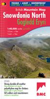
Wandelkaart Snowdonia Noord | Harvey Maps

0
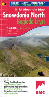
"The 1:40,000 scale used by British Mountain Maps is excellent for hill walking. These maps provide clear, detailed information." Sir Chris Bonington, mountaineer.   Snowdonia's key mountains on a single map.   Enlargements of Snowdon and Tryfan.   This map covers Snowdonia's key mountains on a single map. Colour shading is used for easy identific...

Verkopers met dit product

Verkoper
Bezorging
Prijs
DeZwerver.nl logo
DeZwerver.nl
2,95
29,95

Anderen bekeken ook

Nieuw
Wandelkaart Snowdonia Zuid | Harvey Maps
"The 1:40,000 scale used by British Mountain Maps is excellent for hill walking. These maps provide clear, detailed information." Sir Chris Bonington, mountaineer.   The key mountains of Southern Snowdonia on one map at 1:40,000 scale.   Includes Cadair Idris, the Arans and Arenig Fawr.   Snowdonia South is the latest title in the highly successful and innovative British Mountain Map series. It adjoins existing title, Snowdonia and covers the very popular Cadair Idris, the Rhinogs, the Arans and Arenig Fawr. Printed on polyethylene this map is durable, tearproof and 100% waterproof. Colour shading is used for easy identification of the hills and valleys. The map is also less than half of the weight of a laminated map. The reverse side of the map includes a map extension south to Aberdovey, a geological map, mountain incident, first aid and navigation advice. Local phone numbers and website addresses are also listed.
29,95
Wandelkaart Lake District | Harvey Maps
"The best Lake District map I have ever seen. The 1:40,000 scale provides clear, detailed information to one of the most popular hill walking areas in Britain." Sir Chris Bonington, mountaineer. A new generation of tough polyethylene maps. These maps are a leap forward in technical excellence. Tough, durable and 100% waterproof they are compact - not the great bulky package you get with a laminated map - and light to carry. This all weather British Mountain Map for climbers, hill wallkers, mountaineers and mountain bikers is published by HARVEY in co-operation with the British Mountaineering Council. The Lake District's famous mountains and fells on a single map, colour shading for easy identification of hills and valleys and detailed crag information for climbers. The reverse side of the map includes detailed 1:20000 enlargements of Scafell, Gable, Bowfell, Langdale Pikes and Pillar, a Geological map of the Lake District, mountain incident and first aid advice.
31,95
Nieuw
Wandelkaart Thames Path | Harvey Maps
Mooie, duidelijke kaart van het Thames Path in Engeland. Geplastificeerd met veel extra informatie en uitsnedes van de route.   Thames Path National Trail   The Thames Path follows the banks of the river for 184 miles (294KM) from the flood barrier at Woolwich in South East London to Kemble Gloucestershire. It is a long distance walking route, most of it cannot be cycled. The Trail passes through water meadows, historic towns & lovely villages. The path is flat which makes for easy walking. Jos Joslin National Trails Manager (Marketing & Projects) said of this map "Really beneficial to have the whole length of the Thames Path upstream of London on just one map. Clear mapping and useful information makes this a very practical map"   XT40 New generation of tough polyethylene maps   The HARVEY series of Long Distance Route maps is an established success. Now the advanced technology used in the creation of our best-selling British Mountain Maps is also applied to the route maps.   These m…
25,95
Wandelkaart Rob Roy Way | Harvey Maps
Mooie, duidelijke kaart van de Rob Roy Way in Schotland. Geplastificeerd met veel extra informatie en uitsnedes van de route.    One of Scotland's Great Trails   Rob Roy Way is a walk across part of the Southern Highlands of Scotland taking in some of the most beautiful countryside in the UK. Starting from Drymen it goes north east to finish in Pitlochry. The Way is 77mls or 94 mls (124Km or 151Km) depending on your route choice. The tracks and paths you follow were used by Rob RoyMacGregor in the 17th & 18th centuries, other historical characters throughout the Jacobite uprisings and during the feuds between the local clans. Places you will pass through include Aberfoyle, Callander, Strathyre, Killin or Amulree and Aberfeldy. Lochs you will walk along include Venachar, Lubnaig and Tay passing by Ben Ledi, Ben Chonzie and Ben Lawers.   XT40 New generation of tough polyethylene maps   The HARVEY series of Long Distance Route maps is an established success. Now the advanced technology u…
25,95
Wandelgids Snowdonia | Rockfax
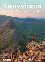
This new book by Mark Reeves covers all the best mountain walks and scrambles in and around the Snowdonia area. The coverage is done in full Rockfax style with bigh overview photos, precise route descriptions and detailsed maps. It also has an extensive introduction covering some of the basic skills required for scrambling, route planning and navigation.The walks start from basic routes up to the summit of Snowdon like the Llanberis Path. The main information is focussed on the multitude of scrambling possibilities which range from long link-ups like the Snowdon Horshoe, steady ridges like Bristly Ridge and full rock climbs like Grooved Arete on the East Face of Tryfan. The walks are covered with a map, description and sometimes an overview photograph. The scrambles mostly have detailed overview photographs, descriptions and approach maps. The harder scrambles and climbs all have detailed description and photo topos.
34,95
Nieuw
Wandelkaart Dartmoor | Harvey Maps
"This inspiring new map will help walkers and climbers explore Dartmoor's wild granite landscapes, and, like the granite, is virtually indestructible." Sir Ranulph Fiennes, adventurer and explorer.   Dartmoor, the latest title in the highly successful and innovative British Mountain Map series, is the only really detailed map for walking to cover this famous area on one sheet. XT40 - A new generation of tough polyethylene maps. These maps are a leap forward in technical excellence. Tough, durable, and 100% waterproof, they are compact - not the great bulky package you get with a laminated map - and light to carry. This all - weather British Mountain Map for climbers, hill - walkers, mountaineers and mountain bikers is published by HARVEY in co-operation with the British Mountaineering Council. The colourful geological map on the back gives understanding of the land form and was specially designed by the British Geological Survey. Colour shading is also used for easy identification of …
29,95
Nieuw
Wandelkaart Knoydart / Kintail & Glen Affric | Harvey Maps
"Clarity is the hallmark of this map. It covers magnificently honed peaks set above western seas and lochs, inviting exploration of one of Scotland's superlative and remote mountain regions", the late Irvine Butterfield, author of The High Mountains.   Detailed map of ‘Britain's last wilderness’ at 1:40,000 scale.   Includes Kintail and Glen Affric.   Detailed crag information for climbers.   Includes 43 Munros, 21 Corbetts and 7 Grahams.   Knoydart & Kintail, seventh in this highly successful & innovative British Mountain Map series, is a long awaited title. It is the only detailed map to cover this famous wilderness area on one sheet. This all weather map for climbers, hillwalkers, mountaineers & mountain bikers includes 43 Munros & 21 Corbetts. It is printed on polyethylene which is durable, tearproof & 100% waterproof. Colour shading is used for easy identification of hills & valleys & the map weighs less than half the weight of a laminated map. There is also an extension covering…
29,95
Nieuw
Wandelkaart Torridon & Fisherfield | Harvey Maps
"HARVEY British Mountain Maps are a joy to use. The detail and accuracy make them my first choice when I am researching a route or just out on the hills for fun". Peter Macfarlane, outdoor writer and photographer.   Detailed map of the giants of Torridon and the remote hills of Fisherfield on one sheet at 1:40,000 scale.   Summit enlargements of Beinn Alligin, Beinn Eighe, Liathach and An Teallach.   Includes 18 Munros, 12 Corbetts and 9 Grahams.     The giants of Torridon and the remote hills of Fisherfields on one sheet. The map area includes 18 Munros and 12 Corbetts. There are also 1:15000 enlargements of An Teallach, Beinn Alligin, Beinn Eighe and Liathach on the reverse. Climbing crags are highlighted and climbing crag route diagrams are also included. Harvey British Mountain maps are a joy to use. The detail and accuracy make them my first choice when I am researching a route or out on the hills.
29,95
Nieuw
Wandelgids Mountain walking Snowdonia | Cicerone
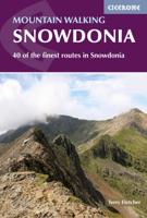
Uitstekende wandelgids voor dit uitdagende wandelgebied in Wales. 38 dagtochten en een tweedaagse tocht. This guidebook describes 40 day walks exploring Snowdonia. It showcases some of the best mountain walks in the area, with routes up Snowdon and Tryfan alongside other classic peaks like Y Garn, Cadair Idris and the Glyders. Routes are graded easy to strenuous and include airy and pulse-quickening scrambles such as Crib Goch and Bristly Ridge as well as the Snowdon Horseshoe, the Nantlle Ridge and a 2-day traverse of all 15 of Snowdon’s peaks over 3000ft.   Walks range in distance from 4 miles (6km) to 16 miles (26km). Clear route descriptions are accompanied by OS mapping, and for each walk there is key information about distance, grade, ascent, terrain, access and parking. With useful advice on where to stay and when to go, and an English-Welsh glossary, this book is an invaluable guide to discovering both the popular and less well-trodden corners of Snowdonia.   Snowdonia can jus…
23,50
Nieuw
Wandelkaart Dark Peak | Harvey Maps
"The 1:40,000 scale used by British Mountain Maps is excellent for hill walking. These maps provide clear, detailed information." Sir Chris Bonington, mountaineer.   Detailed map of the Dark Peak’s famous Moorland Hills and Edges on a single sheet at 1:40,000 scale.   Detailed enlargement of the Kinder plateau. Map extension to Marsden.   As used by Woodhead Mountain Rescue Team.   Tough, durable & 100% waterproof these virtually indestructible maps cover Dark Peak's moorland fells & edges on a single map. Colour shading for easy identification of hill's and valleys makes this the only map you will need to walk in the Peak District. There is also a detailed enlargement of the Kinder plateau on the reverse of the map as well as a geological map. Useful tips, phone numbers etc are also included.
29,95

Klanten-reviews van Wandelkaart Snowdonia Noord | Harvey Maps

Er zijn nog geen beoordelingen voor dit productBen jij de eerste die een review plaatst?

Meer over Wandelkaart Snowdonia Noord | Harvey Maps

Productomschrijving

"The 1:40,000 scale used by British Mountain Maps is excellent for hill walking. These maps provide clear, detailed information." Sir Chris Bonington, mountaineer.   Snowdonia's key mountains on a single map.   Enlargements of Snowdon and Tryfan.   This map covers Snowdonia's key mountains on a single map. Colour shading is used for easy identification of the hills and valleys and the text is bi-lingual in Welsh and English. The reverse side of the map includes detailed 1:20,000 enlargements of Snowdon & Tryfan, a geological map of the area, mountain incident and first aid advice and useful local phone numbers and website addresses.

Verken gerelateerde categorieën

Webshop.nl maakt gebruik van cookies. Ga je verder op onze website, ga dan akkoord met het plaatsen van cookies en de verwerking van deze data door ons en vermelde partners.