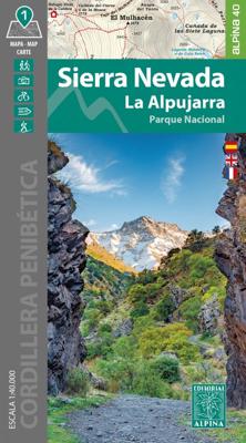
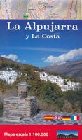
Wandelkaart Sierra Nevada en Alpujarras | Editorial Alpina

0
Goede wandelkaart van dit gebied met alle noodzakelijke informatie als berghutten, campings. Kleurgebruik vrij fel, waardoor hoogtes goed uitkomen. Wandelroutes zijn ingetekend en de GR paden (doorgaande wandelpaden) zijn weergegeven met een teken of nummer. Coordinaten zijn weergegeven, dus GPS compatible met UTM grid Gebied: De Alpujarras staan ...

Verkopers met dit product

Verkoper
Bezorging
Prijs
DeZwerver.nl logo
DeZwerver.nl
2,95
16,95

Anderen bekeken ook

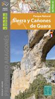
Wandelkaart 11 Sierra y Cañones de Guara, Canyons National Park | Editorial Alpina
Zeer gedetailleerde wandelkaart van een klein gebied. Met ingetekende wandelroutes en andere informatie. Spaanstalig, maar uitstekende kaart. Coordinaten zijn weergegeven, dus GPS compatible met UTM grid.    Op de topografische wandelkaart worden o.a. berghutten, campings aangeduid en hoogtelijnen, ingetekende wandelroutes en de GR paden (doorgaande langeafstandswandelpaden). De kaart is inclusief een Spaanstalig boekje met extra informatie over aanwezige voorzieningen en enkele routes.   Gebied: Huesca, Urriales, Bárcabo, Alquézar, Buera, Adahuesca, Salas Altas, Ibieca, Bastarás, Chibluco, Pedruel, Otín, Lúsera, Arguis, Lúsera, Nueno, Igriés, Loporzano, Chibluco, Bara, Nocito, Used, Tozal de Guara, Tozal de la Cabeza A topographic tourist map and hiking guide with details of tourist attractions, hiking & sporting activities as well as transport information. An excellent folded map & booklet. Sierra de Guara in an extensive and very popular series of walking maps from Editorial Alpina…
19,95
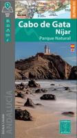
Wandelkaart Cabo de Gata / Nijar | Editorial Alpina
Zeer gedetailleerde wandelkaart van een klein gebied. Met ingetekende wandelroutes en andere informatie. Spaanstalig, maar uitstekende kaart. Coordinaten zijn weergegeven, dus GPS compatible met UTM grid.    Op de topografische wandelkaart worden o.a. berghutten, campings aangeduid en hoogtelijnen, ingetekende wandelroutes en de GR paden (doorgaande langeafstandswandelpaden).  Cabo da Gata-Níjar Natural Park in an extensive and very popular series of walking maps from Editorial Alpina covering the Pyrenees, Catalonia and other selected hiking areas in Spain, including Picos de Europa, Sierra Nevada and parts of Andalucía, Majorca, etc. Scales vary from 1:50,000 to 1:10,000, with the majority of the titles at 1:25,000. The maps have contours, usually at 20m or 10m intervals, with additional hill shading and spot heights. An overprint highlights hiking trails, long-distance footpaths, campsites, mountain huts, refuges, etc. Many maps also show climbing sites, potholing caves, mountain b…
17,95
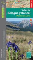
Wandelkaart 02 Valles de Belagua y Roncal | Editorial Alpina
Zeer gedetailleerde wandelkaart van een klein gebied. Met ingetekende wandelroutes en andere informatie. Spaanstalig, maar uitstekende kaart. Coordinaten zijn weergegeven, dus GPS compatible met UTM grid.    Op de topografische wandelkaart worden o.a. berghutten, campings aangeduid en hoogtelijnen, ingetekende wandelroutes en de GR paden (doorgaande langeafstandswandelpaden). De kaart is inclusief een Spaanstalig boekje met extra informatie over aanwezige voorzieningen en enkele routes.   Gebied: Uztarroze / Uztárroz, Izaba / Isaba, Erronkari / Roncal, Zuriza, Bidankoze / Vidángoz, Arette-la-Pierre-Saint-Martin, Puerto de Laza (Pass), Portillo de Ernaz (Pass), Selva de Oza (Waldgebiet), Pena Ezcaurri, Txamantxoia, Pic d'Anie, Mesa de los Tres Reyes, Petrachema, Sierra de Quimboa, Macizo de Larra / Larra-Belagua-Gruppe, Sierra d'Alano.   A topographic tourist map and hiking guide with details of tourist attractions, hiking & sporting activities as well as transport information. An…
16,95
Wandelkaart Tour & Trail Alpujarras | Discovery Walking Guides
Scheur- en watervaste wandelkaart van de Alpujarras met hoogtelijnen en graden. For the best adventures, use the best map. The Moorish white villages of the Alpujarras are well known to day trippers from the Costa del Sol. For walkers this is an idyllic region with stone-laid donkey trails linking the tipico villages and stretching up the southern slopes of the Sierra Nevada to Mulhacen; at 3,483 metres the highest mountain peak on mainland Spain. From Spring to the end of Autumn this is a paradise for hikers, whether you are walking from village to village sampling the local delicacies or tackling the challenging major ascents. One thing you will know is that using the Alpujarras Tour & Trail Map will help you plan, and get the best out of, your adventures.   On a large 960mm by 700mm, double sided, map sheet at 40k scale this map has all the detail you need. 20 and 100 metre contours, combined with altitude shading, giving you a true feel to this impressive landscape.  Stret…
15,95
Wandelgids Walking and trekking in the Sierra Nevada | Cicerone
Uitstekende wandelgids voor de Sierra Nevada. Goed beschreven met veel praktische informatie om de route te kunnen lopen, inclusief redelijke kaarten. Aanbevolen wandelkaarten Wandelkaart NP Sierra Nevada met Alpujarras | Editorial Penibetica 1:40.000 of Wandelkaart Sierra Nevada en Alpujarras | Editorial Alpina - 1:40.000 Wandelkaart Sierra Nevada - la integral de los 3000 | Editorial Piolet 1:25.000   This guidebook presents 33 graded walks and 5 high mountain scrambles in the striking Sierra Nevada, the highest mountain range in mainland Spain and in western Europe outside the Alps. Easily accessible from Granada and Málaga, it is a world of soaring, snow-clad peaks and deep valleys, far removed from the crowded beaches of the Costa del Sol just two hours away. The routes are spread across the national park, with attractive towns and villages such as Trevélez, Lanjarón, Hoya de la Mora and Cumbres Verdes serving as potential bases for a walking holiday.   The walks have been carefu…
20,95
Wandelkaart 24 Vall Fosca - Montsent de Pallars | Editorial Alpina
Zeer gedetailleerde wandelkaart van een klein gebied. Met ingetekende wandelroutes en andere informatie. Spaanstalig, maar uitstekende kaart. Coordinaten zijn weergegeven, dus GPS compatible met UTM grid.    Op de topografische wandelkaart worden o.a. berghutten, campings aangeduid en hoogtelijnen, ingetekende wandelroutes en de GR paden (doorgaande langeafstandswandelpaden). De kaart is inclusief een Spaanstalig boekje met extra informatie over aanwezige voorzieningen en enkele routes.   A topographic tourist map and hiking guide with details of tourist attractions, hiking & sporting activities as well as transport information. An excellent folded map & booklet. Hiking map and guidebook -  Scale: 1:25.000 - Heights of the most interesting spots of the area - Shady relief - UTM grid with divisions of 1 km -Compatible with GPS - Marked routes - Guidebook with hikes, potholing, gully descent, climbing, mountain biking and facts of interest   • Hiking map and guidebook • Scale 1:25.00…
19,95
Wandelkaart NP Sierra Nevada | Editorial Penibetica
Kaart en wandelgids van het Nationaal Park Sierra Nevada (provincie Granada) op schaal 1:40.000. Inclusief de Alpujarra en het markgraafschap Zenete. De gids die bij de kaart hoort, geeft informatie over de ecologie, geografie en geschiedenis van de Sierra Nevada, en praktische informatie over schuilplaatsen, bivaks, campings en interessante telefoonnummers. Het bevat de beschrijving van in totaal wandelroutes, de volledige 3.000, de GR7, de Gr-Sulayr, de Transnevada, track en route en een teledetectiesysteem met QR-code kunnen worden gedownload.   The map covers Alpujarras and Marquesado del Zenete, the western and central parts of the Sierra Nevada range, from just east of Granada to the A337 road crossing the mountains over the Puerto de la Ragua Pass, and shows both the southern and the northern approaches to the peaks.
18,95
Wandelkaart Turbon - Alto Valle de Isabena | Editorial Alpina
Zeer gedetailleerde wandelkaart van een klein gebied. Met ingetekende wandelroutes en andere informatie. Spaanstalig, maar uitstekende kaart. Coordinaten zijn weergegeven, dus GPS compatible met UTM grid.    Op de topografische wandelkaart worden o.a. berghutten, campings aangeduid en hoogtelijnen, ingetekende wandelroutes en de GR paden (doorgaande langeafstandswandelpaden). De kaart is inclusief een Spaanstalig boekje met extra informatie over aanwezige voorzieningen en enkele routes.   Gebied: Villanova, Liri, Chía, Seira, Gabas, Bisaurri, Arasán, Buyelgas, El Run, Urmella, Veri, Las Paules, Ardanué, Denuy, Ardanuy, Barbaruens, Calvera, Llert, Biescas, Bonansa, Egea, Campo, Castillo de El Turbón, Gallinero, Pic de Basibé, Pic de Menada, Cornadelo   A topographic tourist map and hiking guide with details of tourist attractions, hiking & sporting activities as well as transport information. An excellent folded map & booklet. Hiking map and guidebook -  Scale: 1:40.000 - Heights of th…
17,95
Wandelkaart Montserrat | Editorial Alpina
Zeer gedetailleerde wandelkaart van een klein gebied. Met ingetekende wandelroutes en andere informatie. Spaanstalig, maar uitstekende kaart. Coordinaten zijn weergegeven, dus GPS compatible met UTM grid.    Op de topografische wandelkaart worden o.a. berghutten, campings aangeduid en hoogtelijnen, ingetekende wandelroutes en de GR paden (doorgaande langeafstandswandelpaden). De kaart is inclusief een Spaanstalig boekje met extra informatie over aanwezige voorzieningen en enkele routes.   Gebied: el Bruc, Collbató, Monistrol de Montserrat, Monestir de Montserrat / Santa Maria de Montserrat (Kloster), Monestir Santa Cecili, Monestir Sant Benet (Kloster), Miranda de Sant Jeroni / Mt. Sant Jeroni, Cavall Bernat, Coll de Can Maçana (Pass), Cova del Salnitre, Parc Natural de la Muntanya de Montserrat Book Language: Spanish •Hiking map and guidebook •Scale 1:10.000 •Equidistance contours: 10 m distance •Master contours: at 50 m •Shady relief •Compatible with GPS •Marked routes •Land use sym…
15,95
Wandelkaart 42 Costabona | Editorial Alpina
Zeer gedetailleerde wandelkaart van een klein gebied. Met ingetekende wandelroutes en andere informatie. Spaanstalig, maar uitstekende kaart. Coordinaten zijn weergegeven, dus GPS compatible met UTM grid.    Op de topografische wandelkaart worden o.a. berghutten, campings aangeduid en hoogtelijnen, ingetekende wandelroutes en de GR paden (doorgaande langeafstandswandelpaden). De kaart is inclusief een Spaanstalig boekje met extra informatie over aanwezige voorzieningen en enkele routes.   Gebied: Molló, Camprodon, Espinaveell, Fabert, Abella, Tregurà, Setcases, la Presta, els Banys, Feitús, Rocabruna, Beget, Prats de Molló, Costabona, Roca Colom, Puig de la Coma, Puig Cerveris, Puig de Mont-Roig, Pic de la Dona, Pic de Granarois, Puig Sistra, Puig de les Agudes, Puig Moscós   Idiomes: català, español, english • Hiking map and guidebook • Scale 1:25.000 • Equidistance contours: 10 m distance • Master contours: at 50 m • Shady relief • Land use symbolized at three levels • UTM grid wit…
16,95

Klanten-reviews van Wandelkaart Sierra Nevada en Alpujarras | Editorial Alpina

Er zijn nog geen beoordelingen voor dit productBen jij de eerste die een review plaatst?

Meer over Wandelkaart Sierra Nevada en Alpujarras | Editorial Alpina

Productomschrijving

Goede wandelkaart van dit gebied met alle noodzakelijke informatie als berghutten, campings. Kleurgebruik vrij fel, waardoor hoogtes goed uitkomen. Wandelroutes zijn ingetekend en de GR paden (doorgaande wandelpaden) zijn weergegeven met een teken of nummer. Coordinaten zijn weergegeven, dus GPS compatible met UTM grid

Gebied: De Alpujarras staan er op tot en met Trevelez in het oosten. Met Granada, Lanjarrón, Nigüelas, Dúrcal, Restábal, Béznar, Trevélez, Bérchules, Bubíon, Capileira, Almegijar, Cástaras, Pinos del Valle, Dílar, Gójar, Monachil, Órgiva, Güejar-Sierra, Pradollano, Veleta, Mulhacén, La Alcazaba.

New Map of Sierra Nevada at 1:40,000 scale, the most important chain of mountains in the southern Iberian peninsula. It has the highest peaks, as in the case of Mulhacen at 3,479 m, and the peak Veleta which is the third highest at 3396 meters.   The map also includes a significant portion of the region of La Alpujarra. Overall, this area offers immense opportunities for hiking, mountaineering and mountain biking.A topographic tourist map with details of tourist attractions, hiking & sporting activities as well as transport information. An excellent folded map & booklet for the Sierra Nevada. GPS Compatible.  • Scale: 1:40.000 • Heights of the most interesting spots of the area • Shady relief • UTM grid with divisions of 1 km • Compatible with GPS • Marked routes • Guidebook with hikes, potholing, gully descent, climbing, mountain biking and facts of interest

Verken gerelateerde categorieën

Webshop.nl maakt gebruik van cookies. Ga je verder op onze website, ga dan akkoord met het plaatsen van cookies en de verwerking van deze data door ons en vermelde partners.