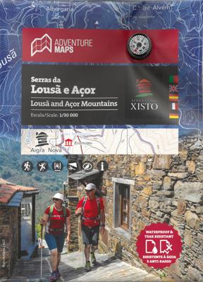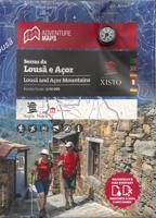
Wandelkaart Serras da Lousa e Acor | Adventure MAPS

0
Prachtige topografische wandelkaart van de Serras da Lousa e Acor.   Schaal: 1:30.000 Legenda en aanvullende informatie PT, EN, ES, FR en DE Magnetisch kompas opgenomen  Net van toeristische paden  Toeristische bezienswaardigheden in de omgeving van de symboliek (monumenten, mooie vergezichten, picknickplaatsen, musea en toeristische kantoren) Kli...

Verkopers met dit product

Verkoper
Bezorging
Prijs
DeZwerver.nl logo
DeZwerver.nl
2,95
23,50

Anderen bekeken ook

Wandelkaart Serras da Lousa e Acor | Adventure MAPS
Prachtige topografische wandelkaart van de Serras da Lousa e Acor.   Schaal: 1:30.000 Legenda en aanvullende informatie PT, EN, ES, FR en DE Magnetisch kompas opgenomen  Net van toeristische paden  Toeristische bezienswaardigheden in de omgeving van de symboliek (monumenten, mooie vergezichten, picknickplaatsen, musea en toeristische kantoren) Klimmen, surfen, duiken, paragliding en de stranden Offset contouren van 10 m Gauss rooster met afdelingen van 1 Km Coördinaten WGS84 (compatibel met GPS) Vertegenwoordiging van magnetische declinatie Printing: Duplex   Topographic map at 1/30 000 scale, subtitled in Portuguese, English, Spanish, French and German, including the entire network of pedestrian paths in the referenced area, tourist attractions such as the Schist Villages, river beaches, bathing areas, waterfalls, campsites, picnic areas, tourist offices, climbing and hang gliding spots, among others.   Schist Villages - Aigra Nova | Aigra Velha |Aldeia das Dez | Benfeita | Candal…
23,50
Wandelkaart Parque Natural da Serra da Estrela | Adventure MAPS
Prachtige topografische kaart van het Nationale park Serra da Estrela in Portugal. Schaal: 1:25000 1/25 (1 cm = 250 meter) Legenda en aanvullende informatie PT, EN, ES, FR en DE Magnetisch kompas opgenomen  Net van toeristische paden (inclusief GR22 en GR33) · Toeristische bezienswaardigheden in de omgeving van de symboliek (monumenten, mooie vergezichten, picknickplaatsen, musea en toeristische kantoren) Klimmen, surfen, duiken, paragliding en de stranden Offset contouren van 10 m Gauss rooster met afdelingen van 1 Km Coördinaten WGS84 (compatibel met GPS) Vertegenwoordiging van magnetische declinatie Printing: Duplex Plaatsen op de kaart Aldeias | Alvôco da Serra | Bouça | Cabeça | Covilhã | Folgosinho | Gouveia | Lapa dos Dinheiros | Loriga | Mangualde da Serra | Manteigas | Melo | Nabais | Penhas da Saúde | Penhas Douradas | S.Romão | Sabugueiro | Sameiro | Sazes da Beira | Seia | Unhais da Serra | Vale do Rossim | Valezim | Vila Cova-à-Coelheira
23,50
Wandelkaart Parque Natural do Sudoeste Alentejano e Costa Vicentina | Adventure MAPS
Prachtige tweezijdige topografische kaart van een groot deel van de zuidwest kust van Portugal, een westelijk stuk van de Alrgarve en de Ruta Vicentina. Veel details op topografisch gebied, ingetekende wandelroutes maar ook toeristische informatie als stranden, campings en jeugdherbergen Schaal: 1:50.000 Legenda en aanvullende informatie over PT, EN, ES, FR en DE Magnetisch kompas opgenomen  Paths, GR(Long Distance Path) and PR(Short Distance Path) includes GR11-E9 (Rota Vicentina) and GR13-E4 ( Via Algarviana)     Toeristische bezienswaardigheden in de omgeving van de symboliek (monumenten, mooie vergezichten, picknickplaatsen, musea en toeristische kantoren) Klimmen, surfen, duiken, paragliding en de stranden Offset contouren van 10 m Gauss rooster met afdelingen van 1 Km Coördinaten WGS84 (compatibel met GPS) Vertegenwoordiging van magnetische declinatie Afmetingen: 66cmx80cm Printing: Duplex Plaatsen op de kaart Aljezur | Almograve | Barão de S.João | Bensafrim | Borde…
23,50
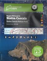
Wandelkaart Parque Natural de Sintra Cascais | Adventure MAPS
Prachtige topografische kaart van het Nationale park Sintra Cascais in Portugal. Schaal: 1:25000 1/25 (1 cm = 250 meter) Legenda en aanvullende informatie over PT, EN, ES, FR en DE Magnetisch kompas opgenomen  Net van toeristische paden (inclusief GR11) · Toeristische bezienswaardigheden in de omgeving van de symboliek (monumenten, mooie vergezichten, picknickplaatsen, musea en toeristische kantoren) Klimmen, surfen, duiken, paragliding en de stranden Offset contouren van 10 m Gauss rooster met afdelingen van 1 Km Coördinaten WGS84 (compatibel met GPS) Vertegenwoordiging van magnetische declinatie Afmetingen: 66cmx80cm Printing: Duplex Plaatsen op de kaart Alcabideche | Almoçageme | Assafora | Cascais | Colares | Estoril | Fontanelas | Magoito | Malveira da Serra | Parede | S.João das Lampas | Sintra | Terrugem
23,50
Wandelkaart Parque Natural Peneda - Geres | Adventure MAPS
Prachtige topografische kaart van het Nationale park Peneda - Geres.   Schaal: 1/50 000 (1 cm = 500 m) Legend en aanvullende informatie over PT, EN, ES, FR en DE Magnetisch kompas opgenomen · Net van toeristische paden (inclusief GR34) Informatie specificeert de "deuren", zoals informatiecentra en de receptie National Park Toeristische bezienswaardigheden in de omgeving met symboliek, zoals Cascades, Panoramisch, picknickplaatsen, musea en toeristische kantoren, enz. Klimmen en Canyoning Offset contouren van 20 m Gauss grid met 2 km divisies Coördinaten WGS84 (compatibel met GPS) Vertegenwoordiging van magnetische declinatie Afmetingen: 96cmx59cm Printing: Duplex Plaatsen op de kaart Arcos de Valdevez | Cabril | Campo do Gerês | Castro Laboreiro | Ermida | Fafião | Gerês | Lamas de Mouro | Lindoso | Lobios | Outeiro | Pitões das Júnias | Ponte da Barca | Sistelo | Soajo | Terras de Bouro | Torém  
23,50
Wandelkaart 3001 Adventure Map trekking map Everest Base Camp | National Geographic
Mooie gedetailleerde topografische kaart, voorzien van veel extra info en gedrukt op water- en scheurvast materiaal. Each Adventure Map is highly detailed, incredibly durable, waterproof and tear-resistant. Stunning shaded relief brings each map to life, giving you the power to discover, plan and dream. Trail routes, villages, cultivated areas, park boundaries and points of interest make these maps essential gear. Each map includes a beautifully crafted map of the Kingdom of Nepal, inset maps of Kathmandu and Thamel, and a comprehensive index of villages, passages and peaks. The very name evokes majesty, mystery and magnificence! Earth's highest peaks soar above, beckoning adventurers to one of the world's most dramatic regions. Includes trail routes, villages, cultivated areas, park boundaries, and points of interest. Printed on waterproof, tear-resistant material that stands up to the rigors of travel. Follow National Geographic to one of the world's most exotic locations with this …
16,50
Wandelkaart 3004 Adventure Map trekkingmap Langtang - Nepal | National Geographic
Each Adventure Map is highly detailed, incredibly durable, waterproof and tear-resistant. Stunning shaded relief brings each map to life, giving you the power to discover, plan and dream. Trail routes, villages, cultivated areas, park boundaries and points of interest make these maps essential gear. Each map includes a beautifully crafted map of the Kingdom of Nepal, inset maps of Kathmandu and Thamel, and a comprehensive index of villages, passages and peaks. Detailed topographic trekking map for Langtang National Park, including coverage for the Shivapuri Watershed, and the Helambu Region. Additional Details: Printed on waterproof, tear-resistant material. Includes detailed place name and locations of useful services. Reverse contains an overview map of the kingdom of Nepal and detailed insets of Kathmandu and Thamel.  
16,50
Wegenkaart - landkaart 3404 Adventure Map Peru | National Geographic
Wegenkaart van Peru met vermelding van veel bezienswaardigheden, nationale parken en attrakties. Watervast en scheurvast. Juist door deze vermeldingen onderscheidt de kaart zich van andere wegenkaarten. National Geographic's Peru Adventure Map is designed to meet the unique needs of adventure travelers—detailed, durable, and accurate. Peru includes the locations of thousands of towns and villages, plus a clearly marked road network complete with distances and designations for highways and roadways. Rough tracks that require four-wheel drive vehicles and paths are included for adventurers seeking to explore more remote regions.   What sets National Geographic Adventure Maps apart from traditional road maps are the hundreds of points of interest that highlight the diverse, unique, and exotic destinations within Peru including World Heritage sites, archeological sites, indigenous areas, churches, museums, and more. Users will find a variety of helpful travel aids on our map as well, incl…
17,50
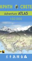
Wandelatlas Adventure Atlas Crete - Kreta | Anavasi
Gedetailleerde atlas van heel Kreta: topografische kaarten met alle noodzakelijke details als hoogtelijnen, kleurschakeringen en bergtoppen. Naast deze kenmerken is ook de E4 ingetekend, een lange afstand wandeling op Kreta van west naar oost. Met symbolen zijn cultuur-historische hoogtepunten ingetekend. Achterin een uitgebreid register. Uitgevoerd in een atlas, harde kaft, A4 formaat. The new ADVENTURE ATLAS of Crete by ANAVASI is the ultimate tool to discover the island. Find all the information you need to go hiking, canyoning, climbing, swimming on beautiful beaches, explore abandoned villages, minoan peak sanctuaries, cave-churches, byzantine and ottoman castles. Whatever you want to visit in Crete you will find it in the 52 plates of this Atlas.  
34,95
Wegenkaart - landkaart 3403 Adventure Map Ecuador & Galapagos | National Geographic
Wegenkaart van Galapagos en Ecuador met vermelding van veel bezienswaardigheden, nationale parken en attrakties. Watervast en scheurvast. Juist door deze vermeldingen onderscheidt de kaart zich van andere wegenkaarten. National Geographic's Ecuador and Galapagos Adventure Map is designed to meet the unique needs of adventure travelers—detailed, durable, and accurate. Ecuador and Galapagos includes the locations of thousands of towns and villages, plus a clearly marked road network complete with distances and designations for highways, roads and more.   What sets National Geographic Adventure Maps apart from traditional road maps are the hundreds of points of interest that highlight the diverse, unique, and exotic destinations within Ecuador and the Galapagos islands including national parks and reserves, World Heritage sites, archeological sites, churches, spas, and more.   The front side of the map shows the southern half of Ecuador including the provinces of Zamora, Chinchipe, Loja,…
17,50

Klanten-reviews van Wandelkaart Serras da Lousa e Acor | Adventure MAPS

Er zijn nog geen beoordelingen voor dit productBen jij de eerste die een review plaatst?

Meer over Wandelkaart Serras da Lousa e Acor | Adventure MAPS

Productomschrijving

Prachtige topografische wandelkaart van de Serras da Lousa e Acor.   Schaal: 1:30.000 Legenda en aanvullende informatie PT, EN, ES, FR en DE Magnetisch kompas opgenomen  Net van toeristische paden  Toeristische bezienswaardigheden in de omgeving van de symboliek (monumenten, mooie vergezichten, picknickplaatsen, musea en toeristische kantoren) Klimmen, surfen, duiken, paragliding en de stranden Offset contouren van 10 m Gauss rooster met afdelingen van 1 Km Coördinaten WGS84 (compatibel met GPS) Vertegenwoordiging van magnetische declinatie Printing: Duplex   Topographic map at 1/30 000 scale, subtitled in Portuguese, English, Spanish, French and German, including the entire network of pedestrian paths in the referenced area, tourist attractions such as the Schist Villages, river beaches, bathing areas, waterfalls, campsites, picnic areas, tourist offices, climbing and hang gliding spots, among others.   Schist Villages - Aigra Nova | Aigra Velha |Aldeia das Dez | Benfeita | Candal | Casal Novo | Cerdeira | Chiqueiro | Comareira | Fajão | Gondramaz | Pena | Talasnal | Vila Cova do Alva   Historic Villages of Portugal - Piódão   Protected Area - Protected Landscape of the Açor Mountains


Productinformatie

    Verken gerelateerde categorieën

    Webshop.nl maakt gebruik van cookies. Ga je verder op onze website, ga dan akkoord met het plaatsen van cookies en de verwerking van deze data door ons en vermelde partners.