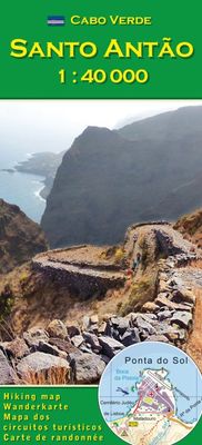
Wandelkaart Santo Antão - Santa Antao | AB Kartenverlag

0
1:40,000 Hiking and walking map of Santo Antao (San Antao, Sint-Antonius) in the Cape Verde Islands. A detailed topographical map with an English keysheet and routes, roads and places of interest shown on the map.    Includes a detailed 1:10,000 map of Cidade do Porto Novo and a number of colour photos on the reverse, showing local places of inter...

Verkopers met dit product

Verkoper
Bezorging
Prijs
DeZwerver.nl logo
DeZwerver.nl
2,95
18,95

Anderen bekeken ook

Wandelkaart Santo Antão - Santa Antao | AB Kartenverlag
1:40,000 Hiking and walking map of Santo Antao (San Antao, Sint-Antonius) in the Cape Verde Islands. A detailed topographical map with an English keysheet and routes, roads and places of interest shown on the map.    Includes a detailed 1:10,000 map of Cidade do Porto Novo and a number of colour photos on the reverse, showing local places of interest, relating to numbered routes described on the map. The descriptions show the average time of the route, the quality of the track (following a description they give), the ascent and total descent.
18,95
Wandelkaart Santiago - Kaapverdische Eilanden | AB Kartenverlag
Santiago Island in the Cape Verde archipelago on a detailed, GPS compatible map at 1:50,000 from AB Kartenverlag, highlighting 33 hiking and mountain bike routes and including small plans of Praia, Tarrafal and Cidade Velha.    The map is double-sided with a very generous overlap between the sides. Contours with relief shading and spot heights present the topography. The map shows the network of local roads, tracks and footpaths. Symbols indicate locations of viewpoints, diving sites and medical facilities.   33 selected walks, from one to five hours long, are highlighted on the map and listed in a table with details of the terrain, altitude, degree of difficulty and suitability as mountain bike routes. Map legend and all the accompanying text include English.   Also included are small plans of Praia, Tarrafal and Cidade Velha, indicating main facilities.
17,95
Wandelkaart Outdoorkarte Madeira - Funchal - Porto Santo | Kümmerly & Frey
Hele goede wandelkaart met alle noodzakelijke topografische details van Madeira met ingetekende routes. De kaart is geplastificeerd, met kleine plattegrond van Funchal. Madeira at 1:40.000 on a contoured, GPS compatible outdoor map from Kümmerly + Frey printed on sturdy waterproof and tear-resistant synthetic paper. The map is double-sided on a more convenient size sheet and includes a street plan of central Funchal, plus coverage of the nearby Islas Desertas and Porto Santo at 1;70,000.   The map divides Madeira east/west with a very generous overlap between the sides. Topography is shown by contours at 20m intervals, enhanced by relief shading and spot heights, plus colouring and/or graphics to indicate different types of terrain and vegetation.. Waymarked hiking trails and footpaths are highlighted by overprint which indicates narrow steep sections. The map also shows cycle routes plus a selection of mountain bike and horse riding trails.   A wide range of symbols indicate various …
13,50
Wandelkaart Route 66 | Collins
Full color, informative map of the famous US Route 66. With detailed mapping, key tourist information and a suggested itinerary, this is a perfect guide for anyone traveling along America’s Route 66.   Main features of this map include:   Clear mapping at a scale of 47 miles to 1 inch / 30 km to 1 cm Tourist route, attractions and places of interest clearly marked Images of top sights along the route accompanied by textual descriptions Suggested itineraries Detailed index of places of interest and place names Essential for those planning an adventure along America’s Route 66.
19,95
Wegenkaart - landkaart 01 Kaapstad - Cape Town and Surrounding Attractions | MapStudio
Het overzicht is soms misschien een beetje onduidelijk. maar de details in de inzetten en delen van de kaart zijn prima en voldoen goed voor het rondrijden met een eigen auto. Double-sided map, with a general road map on one side, plus numerous street plans and descriptions of four special routes on the reverse. The main map covers an area within reach as day trips from Cape Town, extending east to Swellendam and north to Langebaan. Road classification includes unsurfaced roads, intermediate driving distances on main and secondary roads, toll routes with gates, and mountain passes. Railways are shown with local stations. An impression of relief is provided by elevation tinting (perhaps somewhat confusing for regular map users - the higher the altitude, the greener the colour!), spot heights for main peaks, and names of mountain ranges. Nature and forest reserves, plus salt pans and marshes are indicated. Symbols mark local airfields, historical sites, caravan parks, many wine estates,…
16,95
Wandelkaart 17 Banff - Egypt Lake | Gem Trek Maps
Mooie, gedetailleerde kaart uit de serie van Gem Trek Hiking map-guides. Helder kleurgebruik en met de beste / mooiste wandelroutes, hikes en interessante plaatsen erop aangegeven. Gem Trek’s 1:50,000-scale BANFF–EGYPT LAKE MAP covers the most popular hiking trails in the immediate area of the town of Banff in more detail than our Banff & Mount Assiniboine Map.   The Banff–Egypt Lake Map features detailed cartography, accurate hiking trails with distances, and details such as side trips and backcountry campgrounds. For road travellers, it includes viewpoints, picnic areas, and campgrounds.   On the back of the map are trail descriptions of 17 recommended day hikes and four classic multi-day trips, all referenced to the map on the front. Also on the back is a list of trails recommended for early season, birdwatching, wildflowers, waterfalls, expansive views, awe-inspiring scenery, alpine meadows and rainy days. Included are contact numbers for visitor centres and backcountry booki…
17,95

Klanten-reviews van Wandelkaart Santo Antão - Santa Antao | AB Kartenverlag

Er zijn nog geen beoordelingen voor dit productBen jij de eerste die een review plaatst?

Meer over Wandelkaart Santo Antão - Santa Antao | AB Kartenverlag

Productomschrijving

1:40,000 Hiking and walking map of Santo Antao (San Antao, Sint-Antonius) in the Cape Verde Islands. A detailed topographical map with an English keysheet and routes, roads and places of interest shown on the map.    Includes a detailed 1:10,000 map of Cidade do Porto Novo and a number of colour photos on the reverse, showing local places of interest, relating to numbered routes described on the map. The descriptions show the average time of the route, the quality of the track (following a description they give), the ascent and total descent.

Productinformatie

    Verken gerelateerde categorieën

    Webshop.nl maakt gebruik van cookies. Ga je verder op onze website, ga dan akkoord met het plaatsen van cookies en de verwerking van deze data door ons en vermelde partners.