Wandelkaart Route 66 | Collins

0
Full color, informative map of the famous US Route 66. With detailed mapping, key tourist information and a suggested itinerary, this is a perfect guide for anyone traveling along America’s Route 66.   Main features of this map include:   Clear mapping at a scale of 47 miles to 1 inch / 30 km to 1 cm Tourist route, attractions and places of intere...

Verkopers met dit product

Verkoper
Bezorging
Prijs
DeZwerver.nl logo
DeZwerver.nl
niet bekend
19,95

Anderen bekeken ook

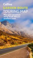
Wegenkaart - landkaart Garden Route | Collins
Full color, informative map of South Africa’s popular Garden Route. With detailed mapping and tourist information, this map is a perfect guide to traveling along the southern coast of South Africa.   Main features of this map include:   Clear comprehensive mapping Tourist routes, attractions and places of interest clearly marked Images of top sights along the route accompanied by textual descriptions Suggested itineraries Detailed index of places of interest and place names Essential for those planning an adventure along South Africa’s Garden Route.
19,95
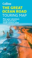
Wegenkaart - landkaart The Great Ocean Road | Collins
Full color, informative map of the popular Great Ocean Road. With detailed mapping, key tourist information and a suggested itinerary, this is a perfect guide for anyone traveling around Australia’s Great Ocean Road   Main features of this map include:   Clear comprehensive mapping Tourist routes, attractions and places of interest clearly marked Images of top sights along the route accompanied by textual descriptions Suggested itineraries Detailed index of places of interest and place names Essential for those planning an adventure along Australia’s Great Ocean Road.
19,95
Wegenkaart - landkaart Pocket Map Wild Atlantic Way | Collins
Handy full-colour map of Ireland’s Wild Atlantic Way with a high level of detail. Clear mapping of the full 2500 km (over 1500 miles) route, showing the road network and places of interest.   Clear, detailed Collins road mapping is presented in a handy format ideal for the pocket or handbag. It is excellent value and very detailed for its size, covering the whole of the Wild Atlantic Way.   Ideal for tourists, locals, hikers and adventurers. Places of interest marked, including famous film locations.   This map includes: • Clear mapping at a scale of 8.7 miles to 1 inch • National Tourist Routes showing best routes through the most scenic areas • Places of interest include film locations such as Star Wars • Tourist and signature locations clearly marked • Suggested itineraries • Detailed place names index • Ideal companion to a sat-nav – it enables route planning and route sense-checking
7,95
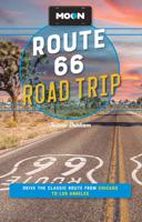
Reisgids Road Trip USA Route 66 | Moon Travel Guides
Moon Route 66 Road Trip reveals the ins and outs of this iconic highway, from sweeping prairies and retro roadside pit-stops to the stunning vistas of the Southwest. Inside you'll find:* Maps and Driving Tools: 38 easy-to-use maps detail the existing roads that comprise the original Route 66, along with site-to-site mileage, driving times, detailed directions for the entire route, and full-color photos throughout* Eat, Sleep, Stop and Explore: With lists of the best hikes, bites, roadside curiosities, and more, you can admire extraordinary landscapes like Acoma Pueblo or Joshua Tree National Park, explore big cities like Los Angeles and Chicago, or wander abandoned ghost towns. Immerse yourself in classic Americana with outsider art and kitsch masterpieces, find the most Instagram-worthy retro motels, and sample the breadth of regional cuisine, from deep dish pizza to carne asada* Flexible Itineraries: Moon Route 66 Road Trip covers Illinois, Missouri, Kansas, Oklahoma, Texas, New Mex…
23,95
Wandelkaart National Trail Map Pennine Way | Collins
Overzichtskaart op vrij grove schaal van deze LAW Lange Afstands Wandeling in Engeland. Let op: je kunt er niet op lopen. Wel met veel informatie op de kaart, goed ingetekend, een route-schema op de achterzijde en een beschrijving van een aantal bezienswaardigheden.  Perfect guide and map for planning your adventure along the iconic Pennine Way.   Highlights of this Planning Map include:   More than 20 highlighted places of interest with detailed descriptions and attractive photographs, including: Hadrian’s Wall, Tan Hill, and Cauldron Snout A comprehensive index to more than 1000 cities, towns and villages A clear, visible route plotted across the map Advice on safety and security when travelling along the route, as well as the countryside code and the code of conduct The Pennine Way is the oldest of the 16 National Trails and runs along The Pennines, linking the Peak District National Park with the Cheviot Hills. Starting in Edale, Derbyshire, the walk covers 268 miles (431 km) and …
11,50
Wandelkaart National Trail Map Hadrian's Wall Path | Collins
Overzichtskaart op vrij grove schaal van deze LAW Lange Afstands Wandeling in Engeland. Let op: je kunt er niet op lopen. Wel met veel informatie op de kaart, goed ingetekend, een route-schema op de achterzijde en een beschrijving van een aantal bezienswaardigheden.  Perfect guide and map for planning your adventure along Hadrian’s Wall.   Highlights of this Planning Map include:   More than 20 highlighted places of interest with detailed descriptions and attractive photographs, including: the Vindolanda archaeological site, Chester’s Roman fort, and Steel Rigg viewpoint. A comprehensive index to more than 400 cities, towns and villages A clear, visible route plotted across the map Advice on safety and security when travelling along the route, as well as the countryside code and the code of conduct Part of the National Trail network, this long-distance footpath covers 84 miles (135 km) along the line of Hadrian's Wall from coast-to-coast. Starting in Wallsend in Newcastle and ending i…
11,50
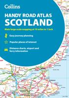
Wegenatlas Collins Handy Road Atlas Scotland | A5-Formaat | Collins
Discover new places with handy road atlases from Collins. Your ideal companion for navigating around Scotland. It has extremely clear, route planning maps of Scotland, detailed city plans of the major cities and towns and fits neatly into your glovebox, briefcase or bag. Main features Clear, attractive route planning maps of the whole of Scotland supported by comprehensive, fully indexed city centre street maps of Aberdeen, Dundee, Edinburgh, Glasgow, Inverness and Perth. Scale of main maps: 1:625,000 (9.9 miles to 1 inch). Also includes * Places of tourist interest are highlighted * Attractive layer colouring showing land height * Road network fully classified and colour coded * Detailed street mapping of Edinburgh, including the Royal Mile with all its attractions clearly marked, Leith and Holyrood Park * Detailed street mapping of Glasgow, including the West End, city centre and M74 extension * Detailed street mapping of Aberdeen, including the bypass * Street maps, with i…
12,95
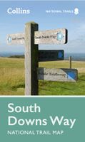
Wandelkaart National Trail Map South Downs Way | Collins
Overzichtskaart op vrij grove schaal van deze LAW Lange Afstands Wandeling in Engeland. Wel met veel informatie op de kaart, goed ingetekend, een route-schema op de achterzijde en een beschrijving van een aantal bezienswaardigheden. ALs je voor lichtgewicht gaat, is dit al vrijwel voldoende om met de bewegwijzering ter plekke de route te kunnen lopen. Perfect guide and map for planning your adventure along the South Downs Way.   Highlights of this Planning Map include:   More than 20 highlighted places of interest with detailed descriptions and attractive photographs, including: Brighton Pier, The Long Man of Wilmington, and Seven Sisters A comprehensive index to more than 800 cities, towns and villages A clear, visible route plotted across a 2 miles to 1 inch ( 1.25 km to 1 cm) scale map Advice on safety and security when travelling along the route, as well as the countryside code and the code of conduct Part of the National Trail network, this long distance footpath covers 100 miles…
11,50
Wandelkaart National Trail Map Peddars Way and Norfolk Coast | Collins
Overzichtskaart op vrij grove schaal van deze LAW Lange Afstands Wandeling in Engeland. Let op: je kunt er niet op lopen. Wel met veel informatie op de kaart, goed ingetekend, een route-schema op de achterzijde en een beschrijving van een aantal bezienswaardigheden.  Perfect guide and map for planning your adventure along Peddar’s Way and the Norfolk Coast Path. This incorporates part of the newly formed England Coast Path.   Highlights of this Planning Map include:   More than 20 highlighted places of interest with detailed descriptions and attractive photographs, including: the Hunstanton striped cliffs, Blakeney Point, and Binham Priory A comprehensive index to more than 600 cities, towns and villages A clear, visible route plotted across a 2.4 miles to 1 inch (1.5 km to 1 cm) scale map Advice on safety and security when travelling along the route, as well as the countryside code and the code of conduct Part of the National Trail network, these two long-distance footpaths cover 93 …
11,50
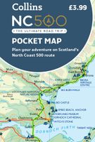
Wegenkaart - landkaart Pocket Map NC500 | Collins
Handy little full colour map of the popular North Coast 500 route. A perfect guide for travelling around Northern Scotland. Detailed mapping and tourist information ideal for any road trip.   Main features of this map include: • Clear mapping • Tourist attractions located and described • Ideal for touring with castles, museums, gardens, monuments, mountains, golf courses, walks and camping/caravan sites all on the map • Photographs of the main attractions along the route • Index to places of interest and place names   Essential for those planning a trip on the North Coast 500.
7,95

Klanten-reviews van Wandelkaart Route 66 | Collins

Er zijn nog geen beoordelingen voor dit productBen jij de eerste die een review plaatst?

Meer over Wandelkaart Route 66 | Collins

Productomschrijving

Full color, informative map of the famous US Route 66. With detailed mapping, key tourist information and a suggested itinerary, this is a perfect guide for anyone traveling along America’s Route 66.   Main features of this map include:   Clear mapping at a scale of 47 miles to 1 inch / 30 km to 1 cm Tourist route, attractions and places of interest clearly marked Images of top sights along the route accompanied by textual descriptions Suggested itineraries Detailed index of places of interest and place names Essential for those planning an adventure along America’s Route 66.

Verken gerelateerde categorieën

Webshop.nl maakt gebruik van cookies. Ga je verder op onze website, ga dan akkoord met het plaatsen van cookies en de verwerking van deze data door ons en vermelde partners.