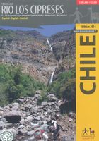
Wandelkaart Rio los Cipreses - Chili | Viachile Editores

0
Hiking map of the National Preserve Rio Los Cipreses east of Rancagua, developed by the Institute for Cartography at the Dresden Technical University. Overview map1:100,000 showing the whole preserve with the Laguna Piuquenes and several 4,000 meter summits, being El Palomo volcano the highest with 4860 m. Detail map 1:25,000 of the preserve’s ent...

Verkopers met dit product

Verkoper
Bezorging
Prijs
DeZwerver.nl logo
DeZwerver.nl
2,95
18,95

Anderen bekeken ook

Wandelkaart Rio los Cipreses - Chili | Viachile Editores
Hiking map of the National Preserve Rio Los Cipreses east of Rancagua, developed by the Institute for Cartography at the Dresden Technical University. Overview map1:100,000 showing the whole preserve with the Laguna Piuquenes and several 4,000 meter summits, being El Palomo volcano the highest with 4860 m. Detail map 1:25,000 of the preserve’s entrance area. GPS compatible, with hiking routes, level curves every 50 m, mountain huts, lodgings and campsites. Landscape pictures and drawings of the local fauna. English - German - Spanish.
18,95
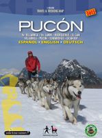
Wandelkaart - Fietskaart Pucón | Viachile Editores
  Completely revised and up-to-date map of the Villarrica – Pucón area. For drivers, hikers and mountainbikers, with a list of the best hikes, a city map of Pucón, a register of tourism providers in Pucón, pictures of the most beautiful attractions and drawings of the local fauna. Information in three languages (English-German-Spanish). Map sheet 70 x 100 cm: Detailed, georeferenced representation (WGS-84) of the area between the lakes Colico, Caburgua, Villarrica, Calafquén and Tromén, wth National parks Huerquehue, Villarrica and El Cañi containing Villarrica (2853 m), Quetrupillán (2350 m) and Lanín (3725 m) volcanoes. Hiking. climbing and biking routes, thermal baths, campsites and lodgings. Scale: 1:100,000 City Map Pucón, including all accommodations, restaurants, agencies and other services.
18,95
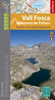
Wandelkaart 24 Vall Fosca - Montsent de Pallars | Editorial Alpina
Zeer gedetailleerde wandelkaart van een klein gebied. Met ingetekende wandelroutes en andere informatie. Spaanstalig, maar uitstekende kaart. Coordinaten zijn weergegeven, dus GPS compatible met UTM grid.    Op de topografische wandelkaart worden o.a. berghutten, campings aangeduid en hoogtelijnen, ingetekende wandelroutes en de GR paden (doorgaande langeafstandswandelpaden). De kaart is inclusief een Spaanstalig boekje met extra informatie over aanwezige voorzieningen en enkele routes.   A topographic tourist map and hiking guide with details of tourist attractions, hiking & sporting activities as well as transport information. An excellent folded map & booklet. Hiking map and guidebook -  Scale: 1:25.000 - Heights of the most interesting spots of the area - Shady relief - UTM grid with divisions of 1 km -Compatible with GPS - Marked routes - Guidebook with hikes, potholing, gully descent, climbing, mountain biking and facts of interest   • Hiking map and guidebook • Scale 1:25.00…
19,95
Wandelkaart - Topografische kaart 243 Everglades National Park | National Geographic
Prachtige geplastificeerde kaart van het nationaal park. Met alle recreatieve voorzieningen als campsites, maar ook met topografische details en wandelroutes ed. Door uitgekiend kleurgebruik zeer prettig in gebruik. Scheur en watervast! This Trails Illustrated topographic map for Everglades National Park and surrounding area is the perfect map for hiking, boating, paddling, biking, fishing, exploring, camping, and sightseeing in this unique national treasure.   This two-sided map includes the Key Largo, Everglades City, Chokoloskee, Everglades National Park, portions of Big Cypress National Preserve, Fakahatchee Strand State Preserve, Cape Romano Ten Thousand Islands Aquatic Preserve, Shark Valley Tram Road, Old Ingraham highway and campsite, North Nest Key, West Lake Canoe Trail, Snake Bight Trail, backcountry campsites, beach sites, ground sites, and chickees, and detailed insets of Flamingo, Whitewater Bay, Pineland Trails of the Long Pine Key area, and Nine Mile Pond. The map also…
16,95
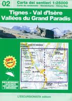
Wandelkaart 02 Tignes - Val d'Isere - Gran Paradiso | L'Escursionista editore
Wandelkaart nr. 02 uit de grensoverschrijdende serie Italië/Frankrijk. Het beslaat het gebied van de bovenste Valgrisenche, Val di Rhêmes en Valsavarenche (Valle d'Aosta), Valle dell'Orco (Piemonte), de gemeenten Tignes en Val d'Isère (Haute Tarentaise), reikend tot aan de poorten van de stad Bonneval-sur-Arc (Haute Maurienne) en Les Lanches (in de Peisey-Nancroix-vallei). Met bewegwijzerde wandel- en mountainbikeroutes, evenals alle kleinere routes. Gedrukt op water- en scheurvast papier, met satellietvolging van de paden via GPS. Verpakt in plastic zak met fotogids van 32 pagina's.   De kaart is gedrukt op scheur- en watervast papier en tweezijdig bedrukt.  This publication is the first of a series of hiking maps of the border mountains between Italy and France. The map covers the areas surrounding La Thuile (Italy) and Bourg-Saint-Maurice, Montvalezan, Sainte Foy-Tarentaise, Séez, Villaroger, including the ski resorts of La Rosière and Les Arcs (France - Haute Tarentaise). The map …
15,95
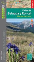
Wandelkaart 02 Valles de Belagua y Roncal | Editorial Alpina
Zeer gedetailleerde wandelkaart van een klein gebied. Met ingetekende wandelroutes en andere informatie. Spaanstalig, maar uitstekende kaart. Coordinaten zijn weergegeven, dus GPS compatible met UTM grid.    Op de topografische wandelkaart worden o.a. berghutten, campings aangeduid en hoogtelijnen, ingetekende wandelroutes en de GR paden (doorgaande langeafstandswandelpaden). De kaart is inclusief een Spaanstalig boekje met extra informatie over aanwezige voorzieningen en enkele routes.   Gebied: Uztarroze / Uztárroz, Izaba / Isaba, Erronkari / Roncal, Zuriza, Bidankoze / Vidángoz, Arette-la-Pierre-Saint-Martin, Puerto de Laza (Pass), Portillo de Ernaz (Pass), Selva de Oza (Waldgebiet), Pena Ezcaurri, Txamantxoia, Pic d'Anie, Mesa de los Tres Reyes, Petrachema, Sierra de Quimboa, Macizo de Larra / Larra-Belagua-Gruppe, Sierra d'Alano.   A topographic tourist map and hiking guide with details of tourist attractions, hiking & sporting activities as well as transport information. An…
16,95
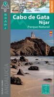
Wandelkaart Cabo de Gata / Nijar | Editorial Alpina
Zeer gedetailleerde wandelkaart van een klein gebied. Met ingetekende wandelroutes en andere informatie. Spaanstalig, maar uitstekende kaart. Coordinaten zijn weergegeven, dus GPS compatible met UTM grid.    Op de topografische wandelkaart worden o.a. berghutten, campings aangeduid en hoogtelijnen, ingetekende wandelroutes en de GR paden (doorgaande langeafstandswandelpaden).  Cabo da Gata-Níjar Natural Park in an extensive and very popular series of walking maps from Editorial Alpina covering the Pyrenees, Catalonia and other selected hiking areas in Spain, including Picos de Europa, Sierra Nevada and parts of Andalucía, Majorca, etc. Scales vary from 1:50,000 to 1:10,000, with the majority of the titles at 1:25,000. The maps have contours, usually at 20m or 10m intervals, with additional hill shading and spot heights. An overprint highlights hiking trails, long-distance footpaths, campsites, mountain huts, refuges, etc. Many maps also show climbing sites, potholing caves, mountain b…
17,95
Wandelkaart Cerdanya 360 - territori | Editorial Alpina
Hiking Map and guide of the crossing of the 3 refuges of the Spanish publisher Alpina.   The crossing of the three shelters is a fantastic hike to discover unforgettable sites in the East Pyrenees. It allows to discover abundant wildlife, superb flowers, spectacular gorges, isolated lakes, beautiful forests and lifetime rivers. At the end of each step, you will experience one night's experience in a guarded refuge and resume forces for the next day. The total altitude of the crossing is more than 3,000 meters. For the more sports, the steps can be supplemented by the rise of the summits of the region: the peaks of Balandrau, Bastiments, Gra de Fajol, Gallinas, Torreneules and Puigmal, for a total altitude of more than 6,000 meters.   The regions of the Ripollès and Upper Conflent, east of the Pyrenees chain, offer a wild territory predominated by the high mountain. It is a very well preserved natural space with great biodiversity. It is in these isolated sites that the Ulldeter shelte…
16,95
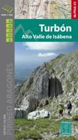
Wandelkaart Turbon - Alto Valle de Isabena | Editorial Alpina
Zeer gedetailleerde wandelkaart van een klein gebied. Met ingetekende wandelroutes en andere informatie. Spaanstalig, maar uitstekende kaart. Coordinaten zijn weergegeven, dus GPS compatible met UTM grid.    Op de topografische wandelkaart worden o.a. berghutten, campings aangeduid en hoogtelijnen, ingetekende wandelroutes en de GR paden (doorgaande langeafstandswandelpaden). De kaart is inclusief een Spaanstalig boekje met extra informatie over aanwezige voorzieningen en enkele routes.   Gebied: Villanova, Liri, Chía, Seira, Gabas, Bisaurri, Arasán, Buyelgas, El Run, Urmella, Veri, Las Paules, Ardanué, Denuy, Ardanuy, Barbaruens, Calvera, Llert, Biescas, Bonansa, Egea, Campo, Castillo de El Turbón, Gallinero, Pic de Basibé, Pic de Menada, Cornadelo   A topographic tourist map and hiking guide with details of tourist attractions, hiking & sporting activities as well as transport information. An excellent folded map & booklet. Hiking map and guidebook -  Scale: 1:40.000 - Heights of th…
17,95
Wandelkaart Sierra Nevada en Alpujarras | Editorial Alpina
Goede wandelkaart van dit gebied met alle noodzakelijke informatie als berghutten, campings. Kleurgebruik vrij fel, waardoor hoogtes goed uitkomen. Wandelroutes zijn ingetekend en de GR paden (doorgaande wandelpaden) zijn weergegeven met een teken of nummer. Coordinaten zijn weergegeven, dus GPS compatible met UTM grid Gebied: De Alpujarras staan er op tot en met Trevelez in het oosten. Met Granada, Lanjarrón, Nigüelas, Dúrcal, Restábal, Béznar, Trevélez, Bérchules, Bubíon, Capileira, Almegijar, Cástaras, Pinos del Valle, Dílar, Gójar, Monachil, Órgiva, Güejar-Sierra, Pradollano, Veleta, Mulhacén, La Alcazaba. New Map of Sierra Nevada at 1:40,000 scale, the most important chain of mountains in the southern Iberian peninsula. It has the highest peaks, as in the case of Mulhacen at 3,479 m, and the peak Veleta which is the third highest at 3396 meters.   The map also includes a significant portion of the region of La Alpujarra. Overall, this area offers immense opportunities for hiking,…
16,95

Klanten-reviews van Wandelkaart Rio los Cipreses - Chili | Viachile Editores

Er zijn nog geen beoordelingen voor dit productBen jij de eerste die een review plaatst?

Meer over Wandelkaart Rio los Cipreses - Chili | Viachile Editores

Productomschrijving

Hiking map of the National Preserve Rio Los Cipreses east of Rancagua, developed by the Institute for Cartography at the Dresden Technical University. Overview map1:100,000 showing the whole preserve with the Laguna Piuquenes and several 4,000 meter summits, being El Palomo volcano the highest with 4860 m. Detail map 1:25,000 of the preserve’s entrance area. GPS compatible, with hiking routes, level curves every 50 m, mountain huts, lodgings and campsites. Landscape pictures and drawings of the local fauna. English - German - Spanish.

Productinformatie

    Verken gerelateerde categorieën

    Webshop.nl maakt gebruik van cookies. Ga je verder op onze website, ga dan akkoord met het plaatsen van cookies en de verwerking van deze data door ons en vermelde partners.