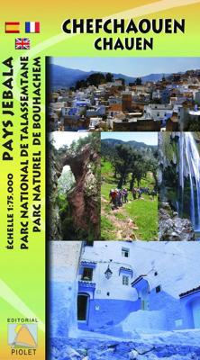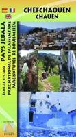
Wandelkaart Rif Occidental, Chefchaouen - Chauen | Editorial Piolet

0
 Gedetailleerde topografische wandelkaart van het westelijke Rifgebergte, Pays Jebala, het Parc national de Talassemtane en het Parc naturel de Bouhachem in Marokko. De kaart bestrijkt een gebied met een straal van 25-30 km rondom Chefchaouen, grofweg tussen Es Soukkane, Oued Laou, Bkikcha en Beni Derkoul.   De kaart toont hoogtelijnen (interval 2...

Verkopers met dit product

Verkoper
Bezorging
Prijs
DeZwerver.nl logo
DeZwerver.nl
2,95
14,95

Anderen bekeken ook

Wandelkaart - Topografische kaart 179 OS Explorer Map Gloucester, Cheltenham, Stroud | Ordnance Survey
The essential map for outdoor activities in Gloucester, Cheltenham and Stroud. The OS Explorer Map is the Ordnance Survey's most detailed folding map and is recommended for anyone enjoying outdoor activities including walking, horse riding and off-road cycling. This map now comes with a digital version which you can download to your smartphone or tablet.Providing complete GB coverage, the OS Explorer map series details information essential in the great outdoors, including youth hostels, pubs and visitor information. Rights of way, fences, permissive paths and bridleways are clearly shown, ensuring you have the best information to get the most out of your time in the countryside. FeaturesCotswold Way Severn Way Gloucestershire Way Macmillan Way Wysis WayCotswold Way (National Trail) GloucesterCheltenhamGloucester Stroud1:25 000 scale (4 cm to 1 km - 2.5 inches to 1 mile) Met zijn 4cm voor 1 km (2 ½ cm voor 1 mijl) schaal, is de OS Explorer kaartenserie de ideale en meest gedetailleerd…
19,50
Wandelkaart - Topografische kaart 181 OS Explorer Map Chiltern Hills North | Ordnance Survey
The essential map for outdoor activities in Chiltern Hills North. The OS Explorer Map is the Ordnance Survey's most detailed folding map and is recommended for anyone enjoying outdoor activities including walking, horse riding and off-road cycling. This map now comes with a digital version which you can download to your smartphone or tablet.Providing complete GB coverage, the OS Explorer map series details information essential in the great outdoors, including youth hostels, pubs and visitor information. Rights of way, fences, permissive paths and bridleways are clearly shown, ensuring you have the best information to get the most out of your time in the countryside. FeaturesIcknield Way RidgewayNorth Buckinghamshire Way Icknield Way PathSwan's Way Two Ridges Link Aylesbury RingSouth Bucks Way Chess Valley Walk Chiltern Link Thame Valley WalkGrand Union Canal Walk Midshires Way Bledlow Circular Ride Hertfordshire Way Chiltern WayRidgeway (National Trail) Bedfordshire Buckinghamshire H…
19,50
Wandelkaart - Topografische kaart 179 OS Explorer Map | Active Gloucester / Cheltenham / Stroud | Ordnance Survey
The essential map for outdoor activities in Gloucester, Cheltenham and Stroud. The OS Explorer Map is the Ordnance Survey's most detailed folding map and is recommended for anyone enjoying outdoor activities including walking, horse riding and off-road cycling. This map now comes with a digital version which you can download to your smartphone or tablet.Providing complete GB coverage, the OS Explorer map series details information essential in the great outdoors, including youth hostels, pubs and visitor information. Rights of way, fences, permissive paths and bridleways are clearly shown, ensuring you have the best information to get the most out of your time in the countryside. FeaturesCotswold Way Severn Way Gloucestershire Way Macmillan Way Wysis WayCotswold Way (National Trail) GloucesterCheltenhamGloucester Stroud1:25 000 scale (4 cm to 1 km - 2.5 inches to 1 mile)   Met zijn 4cm voor 1 km (2 ½ cm voor 1 mijl) schaal, is de OS Explorer kaartenserie de ideale en meest gedetaillee…
25,95
Wandelkaart - Topografische kaart 181 OS Explorer Map | Active Chiltern Hills North | Ordnance Survey
The essential map for outdoor activities in Chiltern Hills North. The OS Explorer Map is the Ordnance Survey's most detailed folding map and is recommended for anyone enjoying outdoor activities including walking, horse riding and off-road cycling. This map now comes with a digital version which you can download to your smartphone or tablet.Providing complete GB coverage, the OS Explorer map series details information essential in the great outdoors, including youth hostels, pubs and visitor information. Rights of way, fences, permissive paths and bridleways are clearly shown, ensuring you have the best information to get the most out of your time in the countryside. FeaturesIcknield Way RidgewayNorth Buckinghamshire Way Icknield Way PathSwan's Way Two Ridges Link Aylesbury RingSouth Bucks Way Chess Valley Walk Chiltern Link Thame Valley WalkGrand Union Canal Walk Midshires Way Bledlow Circular Ride Hertfordshire Way Chiltern WayRidgeway (National Trail) Bedfordshire Buckinghamshire H…
25,95
Wandelkaart NS504 Upper and Lower Dolpa - Dolpo | Himalayan Maphouse
Goede duidelijk leesbare  map voor trekkings in Dolpo. Van Juphal en Jejargaon in het westen tot Kagbeni in Mustang aan de oostkant van de kaart. De trekkingroutes staat goed ingetekend. Shey Phoksundo National Park staat er ook geheel op.  Large area centred on Dho Tarap, lying between the Upper and Lower Dolpa regions, in the Nepa Maps series which provides extensive coverage of trekking areas of Nepal on detailed contoured maps with trekking routes and hiking trails, huts and camp sites, local places of interest and other tourist information.   Cartography is based on the country’s topographic survey, with contours usually at 40m or 50m intervals, enhanced by relief shading, colouring and graphics to show various features of the terrain, including glaciers, forested or cultivated areas, etc. Numerous peaks, with additional spot heights, plus names of glaciers and mountain ranges are prominently shown. The network of rivers, streams and lakes is shown in great detail, with many smal…
12,95
Wegenkaart - landkaart 33 Burgenland - Oostenrijk | Freytag & Berndt
Uitstekende overzichtskaart, tweezijdig, met register, met veel details, alle berijdbare wegen etc.    Top 10 Tips" Map in a series of detailed road maps at 1:150,000 from Freytag & Berndt, covering popular tourist regions of Italy and highlighting each area's top 10 sights, all with brief descriptions in the accompanying booklets which also provide street plan(s) of main town(s) in the region.   Relief is portrayed by hill-shading without distracting from other detail. Road network shows minor roads and selected cart tracks, and includes information indispensable for happy holiday driving: motorway service stations and motels, gradients on steep roads, restricted entry for cars or caravans and seasonal closures, routes not recommended for caravans, scenic roads and special tourist routes, etc. Railways, cable cars, and ferry connections also shown, as well as selected long--distance hiking trails.   Picturesque towns are highlighted and 10 selected places of interest are prominently …
14,95
Wegenkaart - landkaart Niederösterreich | Freytag & Berndt
Uitstekende overzichtskaart, tweezijdig, met register, met veel details, alle berijdbare wegen etc.    Top 10 Tips" Map in a series of detailed road maps at 1:150,000 from Freytag & Berndt, covering popular tourist regions of Italy and highlighting each area's top 10 sights, all with brief descriptions in the accompanying booklets which also provide street plan(s) of main town(s) in the region.   Relief is portrayed by hill-shading without distracting from other detail. Road network shows minor roads and selected cart tracks, and includes information indispensable for happy holiday driving: motorway service stations and motels, gradients on steep roads, restricted entry for cars or caravans and seasonal closures, routes not recommended for caravans, scenic roads and special tourist routes, etc. Railways, cable cars, and ferry connections also shown, as well as selected long--distance hiking trails.   Picturesque towns are highlighted and 10 selected places of interest are prominently …
14,95
Wandelkaart - Topografische kaart 150 OS Explorer Map Canterbury, Isle of Thanet | Ordnance Survey
Discover Canterbury, city of saints and kings, ancient heartland of England at the foot of the Kent Downs and the head of the River Stour Valley with its vineyards. Follow the river to the coast to discover unspoiled Deal, artistic Margate and picturesque Whitstable.  Starting in Canterbury, take the Stour Valley Walk to Sandwich and the long sweeping sand and shingle beach of Sandwich Bay  Walk the Long Rock from Whitstable to Herne Bay before taking the Thanet Coastal Path around the Isle of Thanet and its three famous Georgian and Victorian resorts of Margate, Ramsgate and Broadstairs   Take the National Trails of the England Coast Path and North Downs Way or choose from a lattice of other popular recreational paths  Met zijn 4cm voor 1 km (2 ½ cm voor 1 mijl) schaal, is de OS Explorer kaartenserie de ideale en meest gedetailleerde kaartenreeks voor mensen die graag outdoor-activiteiten zoals fietsen, wandelen, paardrijden, klimmen en watersporten. Deze kaart is nog gedetailleer…
19,50
Wandelkaart - Topografische kaart 150 OS Explorer Map | Active Canterbury / Isle of Thanet | Ordnance Survey
Discover Canterbury, city of saints and kings, ancient heartland of England at the foot of the Kent Downs and the head of the River Stour Valley with its vineyards. Follow the river to the coast to discover unspoiled Deal, artistic Margate and picturesque Whitstable.  Starting in Canterbury, take the Stour Valley Walk to Sandwich and the long sweeping sand and shingle beach of Sandwich Bay  Walk the Long Rock from Whitstable to Herne Bay before taking the Thanet Coastal Path around the Isle of Thanet and its three famous Georgian and Victorian resorts of Margate, Ramsgate and Broadstairs   Take the National Trails of the England Coast Path and North Downs Way or choose from a lattice of other popular recreational paths  Met zijn 4cm voor 1 km (2 ½ cm voor 1 mijl) schaal, is de OS Explorer kaartenserie de ideale en meest gedetailleerde kaartenreeks voor mensen die graag outdoor-activiteiten zoals fietsen, wandelen, paardrijden, klimmen en watersporten.   Deze kaart is nog gedetailleerd…
25,95
Wandelkaart - Topografische kaart OL44 OS Explorer Map Torquay & Dawlish | Ordnance Survey
Met zijn 4cm voor 1 km (2 ½ cm voor 1 mijl) schaal, is de OS Explorer kaartenserie de ideale en meest gedetailleerde kaartenreeks voor mensen die graag outdoor-activiteiten zoals fietsen, wandelen, paardrijden, klimmen en watersporten. Deze kaart is nog gedetailleerder dan de 'gewone' Landranger maps. Voor- en achterzijde bedrukt! Zeker op de moors en andere natuurgebieden van onschatbare waarden met echt alle aspecten van het landschap op de kaart ingetekend. Zeer goede detailkaart met topografische ondergrond. Hierop zijn toeristische symbolen van bezienswaardigheden ingetekend, daarnaast staan bijvoorbeeld campings en jeugdherbergen vermeld en - voor wandelaars het belangrijkst - alle right of way paden en Lange afstands Wandelpaden zijn er op te vinden. De ideale kaart voor het wandelen in Engeland, Wales of Schotland. Ingetekende Langeafstandswandelroute South west coast Path Map sheet OL 44 Map is the perfect map for exploring the Eastern edge of Dartmoor national park and the c…
19,50

Klanten-reviews van Wandelkaart Rif Occidental, Chefchaouen - Chauen | Editorial Piolet

Er zijn nog geen beoordelingen voor dit productBen jij de eerste die een review plaatst?

Meer over Wandelkaart Rif Occidental, Chefchaouen - Chauen | Editorial Piolet

Productomschrijving

 Gedetailleerde topografische wandelkaart van het westelijke Rifgebergte, Pays Jebala, het Parc national de Talassemtane en het Parc naturel de Bouhachem in Marokko.

De kaart bestrijkt een gebied met een straal van 25-30 km rondom Chefchaouen, grofweg tussen Es Soukkane, Oued Laou, Bkikcha en Beni Derkoul.   De kaart toont hoogtelijnen (interval 20 m), ingetekende wandelroutes, accommodaties, bezienswaardigheden, klimgebieden, etc. Op de achterzijde staat informatie over het gebied in drie talen (Engels, Frans, Spaans).   -------   Chefchaouen (Chauen) region of northern Morocco, south-east of Tangier and Tetouan, at 1:75,000 on a contoured and GPS compatible map from Editorial Piolet, highlighting recommended hiking trails, various tourist facilities and places of interest, etc.    Topography is vividly presented by contours at 20m intervals, enhanced by relief shading and altitude colouring. The map shows local roads, country tracks and footpaths, and highlights nine recommended hiking trails in the Talassemtane National Park, plus six more in the Bouhachem Natural Park. Symbols indicate various types of tourist accommodation (hotels, gîtes d’etape, campsites, bivouac zomes), restaurants, interesting natural sites, climbing sites, wildlife observation points, petrol stations, etc. The map has a UTM grid.    On the reverse are extensive notes about the area illustrated with colour photos, plus a list of useful contact details. Map legend and the text include English.


Productinformatie

    Verken gerelateerde categorieën

    Webshop.nl maakt gebruik van cookies. Ga je verder op onze website, ga dan akkoord met het plaatsen van cookies en de verwerking van deze data door ons en vermelde partners.