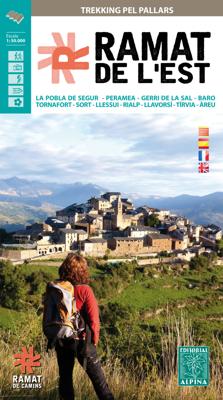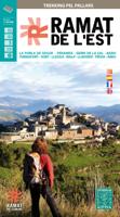
Wandelkaart Ramat de l'Est - trekking pel Pallars | Editorial Alpina

0
Gedetailleerde wandelkaart van een meerdaagse tocht in de Spaanse Pyreneeen, veel detail op topografisch nivo met hoogtelijnen, schaduwwerking, hutten, paden etc.  Zeer gedetailleerde wandelkaart van een klein gebied. Met ingetekende wandelroutes en andere informatie. Spaanstalig, maar uitstekende kaart. Coordinaten zijn weergegeven, dus GPS compa...

Verkopers met dit product

Verkoper
Bezorging
Prijs
DeZwerver.nl logo
DeZwerver.nl
2,95
16,95

Anderen bekeken ook

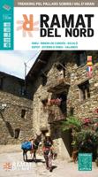
Wandelkaart Ramat del Nord | Editorial Alpina
Gedetailleerde wandelkaart van een meerdaagse tocht in de Spaanse Pyreneeen, veel detail op topografisch nivo met hoogtelijnen, schaduwwerking, hutten, paden etc.    Zeer gedetailleerde wandelkaart van een klein gebied. Met ingetekende wandelroutes en andere informatie. Spaanstalig, maar uitstekende kaart. Coordinaten zijn weergegeven, dus GPS compatible met UTM grid.    Op de topografische wandelkaart worden o.a. berghutten, campings aangeduid en hoogtelijnen, ingetekende wandelroutes en de GR paden (doorgaande langeafstandswandelpaden). De kaart is inclusief een Spaanstalig boekje met extra informatie over aanwezige voorzieningen en enkele routes.   Areu - Ginestarre - Ribera de Cardos - Estaron - Escal o - Espot - Jou - La Guingueta - Esterri d'Aneu - Slardu.   -wandelpaden ingetekend -schaal 1:50.000 (1 cm = 500 m) -hoogtelijnen -campings, berghutten, herberg, jeugherbergen -tankstations, parkeerplaatsen -locaties voor rotsklimmen, wandelen, lalnglaufen etc -GPS-compatibl…
16,95
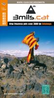
Wandelkaart 3mils.cat | Editorial Alpina
Gedetailleerde wandelkaart van een meerdaagse tocht in Catalonië, veel detail op topografisch niveau met hoogtelijnen, schaduwwerking, hutten, paden etc. Coördinaten zijn weergegeven, dus GPS compatible met UTM grid.  3mils.cat is a walk through a mountain to crown in a row on the road and all the peaks of 3000 meters of Catalonia , designed and documented by Jordi Puigneró i Ferrer.   The crossing has been designed to take in 10 stages of 6 hours on average every day, covering a total of about 125 km and an accumulated rise of about 10.000 meters.   Although it could be within days, this has not been thought through to compete but to enjoy. The route begins at the top of the Hill formally Molières or Mulleres and ends in Pic Rodó de Canalbona , crossing the beautiful valleys as Mollières, Besiberri and Boi , as well as sites of special protection such as the Parc Nacional d’Aigüestrotes-Sant MaMaurici and the Parc Natural de l’Alt Pirineu.   List of summits order of ascension:   • 1.…
16,95
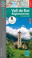
Wandelkaart Vall de Boi - Aigüestortes PN | Editorial Alpina
Zeer gedetailleerde wandelkaart van een klein gebied. Met ingetekende wandelroutes en andere informatie. Spaanstalig, maar uitstekende kaart. Coordinaten zijn weergegeven, dus GPS compatible met UTM grid.    Op de topografische wandelkaart worden o.a. berghutten, campings aangeduid en hoogtelijnen, ingetekende wandelroutes en de GR paden (doorgaande langeafstandswandelpaden). De kaart is inclusief een Spaanstalig boekje met extra informatie over aanwezige voorzieningen en enkele routes.   Gebied: Boí, Taüll, Durro, Barruera, Erill la Vall, Cardet, Besiberri, Punta Alta de Comalesbienes, Gran Tuc de Colomérs, Pic de Comaloforno, Pic de Subenuix, Pic del Pessó. La Vall de Boí pertenece a la comarca de la Alta Ribagorça y limita al norte con la Vall d´Aran, por el este con el Pallars Jussà y el Pallars Sobirà, y por el oeste con la provincia de Huesca, formando parte asimismo de la región histórica de la Ribagorça o Ribagorza. El sector cartografiado en este mapa se centra en el término …
16,95
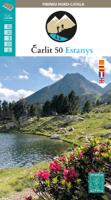
Wandelkaart Carlit 50 Estanys | Editorial Alpina
Ahead of us, more than 50 lakes scattered among 5 stages in the Carlit area, Puig Peric and La Bollosa. This circular trek has been conceived to explore in depth this sector of Pyrenees, without technical hindrances, with awesome landscapes, and crowning the highest summit in the Eastern Pyrenees: the Carlit (2.921 m). The stages cross Animal Reservations, Natural Parks and locations with di erent degrees of environmental protection, due to the high ecologic value of its ora, fauna and landscapes.
16,95
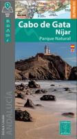
Wandelkaart Cabo de Gata / Nijar | Editorial Alpina
Zeer gedetailleerde wandelkaart van een klein gebied. Met ingetekende wandelroutes en andere informatie. Spaanstalig, maar uitstekende kaart. Coordinaten zijn weergegeven, dus GPS compatible met UTM grid.    Op de topografische wandelkaart worden o.a. berghutten, campings aangeduid en hoogtelijnen, ingetekende wandelroutes en de GR paden (doorgaande langeafstandswandelpaden).  Cabo da Gata-Níjar Natural Park in an extensive and very popular series of walking maps from Editorial Alpina covering the Pyrenees, Catalonia and other selected hiking areas in Spain, including Picos de Europa, Sierra Nevada and parts of Andalucía, Majorca, etc. Scales vary from 1:50,000 to 1:10,000, with the majority of the titles at 1:25,000. The maps have contours, usually at 20m or 10m intervals, with additional hill shading and spot heights. An overprint highlights hiking trails, long-distance footpaths, campsites, mountain huts, refuges, etc. Many maps also show climbing sites, potholing caves, mountain b…
17,95
Wandelkaart 47 Vall de Sau - Collsacabra | Editorial Alpina
Zeer gedetailleerde wandelkaart van een klein gebied. Met ingetekende wandelroutes en andere informatie. Spaanstalig, maar uitstekende kaart. Coordinaten zijn weergegeven, dus GPS compatible met UTM grid.    Op de topografische wandelkaart worden o.a. berghutten, campings aangeduid en hoogtelijnen, ingetekende wandelroutes en de GR paden (doorgaande langeafstandswandelpaden). De kaart is inclusief een boekje met extra informatie over aanwezige voorzieningen en enkele routes: bij deze kaart echter wel in het Catalaans!   Gebied:  l'Esquirol, la Vola, Pruit, les Planes d'Hostoles, Rupit, Villanova de Sau, Sant Roma de Sau, Osor, Sant Marti Sacalm, Sant Feliu de Pallerols, Roda de Ter, Puig de Curull, Puig de Freixeneda, Puig de la Creu, l'Agullola, Roca Llarga, Montcau.   • Hiking map and guidebook  • Scale: 1:25.000 • Heights of the most interesting spots of the area • Shady relief • UTM grid with divisions of 1 km • Compatible with GPS • Marked routes • Guidebook with hikes, potholing…
16,95
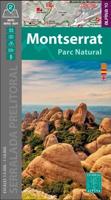
Wandelkaart Montserrat | Editorial Alpina
Zeer gedetailleerde wandelkaart van een klein gebied. Met ingetekende wandelroutes en andere informatie. Spaanstalig, maar uitstekende kaart. Coordinaten zijn weergegeven, dus GPS compatible met UTM grid.    Op de topografische wandelkaart worden o.a. berghutten, campings aangeduid en hoogtelijnen, ingetekende wandelroutes en de GR paden (doorgaande langeafstandswandelpaden). De kaart is inclusief een Spaanstalig boekje met extra informatie over aanwezige voorzieningen en enkele routes.   Gebied: el Bruc, Collbató, Monistrol de Montserrat, Monestir de Montserrat / Santa Maria de Montserrat (Kloster), Monestir Santa Cecili, Monestir Sant Benet (Kloster), Miranda de Sant Jeroni / Mt. Sant Jeroni, Cavall Bernat, Coll de Can Maçana (Pass), Cova del Salnitre, Parc Natural de la Muntanya de Montserrat Book Language: Spanish •Hiking map and guidebook •Scale 1:10.000 •Equidistance contours: 10 m distance •Master contours: at 50 m •Shady relief •Compatible with GPS •Marked routes •Land use sym…
15,95
Wandelkaart 59 Montnegre Corredor | Editorial Alpina
Zeer gedetailleerde wandelkaart van een klein gebied. Met ingetekende wandelroutes en andere informatie. Spaanstalig, maar uitstekende kaart. Coordinaten zijn weergegeven, dus GPS compatible met UTM grid.    Op de topografische wandelkaart worden o.a. berghutten, campings aangeduid en hoogtelijnen, ingetekende wandelroutes en de GR paden (doorgaande langeafstandswandelpaden). De kaart is inclusief een boekje met extra informatie over aanwezige voorzieningen en enkele routes, helaas in het Catalaans!   Gebied: Arenys de Munt, Dosrius, Mataró, Palafolls, Pineda de Mar, Sant Cebrià de Vallalta, Sant Iscle de Vallalta, Tordera, Llinars del Vallès, Sant Celoni, Vallgorguina, Villalba Sasserra, Fogars de Tordera, Calella, Sant Pol de Mar, Canet de Mar, Arenys de Mar, Santa Susanna, Mataro, Campins, Mosqueroles, Gualba, Argentona,Sant Pere de Vilamajor, Turo Gros, Montgros, Turo d'en Vives, Comarcas Maresme, Vallès Oriental und la Selva, Cordillera Litoral, Montnegre-Massiv, Corredor-Massiv …
16,95
Wandelkaart Wilderness Trekking Oman | Gilgamesh
This map is a practical addition to the guide for hiking in the Western Hajar, which is the western portion of the main mountain range in the Sultanate of Oman. The best walking weather in Oman is from mid-November to March. The traverse follows the spine of the mountains in a point-to-point walk taking sixteen days.   It consists of eight one-day walks, two two-day walks and one four-day walk. There is a road intersection with a village or hotel between each of these eleven sections making it practical to walk sections rather than the full traverse. The track climbs to the highest accessible peak in the country at 2999m and finishes in remote dry valleys, called wadis, where impregnable cliffs have precluded road construction and electricity transmission.   This has preserved the Arabian mountain lifestyle that has existed for centuries. This traverse is for hikers who are competent with GPS navigation, as only six of the sixteen day tracks are marked. There are two shorter options, …
19,50
Wandelkaart 51 Alt Emporda | Editorial Alpina
Zeer gedetailleerde wandelkaart van een klein gebied. Met ingetekende wandelroutes en andere informatie. Spaanstalig, maar uitstekende kaart. Coordinaten zijn weergegeven, dus GPS compatible met UTM grid.    Dit is een 2-delige kaartenset. Op de topografische wandelkaart worden o.a. berghutten, campings aangeduid en hoogtelijnen, ingetekende wandelroutes en de GR paden (doorgaande langeafstandswandelpaden). De kaart is inclusief een Spaanstalig boekje met extra informatie over aanwezige voorzieningen en enkele routes.   Gebied: Roses, Cadaques, el Port de la Selva, Figueres, Banyoles, Castello d'Empuries, l'Escala, Llanca, Portbou, la Jonquera, Empuriabrava, Costoja, la Vajol, Borrassa, Santa Pau, Sadernes, Tortellá, Basalú, Peralada, Castellfollit de la Roca, Sant Llorenc de Cerdans / Saint-Laurent-de-Cerdans, Arles-sur-Tech, Cervera / Cerbère, Ceret, Biure, Banyuls-sur-Mer / Banyuls de la Marenda.   The Alt Empordà is a region of great contrasts of the northern Catalonia: the c…
19,95

Klanten-reviews van Wandelkaart Ramat de l'Est - trekking pel Pallars | Editorial Alpina

Er zijn nog geen beoordelingen voor dit productBen jij de eerste die een review plaatst?

Meer over Wandelkaart Ramat de l'Est - trekking pel Pallars | Editorial Alpina

Productomschrijving

Gedetailleerde wandelkaart van een meerdaagse tocht in de Spaanse Pyreneeen, veel detail op topografisch nivo met hoogtelijnen, schaduwwerking, hutten, paden etc. 

Zeer gedetailleerde wandelkaart van een klein gebied. Met ingetekende wandelroutes en andere informatie. Spaanstalig, maar uitstekende kaart. Coordinaten zijn weergegeven, dus GPS compatible met UTM grid.    Op de topografische wandelkaart worden o.a. berghutten, campings aangeduid en hoogtelijnen, ingetekende wandelroutes en de GR paden (doorgaande langeafstandswandelpaden). De kaart is inclusief een Spaanstalig boekje met extra informatie over aanwezige voorzieningen en enkele routes.

The way of Ramat de Camins runs along traditional paths crossing the mountains and valleys in the footsteps of Camilo José Cela and Josep Maria Espinàs by the Pallars Jussà, Pallars Sobirà, Alta Ribagorça and Val d'Aran. This map / guide presents the first five stages of this "Trekking Pel Pallars" grouped under the name of Ramat de l'Est.

The way of this Ramat de Camins trek runs along traditional paths crossing the mountains and valleys in the footsteps of Camilo José Cela and Josep Maria Espinàs by the Pallars Jussà, Pallars Sobirà, Alta Ribagorça and Val d'Aran , Who made this connection in 1956. This map / guide presents the first five stages of this "Trekking Pel Pallars" grouped under the name of Ramat de l'Est. On the first day, you will enter the legendary Congost de Collegats and continue for the other stages in the peripheral valleys of the Aigüestortes-Sant Maurici National Park and the Hautes-Pyrénées Natural Park. The route describes the five stages: 1. Font de la Figuereta - Pujol - Peramea - Gerri of the Sal - Mare de Déu of Arboló - Baro. 2. Baro - Malmercat - Tornafort - Saverneda - Sort. 3. Sort - Pujalt - Olp - Hermitage of Sant Josep - Altron - Bernui - Seurí - Llessui - Sorre - Rialp. 4. Rialp - Roses - Sant Roma de Tavernoles - Llavorsí - Tírvia. 5. Tírvia - Mare of Deu del Roser - Araós - Ainet of Besan - Alins - Àreu.

Productinformatie

    Verken gerelateerde categorieën

    Webshop.nl maakt gebruik van cookies. Ga je verder op onze website, ga dan akkoord met het plaatsen van cookies en de verwerking van deze data door ons en vermelde partners.