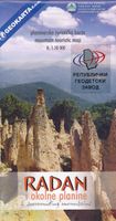
Wandelkaart Rajac suvoborski | Geokarta

0
Gedetailleerde wandelkaart met hoogtelijnen, wandelroutes en toeristische informatie ingetekend van het Suvobor Rajac gebergte in noord Servië. This map covers the popular tourist areas   Rajac is famous for it's limestone caverns, climbing, hiking routes and orienteering events   Very detailed full colour topographc mapping   Footpaths and hiking...

Verkopers met dit product

Verkoper
Bezorging
Prijs
DeZwerver.nl logo
DeZwerver.nl
niet bekend
2,95
12,95

Anderen bekeken ook

Wandelkaart Rajac suvoborski | Geokarta
Gedetailleerde wandelkaart met hoogtelijnen, wandelroutes en toeristische informatie ingetekend van het Suvobor Rajac gebergte in noord Servië. This map covers the popular tourist areas   Rajac is famous for it's limestone caverns, climbing, hiking routes and orienteering events   Very detailed full colour topographc mapping   Footpaths and hiking trails clearly marked   Spot heights and relief shading   Contours at 5m vertical intervals   Reverse on map includes useful local information in English and Serbian
12,95
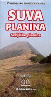
Wandelkaart Suva Planina - Servië | Geokarta
One side topographic marked with footpaths, ski trails, ski lifts, camp sites, picnic sites, mountain huts, also notable features in the landscape. Other side further information, additional words and pics of notable features, mountain huts etc. Suva Mountains with the Gorges of the Jelašnicka River on a detailed contoured map at 1:55,000, plus extensive information on the tourist facilities in the area with colour photos of mountain shelters, notes on fauna and flora, etc. The map has contours at 20m intervals with relief shading and colouring for woodlands. Different levels of protection zones are marked and areas where hunting is allowed are indicated. An overprint highlights waymarked hiking trails including the 130km long-distance trail across the Niš range. Also marked are different types of tourist accommodation including campsites and hunting lodges, paragliding sites, skiing areas, etc. The map has latitude and longitude lines at intervals of 5’. Map legend includes English. …
13,95
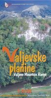
Wandelkaart Valjevske planine - mountain range | GeoSrbija
Gedetailleerde wandelkaart met ingetekende wandelroutes. Hoogtelijnen, hutten staan vermeld. Op de achterzijde informatie over flora en fauna en toeristische bezienswaardigheden. North-West Serbia   This map covers the popular tourist areas   Very detailed full colour topographc mapping   Footpaths and hiking trails clearly marked   Spot heights and relief shading   Contours at 20m vertical intervals   Reverse on map includes useful local information in English and Serbian
12,95
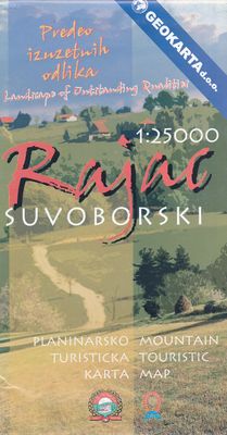
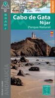
Wandelkaart Cabo de Gata / Nijar | Editorial Alpina
Zeer gedetailleerde wandelkaart van een klein gebied. Met ingetekende wandelroutes en andere informatie. Spaanstalig, maar uitstekende kaart. Coordinaten zijn weergegeven, dus GPS compatible met UTM grid.    Op de topografische wandelkaart worden o.a. berghutten, campings aangeduid en hoogtelijnen, ingetekende wandelroutes en de GR paden (doorgaande langeafstandswandelpaden).  Cabo da Gata-Níjar Natural Park in an extensive and very popular series of walking maps from Editorial Alpina covering the Pyrenees, Catalonia and other selected hiking areas in Spain, including Picos de Europa, Sierra Nevada and parts of Andalucía, Majorca, etc. Scales vary from 1:50,000 to 1:10,000, with the majority of the titles at 1:25,000. The maps have contours, usually at 20m or 10m intervals, with additional hill shading and spot heights. An overprint highlights hiking trails, long-distance footpaths, campsites, mountain huts, refuges, etc. Many maps also show climbing sites, potholing caves, mountain b…
17,95
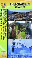
Wandelkaart Rif Occidental, Chefchaouen - Chauen | Editorial Piolet
 Gedetailleerde topografische wandelkaart van het westelijke Rifgebergte, Pays Jebala, het Parc national de Talassemtane en het Parc naturel de Bouhachem in Marokko. De kaart bestrijkt een gebied met een straal van 25-30 km rondom Chefchaouen, grofweg tussen Es Soukkane, Oued Laou, Bkikcha en Beni Derkoul.   De kaart toont hoogtelijnen (interval 20 m), ingetekende wandelroutes, accommodaties, bezienswaardigheden, klimgebieden, etc. Op de achterzijde staat informatie over het gebied in drie talen (Engels, Frans, Spaans).   -------   Chefchaouen (Chauen) region of northern Morocco, south-east of Tangier and Tetouan, at 1:75,000 on a contoured and GPS compatible map from Editorial Piolet, highlighting recommended hiking trails, various tourist facilities and places of interest, etc.    Topography is vividly presented by contours at 20m intervals, enhanced by relief shading and altitude colouring. The map shows local roads, country tracks and footpaths, and highlights nine recommended …
14,95
Wandelkaart Tatry Zachodnie | Sygnatura
Goede wandelkaart van het grote westelijke deel van het Tatra gebergte, zowel aan de Poolse als aan de SLowaakse kant. Wandelpaden, campings, hutten, alles staat er op.  Western Tatra Mountains in Poland and Slovakia at 1:25,000 on a contoured and GPS compatible map from CartoMedia highlighting waymarked hiking trails, mountain huts and campsites, places of interest, etc, Coverage extends from Zakopane westwards to Habovka. On the reverse are panels with an overview of the waymarked hiking trails for planning longer routes, a road map showing access to this part of the Tatra Mountains from both sides of the border, a directory of local mountain huts and other useful tourist information, etc.   Maps in the Cartomedia hiking series present topography is by contours at 20m intervals, enhanced by relief shading and, where appropriate, graphic relief for exposed rocky areas. Waymarked hiking trails indicate approximate walking times in both directions and possible danger points. Most title…
9,95

Klanten-reviews van Wandelkaart Rajac suvoborski | Geokarta

Er zijn nog geen beoordelingen voor dit productBen jij de eerste die een review plaatst?

Meer over Wandelkaart Rajac suvoborski | Geokarta

Productomschrijving

Gedetailleerde wandelkaart met hoogtelijnen, wandelroutes en toeristische informatie ingetekend van het Suvobor Rajac gebergte in noord Servië.

This map covers the popular tourist areas   Rajac is famous for it's limestone caverns, climbing, hiking routes and orienteering events   Very detailed full colour topographc mapping   Footpaths and hiking trails clearly marked   Spot heights and relief shading   Contours at 5m vertical intervals   Reverse on map includes useful local information in English and Serbian

Productinformatie

    Verken gerelateerde categorieën

    Webshop.nl maakt gebruik van cookies. Ga je verder op onze website, ga dan akkoord met het plaatsen van cookies en de verwerking van deze data door ons en vermelde partners.