webshop.nl
Categorieën
  Sluiten

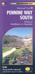
Wandelkaart Pennine Way South | Harvey Maps

Mooie, duidelijke kaart van het zuidelijke gedeelte van de Pennine Way (Edale to Middleton-in-Teesdale). The whole of the Pennine Way on just 2 maps!   Pennine Way South map covers the route from Edale to Middleton-in-Teesdale.   The Pennine Way is a National Trail. It follows the backbone of England from the Peak District to the Scottish borders. ...
28,50

Webshops met dit product

Webshop
Bezorging
Prijs

Anderen bekeken ook

Wandelkaart Pennine Way North | Harvey Maps
Mooie, duidelijke kaart van het Noordelijke gedeelte van de Pennine Way (Middleton-in-Teesdale naar Kirk Yetholm). The whole of the Pennine Way on just 2 maps!   Pennine Way North map covers the route from Middleton-in-Teesdale to Kirk Yetholm.   The Pennine Way is a National Trail. It follows the backbone of England from the Peak District to the Scottish borders. It is one of the toughest UK long distance footpaths, and forms part of the European Footpath Network.   The Pennine Way was Britain's first National Trail, opened in 1965.   Just 2 HARVEY maps cover the whole 431km (268 miles) route. Each starts and finishes near public transport, so no hassle with getting lifts.   Each map also contains lots of information and useful telephone numbers to assist the walker with planning.   Tough, light, durable and 100% waterproof Includes Rights of Way Genuine original HARVEY mapping Route clearly marked  
28,50
Wandelkaart Pennine Bridleway | Harvey Maps
Mooie, duidelijke kaart van de Pennine Bridle Way in Noord-Engeland. Geplastificeerd met veel extra informatie en uitsnedes van de route.    Pennine Bridleway South map - Derbyshire to South Pennines   Entire route on one map - 330km (205 miles)   The Pennine Bridleway is the only National Trail purpose built for horse riders, mountain bikers and walkers. This map covers the entire route from Derbyshire to Cumbria - Middleton Top to Ravenstonedale.   The Trail for mountain bikers starts at Middleton Top near Matlock whereas horse riders can join at Hartington Station. The Trail intersects the limestone plateau of the White Peak, winding through scenic dales before climbing to the more challenging terrain of the Dark Peak. Moving north, from the top of the Mary Towneley Loop, the Trail heads across the hills into the Ribble Valley before reaching the stunning limestone landscape of the Yorkshire Dales and the Settle Loop.   The route continues through the Mallerstang valley befor…
28,50
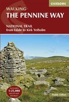
Wandelgids The Pennine Way | Cicerone
Uitstekende wandelgids van de Pennine Way, waarbij naast alle noodzakelijke informatie ook gebruik gemaakt wordt van de echte topografische kaart. inclusief gidsje met routekaarten van 1:25000  Guidebook to the Pennine Way National Trail with OS map booklet. The 270 mile route from Edale to Kirk Yetholm takes three weeks to walk and is suitable for fit and experienced long distance walkers. The route crosses the Peak District, Yorkshire Dales and North Pennines National Parks. Includes separate OS 1:25,000 map booklet of the route. The Pennine Way is Britain's oldest, toughest long-distance footpath – and arguably its most iconic. Now a National Trail, the 427km (265½ mile) route from Edale in Derbyshire to Kirk Yetholm in the Scottish Borders offers wayfarers the opportunity to immerse themselves in wild beauty of the North. The Pennines boast rolling hills, sweeping moorland and wide glacial valleys, and the Pennine Way has come to embody personal challenge and adventure.    This gui…
23,95
Wandelkaart National Trail Map Pennine Way | Collins
Overzichtskaart op vrij grove schaal van deze LAW Lange Afstands Wandeling in Engeland. Let op: je kunt er niet op lopen. Wel met veel informatie op de kaart, goed ingetekend, een route-schema op de achterzijde en een beschrijving van een aantal bezienswaardigheden.  Perfect guide and map for planning your adventure along the iconic Pennine Way.   Highlights of this Planning Map include:   More than 20 highlighted places of interest with detailed descriptions and attractive photographs, including: Hadrian’s Wall, Tan Hill, and Cauldron Snout A comprehensive index to more than 1000 cities, towns and villages A clear, visible route plotted across the map Advice on safety and security when travelling along the route, as well as the countryside code and the code of conduct The Pennine Way is the oldest of the 16 National Trails and runs along The Pennines, linking the Peak District National Park with the Cheviot Hills. Starting in Edale, Derbyshire, the walk covers 268 miles (431 km) and p…
11,50
Wandelkaart St Oswald's Way | Harvey Maps
Mooie, duidelijke kaart van de St Oswald's Way Noord-Engeland. Geplastificeerd met veel extra informatie en uitsnedes van de route.   From Holy Island to Heavenfield, the 97 mile St Oswald's Way links some of the places associated with St Oswaldwho was the King of Northumbria in the early 7th century. The route runs through the Northumbria National Park following the stunning Northumberland Coast before heading inland across beautiful countryside to Heavenfield. It links with St Cuthbert's Way in the north and Hadrian's Wall Path in the south. Along the way you will encounter rolling farmland, villages, vast sandy beaches and fascinating history.   The HARVEY series of Long Distance Route maps is an established success. Now the advanced technology used in the creation of our best-selling British Mountain Maps is also applied to the route maps.   These maps are a leap forward in technical excellence. They are tough, durable, light and 100% waterproof - virtually indestructible in normal…
25,95
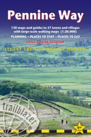
Wandelgids Pennine Way | Trailblazer Guides
Trailblazer British Walking Guide to the Pennine Way, Britain's best-known National Trail that winds for 256 miles through three National Parks - the Peak District, Yorkshire Dales and Northumberland. This superb footpath showcases Britain's finest upland scenery, while touching the literary landscape of the Bronte family and Roman history along Hadrian's Wall. 138 large-scale walking maps - at just under 1:20,000 - showing route times, gradients, where to stay, interesting features.   Guides to 57 towns and villages - along the way. Itineraries for all walkers - whether walking the route in its entirety or sampling the highlights on day walks and short breaks. Practical information for all budgets - Edale to Kirk Yetholm.   Where to stay with reviews - B&Bs, hostels, campsites, pubs and hotels. Where to eat with reviews. What to see, plus detailed town plans.   Public transport information - for all access points on the path. GPS waypoints - also downloadable from the Trailblazer webs…
23,50
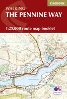
Wandelatlas Pennine Way Map Booklet | Cicerone
Heel handig bedacht van uitgever Cicerone: een boekje dat dienst doet als atlas met alle topografische kaarten die je nodig hebt voor het lopen van de Pennine Way. Past goed in binnenzak of broekzak. Map of the 270 miles (435km) Pennine Way National Trail, between Edale in the Peak District and Kirk Yetholm in the Scottish Borders. This booklet is included with the Cicerone guidebook to the trail, and shows the full route on OS 1:25,000 maps. This popular long-distance route typically takes three weeks to complete.
17,50
Wandelkaart Arran including Arran Coastal Way | Harvey Maps
Een bijzonder handige kaart van dit gebied. Op waterafstotend papier met veel details.    Features the renowned Goat Fell, A'Chir ridge, Beinn Bharrain, Glen Sannox & Glen Rosa. Detailed map for hillwalkers of the whole island at the popular 1:25,000 scale. The 100km (62 miles) Arran Coastal Way is also shown. The route links the coastline of the island with the villages and the stunning scenery Arran has to offer. Includes Gaelic-English glossary and information on local archaeological and historical sites. Landscape and wildlife information from the National Trust for Scotland Includes 4 Corbetts and 1 Graham.   Tough, light, durable and 100% waterproof Genuine, original, HARVEY mapping Opens directly to either side of the sheet Easy to re-fold  
24,95
Wandelkaart 2 South West Coast Path 2 | Harvey Maps
Een bijzonder handige kaart voor een deel van dit lange-afstands-wandelpad (Minehead tot St Ives) van het in totaal maar liefst 1014 km lange South West Coast Path. Op waterafstotend papier met veel details, uitstekend en voldoende voor dit deel van de route. De totale route bestaat uit 3 kaarten.    Ideal map for walkers on Britiain's longest and one of its most popular National Trails. It runs along the coast of Somerset, Cornwall, Devon, and Dorset from Minehead round via Land's End to Poole. It includes all 95 miles of the World Heritage site known as the Jurassic Coast.   3 HARVEY maps will cover the whole 630-mile route. Each map covers a section of the Path suitable for 16 days of walking.   Map 2 covers the Path from St Ives to Plymouth   This map is bio-degradable   Information on finding accommodation, camping, food. Directions to the start. Also Ranger Service contact numbers and enlargements of towns/villages showing facilities available and tips on weather and clothing   D…
25,95
Wandelkaart North Downs Way | Harvey Maps
Mooie, duidelijke kaart van de North Downs Way in Engeland. Geplastificeerd met veel extra informatie en uitsnedes van de route.    XT40 - Leap forward in technical excellence. Tough, light and 100% waterproof   Compact and light - the map itself weighs just 60gms - a third of the weight of a laminated map, and much less bulky. And you can fold or refold it time and again, or stuff it in your back pocket and it won't fall to pieces.   Revised edition and format Shows the entire route on one XT40 map sheet.   The Way is 246km (156 miles). This map covers the whole route from Farnham in the west to Dover on the south east coast.   Information on finding accommodation, camping, food. Directions to the start and end points. Shows facilities available and includes tips on weather and clothing.     Detailed mapping, full legend. National Grid - can be used with GPS. 1:40,000 scale. Waterproof. Supplied in clear plastic pocket.
25,50

Klanten-reviews van Wandelkaart Pennine Way South | Harvey Maps

Er zijn nog geen beoordelingen voor dit productBen jij de eerste die een review plaatst?

Meer over Wandelkaart Pennine Way South | Harvey Maps

Productomschrijving

Mooie, duidelijke kaart van het zuidelijke gedeelte van de Pennine Way (Edale to Middleton-in-Teesdale). The whole of the Pennine Way on just 2 maps!   Pennine Way South map covers the route from Edale to Middleton-in-Teesdale.   The Pennine Way is a National Trail. It follows the backbone of England from the Peak District to the Scottish borders. It is one of the toughest UK long distance footpaths, and forms part of the European Footpath Network.   The Pennine Way was Britain's first National Trail, opened in 1965.   Just 2 HARVEY maps cover the whole 431km (268 miles) route. Each starts and finishes near public transport, so no hassle with getting lifts.   Each map also contains lots of information and useful telephone numbers to assist the walker with planning.   Tough, light, durable and 100% waterproof Includes Rights of Way Genuine original HARVEY mapping Route clearly marked  
Webshop.nl maakt gebruik van cookies. Ga je verder op onze website, ga dan akkoord met het plaatsen van cookies en de verwerking van deze data door ons en vermelde partners.