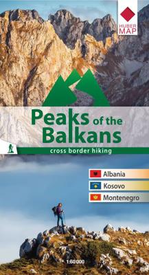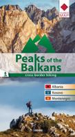
Wandelkaart Peaks of the Balkans | Huber Verlag

0
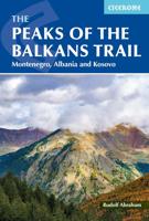
Wandelkaart van een speciaal gebied op de grens van Albanië, Kosovo en Montenegro. Ingetekend is de lange afstands wandelroute Peaks of the Balkans.  he transnational "Peaks of the Balkans Trail" guides through some of the most out of the way and wild mountain areas of the western Balkans. The "Peaks of the Balkans" walking map showing the trail t...

Verkopers met dit product

Verkoper
Bezorging
Prijs
DeZwerver.nl logo
DeZwerver.nl
2,95
14,95

Anderen bekeken ook

Wandelkaart Peaks of the Balkans | Huber Verlag
Wandelkaart van een speciaal gebied op de grens van Albanië, Kosovo en Montenegro. Ingetekend is de lange afstands wandelroute Peaks of the Balkans.  he transnational "Peaks of the Balkans Trail" guides through some of the most out of the way and wild mountain areas of the western Balkans. The "Peaks of the Balkans" walking map showing the trail through the mountains in the border region of Albania, Kosovo, Montenegro, and contains a detailed description of the various parts of the route including elevation profiles. Scale 1:60 000
14,95
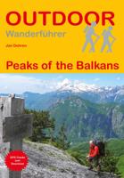
Wandelgids Peaks of the Balkans | Conrad Stein Verlag
Handzaam boekje met de routebeschrijving inclusief een heleboel praktische informatie. De beschrijving is uitstekend, maar kaarten zijn beperkt en schetsmatig aanwezig. Duits. 2012 wurde mit dem Peaks of the Balkans ein abenteuerlicher neuer Fernwanderweg im Dreiländereck zwischen Albanien, Kosovo und Montenegro eröffnet. Dieser Wanderführer liefert eine genaue Beschreibung des knapp 200 km langen Weges durch die faszinierende Landschaft rund um die "Gipfel des Balkans". Mit vielen Tipps zu Themen wie Anreise, Grenzübertritten und Reisewetter, Hinweisen zu Unterkünften und Exkursen zu Land und Leuten beinhaltet das Buch alle Informationen, die man für eine Wanderung auf diesem Weg braucht. Bei der Orientierung helfen neben der detaillierten Beschreibung genaue Karten und Höhenprofile zu jeder Etappe. Zahlreiche Fotos verstärken die Wander- und Abenteuerlust.   Einleitung, Land und Leute, Reise-Infos von A bis Z, Wanderroute in 10 Etappen, Kleiner Sprachführer.
16,95
Wegenkaart - landkaart 3327 Adventure Map Western Balkans - Westelijke Balkan | National Geographic
Wegenkaart van de Westelijke Balkan met vermelding van veel bezienswaardigheden en attrakties. Watervast en scheurvast. Juist door deze vermeldingen onderscheidt de kaart zich van andere wegenkaarten. Landen: Slovenië, Kroatië, Bosnië Herzegovina, Montenegro, Albanië, Servië,  Kosovo, and Macedonië.   The Western Balkans region, an adventure playground and rising star of Europe, is loaded with Old World traditions, slow food culture, ancient towns, and rarely visited villages. The area stretches from the Adriatic Sea in the west, up and over mountain ranges, raging rivers, tectonic lakes, steep gorges, and thousands of miles of paths, trails, and routes. Discover eight countries—all with their special brand of Balkan magic: Slovenia, Croatia, Bosnia and Herzegovina, Montenegro, Albania, Serbia, Kosovo, and Macedonia.   National Geographic's Western Balkans Adventure Map will meet the needs of travelers with its detailed and accurate information. The map includes the locations of UNESC…
17,50
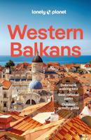
Reisgids Western Balkans | Lonely Planet
De perfecte reisgids voor zowel de georganiseerde als de zelfstandige reiziger. Naast een algemene inleiding van het land / streek vol met praktische informatie over hoe je er het beste kunt reizen: slapen, eten, vervoer, excursies ... alles kun je er in vinden.   Lonely Planet's Western Balkans is your passport to the most relevant, up-to-date advice on what to see and skip, and what hidden discoveries await you. Catch the cable car up Mt Srd for breathtaking views of Dubrovnik, Croatia; watch the beautiful people over the rim of a coffee cup in Budva's cobbled Old Town lanes in Montenegro; and trek around the stunning landscapes of Kosovo's Rugova Mountains. All with your trusted travel companion. Get to the heart of the Western Balkans and begin your journey now!   Coverage includes: Albania, Bosnia & Hercegovina, Croatia, Kosovo, Montenegro, North Macedonia, Serbia, Slovenia and more   Inside Lonely Planet's Western Balkans:   Full-colour maps and images throughout Highlightsand i…
25,95
Wandkaart The Balkans - Balkan landen, 77 x 60 cm | National Geographic
Study the countries of the Balkans with our new map featuring the classic National Geographic reference styling. Features thousands of place names, accurate political boundaries, national parks, and major infrastructure networks such as roads, canals, ferry routes, and railroads. The countries of the Balkans Classic map shows it's diverse terrain as detailed through accurate shaded relief, coastal bathymetry, and symbolism for water features and other landforms. Elevations of major peaks as well as depth soundings are expressed in meters.   Map coverage includes the countries of: Albania, Austria, Bosnia and Herzegovina, Bulgaria, Croatia, Hungary, Kosovo, Macedonia, Moldova, Montenegro, Romania, Slovenia, Vojvodina, as well as the outlying border countries of Greece, Italy, Slovakia, Turkey and Ukraine. Map features also includes listings for the counties of Hungary and Romania along with their respective capitals and the administrative divisions of Bosnia and Herzegovina.
31,95
Wandkaart 20581 The Balkans - Balkan landen, 77 x 60 cm | National Geographic
Study the countries of the Balkans with our new map featuring the classic National Geographic reference styling. Features thousands of place names, accurate political boundaries, national parks, and major infrastructure networks such as roads, canals, ferry routes, and railroads. The countries of the Balkans Classic map shows it's diverse terrain as detailed through accurate shaded relief, coastal bathymetry, and symbolism for water features and other landforms. Elevations of major peaks as well as depth soundings are expressed in meters.   Map coverage includes the countries of: Albania, Austria, Bosnia and Herzegovina, Bulgaria, Croatia, Hungary, Kosovo, Macedonia, Moldova, Montenegro, Romania, Slovenia, Vojvodina, as well as the outlying border countries of Greece, Italy, Slovakia, Turkey and Ukraine. Map features also includes listings for the counties of Hungary and Romania along with their respective capitals and the administrative divisions of Bosnia and Herzegovina.
21,95
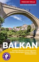
Reisgids Reiseführer Balkan | Trescher Verlag
Die sieben Länder des Westbalkans faszinieren mit der Vielfalt ihrer Kulturen. Uralte Städte, unzählige Schlösser, Burgen und Klöster laden zu Erkundungen ein. Es begeistern spektakuläre Hochgebirgswelten, Flusslandschaften und traumhafte Strände. Ob quirliger Badeort, pittoreske Altstadt oder einsamer Berggipfel - der Trescher-Reiseführer BALKAN ist ein guter Begleiter, die schönsten Reiseziele auf dem Balkan zu entdecken.   Die Länder zwischen Adriaküste und Eisernem Tor, Pannonischer Tiefebene und Balkangebirge besitzen eine Fülle an Natur- und Architekturschätzen. Viele gehören zum UNESCO-Welterbe; darunter die antike Ruinenstadt Butrint im Süden Albaniens und das nordmazedonische Ohrid mit seinen Bauwerken aus byzantinischer und frühchristlicher Zeit, der kroatische Nationalpark Plitvicer Seen und die Klöster in Serbien. Die serbische Hauptstadt Belgrad an der Nahtstelle zwischen Okzident und Orient besticht in ihrem Mix aus osmanischem Baustil und mitteleuropäischer Gründerzeit,…
26,95
Wegenkaart - landkaart Balkans Rail and Road | ITMB
The region of Europe known as the Balkans is normally restricted to the area that used to be Yugoslavia, but it is geographically much larger and needs to be seen in its expanded format that includes Hungary, Romania, Moldova, and Greece, with that portion of Turkey that has had so much influence on the region over many centuries. Side 1 is dominated by the great land mass of historic strategic importance that has been fought over for centuries. Nowadays, conflict is still threatening, with Kosovo and Serbia always at each other's throats and Romania warily watching Russia's aggression next door in both Ukraine and Moldova. Attitudes are shifting towards closer integration with the EU in the region, with Albania, Northern Macedonia, Kosovo, and Montenegro clamouring for admission and NATO being looked at to provide security against further Russian aggression. As a result, the region retains huge geopolitical significance, but it also offers touristic opportunities that are difficult t…
13,95
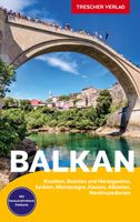
Reisgids Balkan | Trescher Verlag
Goede Duitstalige reisgids met veel culturele beschrijvingen. Daarnaast ook aandacht voor praktische zaken als overnachten en rondreizen. Bijzondere duitse uitgever, vaak als eerste een boek over een bepaald gebied of land. Erster deutschsprachiger Reiseführer zum gesamten Westbalkan- Sieben Länder in einem Band: Kroatien, Bosnien und Herzegowina, Serbien, Montenegro, Kosovo, Albanien, Nordmazedonien- Alle wichtigen Sehenswürdigkeiten auf 536 Seiten- Vorschläge für Balkantouren, umfassende reisepraktische Hinweise - 39 Stadtpläne und Übersichtskarten, große Faltkarte zum Herausnehmen Die Länder des Westbalkan zeigen sich als überraschend vielfältige Reiseziele, zusammen bieten sie eine schier unüberschaubare Fülle an Sehenswürdigkeiten. Der architektonische Reichtum in den Hauptstädten Zagreb, Sarajevo, Belgrad, Podgorica, Prishtin, Tirana und Skopje, aber auch in malerischen Kleinstädten geht auf viele Völker zurück, darunter Römer, Venezianer, Osmanen und Österreicher. Zu entdecken …
27,50

Klanten-reviews van Wandelkaart Peaks of the Balkans | Huber Verlag

Er zijn nog geen beoordelingen voor dit productBen jij de eerste die een review plaatst?

Meer over Wandelkaart Peaks of the Balkans | Huber Verlag

Productomschrijving

Wandelkaart van een speciaal gebied op de grens van Albanië, Kosovo en Montenegro. Ingetekend is de lange afstands wandelroute Peaks of the Balkans. 

he transnational "Peaks of the Balkans Trail" guides through some of the most out of the way and wild mountain areas of the western Balkans. The "Peaks of the Balkans" walking map showing the trail through the mountains in the border region of Albania, Kosovo, Montenegro, and contains a detailed description of the various parts of the route including elevation profiles. Scale 1:60 000

Productinformatie

    Verken gerelateerde categorieën

    Webshop.nl maakt gebruik van cookies. Ga je verder op onze website, ga dan akkoord met het plaatsen van cookies en de verwerking van deze data door ons en vermelde partners.