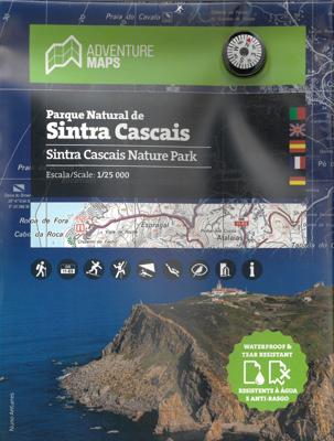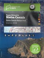
Wandelkaart Parque Natural de Sintra Cascais | Adventure MAPS

0
Prachtige topografische kaart van het Nationale park Sintra Cascais in Portugal. Schaal: 1:25000 1/25 (1 cm = 250 meter) Legenda en aanvullende informatie over PT, EN, ES, FR en DE Magnetisch kompas opgenomen  Net van toeristische paden (inclusief GR11) · Toeristische bezienswaardigheden in de omgeving van de symboliek (monumenten, m...

Verkopers met dit product

Verkoper
Bezorging
Prijs
DeZwerver.nl logo
DeZwerver.nl
2,95
23,50

Anderen bekeken ook

Wandelkaart Parque Natural do Sudoeste Alentejano e Costa Vicentina | Adventure MAPS
Prachtige tweezijdige topografische kaart van een groot deel van de zuidwest kust van Portugal, een westelijk stuk van de Alrgarve en de Ruta Vicentina. Veel details op topografisch gebied, ingetekende wandelroutes maar ook toeristische informatie als stranden, campings en jeugdherbergen Schaal: 1:50.000 Legenda en aanvullende informatie over PT, EN, ES, FR en DE Magnetisch kompas opgenomen  Paths, GR(Long Distance Path) and PR(Short Distance Path) includes GR11-E9 (Rota Vicentina) and GR13-E4 ( Via Algarviana)     Toeristische bezienswaardigheden in de omgeving van de symboliek (monumenten, mooie vergezichten, picknickplaatsen, musea en toeristische kantoren) Klimmen, surfen, duiken, paragliding en de stranden Offset contouren van 10 m Gauss rooster met afdelingen van 1 Km Coördinaten WGS84 (compatibel met GPS) Vertegenwoordiging van magnetische declinatie Afmetingen: 66cmx80cm Printing: Duplex Plaatsen op de kaart Aljezur | Almograve | Barão de S.João | Bensafrim | Borde…
23,50
Nieuw
Wandelkaart Parque Natural da Serra da Estrela | Adventure MAPS
Prachtige topografische kaart van het Nationale park Serra da Estrela in Portugal. Schaal: 1:25000 1/25 (1 cm = 250 meter) Legenda en aanvullende informatie PT, EN, ES, FR en DE Magnetisch kompas opgenomen  Net van toeristische paden (inclusief GR22 en GR33) · Toeristische bezienswaardigheden in de omgeving van de symboliek (monumenten, mooie vergezichten, picknickplaatsen, musea en toeristische kantoren) Klimmen, surfen, duiken, paragliding en de stranden Offset contouren van 10 m Gauss rooster met afdelingen van 1 Km Coördinaten WGS84 (compatibel met GPS) Vertegenwoordiging van magnetische declinatie Printing: Duplex Plaatsen op de kaart Aldeias | Alvôco da Serra | Bouça | Cabeça | Covilhã | Folgosinho | Gouveia | Lapa dos Dinheiros | Loriga | Mangualde da Serra | Manteigas | Melo | Nabais | Penhas da Saúde | Penhas Douradas | S.Romão | Sabugueiro | Sameiro | Sazes da Beira | Seia | Unhais da Serra | Vale do Rossim | Valezim | Vila Cova-à-Coelheira
23,50
Nieuw
Wandelkaart Parque Natural Peneda - Geres | Adventure MAPS
Prachtige topografische kaart van het Nationale park Peneda - Geres.   Schaal: 1/50 000 (1 cm = 500 m) Legend en aanvullende informatie over PT, EN, ES, FR en DE Magnetisch kompas opgenomen · Net van toeristische paden (inclusief GR34) Informatie specificeert de "deuren", zoals informatiecentra en de receptie National Park Toeristische bezienswaardigheden in de omgeving met symboliek, zoals Cascades, Panoramisch, picknickplaatsen, musea en toeristische kantoren, enz. Klimmen en Canyoning Offset contouren van 20 m Gauss grid met 2 km divisies Coördinaten WGS84 (compatibel met GPS) Vertegenwoordiging van magnetische declinatie Afmetingen: 96cmx59cm Printing: Duplex Plaatsen op de kaart Arcos de Valdevez | Cabril | Campo do Gerês | Castro Laboreiro | Ermida | Fafião | Gerês | Lamas de Mouro | Lindoso | Lobios | Outeiro | Pitões das Júnias | Ponte da Barca | Sistelo | Soajo | Terras de Bouro | Torém  
23,50
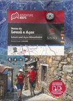
Wandelkaart Serras da Lousa e Acor | Adventure MAPS
Prachtige topografische wandelkaart van de Serras da Lousa e Acor.   Schaal: 1:30.000 Legenda en aanvullende informatie PT, EN, ES, FR en DE Magnetisch kompas opgenomen  Net van toeristische paden  Toeristische bezienswaardigheden in de omgeving van de symboliek (monumenten, mooie vergezichten, picknickplaatsen, musea en toeristische kantoren) Klimmen, surfen, duiken, paragliding en de stranden Offset contouren van 10 m Gauss rooster met afdelingen van 1 Km Coördinaten WGS84 (compatibel met GPS) Vertegenwoordiging van magnetische declinatie Printing: Duplex   Topographic map at 1/30 000 scale, subtitled in Portuguese, English, Spanish, French and German, including the entire network of pedestrian paths in the referenced area, tourist attractions such as the Schist Villages, river beaches, bathing areas, waterfalls, campsites, picnic areas, tourist offices, climbing and hang gliding spots, among others.   Schist Villages - Aigra Nova | Aigra Velha |Aldeia das Dez | Benfeita | Candal…
23,50
Wandelkaart 23 Parque Nacional de Aigüestortes y Estany de Sant Maurici | Editorial Alpina
Prachtig gedetailleerde kaartenset met 2 wandelkaarten van Parc Nacional d`Aigüestortes i Estany de Sant Maurici. Met hoogtelijnen (20m afstand), ingetekende wandelroutes oa GR11 en GR 211.4, campings en berghutten. Zeer gedetailleerde wandelkaart van een klein gebied. Met ingetekende wandelroutes en andere informatie. Spaanstalig, maar uitstekende kaart. Coordinaten zijn weergegeven, dus GPS compatible met UTM grid.    Op de topografische wandelkaart worden o.a. berghutten, campings aangeduid en hoogtelijnen, ingetekende wandelroutes en de GR paden (doorgaande langeafstandswandelpaden). De kaart is inclusief een Spaanstalig boekje met extra informatie over aanwezige voorzieningen en enkele routes.   Gebied:  Caldes de Boi, Erill la Vall, Boi, Taüll, Barruera, Cardet, Durro, Isaverre, Cerbi, Valencia d‘Aneu, Esterri d‘Aneu, Son, Jou, Espot, Estais, Escart, Escalo, la Guinguea d‘Aneu, Montardo, Besiberri Nord, Pic de Comalofrono, Gran Tuc de Colomers, Pic de Peguera   Ingetekende GR-wa…
19,95
Wandelkaart 313 Santorini | Terrain maps
Gedetailleerde wegenkaart en wandelkaart met alle kleine wegen, wandelpaden, hoogtelijnen en toeristische informatie aangegeven. Alle tekst is tweetalig in Engels en Grieks en de waterproof kaart is geschikt voor gebruik met GPS.   This is a detailled map of Santorini. Features: It is waterproof and rip-proof. You can fold and unfold it a thousand times, fold it in irregular ways, dunk it in the sea or leave it out in the rain. This map is indestructible!  It indicates the boundaries of NATURA 2000 areas so that you will know which parts of the island are of special environmental interest and beauty – thus you can enjoy traveling through them, but also take care to protect them.  The length of all trails is measured in kilometers, so you can estimate the duration of your hike no matter which trail / road combination you follow.  It features detailed descriptions of 2 trails on the back, including their total length in kilometers and the duration of the hike, and the wineries of Sa…
11,95
Wandelkaart 316 Folegandros | Terrain maps
Gedetailleerde wegenkaart en wandelkaart met alle kleine wegen, wandelpaden, hoogtelijnen en toeristische informatie aangegeven. Alle tekst is tweetalig in Engels en Grieks en de waterproof kaart is geschikt voor gebruik met GPS. This is a great map because: First and foremost, it’s the only existing GIS map of Folegandros, which makes it the only truly accurate and GPS compatible map of the island.  It comes in the detailed scale of 1:20,000, showing everything with great clarity, and it is made with data collected 100% through field survey.  The entire trail network of Folegandros is shown for the first time, with impeccable accuracy. All trails are measured in kilometers, so you can estimate the duration of your hike. On the back side, the island’s 5 best hikes are presented in detail. These are also distinctly labeled on the map so you can easily locate them.  It is printed on Polyart material, making it totally waterproof and rip-proof. You can fold it and unfold it a hundred…
11,95
Campergids Met de Camper door Portugal | Camperroutes.nl
In de routegids 'Met de Camper door Portugal, neemt het schrijversechtpaar Mike en Loes Bisschops je mee op een schitterende reis per camper langs steden, natuurgebieden en de grote monumenten van Portugal. Naast toeristische beschrijvingen is er veel aandacht voor praktische zaken als: * Campings en camperplaatsen onderweg * Eten en drinken * Openingstijden en prijzen van musea, kerken, kloosters en paleizen * De berijdbaarheid en kwaliteit van de wegen met een camper` De 2300 km lange route in Portugal is in drie grote delen beschreven: 1. NOORD-PORTUGAL Via Braga en Guimarães naar Porto, een rondrit door het natuurgebied van de Alvão in het Noorden en door de wijngebieden van de Douro. 2. MIDDEN-PORTUGAL Het natuurgebied van de Serra da Estrela, de historische en vooral religieuze driehoek Coimbra, Fatima en Tomar, het noordelijk deel van de Alentejo met bezoeken aan Elvas, Vila Viçosa en Évora en tenslotte de Costa de Lisboa, met Cascais, Belém en Sintra en natuurlijk de zonnige h…
20,95
Wandelkaart 341 Symi | Terrain maps
Gedetailleerde wegenkaart en wandelkaart met alle kleine wegen, wandelpaden, hoogtelijnen en toeristische informatie aangegeven. Alle tekst is tweetalig in Engels en Grieks en de waterproof kaart is geschikt voor gebruik met GPS. This is a great map because: For starters, it is the only map of Symi! No other cartographer had bothered creating a map of this remote Greek island in the Dodecanese … Finally, TERRAIN and SKAI created the first reliable map of Symi using GIS technology.  It is waterproof and rip-proof. You can fold and unfold it a thousand times, fold it in irregular ways, dunk it in the sea or leave it out in the rain. This map is indestructible!  It is remarkably detailed, as the 1:20.000 scale makes everything crystal clear!  It is the first time the island’s entire coastline is mapped. Cartography was done with TERRAIN’s specially equipped and staffed cartographic vessel. This means that you can locate all beaches of the island, down to the tiniest cove! In fact, th…
11,95
Wandelkaart 329 Psara | Terrain maps
Gedetailleerde wegenkaart en wandelkaart met alle kleine wegen, wandelpaden, hoogtelijnen en toeristische informatie aangegeven. Alle tekst is tweetalig in Engels en Grieks en de waterproof kaart is geschikt voor gebruik met GPS.   This is a great map because: First and foremost, it is the only available map of Psara! So far, no other cartographer had taken interest in this historical but forgotten corner of Greece. It is made with data collected 100% through field survey and comes in the detailed scale of 1:15,000, showing everything very clearly.  For the first time, all the trails of Psara are shown with absolute accuracy. The length of all trails has been measured in kilometres, so you can estimate the duration of your hike. On the back side of the map you ‘ll find detailed descriptions of the 3 best hikes on the island, also labeled on the map itself, so you easily locate them.  The nearby uninhabited island of Antipsara as well as all the surrounding islets are also included,…
11,95

Klanten-reviews van Wandelkaart Parque Natural de Sintra Cascais | Adventure MAPS

Er zijn nog geen beoordelingen voor dit productBen jij de eerste die een review plaatst?

Meer over Wandelkaart Parque Natural de Sintra Cascais | Adventure MAPS

Productomschrijving

Prachtige topografische kaart van het Nationale park Sintra Cascais in Portugal.
  • Schaal: 1:25000 1/25 (1 cm = 250 meter)
  • Legenda en aanvullende informatie over PT, EN, ES, FR en DE
  • Magnetisch kompas opgenomen 
  • Net van toeristische paden (inclusief GR11) ·
  • Toeristische bezienswaardigheden in de omgeving van de symboliek (monumenten, mooie vergezichten, picknickplaatsen, musea en toeristische kantoren)
  • Klimmen, surfen, duiken, paragliding en de stranden
  • Offset contouren van 10 m
  • Gauss rooster met afdelingen van 1 Km
  • Coördinaten WGS84 (compatibel met GPS)
  • Vertegenwoordiging van magnetische declinatie
  • Afmetingen: 66cmx80cm
  • Printing: Duplex
Plaatsen op de kaart Alcabideche | Almoçageme | Assafora | Cascais | Colares | Estoril | Fontanelas | Magoito | Malveira da Serra | Parede | S.João das Lampas | Sintra | Terrugem

Productinformatie

    Verken gerelateerde categorieën

    Webshop.nl maakt gebruik van cookies. Ga je verder op onze website, ga dan akkoord met het plaatsen van cookies en de verwerking van deze data door ons en vermelde partners.