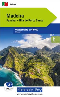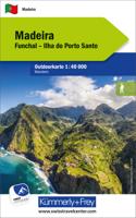
Wandelkaart Outdoorkarte Madeira - Funchal - Porto Santo | Kümmerly & Frey

0
Hele goede wandelkaart met alle noodzakelijke topografische details van Madeira met ingetekende routes. De kaart is geplastificeerd, met kleine plattegrond van Funchal. Madeira at 1:40.000 on a contoured, GPS compatible outdoor map from Kümmerly + Frey printed on sturdy waterproof and tear-resistant synthetic paper. The map is double-sided on a mo...

Verkopers met dit product

Verkoper
Bezorging
Prijs
DeZwerver.nl logo
DeZwerver.nl
2,95
13,95

Anderen bekeken ook

Wandelkaart Outdoorkarte Madeira - Funchal - Porto Santo | Kümmerly & Frey
Hele goede wandelkaart met alle noodzakelijke topografische details van Madeira met ingetekende routes. De kaart is geplastificeerd, met kleine plattegrond van Funchal. Madeira at 1:40.000 on a contoured, GPS compatible outdoor map from Kümmerly + Frey printed on sturdy waterproof and tear-resistant synthetic paper. The map is double-sided on a more convenient size sheet and includes a street plan of central Funchal, plus coverage of the nearby Islas Desertas and Porto Santo at 1;70,000.   The map divides Madeira east/west with a very generous overlap between the sides. Topography is shown by contours at 20m intervals, enhanced by relief shading and spot heights, plus colouring and/or graphics to indicate different types of terrain and vegetation.. Waymarked hiking trails and footpaths are highlighted by overprint which indicates narrow steep sections. The map also shows cycle routes plus a selection of mountain bike and horse riding trails.   A wide range of symbols indicate various …
13,95
Wandelkaart - Fietskaart Outdoorkarte Tenerife | Kümmerly & Frey
Hele goede wandelkaart met alle noodzakelijke topografische details van Tenerife met ingetekende routes. De kaart is geplastificeerd, met kleine plattegrond van San Christobal en Santa Cruz The Kümmerly+Frey outdoor maps help your with your planning. And once your have arrived at your holiday destination they double up as silent tour guides: attractive map image, comprehensive regional coverage (a map for each holiday region), contents featuring interesting tourist information such as important walking paths, mountain huts and tourist attractions. Scale: 1:60 000. Water and rip-proof map.
13,95
Wandelkaart 7 Outdoorkarte Chiemsee | Kümmerly & Frey
Wandelkaart met ingetekende routes.   The Kümmerly+Frey outdoor maps help your with your planning. And once your have arrived at your holiday destination they double up as silent tour guides: attractive map image, comprehensive regional coverage (a map for each holiday region), contents featuring interesting tourist information such as important walking paths, mountain huts and tourist attractions. Scale: 1:35 000. Water and rip-proof map.   Dorpen: Bad Endorf, Seebruck, Traunreut, Chiemsee, Herrenchiemsee, Traunstein, Prien, Bernau, Grassau, Siegsdorf, Ruhpolding, Kampenwand, Aschau, Schleching, Reitr im Winkel, Schwendt
13,95
Wandelkaart 36 Outdoorkarte Fichtelgebirge | Kümmerly & Frey
Wandelkaart met ingetekende routes.   The Kümmerly+Frey outdoor maps help your with your planning. And once your have arrived at your holiday destination they double up as silent tour guides: attractive map image, comprehensive regional coverage (a map for each holiday region), contents featuring interesting tourist information such as important walking paths, mountain huts and tourist attractions. Scale: 1:50 000. Water and rip-proof map.   Dorpen en steden op de kaart Wüstenselbitz, Schwarzenberg, Münchberg, Selb, Stammbach, Gefrees, Marktleuthen, Bad Berneck, Schneeberg, Wunsiedel, Goldkronach, Makrtredwitz, Warmensteinach, Fichtelbergm Brand, Weidenberg, Kulmain
13,95
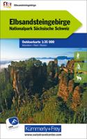
Wandelkaart 18 Outdoorkarte Elbsandsteingebirge | Kümmerly & Frey
Wandelkaart met ingetekende routes.   The Kümmerly+Frey outdoor maps help your with your planning. And once your have arrived at your holiday destination they double up as silent tour guides: attractive map image, comprehensive regional coverage (a map for each holiday region), contents featuring interesting tourist information such as important walking paths, mountain huts and tourist attractions. Scale: 1:50 000. Water and rip-proof map.   Dorpen en steden op de kaart Stolpen, Neustadt in Sachsen, Steinigtwolmsdorf, Lohmen, Bastei, Hohnstein, Sebnitz, Pirna, Elbe, Lilienstein, Könogstein, Berggießhübel, Bad Gottleuba, Rosenthal, Decin, Schmilka, Großer Winterberg, Kirnitzsch, Ruzova
13,95
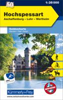
Wandelkaart 50 Outdoorkarte Hochspessart | Kümmerly & Frey
Wandelkaart met ingetekende routes.   The Kümmerly+Frey outdoor maps help your with your planning. And once your have arrived at your holiday destination they double up as silent tour guides: attractive map image, comprehensive regional coverage (a map for each holiday region), contents featuring interesting tourist information such as important walking paths, mountain huts and tourist attractions. Scale: 1:50 000. Water and rip-proof map.   Dorpen: Hösbach, Aschaffenburg, Weibersbrunn, Geiersberg, Main, Rothenfels, Heimbuchenthal, Obernburg, Klingenberg, Schollbrunn, Marktheidenfeld, Wertheim, Miltenberg, Bronnbach
13,95
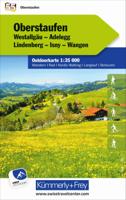
Wandelkaart 55 Outdoorkarte Oberstaufen | Kümmerly & Frey
Wandelkaart met ingetekende routes.   The Kümmerly+Frey outdoor maps help your with your planning. And once your have arrived at your holiday destination they double up as silent tour guides: attractive map image, comprehensive regional coverage (a map for each holiday region), contents featuring interesting tourist information such as important walking paths, mountain huts and tourist attractions. Scale: 1:50 000. Water and rip-proof map.   Dorpen: Wolfegg, Leutkirch, Kißlegg, Waldburg, Beuren, Isny, Wangen, Neuravensburg, Wengen, Lindenberg, Oberstaufen, Immenstadt, Lindau, Bregenz, Hochgrat
13,95
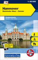
Wandelkaart 57 Outdoorkarte Hannover | Kümmerly & Frey
Wandelkaart met ingetekende routes.   The Kümmerly+Frey outdoor maps help your with your planning. And once your have arrived at your holiday destination they double up as silent tour guides: attractive map image, comprehensive regional coverage (a map for each holiday region), contents featuring interesting tourist information such as important walking paths, mountain huts and tourist attractions. Scale: 1:50 000. Water and rip-proof map.   Dorpen: Nienburg, Stolzenau, Neustadt, Weser, Steinhuder Meer, Leine, Wunstorf, Garbsen, Langenhagen, Hannover, Mittellandkanal, Stadthagen, Barsinghausen, Pattensen, Springe, Hessisch Oldendorf, Bückeburg
13,95
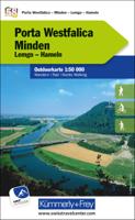
Wandelkaart 58 Outdoorkarte Porta Westfalica | Kümmerly & Frey
Wandelkaart met ingetekende routes.   The Kümmerly+Frey outdoor maps help your with your planning. And once your have arrived at your holiday destination they double up as silent tour guides: attractive map image, comprehensive regional coverage (a map for each holiday region), contents featuring interesting tourist information such as important walking paths, mountain huts and tourist attractions. Scale: 1:50 000. Water and rip-proof map.   Dorpen: Bad Essen, Espelkamp, Petershagen, Minden, Bückeburg, Wiehengebirge, Bad Oeynhausen, Porta Westfalica, Löhne, Melle Bünde, Vlotho, Rinteln, Hameln, Herford, Bad Salzfluen, Lemgo, Oerlingshausen, Detmold, Bad Pyrmont
13,95
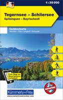
Wandelkaart 5 Outdoorkarte Tegernsee - Schliersee | Kümmerly & Frey
Wandelkaart met ingetekende routes.   The Kümmerly+Frey outdoor maps help your with your planning. And once your have arrived at your holiday destination they double up as silent tour guides: attractive map image, comprehensive regional coverage (a map for each holiday region), contents featuring interesting tourist information such as important walking paths, mountain huts and tourist attractions. Scale: 1:50 000. Water and rip-proof map.   Dorpen: Holzkirhcne, Wyarn, Bruckmühl, Bad Aibling, Miesbach, Mangfall, Schliersee, Tergensee, Gmund, Bas Tölz, Bad Wiessee, Rottach-Egern, Wildbad Kreuth, Ursprungpass
13,95

Klanten-reviews van Wandelkaart Outdoorkarte Madeira - Funchal - Porto Santo | Kümmerly & Frey

Er zijn nog geen beoordelingen voor dit productBen jij de eerste die een review plaatst?

Meer over Wandelkaart Outdoorkarte Madeira - Funchal - Porto Santo | Kümmerly & Frey

Productomschrijving

Hele goede wandelkaart met alle noodzakelijke topografische details van Madeira met ingetekende routes. De kaart is geplastificeerd, met kleine plattegrond van Funchal.

Madeira at 1:40.000 on a contoured, GPS compatible outdoor map from Kümmerly + Frey printed on sturdy waterproof and tear-resistant synthetic paper. The map is double-sided on a more convenient size sheet and includes a street plan of central Funchal, plus coverage of the nearby Islas Desertas and Porto Santo at 1;70,000.

  The map divides Madeira east/west with a very generous overlap between the sides. Topography is shown by contours at 20m intervals, enhanced by relief shading and spot heights, plus colouring and/or graphics to indicate different types of terrain and vegetation.. Waymarked hiking trails and footpaths are highlighted by overprint which indicates narrow steep sections. The map also shows cycle routes plus a selection of mountain bike and horse riding trails.   A wide range of symbols indicate various facilities and places of interest, including campsites, youth hostels, mountain huts, sport and recreational facilities, beaches, etc. The map has a 1-km UTM grid. Map legend includes English.   The street plan of central Funchal indicates main traffic arteries and highlights various places of interest.   Dorpen op de kaart Achadas da Cruz, Porto Moniz, Serra de Água, Ribeira Brava, Porto Santo, Ilhas Desertas, Bugio, Sao Jorge, Santana, Machico, Funchal, Camara de Lobos   Funchal, Ilha do Porto Santo Die Outdoor Karten von Kümmerly+Frey helfen beim Planen. Und am Ferienort trumpfen sie als stumme Reisebegleiter auf: attraktives Kartenbild, umfassende Regionalabdeckung (eine Karte für eine Ferienregion), informative touristische Inhalte wie z. B. wichtige Wander- und Velowege, Berghütten und Sehenswürdigkeiten. Massstab: 1:40 000. Karte wasser- und reissfest.


Productinformatie

    Verken gerelateerde categorieën

    Webshop.nl maakt gebruik van cookies. Ga je verder op onze website, ga dan akkoord met het plaatsen van cookies en de verwerking van deze data door ons en vermelde partners.