webshop.nl
Categorieën
  Sluiten

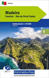
Wandelkaart Outdoorkarte Madeira - Funchal - Porto Santo | Kümmerly &

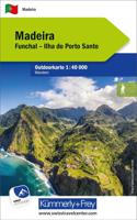
Hele goede wandelkaart met alle noodzakelijke topografische details van Madeira met ingetekende routes. De kaart is geplastificeerd, met kleine plattegrond van Funchal. Madeira at 1:40.000 on a contoured, GPS compatible outdoor map from Kümmerly + Frey printed on sturdy waterproof and tear-resistant synthetic paper. The map is double-sided on a mor...
13,50

Webshops met dit product

Webshop
Bezorging
Prijs

Anderen bekeken ook

Wandelkaart Outdoorkarte Madeira - Funchal - Porto Santo | Kümmerly &
Hele goede wandelkaart met alle noodzakelijke topografische details van Madeira met ingetekende routes. De kaart is geplastificeerd, met kleine plattegrond van Funchal. Madeira at 1:40.000 on a contoured, GPS compatible outdoor map from Kümmerly + Frey printed on sturdy waterproof and tear-resistant synthetic paper. The map is double-sided on a more convenient size sheet and includes a street plan of central Funchal, plus coverage of the nearby Islas Desertas and Porto Santo at 1;70,000.   The map divides Madeira east/west with a very generous overlap between the sides. Topography is shown by contours at 20m intervals, enhanced by relief shading and spot heights, plus colouring and/or graphics to indicate different types of terrain and vegetation.. Waymarked hiking trails and footpaths are highlighted by overprint which indicates narrow steep sections. The map also shows cycle routes plus a selection of mountain bike and horse riding trails.   A wide range of symbols indicate various f…
13,50
Wandelgids Walking on Madeira | Cicerone
Zeer goede wandelgids van deze gerenommeerde Engelse uitgever. Met veel detail worden de wandelingen beschreven, voorzien van goede kaarten en ook nog praktische informatie. Veelal veel keuze uit het grote aantal dagtochten dat beschreven wordt. De afstand is tussen de 5 en 18 kilometer, al naar gelang wat je als wandelaar in gedachte hebt.    This guide describes a varied selection of 57 walks on the Portuguese island of Madeira, exploring the dramatic cliff coastline, scenic levadas (irrigation channels), dense laurisilva 'cloud' forests and high mountain peaks, plus three walks on neighbouring Porto Santo. There are routes to suit all abilities, from easy, level levada walks to steep and rugged mountain paths – some with exposed sections calling for a sure foot and good head for heights. Since the steep terrain of Madeira does not easily support circular walks, many of the routes are linear, however most can be accessed by public transport and there is the option to link routes to c…
24,95
Wandelkaart - Wegenkaart - landkaart Madeira | Freytag & Berndt
Duidelijke kaart met hoofdwegen en kleine wegen. Afstanden zijn gemarkeerd, Schaduwwerking en en bergtekening tonen de hoogte. De Levada's - de kanalen waarlangs uitstekend gewandeld kan worden - staan goed ingetekend. Verder met veel toeristische symbolen voor bezienswaardigheden, campings, nationaal park grenzen, etc. Ingevoegd een simpele kaart van het centrum van Funchal en een inzet van Porto Santo op schaal 1:50.000.   This detailed road map of Madeira is very suitable for planning and traveling around the country. The road network is well represented, both the main roads, provincial and local roads. Road numbers are also clearly stated. Distances between places are marked on the map in kilometers, and gas stations are also marked in important places. Shadow shows the relief and sometimes some points with the actual height. Province borders, national parks and reserves are easy to find. Symbols indicate the location of tourist sites, monuments, historically important places and v…
14,95
Reisgids Mini Rough Guide Madeira | Rough Guides
Een kleinere versie in zakformaat van de grotere versies van de Rough Guides. Als altijd weer vol met goede informatie over cultuur en praktische zaken. Achterin kleine plattegronden. This pocket-sized guide is a convenient, quick-reference companion to discovering what to do, what to see and how to get around Madeira. It covers top attractions like Funchal, Monte, Jardim Botânico and Pico do Arieiro, as well as hidden gems, including Curral das Freiras, São Vicente and Ponta do Pargo. This will save you time and enhance your exploration of this fascinating country. This Mini Rough Guide to Madeira covers: Funchal, Funchal Old Town, Monte, Curral das Freiras, Câmara de Lobos, Cabo Girão, Ribeira Brava, Ponta do Sol, Calheta, São Vicente, Quinta do Palheiro, Porto Moniz, Pico do Arieiro, Ribeiro Frio, Santana, Machico, Ponta de São Lourenço, Porto Santo In this travel guide you will find: RECOMMENDATIONS FOR EVERY TYPE OF TRAVELLER Experiences selected for every kind of trip to Madei…
12,50
Reisgids Madeira | Michael Müller Verlag
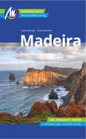
Hele goede, zeer degelijke en bijzonder complete reisgids over Madeira. Met zowel aandacht voor cultuur als voor praktische feiten voor het rondreizen zelf. Anders reisen und dabei das Besondere entdecken: Mit den aktuellen Tipps aus den Michael-Müller-Reiseführern gestalten Sie Ihre Reise individuell, nachhaltig und sicher.   Reif für die Insel? Dann reisen Sie einfach nach Madeira - mit unserem Reiseführer in der siebten Auflage. Unsere Autoren Irene Börjes und Sven Bremer zeigen auf 256 Seiten die Pracht der portugiesischen Insel. 32 Übersichtskarten und Pläne plus herausnehmbare Madeira-Karte im Maßstab 1:100.000 verschaffen Orientierung. Zwölf Wanderungen und Touren führen in jeden Winkel Madeiras. Alles vor Ort für Sie recherchiert und ausprobiert. Ökologisch, regional und nachhaltig wirtschaftende Betriebe sind kenntlich gemacht. Viele Kurz-Essays vermitteln interessantes Hintergrundwissen. Geheimtipps der Autorin nennen besonders lohnende Sehenswürdigkeiten, Unterkünfte oder Re…
22,50

Klanten-reviews van Wandelkaart Outdoorkarte Madeira - Funchal - Porto Santo | Kümmerly &

Er zijn nog geen beoordelingen voor dit productBen jij de eerste die een review plaatst?

Meer over Wandelkaart Outdoorkarte Madeira - Funchal - Porto Santo | Kümmerly &

Productomschrijving

Hele goede wandelkaart met alle noodzakelijke topografische details van Madeira met ingetekende routes. De kaart is geplastificeerd, met kleine plattegrond van Funchal. Madeira at 1:40.000 on a contoured, GPS compatible outdoor map from Kümmerly + Frey printed on sturdy waterproof and tear-resistant synthetic paper. The map is double-sided on a more convenient size sheet and includes a street plan of central Funchal, plus coverage of the nearby Islas Desertas and Porto Santo at 1;70,000.   The map divides Madeira east/west with a very generous overlap between the sides. Topography is shown by contours at 20m intervals, enhanced by relief shading and spot heights, plus colouring and/or graphics to indicate different types of terrain and vegetation.. Waymarked hiking trails and footpaths are highlighted by overprint which indicates narrow steep sections. The map also shows cycle routes plus a selection of mountain bike and horse riding trails.   A wide range of symbols indicate various facilities and places of interest, including campsites, youth hostels, mountain huts, sport and recreational facilities, beaches, etc. The map has a 1-km UTM grid. Map legend includes English.   The street plan of central Funchal indicates main traffic arteries and highlights various places of interest.   Dorpen op de kaart Achadas da Cruz, Porto Moniz, Serra de Água, Ribeira Brava, Porto Santo, Ilhas Desertas, Bugio, Sao Jorge, Santana, Machico, Funchal, Camara de Lobos   Funchal, Ilha do Porto Santo Die Outdoor Karten von Kümmerly+Frey helfen beim Planen. Und am Ferienort trumpfen sie als stumme Reisebegleiter auf: attraktives Kartenbild, umfassende Regionalabdeckung (eine Karte für eine Ferienregion), informative touristische Inhalte wie z. B. wichtige Wander- und Velowege, Berghütten und Sehenswürdigkeiten. Massstab: 1:40 000. Karte wasser- und reissfest.
Webshop.nl maakt gebruik van cookies. Ga je verder op onze website, ga dan akkoord met het plaatsen van cookies en de verwerking van deze data door ons en vermelde partners.