webshop.nl
Categorieën
  Sluiten

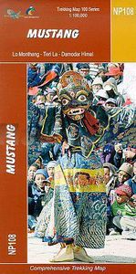
Wandelkaart NP108 Mustang - Nepal | Himalayan Maphouse

  Zeer gedetailleerde topografische wandelkaart. Dit is een nieuwe serie kaarten die de Great Himalaya Trail (GHT) in Nepal volgt. Kaart 1 begint in het oosten van Nepal, de volgende kaarten lopen richting noordwest  tot India.    Watervaste trekkingkaart met ingetekende GHT High route en andere belangrijke trekkingroutes in de omgeving: GHT Cultur...
19,95

Webshops met dit product

Webshop
Bezorging
Prijs

Anderen bekeken ook

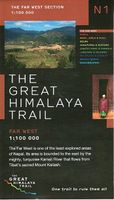
Wandelkaart The Great Himalaya Trail | GHT
  Prachtige kaartenserie van één van 'swerelds mooiste wandeltochten.   The Far West is one of the least explored areas of Nepal. Its area is bounded to the east by mighty, turquoise Karnali river which flows from Tibet’s sacred Mount Kailash.   Myth and superstition remain part of the fabric of life here. Though the Nepali language originated here, it seems a distant world from ‘modern’ Nepal. One Nepali visitor described his visit as “fascinating, like travelling back to the 18th century.”   Along the trails you may meet a turbaned Dhami, a shaman, with silver-bangled limbs and gold-ringed ears, who are still depended on for treating sickness.   Organised tourism has so far been limited to Khaptad National Park, the only national park in the mid-hills of Nepal and held dearly by conservationists. Gentle hills, pristine forests and abundant wildlife with a snow-covered backdrop of the Nampa, Api and Saipal peaks make for beautiful trekking.   It’s also a holy place associated with Kha…
26,95
Wandelgids A Trekking Guide to Ganesh Himal - Nepal | Himalayan Maphouse
Ganesh Himal is sure to be the next sought-after destination along the Great Himalaya Trail trekking route. Although visible from the rooftops of Kathmandu, the Ganesh Himal massif is surprisingly remote. Named after the Hindu god of good fortune, the Ganesh - Ruby Valley - region is home to an enticing treasure trove of trails and mysterious deep canyons. From the Pangsang La pass, one of the most overwhelming panoramas of the entire Nepalese Himalaya unfolds. With enchanting forests, an amazing wealth of cultural attractions, centuries-old traditions and the colourful blend of Gurung and Tamang people, the gods have bestowed great favour on the region. Add in the superb attractions of the Tamang Heritage Trail and the mix is as intoxicating as the dreams of those seeking the riches of Ganesh himself.   Authors Bob Gibbons and Sian Pritchard-Jones first visited Nepal in 1974 and 1982 respectively. Bob arrived overland from the UK in an old Land Rover, at a time when Boudhanath stupa w…
25,95
Wandelkaart NA520 Trekking map Mustang to Annapurna | Himalayan Maphouse
Wat grof van schaal, maar de grote trek van Mustang via de Saribung naar Phu , Naar en de Annapurna trail is er goed mee te doen. Met name de geweldige Saribung trek staart best goed op.   Deze kaart biedt voldoende details om de gangbare trekkings in Nepal te kunnen lopen. Bergklimmen op deze kaart zouden we niet aanraden, maar de oversteek van de passen tot 6000 meter zijn uitstekend uitvoerbaar met deze kaart.   Prachtige, gedetailleerde en watervaste trekking map - wandelkaart van een gedeelte van Nepal. Op deze kaart staan vrijwel alle wandelpaden in deze regio ingetekend. Bij de dorpen onderweg staan met symbolen de mogelijkheden ingetekend om te kamperen, maar ook of er een lodge is of dat er een winkel zou kunnen zijn.    De kaart bevat veel topografische details die behoorlijk nauwkeurig zijn: hoogtelijnen, rivieren en beken, sneeuwvelden, bosgebieden en bijvoorbeeld ook vliegvelden.    This map covers one of Nepal’s two main trekking areas at 1:165,000 scale, extending north…
12,95
Wandelgids Nepal Trekking and the Great Himalaya Trail: A Route and Planning Guide | Trailblazer Guides
With extensive sections to help you choose your trekking region, this is a route and planning guide for anyone organising a trekking holiday in Nepal. It includes the most popular routes as well as the newest trekking areas plus the most extreme route of all, the Great Himalaya Trail. There are route guides to the following regions: Kanchenjunga, Makalu, Rolwaling, Solu-Khumbu (Everest Region), Helambu & Langtang, Ganesh & Manaslu Annapurna, Naar & Phu, Mustang Dolpo, The Far West The guide covers: Visas, permits, fees and equipment Choosing a trek – independent tea-house trekking or guided treks arranged through trekking agencies; choosing a guide and crew; when to go; trekking grades and duration Kathmandu & Pokhara city guides – hotels, restaurants, what to see Nepal background – people, religions, festivals and etiquette Health, safety and responsible tourism Colour mapping – showing the main trekking routes in Nepal The Great Himalaya Trail Running the entire 4500 km length of the…
23,50
Wandelkaart NA504 Trekking map Around Annapurna | Himalayan Maphouse
Zeer duidelijke trekking kaart van de Annapurna Trail en een groot aantal zijpaden en alternatieve trekkings.  Alle noodzakelijke informatie vind je op deze kaart: van hoogtelijnen en andere topografische details tot meer toeristisch handige informatie als plaatsen met lodges of waar je kunt kamperen. De ideale kaart om de Annapurna trek te lopen, ook al is deze kaart gedrukt op wat dik papier met kans op scheuren bij de naden ... op z'n Nepali! The NA504 Around Annapurna Map is a 1:100,000 scale map of this area in Nepal from Nepa Maps.   The whole of the Annapurna Circuit is highlighted on this map at 1:100,000 scale, with alternative variants via the Tilicho Lakes or Naar, treks to the Machhapuchhre and South Annapurna Base Camps, climbing routes to the Chulu Peaks, Pisang Peak and Singu Chuli (Fluted Peak), etc.   Coverage extends from Pohkara to Muktinath and Kagbeni in the north, and in the north east includes the route to Phugaon and the trek/climb to Himlung. Contours are at 80…
12,95
Wandelkaart NS504 Upper and Lower Dolpa - Dolpo | Himalayan Maphouse
Goede duidelijk leesbare  map voor trekkings in Dolpo. Van Juphal en Jejargaon in het westen tot Kagbeni in Mustang aan de oostkant van de kaart. De trekkingroutes staat goed ingetekend. Shey Phoksundo National Park staat er ook geheel op.  Large area centred on Dho Tarap, lying between the Upper and Lower Dolpa regions, in the Nepa Maps series which provides extensive coverage of trekking areas of Nepal on detailed contoured maps with trekking routes and hiking trails, huts and camp sites, local places of interest and other tourist information.   Cartography is based on the country’s topographic survey, with contours usually at 40m or 50m intervals, enhanced by relief shading, colouring and graphics to show various features of the terrain, including glaciers, forested or cultivated areas, etc. Numerous peaks, with additional spot heights, plus names of glaciers and mountain ranges are prominently shown. The network of rivers, streams and lakes is shown in great detail, with many small…
12,95
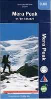
Wandelkaart CL802 Mera Peak climbing map | Himalayan Maphouse
A detailed 1:40,000 scale map which covers trekking to the Top of Mera Peak. The route is a very strenous 14 days going via, Lukla, Chutanga, Zatrwala, Thuli Kharja, Tashing, Ongma, Mosom Kharka, Thangnak. Dig khare, Khare Camp, Merala, Base Camp, High Camp, Mera Central Summit, Mera North Summit, Lukla. Deze kaart biedt voldoende details om de gangbare trekkings in Nepal te kunnen lopen. Bergklimmen op deze kaart zouden we niet aanraden, maar de oversteek van de passen tot 6000 meter zijn uitstekend uitvoerbaar met deze kaart.   Prachtige, gedetailleerde en trekking map - wandelkaart van een gedeelte van Nepal. Op deze kaart staan vrijwel alle wandelpaden in deze regio ingetekend. Bij de dorpen onderweg staan met symbolen de mogelijkheden ingetekend om te kamperen, maar ook of er een lodge is of dat er een winkel zou kunnen zijn.    De kaart bevat veel topografische details die behoorlijk nauwkeurig zijn: hoogtelijnen, rivieren en beken, sneeuwvelden, bosgebieden en bijvoorbeeld ook v…
14,95
Fietskaart Cycling guides Dartmoor - South Devon | Goldeneye
Dartmoor. One of England’s greater National Parks; the Forest of Dartmoor covers 365 square miles and contains the highest ground in England south of the Peak District. On its desolate moorland tracks the wanderer can believe they are further from a public road than anywhere in the country, but on the fringes lush valleys lead down on every side to thick woodland, green vegetation and picturesque villages. Dartmoor is well known for its wildlife - attractive herds of ponies, seemingly wild but in fact individually owned, foxes, badgers and otters - also the occasional adder. Fallow, roe and Sitka deer can often be seen, but the red deer of Exmoor have never penetrated the area. Buzzards, kestrels and various Birds of Prey are frequently seen, as well as the wheatear, while crows, ravens and the skylark are fairly commonplace. The Moor abounds in prehistoric remains. There are also many deserted medieval villages with remains of the traditional ‘longhouse’ buildings. For centuries tin m…
12,95
Reisgids Te gast in Nepal | Informatie Verre Reizen
Samengesteld door en voor reizigers: verhalen van mensen die er gewoond of gereisd hebben. Literatuurlijst, praktische tips, vooral veel achtergrond- en cultuur informatie. Nu in nieuw pocket formaat. Het toerisme naar Nepal zit in de lift sinds de vrede in het land is weergekeerd. In de geheel vernieuwde editie van TE GAST IN Nepal beschrijft een vijftal auteurs hun ervaringen in de jonge republiek. Ze ontdekken een land waar traditie en moderniteit naast elkaar lijken te bestaan. Ze maken een reis van de oude wereld, zonder radio, elektriciteit en stromend water, naar de nieuwe wereld van hippe bars, satellietschotels en iPhones. Nepal is economisch arm, maar rijk aan tradities, cultureel erfgoed en natuurlijke schoonheid. Wie van zuid naar noord reist, doorkruist bijna alle bestaande subtropische en alpiene landschappen en ontdekt een ongeëvenaarde culturele diversiteit. In de Kathmandu-vallei alleen al zijn er zo’n drieduizend monumenten te vinden waarvan er zeven op de Werelderfgo…
8,95
Fietsgids Bikeline Danube Bike Trail 2 (Engels - Donau Radweg) | Esterbauer
Praktische fietsgids met detailkaarten, ingetekende route, informatie over overnachten en fietsenmakers, zwaarte en hoogteprofiel. In spiraalbinding, Engelstalig.   Danube Bike Trail In the last decade the Danube bike trail has emerged as Europe’s most important long-distance bicycle touring route. Its popularity is due primarily to the Danube’s natural beauty and the wealth of cultural and historical sites that line its banks. But the large numbers of bicycle tourists visiting the Danube would not be possible without well-developed infrastructure and services. The Danube bike route has benefited from well-built posted bike trails and an extensive network of services oriented to meeting the needs of bicycle tourists. The following pages provide a few practical notes about how to use the book, and some tips on getting ready for the tour.   Length The total distance from the start in Passau to the final destination, Vienna, is 320?kilometres. This figure does not include about 160?kilome…
16,50

Klanten-reviews van Wandelkaart NP108 Mustang - Nepal | Himalayan Maphouse

Er zijn nog geen beoordelingen voor dit productBen jij de eerste die een review plaatst?

Meer over Wandelkaart NP108 Mustang - Nepal | Himalayan Maphouse

Productomschrijving

  Zeer gedetailleerde topografische wandelkaart. Dit is een nieuwe serie kaarten die de Great Himalaya Trail (GHT) in Nepal volgt. Kaart 1 begint in het oosten van Nepal, de volgende kaarten lopen richting noordwest  tot India.    Watervaste trekkingkaart met ingetekende GHT High route en andere belangrijke trekkingroutes in de omgeving: GHT Cultural Trail, Main Trekking Route. Geeft wandelwegen weer, hoogtelijnen, nederzetingen, campings, tempels en kloosters, tourist infos, hotels etc.   The Far West is one of the least explored areas of Nepal. Its area is bounded to the east by mighty, turquoise Karnali river which flows from Tibet's sacred Mount Kailash. Myth and superstition remain part of the fabric of life here. One Nepali visitor described his visit as “fascinating, like travelling back to the 18th century.”   Humla, the Hidden Himalaya, is also known as the Gateway to Mt. Kailash and many pilgrims make their way along the turquoise Karnali river, 'the pulse of the earth', to the border with Tibet. A detour north into Limi Valley makes for a special experience.  
Webshop.nl maakt gebruik van cookies. Ga je verder op onze website, ga dan akkoord met het plaatsen van cookies en de verwerking van deze data door ons en vermelde partners.