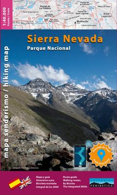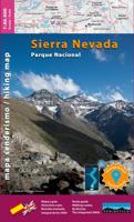
Wandelkaart NP Sierra Nevada | Editorial Penibetica

0
Kaart en wandelgids van het Nationaal Park Sierra Nevada (provincie Granada) op schaal 1:40.000. Inclusief de Alpujarra en het markgraafschap Zenete. De gids die bij de kaart hoort, geeft informatie over de ecologie, geografie en geschiedenis van de Sierra Nevada, en praktische informatie over schuilplaatsen, bivaks, campings en interessante telef...

Verkopers met dit product

Verkoper
Bezorging
Prijs
DeZwerver.nl logo
DeZwerver.nl
2,95
18,95

Anderen bekeken ook

Wandelkaart Sierra Nevada en Alpujarras | Editorial Alpina
Goede wandelkaart van dit gebied met alle noodzakelijke informatie als berghutten, campings. Kleurgebruik vrij fel, waardoor hoogtes goed uitkomen. Wandelroutes zijn ingetekend en de GR paden (doorgaande wandelpaden) zijn weergegeven met een teken of nummer. Coordinaten zijn weergegeven, dus GPS compatible met UTM grid Gebied: De Alpujarras staan er op tot en met Trevelez in het oosten. Met Granada, Lanjarrón, Nigüelas, Dúrcal, Restábal, Béznar, Trevélez, Bérchules, Bubíon, Capileira, Almegijar, Cástaras, Pinos del Valle, Dílar, Gójar, Monachil, Órgiva, Güejar-Sierra, Pradollano, Veleta, Mulhacén, La Alcazaba. New Map of Sierra Nevada at 1:40,000 scale, the most important chain of mountains in the southern Iberian peninsula. It has the highest peaks, as in the case of Mulhacen at 3,479 m, and the peak Veleta which is the third highest at 3396 meters.   The map also includes a significant portion of the region of La Alpujarra. Overall, this area offers immense opportunities for hiking,…
16,95
Wandelgids Walking and trekking in the Sierra Nevada | Cicerone
Uitstekende wandelgids voor de Sierra Nevada. Goed beschreven met veel praktische informatie om de route te kunnen lopen, inclusief redelijke kaarten. Aanbevolen wandelkaarten Wandelkaart NP Sierra Nevada met Alpujarras | Editorial Penibetica 1:40.000 of Wandelkaart Sierra Nevada en Alpujarras | Editorial Alpina - 1:40.000 Wandelkaart Sierra Nevada - la integral de los 3000 | Editorial Piolet 1:25.000   This guidebook presents 33 graded walks and 5 high mountain scrambles in the striking Sierra Nevada, the highest mountain range in mainland Spain and in western Europe outside the Alps. Easily accessible from Granada and Málaga, it is a world of soaring, snow-clad peaks and deep valleys, far removed from the crowded beaches of the Costa del Sol just two hours away. The routes are spread across the national park, with attractive towns and villages such as Trevélez, Lanjarón, Hoya de la Mora and Cumbres Verdes serving as potential bases for a walking holiday.   The walks have been carefu…
20,95
Wandelkaart Tour & Trail Alpujarras | Discovery Walking Guides
Scheur- en watervaste wandelkaart van de Alpujarras met hoogtelijnen en graden. For the best adventures, use the best map. The Moorish white villages of the Alpujarras are well known to day trippers from the Costa del Sol. For walkers this is an idyllic region with stone-laid donkey trails linking the tipico villages and stretching up the southern slopes of the Sierra Nevada to Mulhacen; at 3,483 metres the highest mountain peak on mainland Spain. From Spring to the end of Autumn this is a paradise for hikers, whether you are walking from village to village sampling the local delicacies or tackling the challenging major ascents. One thing you will know is that using the Alpujarras Tour & Trail Map will help you plan, and get the best out of, your adventures.   On a large 960mm by 700mm, double sided, map sheet at 40k scale this map has all the detail you need. 20 and 100 metre contours, combined with altitude shading, giving you a true feel to this impressive landscape.  Stret…
15,95
Wandelkaart - Fietskaart Sierra de Huetor | Editorial Penibetica
Topografische kaart met ingetekende rondwandelingen en fietsroutes. Een aantal van de routes wordt beschreven in het bijbehorende spaanstalige boekje. Het is een gebied net ten noordoosten van Granada. Este nuevo mapa que presentamos tiene como objetivo fundamentalque todo el visitante que se adentre en el Parque Naturalde la Sierra de Huétor, tenga una herramienta con informaciónclara y precisa, en la que se recojan las diferentes posibilidadesque ofrece este paraje para su total disfrute. Se trata de uninstrumento sencillo de consulta que contiene todo lo que senecesita para disfrutar de un placentero recorrido, en un marcoincomparable de ocio y descanso.Esta guía está pensada tanto para los montañeros, aficionados alsenderismo y a otros deportes que pueden ser practicados enesta sierra (bicicleta de montaña, escalada, trail running, etc.),como para todos los que quieran disfrutar de una jornada enplena naturaleza.
16,95
Wandelkaart 11 Sierra y Cañones de Guara, Canyons National Park | Editorial Alpina
Zeer gedetailleerde wandelkaart van een klein gebied. Met ingetekende wandelroutes en andere informatie. Spaanstalig, maar uitstekende kaart. Coordinaten zijn weergegeven, dus GPS compatible met UTM grid.    Op de topografische wandelkaart worden o.a. berghutten, campings aangeduid en hoogtelijnen, ingetekende wandelroutes en de GR paden (doorgaande langeafstandswandelpaden). De kaart is inclusief een Spaanstalig boekje met extra informatie over aanwezige voorzieningen en enkele routes.   Gebied: Huesca, Urriales, Bárcabo, Alquézar, Buera, Adahuesca, Salas Altas, Ibieca, Bastarás, Chibluco, Pedruel, Otín, Lúsera, Arguis, Lúsera, Nueno, Igriés, Loporzano, Chibluco, Bara, Nocito, Used, Tozal de Guara, Tozal de la Cabeza A topographic tourist map and hiking guide with details of tourist attractions, hiking & sporting activities as well as transport information. An excellent folded map & booklet. Sierra de Guara in an extensive and very popular series of walking maps from Editorial Alpina…
19,95
Wandelgids Walking the GR7 in Andalucia | Cicerone
Uitstekende wandelgids van een gerenommeerde Engelse uitgever. De tochten zijn met zorg beschreven en voorzien van allerhande nuttige informatie. With its white sandy beaches, pine forests, snow-capped peaks, traditional villages, lush river valleys and olive groves, the GR7 in Andalucía takes you on a journey through the most geographically diverse region on the Iberian peninsula. This wonderfully varied route starts at the southernmost tip of Spain at Tarifa, and meanders through the provinces of Cádiz and Málaga before dividing. The northern route heads through Córdoba and Jaén provinces (711km in total), whilst the southern route passes through Almería and Granada (720km). The route crosses seven stunning natural parks and the Sierra Nevada national park. • The first guide to cover the whole of the GR7 in Andalucía. • Detailed route description for around 60 days of walking, with options for creating shorter sections and days. • Information on all the villages en route offering ac…
26,50
Wandelkaart 10 Parques Nacionales Sierra Nevada | CNIG - Instituto Geográfico Nacional
Sierra Nevada National Park in Andalusië op 1:25.000 op een set van 8 grote, dubbelzijdige en GPS-compatibele kaarten van CNIG/IGN met cartografie van hun topografisch onderzoek van Spanje. De kaarten beslaan het hele Nationale Park, vanaf de buitenwijken van Granada in oostelijke richting, inclusief het gedeelte in de provincie Almeria.   De kaart gaat vergezeld van een Spaanstalige gids met beschrijvingen van wandelingen, contactgegevens voor aanbevolen accommodatie, etc.   De kaart heeft contouren op intervallen van 10 m, versterkt door reliëfschaduwen, plus kleuren en afbeeldingen om verschillende soorten vegetatie te tonen. De opdruk markeert bewegwijzerde wandelroutes, verschillende soorten toevluchtsoorden, campings, paradors en andere toeristische accommodaties, restaurants en lokale bezienswaardigheden. Gebieden voor verschillende sport- en recreatieve activiteiten zijn ook gemarkeerd. Wegennet geeft locaties van tankstations aan. De kaart heeft een UTM-raster van 1 km en maa…
29,95
Wegenkaart - landkaart Sierra Nevada | National Geographic
&; Waterproof &; Tear-Resistant &; Travel Map   National Geographic's Sierra Nevada Destination Map strikes the perfect balance between map and guidebook and is an ideal resource for touring the rugged landscape of this culturally and geographically unique region of California and Nevada.   The front side of the print map reveals a detailed map of the region stretching from the Oregon border to California's Eldorado National Forest, bordered by the Sacramento Valley to the west and Nevada's Great Basin to the east. Modoc, Shasta-Trinity, Lassen, Plumas, and Humbolt-Toiyabe National Forests are also included on the map. The map features a comprehensive road network including scenic byways as well as areas of interest such as Indian Reservations, National Parks and Monuments, and Recreation Areas. Trails, historic sites, museums, cultural centers, scenic areas, state parks and other points of interest are also included. In addition, the map features beautiful photographs and inform…
17,50
Wegenkaart - landkaart 3119 California - Nevada | National Geographic
Mooie kaart van de bekende kaartenmaker National Geographic. Veel details door kleurgebruik. De wegen zijn met kleuren verdeeld in drukke en minder drukke, de wegnummers zijn goed terug te vinden. De kaart onderscheidt zich van andere series door de hoeveelheid topografische details als counties, plaatsnamen en waterwegen en het bevat een register waarin het eenvoudig zoeken is. Daarnaast is de kaart gedrukt op scheur- en watervast papier. The United States California and Nevada Adventure Map will guide you through two of the most spectacular and diverse states in the country. California and Nevada contain Yosemite and Sequoia & Kings Canyon National Parks, Death Valley and the Mohave Desert, the Sierra Nevada Mountains, Lake Tahoe, and dozens of magnificent National Monuments, Forests, and Wilderness Areas. The map includes the cities of Los Angeles, San Francisco, San Diego, and Las Vegas as well as the breathtaking Pacific coast of California. It covers western Utah and Arizona, in…
17,50

Klanten-reviews van Wandelkaart NP Sierra Nevada | Editorial Penibetica

Er zijn nog geen beoordelingen voor dit productBen jij de eerste die een review plaatst?

Meer over Wandelkaart NP Sierra Nevada | Editorial Penibetica

Productomschrijving

Kaart en wandelgids van het Nationaal Park Sierra Nevada (provincie Granada) op schaal 1:40.000. Inclusief de Alpujarra en het markgraafschap Zenete. De gids die bij de kaart hoort, geeft informatie over de ecologie, geografie en geschiedenis van de Sierra Nevada, en praktische informatie over schuilplaatsen, bivaks, campings en interessante telefoonnummers. Het bevat de beschrijving van in totaal wandelroutes, de volledige 3.000, de GR7, de Gr-Sulayr, de Transnevada, track en route en een teledetectiesysteem met QR-code kunnen worden gedownload.  

The map covers Alpujarras and Marquesado del Zenete, the western and central parts of the Sierra Nevada range, from just east of Granada to the A337 road crossing the mountains over the Puerto de la Ragua Pass, and shows both the southern and the northern approaches to the peaks.

Verken gerelateerde categorieën

Webshop.nl maakt gebruik van cookies. Ga je verder op onze website, ga dan akkoord met het plaatsen van cookies en de verwerking van deze data door ons en vermelde partners.