Wandelkaart North York Moors West | Harvey Maps

0
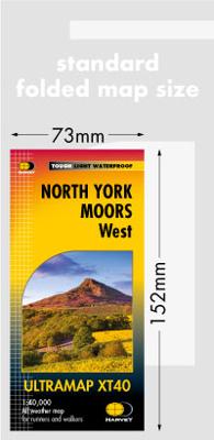
Covers a large area yet is handily compact. Pocket perfect!   Detailed map for runners and walkers of the western section of the North York Moors National Park at the magic scale of 1:40,000.   Includes the popular Hambleton Hills and Cleveland Hills.   Roseberry Topping, Sutton Bank and the White Horse.   The Lyke Wake Walk is marked....

Verkopers met dit product

Verkoper
Bezorging
Prijs
DeZwerver.nl logo
DeZwerver.nl
niet bekend
2,95
20,95

Anderen bekeken ook

Wandelkaart North York Moors | Harvey Maps
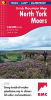
"I’ve enjoyed and endured tough and challenging walks throughout the North York Moors, and this tough, durable, detailed map is the ideal companion and guide." Paddy Dillon, outdoor writer.   Detailed map of the North York Moors on one sheet at 1:40,000 scale.   Includes the popular North Yorkshire Moors Railway and the Lyke Wake Walk.     North York Moors on one sheet: This map covers around 560 square miles of country - the only detailed map to cover this whole area on one sheet. It also includes the popular North Yorkshire Moors Railway and the Lyke Wake Walk. There are also map extensions to Guisborough and east towards Scarborough. Being part of the British Mountain Map series this map is printed on polyethylene - light, durable, tearproof and 100% waterproof. Colour shading is used for easy identification of hills and valleys.
29,95
Wandelgids The North York Moors | Cicerone
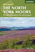
Uitstekende wandelgids van dit geweldige gebied. Goed beschreven met veel praktische informatie om de routes te kunnen lopen, inclusief redelijke kaarten. Guidebook to 50 walks in the North York Moors National Park. The walks, which range from 4 to 13 miles, are distributed through seven regions within the park, enabling walkers to discover and appreciate the Tabular Hills, Hambleton Hills, Cleveland Hills, Northern Moors, High Moors, Eastern Moors and Cleveland Coast. For those who like a challenge, the course of the classic Lyke Wake Walk, crossing the national park from east to west, is also described.   For each walk (most of which are circular), step-by-step route description is accompanied by extracts of OS mapping. Points of interest are highlighted, and background information provided, detailing the history and industry of the area. The guidebook also includes planning and preparation details such as when to go, where to stay, and how to get around using public transport.   Co…
18,50
Wandelgids Day Walks the North York Moors | Vertebrate Publishing
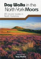
Day Walks on the North York Moors showcases 20 circular walks, between 5 and 13.7 miles (8 and 22 kilometres) in length, suitable for hillwalkers of all abilities. The routes are split into three areas - The Cleveland Hills and Hambleton Hills, Central Moors and Coastal Walks - and include walks to the most historic and beautiful areas of the Moors, including: Lord Stones, Wainstones and Clay Bank, Rievaulx Abbey, Blakey Ridge and Farndale, the Hole of Horcum, and the stunning coastline at Robin Hood's Bay and Ravenscar. The author of this guidebook, Tony Harker, is a Moors local and keen hillwalker.   Each route in this guide is described with easy-to-follow directions and details of distance, navigation information and refreshment stops, and is plotted on clear and easy to use Ordnance Survey 1:25,000 maps. The walks are illustrated with stunning photography by Adam Long. Also included is a detailed Appendix.
20,95
Wandelgids North York Moors: Western Area | Hallewell Publications
Rewalked and updated in 2022, Walks North York Moors (Western Area) features walks in the North York Moors National Park - an area of picturesque moorland intersected by narrow dales, butted up against the coast in the north-east corner of Yorkshire. This guide covers the western half of the area - as far east as the villages of Danby and Rosedale Abbey (for routes around Whitby and the east of the area, see Walks North York Moors (Eastern Area)). The 24 walks in the guide range from 1.5 to 8 miles (2.5 13km). Routes include the ascent of distinctive Roseberry Topping, the path to the famous White Horse near Thirsk, and from Helmsley to the ruin of Rievaulx Abbey. Walks North York Moors (Western Area) is part of a popular series of A6 pocket walking guides which describe routes which are suitable for walkers of all abilities and to suit all tastes. Route descriptions are accompanied by 2-colour sketch maps. The guides are illustrated with line illustrations, and will provide walkers w…
5,95
Wandelkaart Yorkshire Dales Zuid West | Harvey Maps
HARVEY launch innovative new series: Ultramap XT40. 16 titles featuring in Trail magazine through spring 2016. 40 years experience have gone into HARVEY's most creative new series. The Ultramap covers a large area yet is small enough to slip in a pocket. The Ultramap is fully detailed genuine original HARVEY mapping. The Ultramap is tough and 100% waterproof. Use it without a map case, whatever the weather! To provide the biggest area on the smallest lightest sheet, the Ultramap is printed double sided. The ingenious folding pattern allows you to open the Ultramap directly to any part and either side of the sheet. The two sides are aligned, so when you reach the edge of the Ultramap sheet you simply flip it over without re-folding. There's an overlap as well so you can map read continuously. The magic scale of 1:40,000 enables the Ultramap to provide all the detail you would expect to find on a large scale walking map including rights of way and boundaries. Actual size 73mm x 152mm. P…
20,95

Klanten-reviews van Wandelkaart North York Moors West | Harvey Maps

Er zijn nog geen beoordelingen voor dit productBen jij de eerste die een review plaatst?

Meer over Wandelkaart North York Moors West | Harvey Maps

Productomschrijving

Covers a large area yet is handily compact. Pocket perfect!   Detailed map for runners and walkers of the western section of the North York Moors National Park at the magic scale of 1:40,000.   Includes the popular Hambleton Hills and Cleveland Hills.   Roseberry Topping, Sutton Bank and the White Horse.   The Lyke Wake Walk is marked.

Productinformatie

    Verken gerelateerde categorieën

    Webshop.nl maakt gebruik van cookies. Ga je verder op onze website, ga dan akkoord met het plaatsen van cookies en de verwerking van deze data door ons en vermelde partners.