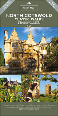
Wandelkaart North Cotswold Classic Walks | Goldeneye

0
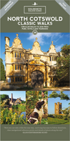
With 10 circular, clearly-marked routes this easy-to-use map will help you discover the Cotswolds via some of the finest pubs and tearooms.   Step into the Cotswolds with these exceptionally beautiful walks. Discover idyllic honey-coloured stone villages, quintessentially English market towns and spectacular views as you explore the quiet trails i...

Verkopers met dit product

Verkoper
Bezorging
Prijs
DeZwerver.nl logo
DeZwerver.nl
2,95
14,95

Anderen bekeken ook

Wandelkaart North Cotswold Classic Walks | Goldeneye
With 10 circular, clearly-marked routes this easy-to-use map will help you discover the Cotswolds via some of the finest pubs and tearooms.   Step into the Cotswolds with these exceptionally beautiful walks. Discover idyllic honey-coloured stone villages, quintessentially English market towns and spectacular views as you explore the quiet trails in and away from the tourist hotspots.   Each of the 10 walking tours include: All the practical information you need how far, how much time to allow, what's the terrain like, is it suitable for dogs, where are the loos, where do I park, can I get a cream tea or a beer along the way Features of interest each map includes the highlights of what you can expect to see along the way Clear navigational reference points at each turn there is a clear description of what you should be able to see to ensure you select the correct route   With the walks starting from 4 miles, there s a walk for everyone here. Use the short description and photographs to…
14,95
Wandelgids Cotswold Classic Walks | Goldeneye
Cotswold Classic Walks guide is a wonderful collection of 25 scenic, circular walks that will take you off the beaten track to discover the beautiful Cotswolds. Be prepared for some hills as you don your boots and enjoy a day or a weekend of fresh air, exercise and some much-needed freedom. We give you advice on which walks are best for kids, for dogs or a sumptuous pub lunch. If you’re after a great view or need some solitude, whatever you need, this book will guide you to find a walk that suits you. Discover bluebells in springtime, wonderful, hidden-away pubs, pushchair-friendly routes and peace and quiet in remote landscapes. The clear mapping and even clearer instructions will ensure you explore with confidence. Enjoy your time out with this wonderful Cotswold walking guide.
20,95
Fietskaart 02 Cycling guides Cotswolds cycling | Goldeneye
Fietskaart van Cotswold met ondermeer 28 ingetekende rondritten en veel toeristische informatie. Explore the Cotswolds by bike with this laminated, waterproof Cotswolds map. With 28 circular, clearly-marked routes this easy-to-use map will help you discover the best of the Cotswolds along the quietest country lanes. The Cotswolds are ideal for the touring cyclist and day-tripper.   They represent England at her very best. Long, winding lanes connect beautiful villages with excellent pubs and friendly tearooms. The landscape you cycle through is rich in imagery; rolling hills, dry-stone walls, lazy trickling trout streams and quaint, undisturbed hamlets.   Our Cotswold Cycling Country Lanes map includes:* Traffic-free family cycling trails - including the Stroud Valley Cycle Trail, The Oxford Waterway and the Forest of Dean Family Trail with recommendations on where to park. * National Cycle Network routes - the linked series of traffic-free paths and traffic-calmed roads being de…
15,95
Reisgids The Cotswolds Guide Book | Goldeneye
The definitive guide to The Cotswolds. In this fully revised and updated Cotswolds guide book, Cotswold specialist, William Fricker, provides his insightful advice on what to see and where to stay in this wonderful area of England. Offering a unique perspective on this glorious corner of Britain, William reveals little-known corners of the Cotswolds that will delight and surprise. Discover the most beautiful villages and valleys in this Area of Outstanding Natural Beauty. Experience a full range of activities from visiting gardens to exploring the brilliant architecture of the country houses, barns and churches. Enjoy a wide range of interesting and luxurious places to stay, from B&B's to country houses to inns and restaurants with rooms. Immerse yourself in the best variety of eateries, from delis and coffee shops, to dining pubs and traditional hostelries, as well as the best local craftspeople, and art galleries. Includes over 340 photographs and illustrations really bringing your …
26,50
Wandelgids Day Walks in the Cotswolds | Vertebrate Publishing
Day Walks in the Cotswolds features 20 circular routes, between 7.1 and 12.6 miles (11.5km and 20.2km), suitable for hillwalkers of all abilities. Split across three areas - North-East Cotswolds, North-West Cotswolds and South Cotswolds - local author Judy Mills shares her favourite walks in this Area of Outstanding Natural Beauty. These walks take in a variety of local landmarks, including the World War II airfield and Roman villa at Chedworth; Neolithic long barrows such as Hetty Pegler's Tump; grand country estates like Badminton; magnificent Cotswold manor houses and historic churches; high points at Bredon Hill and North Nibley; and the many charming rural villages, such as the Duntisbournes and the Slaughters, for which the Cotswolds are famous.   Each route features Ordnance Survey 1:25,000 maps, easy-to-follow directions, details of distance and navigation information, and refreshment stops and local information. The walks are illustrated with stunning photography by outdoor p…
20,95
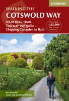
Wandelkaart Walking the Cotswold Way | Cicerone
Handzaam gidsje met alleen de topografische routekaarten van 1:25000. De uitgebreide wandelgids (inclusief dit gidsje) is hier te bestellen. All the mapping you need to complete the Cotswold Way National Trail between Chipping Campden and Bath, across the Cotswolds AONB.   An accompanying Cicerone guidebook - The Cotswold Way - describes the full route in both directions with lots of other practical and historical information. NOTE: The accompanying guidebook includes a copy of this map booklet.   Following the Cotswold escarpment, the Cotswold Way provides dramatic and far-reaching views across the Severn Vale towards the Welsh hills, plunging down to visit honey-coloured villages, old market towns and the elegant and historic city of Bath. The longest of the 13 stages is 10 miles, the shortest 6 miles: these are dictated by the existence of overnight accommodation.   This booklet of Ordnance Survey 1:25,000 Explorer maps has been designed for convenient use on the trail. It shows th…
13,95
Wandelgids The Cotswold Way | Cicerone
Uitstekende wandelgids van de Cotswolds Way, waarbij naast alle noodzakelijke informatie ook gebruik gemaakt wordt van de echte topografische kaart. inclusief gidsje met routekaarten van 1:25000 (deze is hier ook los te bestellen) Guidebook to walking the 102 mile (163km) Cotswold Way National Trail between Chipping Campden and Bath, across the Cotswolds AONB. The guidebook - which includes both a guide to the route and a separate OS 1:25,000 map booklet - describes the route in both directions.   The route is described over 13 stages, each following the Cotswold escarpment, with dramatic and far-reaching views across the Severn Vale towards the Welsh hills, plunging down to visit honey-coloured villages, old market towns and the elegant and historic city of Bath. The longest of the 13 stages is 10 miles, the shortest 6 miles: these are dictated by the existence of overnight accommodation. For the determined, the trail can be walked in as little as five days.   The Cotswold Way offers…
23,50
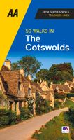
Wandelgids 50 Walks in the Cotswolds | AA Publishing
Uitstekende wandelgids met een aantal dagtochten tussen de 5 en 13 kilometer. Niet heel erg lang dus, maar wel op de mooiste plekken en goed beschreven en prima kaartmateriaal. Walking is one of Britain's favourite leisure activities, and with "50 Walks in the Cotswolds" you can find a variety of mapped walks to suit all abilities - from the casual walker to the experienced hiker. The book features all the practical detail you need, accompanied by fascinating background reading on the history and wildlife of the area, as well as other local points of interest. All walks are annotated with places to visit along the way: 'While You're There', featuring churches, country houses, museums, villages and towns. Each walk also has refreshment information: 'Where to Eat and Drink', including tea rooms and pubs, with extra details on their character and the food on offer. A 'What to Look For' panel features more specific details of urban and industrial heritage, flora and fauna. Every walk is g…
19,95
Fietskaart - Mountainbikekaart Cotswold Gravel & Mountain Bike Routes | Goldeneye
Cotswolds – Gravel- en Mountainbikeroutes  Ontdek de mooiste offroad fietsroutes in de Cotswolds met deze praktische en duurzame fietskaart, speciaal ontworpen voor gravelbikers en mountainbikers. De kaart leidt je over ruige heidevelden, eeuwenoude ruiterpaden en uitdagende afdalingen – ideaal voor avontuurlijke fietsers. Wat biedt deze kaart? 10 zorgvuldig geselecteerde offroad-routes – perfect voor gravel- en mountainbikes Overzichtskaart met duidelijke routeaanduidingen voor eenvoudige navigatie 18 kleurenfoto’s die het landschap en de ondergrond in beeld brengen Weerbestendig en duurzaam – mat gelamineerd, dubbelzijdig A2-formaat met harmonica-vouw Licht en compact – ideaal voor bikepacking en meerdaagse tochten Of je nu op zoek bent naar technische trails, pittige beklimmingen of rustige stukken door het glooiende landschap: deze kaart is een onmisbare metgezel voor je volgende fietstocht in de Cotswolds. Voordelen 10 routes op één kaart – voor elk niveau en elk…
15,95
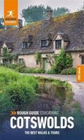
Reisgids Cotswolds | Rough Guides
Handige pocketgids met enkele auto- en wandelroutes.   Inspirational and informative new pocket guide, with free eBook, making the most of holidaying at home in the UK through clearly laid-out walks and tours.   Explore the best of the Cotswolds with this unique travel guide, packed full of insider information and stunning images. From making sure you don't miss out on must-see, top attractions like Stratford-upon-Avon, Cheltenham and Gloucester to discovering cultural gems including the stunning National Arboretum in Westonbirt, a picturesque hike along the Cotswold Way, and a typical Cotswold-stone manor house at Snowshill Manor, the easy-to-follow, ready-made walking and driving routes will save you time, and help you plan and enhance your staycation in the Cotswolds.   Features of this travel guide to the Cotswolds: - Eight walks and tours: detailed itineraries feature all the best places to visit, including where to eat along the way - Local highlights: discover the area's…
12,95

Klanten-reviews van Wandelkaart North Cotswold Classic Walks | Goldeneye

Er zijn nog geen beoordelingen voor dit productBen jij de eerste die een review plaatst?

Meer over Wandelkaart North Cotswold Classic Walks | Goldeneye

Productomschrijving

With 10 circular, clearly-marked routes this easy-to-use map will help you discover the Cotswolds via some of the finest pubs and tearooms.   Step into the Cotswolds with these exceptionally beautiful walks. Discover idyllic honey-coloured stone villages, quintessentially English market towns and spectacular views as you explore the quiet trails in and away from the tourist hotspots.   Each of the 10 walking tours include: All the practical information you need how far, how much time to allow, what's the terrain like, is it suitable for dogs, where are the loos, where do I park, can I get a cream tea or a beer along the way Features of interest each map includes the highlights of what you can expect to see along the way Clear navigational reference points at each turn there is a clear description of what you should be able to see to ensure you select the correct route   With the walks starting from 4 miles, there s a walk for everyone here. Use the short description and photographs to help you decide whether the route suits you then strap on your boots and head out for a wonderful escape into the Cotswolds countryside.

Productinformatie

    Verken gerelateerde categorieën

    Webshop.nl maakt gebruik van cookies. Ga je verder op onze website, ga dan akkoord met het plaatsen van cookies en de verwerking van deze data door ons en vermelde partners.