Wandelkaart National 3 Peaks Challenge Map | Discovery Walking Guides

0
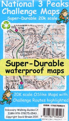
Goede scheur- en watervaste wandelkaart. National 3 Peaks Challenge Maps. Ben Nevis, Scafell Pike and Snowdon at 20k scale. Waterproof, tearproof and 100% recyclable 820mm by 420mm double sided map sheet.   Taking OS mapping at 50k scale we expand the mapping to produce 20k scale maps of the three challenge peaks, Ben Nevis, Scafell Pike and Snowd...

Verkopers met dit product

Verkoper
Bezorging
Prijs
DeZwerver.nl logo
DeZwerver.nl
2,95
15,95

Anderen bekeken ook

Wandelkaart National 3 Peaks Challenge Map | Discovery Walking Guides
Goede scheur- en watervaste wandelkaart. National 3 Peaks Challenge Maps. Ben Nevis, Scafell Pike and Snowdon at 20k scale. Waterproof, tearproof and 100% recyclable 820mm by 420mm double sided map sheet.   Taking OS mapping at 50k scale we expand the mapping to produce 20k scale maps of the three challenge peaks, Ben Nevis, Scafell Pike and Snowdon. By expanding the OS mapping the features of names, roads, tracks and trails are more than doubled in size making them easier to read under Challenge conditions. We then add the Challenge Routes, specially highlighted to make them stand out against the OS map background information and add in additional information that will help your challenge.   Each map covers the region to show the access roads as well as the walking routes. Ben Nevis includes the Glen Nevis Information Centre starting point and Glen Nevis Youth Hostel starting point. Scafell Pike includes the Wasdale and Seathwaite Challenge Routes.   Snowdon includes the Pyg Track, M…
15,95
Wandelkaart Yorkshire 3 Peaks Challenge Map | Discovery Walking Guides
Goede scheur- en watervaste wandelkaart. OS 50k scale mapping is doubled in size to produce a 25k map but the features, text and logos are now doubled in size making them much easier to read under challenge conditions.  Y3P 12 Hour Challenge Route, and its options for ascending Whernside, are added and specially highlighted so that the route stands out against the OS background map. Then we add any additional detail you might need including the popular Challenge starting points of the Pen Y Ghent Cafe, Station Inn and Hill Inn.   On the reverse of the map sheet are the Challenge and OS Legends, cover design, and an access map (approx 60k scale) for road access from the nearest towns of Ingleton and Settle.   The result is a double sided 600mm by 600mm OSlike Super-Durable Map. 
15,95
Wandelkaart Isle of Wight | Discovery Walking Guides
Goede scheur- en watervaste wandelkaart. Isle of Wight Walkers' Map at 32k scale with challenge routes and walking trails highlighted. OS 50k scale mapping is expanded in size to produce a 32k map. The OS features, text and logos are now 50% larger making them much easier to read under outdoor conditions.   Isle of Wight Challenge Route (66 miles) is specially highlighted in green and white so that the route stands out against the OS background map. Then we add the Earl Mountbatten Hospice's Walk (26.5 miles) highlighted in gold and white. A large range of gps surveyed walking trails are then highlighted in grey and white.   The result is an easy to read `OSlike' map with walking trails specially highlighted. We then split the island into East (cover side) and West (reverse side) with a ten mile common overlap to the two sides; meaning you will only have to turn the map over if you are undertaking the longest Challenge or Earl Mountbatten routes. The result is a double sided 840mm by …
15,95
Wandelkaart Coast 2 Coast | Discovery Walking Guides
Goede scheur- en watervaste wandelkaart. The whole Coast 2 Coast on one double sided, 960mm by 694mm, map sheet. All 193 miles (308 kilometres) of the Wainwright route along with its alternatives are highlighted across 9 map sections at 40k scale. Ordnance Survey accuracy is combined with Tour & Trail map design to produce 40k scale map sections which are easy to read.   OS 50k Landranger mapping is expanded to 40k scale making the text and features over 40% larger making them easy to read and understand. Wainwright's C2C walking routes, and their alternatives, are specially highlighted in Tour & Trail style making the routes easy to find on the map and on the ground. Public `Rights of Way' paths and bridleways are also highlighted in Tour & Trail style making them easy to recognise and find.   Coast 2 Coast Challenge Map design is then printed on Polyart using 100% oxygenation inks to produce a lightweight, Super-Durable, waterproof map that is tough enough to shrug off the worst tha…
15,95
Wandelkaart Tour & Trail Alpujarras | Discovery Walking Guides
Scheur- en watervaste wandelkaart van de Alpujarras met hoogtelijnen en graden. For the best adventures, use the best map. The Moorish white villages of the Alpujarras are well known to day trippers from the Costa del Sol. For walkers this is an idyllic region with stone-laid donkey trails linking the tipico villages and stretching up the southern slopes of the Sierra Nevada to Mulhacen; at 3,483 metres the highest mountain peak on mainland Spain. From Spring to the end of Autumn this is a paradise for hikers, whether you are walking from village to village sampling the local delicacies or tackling the challenging major ascents. One thing you will know is that using the Alpujarras Tour & Trail Map will help you plan, and get the best out of, your adventures.   On a large 960mm by 700mm, double sided, map sheet at 40k scale this map has all the detail you need. 20 and 100 metre contours, combined with altitude shading, giving you a true feel to this impressive landscape.  Stret…
15,95
Wandelkaart Tour & Trail Mallorca - Tramuntana South | Discovery Walking Guides
For your best adventures, use the best map. Water-proof, split-proof, tear-proof, adventure-proof. Mallorca's Tramuntana South Tour & Trail Super-Durable Map is simply the toughest, most accurate, easy-to-read, easy-to-use multi-purpose map that you can get.   Whether you plan to walk, or explore southern Tramuntana by car or the bus, this is the map for you. A large 960mm by 694mm double sided map sheet covers southern half of Serra de Tramuntana at 1:30,000 scale. This 8th edition sees a significant upgrade from the previous Mallorca North & Mountains Tour & Trail Map, as we have split Serra de Tramuntana in two halves to produce TWO much more detailed maps of larger scale, now also including all the popular tourist resorts on the southern coast.   This map covers a continuous area from Tramuntana's southern-most point Cap de Cala Figuera, including all the coastal resorts such as Magaluf, Santa Ponca and Peguera, with Port d'Andratx and Sa Dragonera islet also covered, all the way …
18,95
Wandelkaart Tour & Trail Mallorca - Tramuntana North | Discovery Walking Guides
Let op: deze kaart dekt het noordelijke deel van Mallorca.   For your best adventures, use the best map. Water-proof, split-proof, tear-proof, adventure-proof. Mallorca's Tramuntana North Tour & Trail Super-Durable Map is simply the toughest, most accurate, easy-to-read, easy-to-use multi-purpose map that you can get.   Whether you plan to walk, or explore northern Tramuntana by car or the bus, this is the map for you. A large 960mm by 694mm double sided map sheet covers northern half of Serra de Tramuntana at 1:30,000 scale. This 8th edition sees a significant upgrade from the previous Mallorca North & Mountains Tour & Trail Map, as we have split Serra de Tramuntana in two halves to produce TWO much more detailed maps of larger scale.   This map covers a continuous area from Tramuntana's northern-most Cap de Formentor, including all the coastal resorts such as Port de Pollenca and Port d'Alcudia, all the way to Soller and Deia at the opposite end of the map (for the area from S…
18,95
Wandelkaart Kefalonia & Ithaca | Discovery Walking Guides
Scheur- en watervaste wandelkaart van Kefalonia en Ithaka met hoogtelijnen en graden. Kefalonia was popularised and made famous by "Captain Corelli's Mandolin". For your best adventures, use the best map. Water-proof, split-proof, tear-proof, adventure-proof.   Kefalonia & Ithaca Tour & Trail Super-Durable Map is simply the toughest, most accurate, easy to read, easy to use map of the island you can buy at any price. A large 960mm by 690mm double sided map sheet has both Kefalonia and Ithaca at 1:40,000 scale with the North-West of Kefalonia on the cover side and the South-East of Kefalonia with neighbouring island Ithaca on the reverse. A generous common overlap of Kefalonia reduces the need to turn the map over when navigating.   Our special concertina map fold makes your map easy to open and easy to refold to its 230mm by 120mm pocket size. Our legendary 'Tour & Trail' level of detail ranges from major roads to secondary roads to minor roads to streets and narrow country roads, plu…
15,95
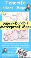
Wandelkaart Tour & Trail Tenerife | Discovery Walking Guides
Uitstekende wandelkaart, met ingetekende wandelroutes, voor specifieke wandelgebieden van Tenerife. Let op: dit is niet een kaart van het hele eiland, maar puur en alleen voor de wandelgebieden > daar is deze kaart de beste in! Our latest hiking research on Tenerife has resulted in new editions of Walk! Tenerife and Tenerife Hikers' Super-Durable Maps. Thanks to Jan Kostura's research we have several new hiking adventures described in detail in Walk! Tenerife. Jan's gps records of his research for new routes and updating of current routes has provided the detailed information to produce our new fourth edition of Tenerife Hiker's Super-Durable Maps. Note that Tenerife Hikers' Super-Durable Maps is a collection of four 30k scale map sections on a double sided sheet of 840mm by 600mm which folds up to 220mm by 120mm. It is not a map of all of Tenerife.  In this edition you will find 30k scale maps covering Valle de Orotava, West, Anaga and Adeje/Arona - Teide printed on a double sided…
17,95
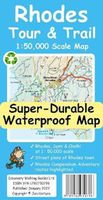
Wandelkaart Tour & Trail Rhodes - Rodos | Discovery Walking Guides
A large 960mm by 700mm double sided map sheet covers Rhodes at 1:50,000 scale and includes Chalki and Symi islets. On the cover side is Rhodes South with Chalki and Symi, with Rhodes North and street plans of Rhodes Town on the reverse. We have two street plans of the capital town.   Rhodes Town greater area is at 12k scale, including Acropolis in the west and spanning beyond Rodini park in the south. The other street plan shows the fortified Old Town in great detail at 5k scale. DWG's special concertina map fold makes our map easy to open and easy to refold to its 233mm by 120mm pocket size.   Our legendary 'Tour & Trail' level of detail ranges from major roads to secondary roads to minor roads to streets and narrow country roads, plus dirt roads, tracks and walking trails. Place names are in English and Greek to aid your navigation. Altitude shading is designed to clearly show the altitude range when travelling across the island by car or on foot.   20 metre and 100 metre contours c…
17,95

Klanten-reviews van Wandelkaart National 3 Peaks Challenge Map | Discovery Walking Guides

Er zijn nog geen beoordelingen voor dit productBen jij de eerste die een review plaatst?

Meer over Wandelkaart National 3 Peaks Challenge Map | Discovery Walking Guides

Productomschrijving

Goede scheur- en watervaste wandelkaart.

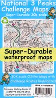
National 3 Peaks Challenge Maps. Ben Nevis, Scafell Pike and Snowdon at 20k scale. Waterproof, tearproof and 100% recyclable 820mm by 420mm double sided map sheet.   Taking OS mapping at 50k scale we expand the mapping to produce 20k scale maps of the three challenge peaks, Ben Nevis, Scafell Pike and Snowdon. By expanding the OS mapping the features of names, roads, tracks and trails are more than doubled in size making them easier to read under Challenge conditions. We then add the Challenge Routes, specially highlighted to make them stand out against the OS map background information and add in additional information that will help your challenge.   Each map covers the region to show the access roads as well as the walking routes. Ben Nevis includes the Glen Nevis Information Centre starting point and Glen Nevis Youth Hostel starting point. Scafell Pike includes the Wasdale and Seathwaite Challenge Routes.   Snowdon includes the Pyg Track, Miners Track and Llamberis Challenge Routes. Each peak is a 420mm by 420mm OSlike map mounted on a double sided map sheet of 840mm by 420mm. The map designs are then printed on a 100 micron plastic substrate using UV cured inks on the UK's only press capable of using this latest technology.   The result is a lightweight map that is both waterproof and tearproof, and fully recyclable, that will survive anything your 3 Peaks Challenge can throw at it and afterwards will fold up like new.  

Productinformatie

    Verken gerelateerde categorieën

    Webshop.nl maakt gebruik van cookies. Ga je verder op onze website, ga dan akkoord met het plaatsen van cookies en de verwerking van deze data door ons en vermelde partners.