webshop.nl
Categorieën
  Sluiten

Meer Himalayan Maphouse

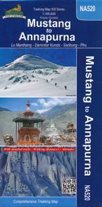
Wandelkaart NA520 Trekking map Mustang to Annapurna | Himalayan Maphou

0
Wat grof van schaal, maar de grote trek van Mustang via de Saribung naar Phu , Naar en de Annapurna trail is er goed mee te doen. Met name de geweldige Saribung trek staart best goed op.   Deze kaart biedt voldoende details om de gangbare trekkings in Nepal te kunnen lopen. Bergklimmen op deze kaart zouden we niet aanraden, maar de oversteek van de...

Webshops met dit product

Webshop
Bezorging
Prijs

Anderen bekeken ook

Wandelkaart NA520 Trekking map Mustang to Annapurna | Himalayan Maphou
Wat grof van schaal, maar de grote trek van Mustang via de Saribung naar Phu , Naar en de Annapurna trail is er goed mee te doen. Met name de geweldige Saribung trek staart best goed op.   Deze kaart biedt voldoende details om de gangbare trekkings in Nepal te kunnen lopen. Bergklimmen op deze kaart zouden we niet aanraden, maar de oversteek van de passen tot 6000 meter zijn uitstekend uitvoerbaar met deze kaart.   Prachtige, gedetailleerde en watervaste trekking map - wandelkaart van een gedeelte van Nepal. Op deze kaart staan vrijwel alle wandelpaden in deze regio ingetekend. Bij de dorpen onderweg staan met symbolen de mogelijkheden ingetekend om te kamperen, maar ook of er een lodge is of dat er een winkel zou kunnen zijn.    De kaart bevat veel topografische details die behoorlijk nauwkeurig zijn: hoogtelijnen, rivieren en beken, sneeuwvelden, bosgebieden en bijvoorbeeld ook vliegvelden.    This map covers one of Nepal’s two main trekking areas at 1:165,000 scale, extending north…
12,95
Wandelkaart NA504 Trekking map Around Annapurna | Himalayan Maphouse
Zeer duidelijke trekking kaart van de Annapurna Trail en een groot aantal zijpaden en alternatieve trekkings.  Alle noodzakelijke informatie vind je op deze kaart: van hoogtelijnen en andere topografische details tot meer toeristisch handige informatie als plaatsen met lodges of waar je kunt kamperen. De ideale kaart om de Annapurna trek te lopen, ook al is deze kaart gedrukt op wat dik papier met kans op scheuren bij de naden ... op z'n Nepali! The NA504 Around Annapurna Map is a 1:100,000 scale map of this area in Nepal from Nepa Maps.   The whole of the Annapurna Circuit is highlighted on this map at 1:100,000 scale, with alternative variants via the Tilicho Lakes or Naar, treks to the Machhapuchhre and South Annapurna Base Camps, climbing routes to the Chulu Peaks, Pisang Peak and Singu Chuli (Fluted Peak), etc.   Coverage extends from Pohkara to Muktinath and Kagbeni in the north, and in the north east includes the route to Phugaon and the trek/climb to Himlung. Contours are at 80…
12,95
Wandelgids Annapurna - A Trekker's Guide - Nepal | Cicerone
Trekkinggids met de gedetailleerde beschrijving van de klassieke Annapurna-trek, maar ook vele varianten en dagtochten. Goede etappe-beschrijvingen met veel praktische info. A comprehensive trekking guidebook to the Annapurna region - the most popular trekking area in Nepal. Fourteen diverse treks are described including the classic Annapurna Circuit and the Annapurna Sanctuary as well as treks in the lesser known Machhapuchhre area, the foothills of Lamjung Himal and restricted areas - Mustang, Damodar and Nar-Phu. This guidebook describes 14 multi-day treks in Nepal's captivating Annapurna region, among the foothills of the mighty Himalaya. Routes range between 24km and 200km (15-124 miles) and between 4 and 23 days, with maximum altitudes from 1750m to 5416m. With accommodation options including a mixture of homestay, camping and lodges, trekkers have the opportunity to immerse themselves in their surroundings and experience the warmth and richness of Nepalese hospitality and cultur…
26,50
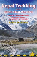
Wandelgids Nepal Trekking and the Great Himalaya Trail: A Route and Pl
With extensive sections to help you choose your trekking region, this is a route and planning guide for anyone organising a trekking holiday in Nepal. It includes the most popular routes as well as the newest trekking areas plus the most extreme route of all, the Great Himalaya Trail. There are route guides to the following regions: Kanchenjunga, Makalu, Rolwaling, Solu-Khumbu (Everest Region), Helambu & Langtang, Ganesh & Manaslu Annapurna, Naar & Phu, Mustang Dolpo, The Far West The guide covers: Visas, permits, fees and equipment Choosing a trek – independent tea-house trekking or guided treks arranged through trekking agencies; choosing a guide and crew; when to go; trekking grades and duration Kathmandu & Pokhara city guides – hotels, restaurants, what to see Nepal background – people, religions, festivals and etiquette Health, safety and responsible tourism Colour mapping – showing the main trekking routes in Nepal The Great Himalaya Trail Running the entire 4500 km length of the…
23,50
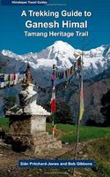
Wandelgids A Trekking Guide to Ganesh Himal - Nepal | Himalayan Maphou
Ganesh Himal is sure to be the next sought-after destination along the Great Himalaya Trail trekking route. Although visible from the rooftops of Kathmandu, the Ganesh Himal massif is surprisingly remote. Named after the Hindu god of good fortune, the Ganesh - Ruby Valley - region is home to an enticing treasure trove of trails and mysterious deep canyons. From the Pangsang La pass, one of the most overwhelming panoramas of the entire Nepalese Himalaya unfolds. With enchanting forests, an amazing wealth of cultural attractions, centuries-old traditions and the colourful blend of Gurung and Tamang people, the gods have bestowed great favour on the region. Add in the superb attractions of the Tamang Heritage Trail and the mix is as intoxicating as the dreams of those seeking the riches of Ganesh himself.   Authors Bob Gibbons and Sian Pritchard-Jones first visited Nepal in 1974 and 1982 respectively. Bob arrived overland from the UK in an old Land Rover, at a time when Boudhanath stupa w…
25,95
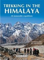
Wandelgids Trekking in the Himalaya | Cicerone
Cicerone wandelgids van Himalaya met 20 uitdagende trekkingen.  The Himalaya have always fed the dreams and called to those who love wild places. Stretching from Pakistan through Northern India, Nepal, Tibet and Bhutan, this book includes 20 descriptions of the best, and most spectacular treks in the range. From glaciers to jungle, snow-swept passes to plunging valleys, remote plateaus to bustling base camps, the Himalaya offer an unparalleled wealth of landscapes and trekking opportunities.   This inspirational guide was edited by trekking specialist Kev Reynolds, and written by a team of eight experienced authors, writers and guides. A compilation of the best walking in the Himalaya, it looks at each trek in turn, and discovers what makes the trek special, and entices with vivid accounts and breathtaking photography.   The Treks:   Pakistan K2 and Concordia Snow Lake Nanga Parbat India Zanskar Dream Trek (Ladakh) Nanda Devi (Garhwal and Kumaon) Kanchenjunga: Singalila Ridge and…
30,95

Klanten-reviews van Wandelkaart NA520 Trekking map Mustang to Annapurna | Himalayan Maphou

Er zijn nog geen beoordelingen voor dit productBen jij de eerste die een review plaatst?

Meer over Wandelkaart NA520 Trekking map Mustang to Annapurna | Himalayan Maphou

Productomschrijving

Wat grof van schaal, maar de grote trek van Mustang via de Saribung naar Phu , Naar en de Annapurna trail is er goed mee te doen. Met name de geweldige Saribung trek staart best goed op.   Deze kaart biedt voldoende details om de gangbare trekkings in Nepal te kunnen lopen. Bergklimmen op deze kaart zouden we niet aanraden, maar de oversteek van de passen tot 6000 meter zijn uitstekend uitvoerbaar met deze kaart.   Prachtige, gedetailleerde en watervaste trekking map - wandelkaart van een gedeelte van Nepal. Op deze kaart staan vrijwel alle wandelpaden in deze regio ingetekend. Bij de dorpen onderweg staan met symbolen de mogelijkheden ingetekend om te kamperen, maar ook of er een lodge is of dat er een winkel zou kunnen zijn.    De kaart bevat veel topografische details die behoorlijk nauwkeurig zijn: hoogtelijnen, rivieren en beken, sneeuwvelden, bosgebieden en bijvoorbeeld ook vliegvelden.    This map covers one of Nepal’s two main trekking areas at 1:165,000 scale, extending northwards from Pokhara to the Tibetan border. The main Annapurna Circuit is prominently highlighted, including alternative routes between Muktinath and Jomsom. Also marked and named are the region’s numerous other routes: treks to Annapurna’s main and north base camps, the Tilicho Lake trail, the routes north from Jomsom to Lo-Mantang, the Mustang - Phu trek including Damodar Kunda and Saribung Base Camp, etc. Additional information includes a profile of the Jomsom to Bhulbhule route via Damodar Kunda, plus information for the main Annapurna Circuit and other local treks. Contours are at 120m intervals     Route: Kathmandu, Pokhara, Kagbeni, Muktinath, Jomsom, Chusang, Chiling, Tsarang, Lo Manthang, Yara, Luri Gmpa, Bacha Khola Camp, French Camp, Japanese Base Camp, Saribung Pass, (Bhrikuti Himal, Kumlung Peak, Sonam Himal, Chhib Himal, Jomsom Himal, Bhrikuti Shail), Nagoru, Phu, Manang, Pokhara.

Productspecificaties

Artikelnummer(s)
Brand
Himalayan Maphouse
Webshop.nl maakt gebruik van cookies. Ga je verder op onze website, ga dan akkoord met het plaatsen van cookies en de verwerking van deze data door ons en vermelde partners.