webshop.nl
Categorieën
  Sluiten

Meer Himalayan Maphouse

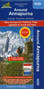
Wandelkaart NA504 Trekking map Around Annapurna | Himalayan Maphouse

0
Zeer duidelijke trekking kaart van de Annapurna Trail en een groot aantal zijpaden en alternatieve trekkings.  Alle noodzakelijke informatie vind je op deze kaart: van hoogtelijnen en andere topografische details tot meer toeristisch handige informatie als plaatsen met lodges of waar je kunt kamperen. De ideale kaart om de Annapurna trek te lopen, ...

Webshops met dit product

Webshop
Bezorging
Prijs

Anderen bekeken ook

Wandelkaart NA504 Trekking map Around Annapurna | Himalayan Maphouse
Zeer duidelijke trekking kaart van de Annapurna Trail en een groot aantal zijpaden en alternatieve trekkings.  Alle noodzakelijke informatie vind je op deze kaart: van hoogtelijnen en andere topografische details tot meer toeristisch handige informatie als plaatsen met lodges of waar je kunt kamperen. De ideale kaart om de Annapurna trek te lopen, ook al is deze kaart gedrukt op wat dik papier met kans op scheuren bij de naden ... op z'n Nepali! The NA504 Around Annapurna Map is a 1:100,000 scale map of this area in Nepal from Nepa Maps.   The whole of the Annapurna Circuit is highlighted on this map at 1:100,000 scale, with alternative variants via the Tilicho Lakes or Naar, treks to the Machhapuchhre and South Annapurna Base Camps, climbing routes to the Chulu Peaks, Pisang Peak and Singu Chuli (Fluted Peak), etc.   Coverage extends from Pohkara to Muktinath and Kagbeni in the north, and in the north east includes the route to Phugaon and the trek/climb to Himlung. Contours are at 80…
12,95
Wandelkaart NA520 Trekking map Mustang to Annapurna | Himalayan Maphou
Wat grof van schaal, maar de grote trek van Mustang via de Saribung naar Phu , Naar en de Annapurna trail is er goed mee te doen. Met name de geweldige Saribung trek staart best goed op.   Deze kaart biedt voldoende details om de gangbare trekkings in Nepal te kunnen lopen. Bergklimmen op deze kaart zouden we niet aanraden, maar de oversteek van de passen tot 6000 meter zijn uitstekend uitvoerbaar met deze kaart.   Prachtige, gedetailleerde en watervaste trekking map - wandelkaart van een gedeelte van Nepal. Op deze kaart staan vrijwel alle wandelpaden in deze regio ingetekend. Bij de dorpen onderweg staan met symbolen de mogelijkheden ingetekend om te kamperen, maar ook of er een lodge is of dat er een winkel zou kunnen zijn.    De kaart bevat veel topografische details die behoorlijk nauwkeurig zijn: hoogtelijnen, rivieren en beken, sneeuwvelden, bosgebieden en bijvoorbeeld ook vliegvelden.    This map covers one of Nepal’s two main trekking areas at 1:165,000 scale, extending north…
12,95
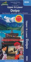
Wandelkaart NS504 Upper and Lower Dolpa - Dolpo | Himalayan Maphouse
Goede duidelijk leesbare  map voor trekkings in Dolpo. Van Juphal en Jejargaon in het westen tot Kagbeni in Mustang aan de oostkant van de kaart. De trekkingroutes staat goed ingetekend. Shey Phoksundo National Park staat er ook geheel op.  Large area centred on Dho Tarap, lying between the Upper and Lower Dolpa regions, in the Nepa Maps series which provides extensive coverage of trekking areas of Nepal on detailed contoured maps with trekking routes and hiking trails, huts and camp sites, local places of interest and other tourist information.   Cartography is based on the country’s topographic survey, with contours usually at 40m or 50m intervals, enhanced by relief shading, colouring and graphics to show various features of the terrain, including glaciers, forested or cultivated areas, etc. Numerous peaks, with additional spot heights, plus names of glaciers and mountain ranges are prominently shown. The network of rivers, streams and lakes is shown in great detail, with many small…
12,95
Wandelkaart Tour of Monte Rosa Trekking Map | Knife Edge Outdoor
The best sheet map for the Tour of Monte Rosa. Displays the entire route and variants on a single sheet: perfect for planning and navigation.   1:40,000 - larger scale and more detail than any other map.   Made specifically for the Tour of Monte Rosa by Knife Edge Outdoor Guidebooks:   English/French/German map key 1:40,000 Numerous variants Includes free GPX downloads for the trail GPS compatible Tougher than traditional maps: try to tear it! More water-resistant than traditional maps Lighter than traditional maps Huts/accommodation marked on the map   The Tour of Monte Rosa is one of the classic Alpine treks. It leads the trekker on an epic circuit around the Monte Rosa massif. The largest group of 4000m peaks in the Alps is on display: the Weisshorn, the Zinalrothorn, the Dom, the Täschhorn, the Breithorn and the Matterhorn, to name a few.   It is the sister trek to the Walker’s Haute Route and crosses unspoilt and remote mountain terrain: amazing glaciers, snow frosted summits, bea…
23,95
Fietskaart 01 Cycling guides Cornwall | Goldeneye
Our maps are double-sided, printed on an A2 sheet with a concertina fold. This allows for easy folding and folding, and an ease of access to the mapping. The material is rain and tear-resistant. Our early maps were designed at the scale of 2 miles to 1 inch/1:126,720. The later designs along with digitalisation are 1: 100,000. We were encouraged by the Cycle Touring Club to convert our cartography toward the cycle market (to replace the out-of-print Bartholomew series). As time and the series progressed we have added more data: The National Cycle Network routes, Regional Routes, and Traffic-Free Family Routes, as and when they are developed. These routes are in addition to the Circular Routes Goldeneye Commissioned at the outset of our publishing schedule. We are also adding to new editions; bike shops, cycle hire, and tea rooms, along with the tourist attractions already featured. Our plan is to make available digital versions for cell phones and tablets and to update, on an annual ba…
15,95
Wandelkaart Walker's Haute Route: Chamonix to Zermatt | Knife Edge Out
Een hele goede kaart van én van de grote wandeltochten in de Alpen: Haute Route Chamonix-Zermatt. Deze wandelkaart op scheur- en watervast papier gedrukt geeft de hele route weer op een gedetailleerde schaal. Alle noodzakelijke informatie vind je er op terug.   The best sheet map for the Walker's Haute Route: Chamonix to Zermatt. This is the only map available that displays the entire route and numerous variants on a single sheet: perfect for planning and navigation. 1:40,000 - larger scale and more detail than any other map. 1:10,000: for select areas where navigation is challenging. Made specifically for the Walker's Haute Route by Knife Edge Outdoor Guidebooks:   - English/French/German map key - 1:40,000/1:10,000 - Numerous variants - Includes free GPX downloads for the trail - GPS compatible - Tougher than traditional maps: try to tear me! - More water-resistant than traditional maps - Lighter than traditional maps - Huts/accommodation marked on the map   The Walker's Haute Route …
23,95

Klanten-reviews van Wandelkaart NA504 Trekking map Around Annapurna | Himalayan Maphouse

Er zijn nog geen beoordelingen voor dit productBen jij de eerste die een review plaatst?

Meer over Wandelkaart NA504 Trekking map Around Annapurna | Himalayan Maphouse

Productomschrijving

Zeer duidelijke trekking kaart van de Annapurna Trail en een groot aantal zijpaden en alternatieve trekkings.  Alle noodzakelijke informatie vind je op deze kaart: van hoogtelijnen en andere topografische details tot meer toeristisch handige informatie als plaatsen met lodges of waar je kunt kamperen. De ideale kaart om de Annapurna trek te lopen, ook al is deze kaart gedrukt op wat dik papier met kans op scheuren bij de naden ... op z'n Nepali! The NA504 Around Annapurna Map is a 1:100,000 scale map of this area in Nepal from Nepa Maps.   The whole of the Annapurna Circuit is highlighted on this map at 1:100,000 scale, with alternative variants via the Tilicho Lakes or Naar, treks to the Machhapuchhre and South Annapurna Base Camps, climbing routes to the Chulu Peaks, Pisang Peak and Singu Chuli (Fluted Peak), etc.   Coverage extends from Pohkara to Muktinath and Kagbeni in the north, and in the north east includes the route to Phugaon and the trek/climb to Himlung. Contours are at 80m intervals.   The index lists settlements, peaks, passes and lakes. Margin ticks give latitude and longitude at 5’ intervals. Additional information includes a profile of the route and tables showing the route and its variants in stage with altitudes in metres and feet, plus trekking times.

Productspecificaties

Artikelnummer(s)
Brand
Himalayan Maphouse
Webshop.nl maakt gebruik van cookies. Ga je verder op onze website, ga dan akkoord met het plaatsen van cookies en de verwerking van deze data door ons en vermelde partners.