webshop.nl
Categorieën
  Sluiten

Meer Orama

Wandelkaart Mount Athos | Orama

0
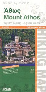
Wandelkaart  van dit bijzondere stukje Griekenland: de berg Athos.   Mount Athos - Agion Oros (Greece) 1:60,000 Hiking Map, waterproof, GPS compatible, ORAMA Mount Athos is a mountain and peninsula in Macedonia, Greece. A World Heritage Site, it is home to 20 Eastern Orthodox monasteries and forms a self-governed monastic state within the sovereign...

Webshops met dit product

Webshop
Bezorging
Prijs

Anderen bekeken ook

Wandelkaart Mount Athos | Orama
Wandelkaart  van dit bijzondere stukje Griekenland: de berg Athos.   Mount Athos - Agion Oros (Greece) 1:60,000 Hiking Map, waterproof, GPS compatible, ORAMA Mount Athos is a mountain and peninsula in Macedonia, Greece. A World Heritage Site, it is home to 20 Eastern Orthodox monasteries and forms a self-governed monastic state within the sovereignty of Greece. Today, Greeks commonly refer to Mount Athos as the "Holy Mountain" ( Agion Oros).   This is a double sided, very detailed, topographic hiking map of the peninsula at 1:60,000. Relief colouring with spot heights and contours (20 m interval) indicate the terrain. Symbols mark churches, monasteries, archaeological sites, campsites, beaches, etc.   Reverse side features a simplified map of the southern end of the peninsula with hiking routes highlighted and described (in Greek and English).   Added is an index of villages. Place names are in both Greek and Latin script, multilingual legend includes English, printed on synthetic pape…
10,25
Wandelkaart - Wegenkaart - landkaart 209 Mount Athos | Terrain maps
Gedetailleerde wegenkaart en wandelkaart met alle kleine wegen, wandelpaden, hoogtelijnen en toeristische informatie aangegeven. Alle tekst is tweetalig in Engels en Grieks en de waterproof kaart is geschikt voor gebruik met GPS. The first highly accurate map of Mt Athos.    Created with GPS technology and extensive field survey, this map of Mt. Athos from TERRAIN Editions offers to the visitor a unique wealth of information. If you plan to hike from one monastery to the other, explore the mainland or climb to the top of Mt. Athos, this precise and reliable map will prove invaluable. FEATURES  Κaryes town plan in 1:3.000 scale and Κaryes area map in 1:10.000 scale All monasteries, scetes, cells, seats and huts, marked with distinctive symbols and their names All walking trails, with measured distances A concise guide to the monasteries, and general information on Mt. Athos Printed on polyart
12,50
Reisverhaal Athos - the holy mountain | TPP
“It calls for a writer more able at words to picture the sheer beauty of the Mountain. To convey the altering feeling of morning, or high noon; of afternoon, and deep midnight; of the golden scores of stars puncturing the sky.”   Athos, the Holy Mountain of Greece, is one of the most mysterious places in the world. A rugged pyramid that rises up from the Aegean Sea, the mountain is wreathed in myth, legend and ancient traditions that, to this day, remain largely hidden from view. The heart of Athos started to beat at the dawn of Christianity and its community lays claim to being the oldest democracy in the world. An entirely autonomous region of the Hellenic Republic, it is home to twenty Eastern Orthodox monasteries that cling to its rocky flanks. No women are allowed to set foot upon the peninsula and the monks who inhabit this isolated place still use the Julian calendar, living on 'Byzantine Time', where each day starts at sunset. While living in the mountain's shadow, in Ouranopol…
16,95
Wandelkaart 43 Iti | Road Editions
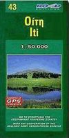
Mt Oiti/Iti at 1:50,000 in a series of contoured maps from Road Editions covering popular hiking areas of Greece. All the maps have altitude coloring and spot heights - contour interval varies, as indicated in the descriptions of individual titles. Local footpaths are marked and, for road users the maps show picturesque routes, intermediate driving distances on minor roads, and locations of petrol stations and tyre repairs workshops. Boundaries of national parks and administrative regions are marked, and symbols show campsites, hotels and mountain refuges, and various landmarks and places of interest, e.g. archaeological sites, churches, etc. All place names are in both Greek and Latin alphabet. All the titles have latitude and longitude margin ticks, many also show GPS waypoints. Some maps come with a booklet or notes on the reverse side giving further information about the area and/or descriptions of hiking routes. Map legends include English. In this title: Mount Oiti (Iti) and th…
7,95
Wandelkaart 37 Mount Agrafa | Road Editions
Mt Agrafa at 1:50,000 in a series of contoured maps from Road Editions covering popular hiking areas of Greece. All the maps have altitude coloring and spot heights - contour interval varies, as indicated in the descriptions of individual titles. Local footpaths are marked and, for road users the maps show picturesque routes, intermediate driving distances on minor roads, and locations of petrol stations and tyre repairs workshops. Boundaries of national parks and administrative regions are marked, and symbols show campsites, hotels and mountain refuges, and various landmarks and places of interest, e.g. archaeological sites, churches, etc. All place names are in both Greek and Latin alphabet. All the titles have latitude and longitude margin ticks, many also show GPS waypoints. Some maps come with a booklet or notes on the reverse side giving further information about the area and/or descriptions of hiking routes. Map legends include English. In this title: the Agrafa region, on the…
5,25
Wandelkaart - Wegenkaart - landkaart 209 Mount Athos | Terrain maps
Gedetailleerde wegenkaart en wandelkaart met alle kleine wegen, wandelpaden, hoogtelijnen en toeristische informatie aangegeven. Alle tekst is tweetalig in Engels en Grieks en de waterproof kaart is geschikt voor gebruik met GPS. The first highly accurate map of Mt Athos.    Created with GPS technology and extensive field survey, this map of Mt. Athos from TERRAIN Editions offers to the visitor a unique wealth of information. If you plan to hike from one monastery to the other, explore the mainland or climb to the top of Mt. Athos, this precise and reliable map will prove invaluable. FEATURES  Κaryes town plan in 1:3.000 scale and Κaryes area map in 1:10.000 scale All monasteries, scetes, cells, seats and huts, marked with distinctive symbols and their names All walking trails, with measured distances A concise guide to the monasteries, and general information on Mt. Athos Printed on polyart
12,50
Wandelkaart 43 Iti | Road Editions
Mt Oiti/Iti at 1:50,000 in a series of contoured maps from Road Editions covering popular hiking areas of Greece. All the maps have altitude coloring and spot heights - contour interval varies, as indicated in the descriptions of individual titles. Local footpaths are marked and, for road users the maps show picturesque routes, intermediate driving distances on minor roads, and locations of petrol stations and tyre repairs workshops. Boundaries of national parks and administrative regions are marked, and symbols show campsites, hotels and mountain refuges, and various landmarks and places of interest, e.g. archaeological sites, churches, etc. All place names are in both Greek and Latin alphabet. All the titles have latitude and longitude margin ticks, many also show GPS waypoints. Some maps come with a booklet or notes on the reverse side giving further information about the area and/or descriptions of hiking routes. Map legends include English. In this title: Mount Oiti (Iti) and th…
7,95
Reisverhaal Athos - the holy mountain | TPP
“It calls for a writer more able at words to picture the sheer beauty of the Mountain. To convey the altering feeling of morning, or high noon; of afternoon, and deep midnight; of the golden scores of stars puncturing the sky.”   Athos, the Holy Mountain of Greece, is one of the most mysterious places in the world. A rugged pyramid that rises up from the Aegean Sea, the mountain is wreathed in myth, legend and ancient traditions that, to this day, remain largely hidden from view. The heart of Athos started to beat at the dawn of Christianity and its community lays claim to being the oldest democracy in the world. An entirely autonomous region of the Hellenic Republic, it is home to twenty Eastern Orthodox monasteries that cling to its rocky flanks. No women are allowed to set foot upon the peninsula and the monks who inhabit this isolated place still use the Julian calendar, living on 'Byzantine Time', where each day starts at sunset. While living in the mountain's shadow, in Ouranopol…
16,95
Wandelgids Trekking in Greece - Griekenland | Cicerone
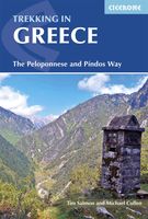
Duidelijke wandelgids van twee belangrijke meerdaagse tochten in Griekenland: the Peloponnese and Pindos Way. Daarnaast een beschrijving van enkele dagtochten in het gebied van Mount Olympos. De beschrijvingen zijn heel goed, met veel praktische informatie. Kaartmateriaal is redelijk. Guidebook describing challenging treks in the mountains of Greece, traversing the Pindhos Range, near Athens, and the Peloponnese, plus a handful of shorter routes including Mount Olympus. The treks demand a high level of commitment and fitness due to their remoteness and difficult terrain, and boast stunning unspoilt scenery. This guidebook presents four specially devised treks in the mountains of Greece, showcasing its beautiful scenery, rich flora and cultural interest. The Peloponnese Way crosses the Peloponnese peninsula from Dhiakoftó in the north to Pantazí beach in the south, via Trípoli. Taking in alpine meadows, a dramatic gorge and forest-clad slopes, the 220km route can be walked in around a f…
24,95

Klanten-reviews van Wandelkaart Mount Athos | Orama

Er zijn nog geen beoordelingen voor dit productBen jij de eerste die een review plaatst?

Meer over Wandelkaart Mount Athos | Orama

Productomschrijving

Wandelkaart  van dit bijzondere stukje Griekenland: de berg Athos.   Mount Athos - Agion Oros (Greece) 1:60,000 Hiking Map, waterproof, GPS compatible, ORAMA Mount Athos is a mountain and peninsula in Macedonia, Greece. A World Heritage Site, it is home to 20 Eastern Orthodox monasteries and forms a self-governed monastic state within the sovereignty of Greece. Today, Greeks commonly refer to Mount Athos as the "Holy Mountain" ( Agion Oros).   This is a double sided, very detailed, topographic hiking map of the peninsula at 1:60,000. Relief colouring with spot heights and contours (20 m interval) indicate the terrain. Symbols mark churches, monasteries, archaeological sites, campsites, beaches, etc.   Reverse side features a simplified map of the southern end of the peninsula with hiking routes highlighted and described (in Greek and English).   Added is an index of villages. Place names are in both Greek and Latin script, multilingual legend includes English, printed on synthetic paper, waterproof and tearproof, sheet size 98 x 68 cm / 38.5 x 26.5 inches. Authentic Greek cartography.

Productspecificaties

Artikelnummer(s)
Brand
Orama
Webshop.nl maakt gebruik van cookies. Ga je verder op onze website, ga dan akkoord met het plaatsen van cookies en de verwerking van deze data door ons en vermelde partners.