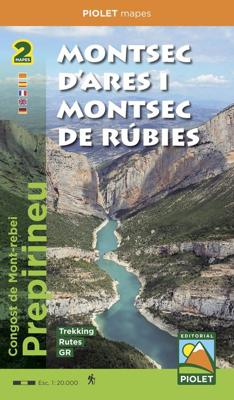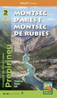
Wandelkaart Montsec d'Ares i Montsec de Rúbies | Editorial Piolet

0
Mooie 2-delige kaarten set. 1. Montsect de rubies o de Meia 2. Montsec d'ares - congost de mont-rebei   Folder that includes two maps: the Montsec d'Ares and the Montsec de Rúbies or de Meià. These two maps give continuity to those already published in the area: Montsec d'Estall, Sant Llorenç de Montgai and Les Avellanes. The entire collection is ...

Verkopers met dit product

Verkoper
Bezorging
Prijs
DeZwerver.nl logo
DeZwerver.nl
2,95
20,95

Anderen bekeken ook

Wandelkaart Tour & Trail Mallorca - Tramuntana South | Discovery Walking Guides
For your best adventures, use the best map. Water-proof, split-proof, tear-proof, adventure-proof. Mallorca's Tramuntana South Tour & Trail Super-Durable Map is simply the toughest, most accurate, easy-to-read, easy-to-use multi-purpose map that you can get.   Whether you plan to walk, or explore southern Tramuntana by car or the bus, this is the map for you. A large 960mm by 694mm double sided map sheet covers southern half of Serra de Tramuntana at 1:30,000 scale. This 8th edition sees a significant upgrade from the previous Mallorca North & Mountains Tour & Trail Map, as we have split Serra de Tramuntana in two halves to produce TWO much more detailed maps of larger scale, now also including all the popular tourist resorts on the southern coast.   This map covers a continuous area from Tramuntana's southern-most point Cap de Cala Figuera, including all the coastal resorts such as Magaluf, Santa Ponca and Peguera, with Port d'Andratx and Sa Dragonera islet also covered, all the way …
18,95
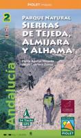
Wandelkaart Parque Natural Sierras de Tejeda, Almijara y Alhama | Editorial Piolet
Een prachtige kaartenset op heel gedetaileerd nivo van de Sierra de Tejeda, opgedeeld in een west en oost gedeelte. Het nationale park igt ten noorden van Nerja, tussen Malaga en Motril.  Alle noodzakelijke details staan er op die je nodig hebt voor het wandelen. Hoogtelijnen, schaduwwerking in de kleuren, ingetekende wandelpaden en routesuggesties. Met name in nationale parken en daarom heen in zuidelijk Europa is een geode kaart best handig: er zijn veel ezel- en geitenpaadjes die voor verwarring zorgen.  Van de uitgever Topographic map of the whole 'Natural Park of Sierras de Tejeda, Almijara and Alhama', more than 40,000 hectares of protected area with an impressive natural wealth. The peaks, some over 2,000 m high, are a natural border between the provinces of Granada and Malaga. The rugged and rugged landscapes make this area an ideal place for hiking enthusiasts of all levels. From a cultural point of view, Muslim heritage is present throughout the territory, with whitewashed v…
19,95
Wandelkaart Tour & Trail Mallorca - Tramuntana North | Discovery Walking Guides
Let op: deze kaart dekt het noordelijke deel van Mallorca.   For your best adventures, use the best map. Water-proof, split-proof, tear-proof, adventure-proof. Mallorca's Tramuntana North Tour & Trail Super-Durable Map is simply the toughest, most accurate, easy-to-read, easy-to-use multi-purpose map that you can get.   Whether you plan to walk, or explore northern Tramuntana by car or the bus, this is the map for you. A large 960mm by 694mm double sided map sheet covers northern half of Serra de Tramuntana at 1:30,000 scale. This 8th edition sees a significant upgrade from the previous Mallorca North & Mountains Tour & Trail Map, as we have split Serra de Tramuntana in two halves to produce TWO much more detailed maps of larger scale.   This map covers a continuous area from Tramuntana's northern-most Cap de Formentor, including all the coastal resorts such as Port de Pollenca and Port d'Alcudia, all the way to Soller and Deia at the opposite end of the map (for the area from S…
18,95
Pelgrimsroute (kaart) - Wandelkaart Camino Frances, wandelen naar Santiago de Compostela | CNIG - Instituto Geográfico Nacional
Kaarten voor de Camino Frances: Set van 10 topografische kaarten en een overzichtskaart om te wandelen door Noord Spanje naar Santiago de Compostella, op de kaarten  toeristische informatie (zoals overnachten, restaurants, bussen, winkels, etc) met symbolen aangegeven. De kaarten zijn met UTM grid en geschikt voor gebruik met GPS. Op de kaarten zijn ook hoogteprofielen te vinden. De pelgrimsroute is in 38 etappes en loopt vanaf de grens, Pyreneeen naar Santiago.   The whole of Way of St James to Santiago de Compostela in a set of 11 maps: 10 double-sided topographic maps at 1:50,000 plus an overview map of northern Spain, published by the Spanish civilian survey organization. Descriptions in 6 languages; English, French, Spanish, German, Italian & Portuguese   Each 1:50,000 map is double-sided and has four 57 x 35cm panels with full topographic mapping of the area through which the route passes. Contours are at 50m intervals, with additional shading and colouring/graphics to show s…
18,95
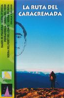
Wandelkaart La Ruta del Caracremada | Editorial Piolet
De Spaanse uitgever Editorial Piolet maakt bijzonder gedetailleerde kaarten van deelgebieden in Spanje, geschikt voor wandelaars en MTB-ers. Van ouds her zijn ze begonnen in de regio rond Barcelona maar ze breiden steeds meer uit richting andere delen van Spanje,   De kaarten hebben een topografische ondergrond met hoogtelijnen, toppen, schaduwtekening bij bergruggen, wegen en dorpen, gehuchten en zelfs boerderijen. Daarbij hebben ze enkele wandelpaden gemarkeerd, met name de GR paden en de PR paden, de regionale lange-afstands paden. Andere wandelpaden staan wel ingetekend, maar met de gewone zwarte lijntjes in plaats van een opvallende kleur. Ook worden op bepaalde kaarten MTB routes weergegeven, maar dat is eerder een uitzondering dan een regel. Met symbolen zijn andere handige zaken aangeduid als campings, bezienswaardigheden, grotten en zelfs hier en daar een lokale bar!    La Ruta del Caracremada, a hiking circuit in the Catalan Pyrenees just north-west of Berga, presented at 1…
12,95
Wandelkaart Andorra | Editorial Piolet
Topographic map and hiking guide (multilingual, in 4 languages) that contain all the necessary information for the hiker.   It presents 30 itineraries, grouped in ascents and excursions that allow you to discover the country in all its facets. Each itinerary is described in detail and incorporates a technical sheet that includes the slope, duration, difficulty and the material necessary to carry out each of the excursions.   The guide is complemented by photographs of the most emblematic places of each itinerary.   On the 1: 40,000 scale map, all the itineraries described in the guide are represented, as well as the network of trails that run through the area.   In short, it is an essential tool to discover Andorra from a new perspective.
16,95
Wandelkaart Cabo de Gata / Nijar | Editorial Alpina
Zeer gedetailleerde wandelkaart van een klein gebied. Met ingetekende wandelroutes en andere informatie. Spaanstalig, maar uitstekende kaart. Coordinaten zijn weergegeven, dus GPS compatible met UTM grid.    Op de topografische wandelkaart worden o.a. berghutten, campings aangeduid en hoogtelijnen, ingetekende wandelroutes en de GR paden (doorgaande langeafstandswandelpaden).  Cabo da Gata-Níjar Natural Park in an extensive and very popular series of walking maps from Editorial Alpina covering the Pyrenees, Catalonia and other selected hiking areas in Spain, including Picos de Europa, Sierra Nevada and parts of Andalucía, Majorca, etc. Scales vary from 1:50,000 to 1:10,000, with the majority of the titles at 1:25,000. The maps have contours, usually at 20m or 10m intervals, with additional hill shading and spot heights. An overprint highlights hiking trails, long-distance footpaths, campsites, mountain huts, refuges, etc. Many maps also show climbing sites, potholing caves, mountain b…
17,95
Wandelgids - Klimgids - Klettersteiggids Via Ferratas of the French Alps | Cicerone
This guidebook covers 66 varied via ferratas in the French Alps. The routes are spread over six areas: Geneva and the Northern Alps, Chambéry, Tarentaise and Maurienne valleys, Grenoble and Briançon, amid the Mont Blanc, Vanoise and Queyras ranges. Difficulty ranges from easy, protected routes through to exposed, technical challenges. With some of the most beautiful scenery in the world, the French Alps have long been a popular destination for a wide range of outdoor activities. In recent years, the region has seen the arrival of a growing number of via ferrata routes.   Via ferrata climbing – using fixed cables, bridges and ladders to explore terrain that is normally only accessible to experienced rock climbers – combines elements of scrambling, mountaineering and rock climbing, yet is a very distinct pursuit. Increasingly popular, recent years have seen a surge in the number of routes being established in these iconic mountains.   The routes in this guidebook range from straightforw…
25,95
Wandelkaart Tour & Trail Tenerife | Discovery Walking Guides
Uitstekende wandelkaart, met ingetekende wandelroutes, voor specifieke wandelgebieden van Tenerife. Let op: dit is niet een kaart van het hele eiland, maar puur en alleen voor de wandelgebieden > daar is deze kaart de beste in! Our latest hiking research on Tenerife has resulted in new editions of Walk! Tenerife and Tenerife Hikers' Super-Durable Maps. Thanks to Jan Kostura's research we have several new hiking adventures described in detail in Walk! Tenerife. Jan's gps records of his research for new routes and updating of current routes has provided the detailed information to produce our new fourth edition of Tenerife Hiker's Super-Durable Maps. Note that Tenerife Hikers' Super-Durable Maps is a collection of four 30k scale map sections on a double sided sheet of 840mm by 600mm which folds up to 220mm by 120mm. It is not a map of all of Tenerife.  In this edition you will find 30k scale maps covering Valle de Orotava, West, Anaga and Adeje/Arona - Teide printed on a double sided…
17,95
Wandelkaart Toubkal, Hoge Atlas - Marokko | Editorial Piolet
Uitstekende wandelkaart met veel topografische details op scheur- en watervast papier. O.a. hoogtelijnen, berghutten en wandelpaden zijn ingetekend. Geschikt voor GPS.  Most of the region shown on the map is within the limits of the Toubkal National Park. Due to its location, only 70 km away from the city Marrakech, it`s the most visited park in all os Morocco. Its a region wiht an exceptional  natural and scenic heritage, in an area containing the highest mountains in northem Africa. This area is also home to a diverse collections of vegetacion and animal life, as well as several human sttlements inhabited by Berbers who live in harminy with their environment.   We recommend hiring a hiking guide to reach the región because of the treacherous topogragraphy, with numerous valleys and mountains, where it is dificult to navigate. A guide is also useul to facilitate communication wiht the native people. Dorpen:  El Bour, Imlil, Oukaimeden, Tioudou, Bou, Iguenouane, Aksoual, Tiziane, Azro…
15,95

Klanten-reviews van Wandelkaart Montsec d'Ares i Montsec de Rúbies | Editorial Piolet

Er zijn nog geen beoordelingen voor dit productBen jij de eerste die een review plaatst?

Meer over Wandelkaart Montsec d'Ares i Montsec de Rúbies | Editorial Piolet

Productomschrijving

Mooie 2-delige kaarten set. 1. Montsect de rubies o de Meia 2. Montsec d'ares - congost de mont-rebei   Folder that includes two maps: the Montsec d'Ares and the Montsec de Rúbies or de Meià. These two maps give continuity to those already published in the area: Montsec d'Estall, Sant Llorenç de Montgai and Les Avellanes. The entire collection is published at 1: 20,000 scale   The Montsecs are a reference area for hikers, lovers of the via ferrata, climbers and cyclists, who, with this publication, can plan a large number of excursions and mountain activities through this territory, which extends from the border with Aragon (Congost de Mont-rebei) to the buttresses of Santa María de Meià.   Cova de Montardit en els feixants del Montsec

Productinformatie

    Verken gerelateerde categorieën

    Webshop.nl maakt gebruik van cookies. Ga je verder op onze website, ga dan akkoord met het plaatsen van cookies en de verwerking van deze data door ons en vermelde partners.