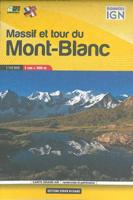
Wandelkaart Massif et tour du Mont-Blanc | Didier Richard

0
De hele Tour du Mont Blanc op 1 pocket-sized kaart. Toeristische informatie en outdoor aktiviteiten zijn gemarkeerd op de kaart, GR-paden zijn duidelijk zichtbaar, wegen en sporen worden ook getoond en de kaart is compatible met GPS. Dat is alles in een superhandig klein formaar van 11,5 x 7,5 cm!   The whole of the  Tour du Mont Blanc on one pock...

Verkopers met dit product

Verkoper
Bezorging
Prijs
DeZwerver.nl logo
DeZwerver.nl
2,95
12,95

Anderen bekeken ook

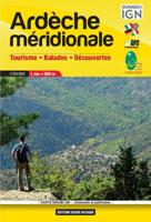
Wandelkaart Ardèche méridionale | Didier Richard
De hele Ardèche  op 1 pocket-sized kaart. Toeristische informatie en outdoor aktiviteiten zijn gemarkeerd op de kaart, GR-paden zijn duidelijk zichtbaar, wegen en sporen worden ook getoond en de kaart is compatible met GPS. Dat is alles in een superhandig klein formaar van 11,5 x 7,5 cm!   The whole of the Ardèche  on one pocket sized light weight map. Tourist information and outdoor activities are marked on the map, GR hiking trails are all highlighted, Road and rail networks are also shown and it is compatible with GPS systems.
12,95
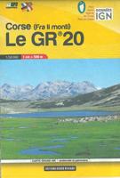
Wandelkaart Le GR 20 - Corsica | Didier Richard
De hele GR-20 op 1 pocket-sized kaart. Toeristische informatie en outdoor aktiviteiten zijn gemarkeerd op de kaart, GR-paden zijn duidelijk zichtbaar, wegen en sporen worden ook getoond en de kaart is compatible met GPS. Dat is alles in een superhandig klein formaar van 11,5 x 7,5 cm! The whole of the GR20 on one pocket sized light weight map. Tourist information and outdoor activities are marked on the map, GR hiking trails are all highlighted, Road and rail networks are also shown and it is compatible with GPS systems.
12,95
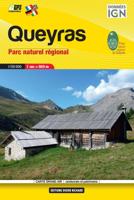
Wandelkaart Queyras Parc naturel regional | Didier Richard
De hele Queyras op 1 pocket-sized kaart. Toeristische informatie en outdoor aktiviteiten zijn gemarkeerd op de kaart, GR-paden zijn duidelijk zichtbaar, wegen en sporen worden ook getoond en de kaart is compatible met GPS. Dat is alles in een superhandig klein formaar van 11,5 x 7,5 cm!   The whole of the  Queyras on one pocket sized light weight map. Tourist information and outdoor activities are marked on the map, GR hiking trails are all highlighted, Road and rail networks are also shown and it is compatible with GPS systems.
12,95
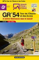
Wandelkaart Tour de l'Oisans et des Écrins GR54 | Didier Richard
De hele GR5-4 op 1 pocket-sized kaart. Toeristische informatie en outdoor aktiviteiten zijn gemarkeerd op de kaart, GR-paden zijn duidelijk zichtbaar, wegen en sporen worden ook getoond en de kaart is compatible met GPS. Dat is alles in een superhandig klein formaar van 11,5 x 7,5 cm!   Avec le Grand Tour des Écrins, retrouvez toutes les offres ditinérance que vous offre le Parc national des Écrins. À lassaut des cols daltitude du GR®54 ou sur les pentes douces des Balcons des Écrins vous pourrez parcourir les sentiers de ce massif exceptionnel à votre rythme, en famille ou entre amis, sur deux jours ou quinze...   Dans cette carte sont présentés et tracés, le tout complété par les coordonnées utiles pour organiser son séjour : Le GR® 54 Tour de l'Oisans et des Écrins Dans les pas des pionniers, lui seul mène au pied des sommets mythiques des Alpes du Sud : La Meije, la barre des Écrins, Le Sirac 190 kilomètres à parcourir, 14 cols et 12 000 mètres de dénivelé positif, c'est un parcou…
12,95
Wandelkaart Tour & Trail La Gomera & El Hierro | Discovery Walking Guides
Super gedetailleerde kaart van het hele eiland. Met heel veel wandelroutes, al dan niet gemarkeerd. Quite simply La Gomera and El Hierro Tour & Trail Super-Durable Maps are the most detailed, accurate, toughest, easy to read, large scale maps of La Gomera and El Hierro that you can buy. Our map sheet is 840mm by 680mm. On the cover side you get the latest 35k scale 8th edition La Gomera Tour & Trail Super-Durable Map by David Brawn.   On the reverse side is our 35k scale 1st edition El Hierro Tour & Trail Super-Durable Map by Jan Kostura. Both maps are produced to our 'Tour & Trail' level of detail ranging from major roads to secondary roads to minor roads to streets and camino rural narrow country roads, plus dirt roads and walking trails. Walking trails are specially highlighted, GR (Gran Recorido trails in green) and Walk La Gomera (in red), making them easier to identify on the maps and easier to find on the ground.   Altitude background colouring is designed to clearly show …
15,95
Wandelkaart Tour & Trail Azores - Azoren | Discovery Walking Guides
Gedetailleerde kaart van de Azoren. Met heel veel wandelroutes, al dan niet gemarkeerd. For the best adventures, use the best map. Azores Tour & Trail Super-Durable Map is the most detailed, accurate, toughest, large scale map of these 9 islands that you can buy.    1:60,000 scale for each island, Sao Miguel at 70,000 scale, produces a double sided map sheet of 960mm by 694mm; big enough to show masses of detail but compact enough to use in the car or on the trail. Faial, Pico, Santa Maria and Sao Jorge are on the facing sheet of the map with Corvo, Flores, Graciosa, Sao Miguel and Terceira are on the reverse side. Our special concertina map fold means your map is easy to unfold, and more importantly easy to refold back to its pocket size.   You get the most detailed map of the Azores islands that is produced including our 'Tour & Trail' level of detail ranging from major roads to secondary roads to minor roads to streets and narrow country roads, plus dirt roads and walking trails. W…
15,95
Wandelkaart Tour & Trail Tenerife | Discovery Walking Guides
Uitstekende wandelkaart, met ingetekende wandelroutes, voor specifieke wandelgebieden van Tenerife. Let op: dit is niet een kaart van het hele eiland, maar puur en alleen voor de wandelgebieden > daar is deze kaart de beste in! Our latest hiking research on Tenerife has resulted in new editions of Walk! Tenerife and Tenerife Hikers' Super-Durable Maps. Thanks to Jan Kostura's research we have several new hiking adventures described in detail in Walk! Tenerife. Jan's gps records of his research for new routes and updating of current routes has provided the detailed information to produce our new fourth edition of Tenerife Hiker's Super-Durable Maps. Note that Tenerife Hikers' Super-Durable Maps is a collection of four 30k scale map sections on a double sided sheet of 840mm by 600mm which folds up to 220mm by 120mm. It is not a map of all of Tenerife.  In this edition you will find 30k scale maps covering Valle de Orotava, West, Anaga and Adeje/Arona - Teide printed on a double sided…
17,95
Wandelkaart Tour & Trail Madeira | Discovery Walking Guides
Goed gedetallieerde wandelkaart van Madeira, schaal 1:40.000, scheur en watervast papier. Wandelroutes staan ingetekend. Our large 1:40,000 scale, combined with splitting the island into East and West with a generous overlap, produces double sided map whose total size is 840mm by 600mm and folds to 235mm by 120mm. You get the most detailed map of Madeira that is produced including our 'Tour & Trail' level of detail ranging from major roads to secondary roads to minor roads to streets and camino rural narrow country roads, plus dirt roads and walking trails. Altitude background colouring is designed to clearly show the altitude range when travelling across the island by car or on foot. 100 metre and 50 metre contours are clearly shown on the map along with a large number of individual height points and all of the official 'Trig' points. Tour & Trail attention to detail is legendary as is our useful symbol range including miradors, picnic areas, petrol stations, bar/restaurants and park…
15,95
Wandelkaart Tour & Trail Costa de Sol - Axarquia | Discovery Walking Guides
Goede wandelkaart van de omgeving Nerja - Competa in het binnenland. For better adventures, use the best map. Costa del Sol (Axarquia) Tour & Trail Super-Durable Map comes with a 2 year adventurous use wear and tear guarantee against splitting or falling apart, see Discovery Walking Guides website for details. From 1 April 2020 a free Custom Map digital edition for Garmin users is available to download from the Discovery Walking Guides website.   Our large 1:40,000 scale, combined with splitting the region into West and East sections with a generous overlap, produces double sided map whose total size is 840mm by 700mm that folds to a pocketable 240mm by 120mm. Costa del Sol (Axarquia) covers the region from Ventas de Zafarraya in the North-West to Almunecar in the South-East; approx 3 42'W to 4 08'W and 36 43'N to 36 58'N. You get the most detailed map of the region that is produced including our 'Tour & Trail' level of detail ranging from major roads to secondary roads to minor ro…
15,95
Wandelkaart Tour & Trail Corfu - Korfoe | Discovery Walking Guides
Goede wandelkaart van Korfoe. Scheur- en watervast. Corfu Tour & Trail Super-Durable Map is the most detailed, accurate, toughest, large scale map of the island that you can buy. Super-Durable Maps now come with a 2 year adventurous use wear and tear guarantee, see Discovery Walking Guides website for details. Our large 1:40,000 scale produces a double sided map sheet of 840mm by 680mm; big enough to show masses of detail but compact enough to use in the car or on the trail.   Corfu North is on the facing sheet of the map with Corfu South on the reverse side, including a generous overlap between the two sides. Our special concertina map fold means your map is easy to unfold, and more importantly easy to refold back to its pocket size. You get the most detailed map of Corfu that is produced including our 'Tour & Trail' level of detail ranging from major roads to secondary roads to minor roads to streets and narrow country roads, plus dirt roads and walking trails.   We have a new metho…
15,95

Klanten-reviews van Wandelkaart Massif et tour du Mont-Blanc | Didier Richard

Er zijn nog geen beoordelingen voor dit productBen jij de eerste die een review plaatst?

Meer over Wandelkaart Massif et tour du Mont-Blanc | Didier Richard

Productomschrijving

De hele Tour du Mont Blanc op 1 pocket-sized kaart. Toeristische informatie en outdoor aktiviteiten zijn gemarkeerd op de kaart, GR-paden zijn duidelijk zichtbaar, wegen en sporen worden ook getoond en de kaart is compatible met GPS. Dat is alles in een superhandig klein formaar van 11,5 x 7,5 cm!   The whole of the  Tour du Mont Blanc on one pocket sized light weight map. Tourist information and outdoor activities are marked on the map, GR hiking trails are all highlighted, Road and rail networks are also shown and it is compatible with GPS systems.

Verken gerelateerde categorieën

Webshop.nl maakt gebruik van cookies. Ga je verder op onze website, ga dan akkoord met het plaatsen van cookies en de verwerking van deze data door ons en vermelde partners.