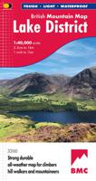
Wandelkaart Lake District | Harvey Maps

0
"The best Lake District map I have ever seen. The 1:40,000 scale provides clear, detailed information to one of the most popular hill walking areas in Britain." Sir Chris Bonington, mountaineer. A new generation of tough polyethylene maps. These maps are a leap forward in technical excellence. Tough, durable and 100% waterproof they are compact - ...

Verkopers met dit product

Verkoper
Bezorging
Prijs
DeZwerver.nl logo
DeZwerver.nl
niet bekend
31,95

Anderen bekeken ook

Nieuw
Wandelkaart Dartmoor | Harvey Maps
"This inspiring new map will help walkers and climbers explore Dartmoor's wild granite landscapes, and, like the granite, is virtually indestructible." Sir Ranulph Fiennes, adventurer and explorer.   Dartmoor, the latest title in the highly successful and innovative British Mountain Map series, is the only really detailed map for walking to cover this famous area on one sheet. XT40 - A new generation of tough polyethylene maps. These maps are a leap forward in technical excellence. Tough, durable, and 100% waterproof, they are compact - not the great bulky package you get with a laminated map - and light to carry. This all - weather British Mountain Map for climbers, hill - walkers, mountaineers and mountain bikers is published by HARVEY in co-operation with the British Mountaineering Council. The colourful geological map on the back gives understanding of the land form and was specially designed by the British Geological Survey. Colour shading is also used for easy identification of …
29,95
Wandelkaart Brecon Beacons | Harvey Maps
"The Brecon Beacons have an irresistible draw and this is where I began my journey to the roof of the world. The breathtaking landscape provides challenges and adventures for all ages and abilities and this expertly designed map is the key to exploring it." Tori James, the first Welsh woman to climb Mount Everest Brecon Beacons - the latest edition to the popular British Mountain Map series. It covers 350 square mile of country - the only really detailed map to cover this whole area on one sheet. These maps are a leap forward in technical excellence. Tough, durable, and 100% waterproof, they are compact - not the great bulky package you get with a laminated map - and they are light to carry. This all weather British Mountain Map for climbers, hill walkers and mountaineers is published by HARVEY in co-operation with the British Mountaineering Council.
29,95
Nieuw
Wandelkaart Dark Peak | Harvey Maps
"The 1:40,000 scale used by British Mountain Maps is excellent for hill walking. These maps provide clear, detailed information." Sir Chris Bonington, mountaineer.   Detailed map of the Dark Peak’s famous Moorland Hills and Edges on a single sheet at 1:40,000 scale.   Detailed enlargement of the Kinder plateau. Map extension to Marsden.   As used by Woodhead Mountain Rescue Team.   Tough, durable & 100% waterproof these virtually indestructible maps cover Dark Peak's moorland fells & edges on a single map. Colour shading for easy identification of hill's and valleys makes this the only map you will need to walk in the Peak District. There is also a detailed enlargement of the Kinder plateau on the reverse of the map as well as a geological map. Useful tips, phone numbers etc are also included.
29,95
Nieuw
Wandelkaart 03 Bow Lake / Saskatchewan Crossing | Gem Trek Maps
Waterproof and tear-resistant hiking and recreation map for the Bow Lake and Saskatchewan Crossing region of Banff National Park.   Gem Trek's 1:70,000 Bow Lake and Saskatchewan Crossing Map is designed for outdoor enthusiasts looking to explore the Bow Lake and Saskatchewan Crossing region at the north end of Banff National Park. Whether you are touring along the roads or heading into the backcountry, you’ll find the waterproof and tear-resistant Bow Lake and Saskatchewan Crossing Map to be an invaluable tool. This map features detailed cartography, accurate hiking trails with distances, and details such as logging roads on the British Columbia side of the Continental Divide, campgrounds, picnic areas, and abandoned fire lookouts. On the back are descriptions of 24 recommended hikes, ranging from short walks to overnight treks, as well as details of services such as campgrounds and visitor centres.   Map specs     – Edition: 6th – Map scale: 1:70,000 – Sheet size: 27 x 39 inches – Fo…
18,95
Nieuw
Wandelkaart Knoydart / Kintail & Glen Affric | Harvey Maps
"Clarity is the hallmark of this map. It covers magnificently honed peaks set above western seas and lochs, inviting exploration of one of Scotland's superlative and remote mountain regions", the late Irvine Butterfield, author of The High Mountains.   Detailed map of ‘Britain's last wilderness’ at 1:40,000 scale.   Includes Kintail and Glen Affric.   Detailed crag information for climbers.   Includes 43 Munros, 21 Corbetts and 7 Grahams.   Knoydart & Kintail, seventh in this highly successful & innovative British Mountain Map series, is a long awaited title. It is the only detailed map to cover this famous wilderness area on one sheet. This all weather map for climbers, hillwalkers, mountaineers & mountain bikers includes 43 Munros & 21 Corbetts. It is printed on polyethylene which is durable, tearproof & 100% waterproof. Colour shading is used for easy identification of hills & valleys & the map weighs less than half the weight of a laminated map. There is also an extension covering…
29,95
Wandelkaart Snowdonia Zuid | Harvey Maps
"The 1:40,000 scale used by British Mountain Maps is excellent for hill walking. These maps provide clear, detailed information." Sir Chris Bonington, mountaineer.   The key mountains of Southern Snowdonia on one map at 1:40,000 scale.   Includes Cadair Idris, the Arans and Arenig Fawr.   Snowdonia South is the latest title in the highly successful and innovative British Mountain Map series. It adjoins existing title, Snowdonia and covers the very popular Cadair Idris, the Rhinogs, the Arans and Arenig Fawr. Printed on polyethylene this map is durable, tearproof and 100% waterproof. Colour shading is used for easy identification of the hills and valleys. The map is also less than half of the weight of a laminated map. The reverse side of the map includes a map extension south to Aberdovey, a geological map, mountain incident, first aid and navigation advice. Local phone numbers and website addresses are also listed.
29,95
Nieuw
Wandelkaart 17 Banff - Egypt Lake | Gem Trek Maps
Mooie, gedetailleerde kaart uit de serie van Gem Trek Hiking map-guides. Helder kleurgebruik en met de beste / mooiste wandelroutes, hikes en interessante plaatsen erop aangegeven. Gem Trek’s 1:50,000-scale BANFF–EGYPT LAKE MAP covers the most popular hiking trails in the immediate area of the town of Banff in more detail than our Banff & Mount Assiniboine Map.   The Banff–Egypt Lake Map features detailed cartography, accurate hiking trails with distances, and details such as side trips and backcountry campgrounds. For road travellers, it includes viewpoints, picnic areas, and campgrounds.   On the back of the map are trail descriptions of 17 recommended day hikes and four classic multi-day trips, all referenced to the map on the front. Also on the back is a list of trails recommended for early season, birdwatching, wildflowers, waterfalls, expansive views, awe-inspiring scenery, alpine meadows and rainy days. Included are contact numbers for visitor centres and backcountry booki…
17,95
Reisgids Marco Polo ENG Lake District | MairDumont
Handige en overzichtelijke, kleine reisgids voor een eerste kennismaking met de vakantiebestemming. Globale uitklapkaart achterin, makkelijk binnenzakformaat. Marco Polo Pocket Guide Lake District: the Travel Guide with Insider Tips Explore the Lake District with this handy, pocket-sized, authoritative guide, packed with Insider Tips. Discover boutique hotels, authentic restaurants, the region's trendiest places, and get tips on shopping and what to do on a limited budget. There are plenty of ideas for travel with kids, and a summary of all the festivals and events that take place. Let Marco Polo show you all this beautiful corner of Britain has to offer... From the highest peaks to the deepest lakes, picture perfect villages, sweeping panoramic views, hilltop walks, literary locations, country pubs and bustling market towns - welcome to the Lake District. England's largest National Park, and now World Heritage Site, the Lake District offers a perfect retreat to the countryside... Thi…
11,50
Nieuw
Wandelkaart Lake District Noord | Harvey Maps
New Superwalker XT25 of the Lake District. Revised and re-designed It's got everything! Genuine original HARVEY mapping at 1:25,000. Clear, easy to read. Easy to re-fold. Opens directly to either side of the sheet. Slim and flexible. Light to carry. Tearproof, durable, AND 100% waterproof as standard - no need for a map case. The Lake District National Park on just 4 sheets. This Lake District North covers the northern fells including Skiddaw, Blencathra, Great Calva Keswick and Derwentwater
24,95
Nieuw
Wandelkaart Snowdonia Noord | Harvey Maps
"The 1:40,000 scale used by British Mountain Maps is excellent for hill walking. These maps provide clear, detailed information." Sir Chris Bonington, mountaineer.   Snowdonia's key mountains on a single map.   Enlargements of Snowdon and Tryfan.   This map covers Snowdonia's key mountains on a single map. Colour shading is used for easy identification of the hills and valleys and the text is bi-lingual in Welsh and English. The reverse side of the map includes detailed 1:20,000 enlargements of Snowdon & Tryfan, a geological map of the area, mountain incident and first aid advice and useful local phone numbers and website addresses.
29,95

Klanten-reviews van Wandelkaart Lake District | Harvey Maps

Er zijn nog geen beoordelingen voor dit productBen jij de eerste die een review plaatst?

Meer over Wandelkaart Lake District | Harvey Maps

Productomschrijving

"The best Lake District map I have ever seen. The 1:40,000 scale provides clear, detailed information to one of the most popular hill walking areas in Britain." Sir Chris Bonington, mountaineer.

A new generation of tough polyethylene maps. These maps are a leap forward in technical excellence. Tough, durable and 100% waterproof they are compact - not the great bulky package you get with a laminated map - and light to carry. This all weather British Mountain Map for climbers, hill wallkers, mountaineers and mountain bikers is published by HARVEY in co-operation with the British Mountaineering Council. The Lake District's famous mountains and fells on a single map, colour shading for easy identification of hills and valleys and detailed crag information for climbers. The reverse side of the map includes detailed 1:20000 enlargements of Scafell, Gable, Bowfell, Langdale Pikes and Pillar, a Geological map of the Lake District, mountain incident and first aid advice.

Verken gerelateerde categorieën

Webshop.nl maakt gebruik van cookies. Ga je verder op onze website, ga dan akkoord met het plaatsen van cookies en de verwerking van deze data door ons en vermelde partners.