Wandelkaart Knoydart / Kintail & Glen Affric | Harvey Maps

0
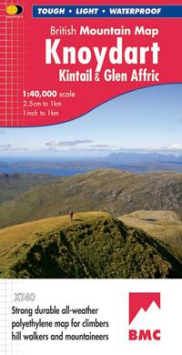
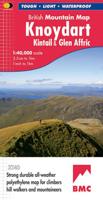
"Clarity is the hallmark of this map. It covers magnificently honed peaks set above western seas and lochs, inviting exploration of one of Scotland's superlative and remote mountain regions", the late Irvine Butterfield, author of The High Mountains.   Detailed map of ‘Britain's last wilderness’ at 1:40,000 scale.   Includes Kintail and Glen Affri...

Verkopers met dit product

Verkoper
Bezorging
Prijs
DeZwerver.nl logo
DeZwerver.nl
2,95
29,95

Anderen bekeken ook

Wandelkaart Knoydart / Kintail & Glen Affric | Harvey Maps
"Clarity is the hallmark of this map. It covers magnificently honed peaks set above western seas and lochs, inviting exploration of one of Scotland's superlative and remote mountain regions", the late Irvine Butterfield, author of The High Mountains.   Detailed map of ‘Britain's last wilderness’ at 1:40,000 scale.   Includes Kintail and Glen Affric.   Detailed crag information for climbers.   Includes 43 Munros, 21 Corbetts and 7 Grahams.   Knoydart & Kintail, seventh in this highly successful & innovative British Mountain Map series, is a long awaited title. It is the only detailed map to cover this famous wilderness area on one sheet. This all weather map for climbers, hillwalkers, mountaineers & mountain bikers includes 43 Munros & 21 Corbetts. It is printed on polyethylene which is durable, tearproof & 100% waterproof. Colour shading is used for easy identification of hills & valleys & the map weighs less than half the weight of a laminated map. There is also an extension covering…
29,95
Wandelkaart Affric Kintail Way | Harvey Maps
Mooie, duidelijke kaart van de Affric Kintail way in Schotland. Geplastificeerd met veel extra informatie en uitsnedes van de route. De hele rote op 1 kaart, erg handig! The Affric Kintail Way is a superb cross-country route for walkers, mountain bikers and horse riders stretching almost 44 miles from Drumnadrochit by Loch Ness to Morvich in Kintail by Loch Duich. The trail is in close proximity to the Great Glen at Drumnadrochit thus offering the traveller the opportunity of extending their journey. The Way has been created by linking a number of rights of way, forest trails and footpaths that have existed in some cases for centuries.Compact and light - the map itself weighs just 60gms - a third of the weight of a laminated map, and much less bulky. And you can fold or refold it time and again, or stuff it in your back pocket and it won't fall to pieces. Shows the entire route on one sheet.
16,55
Wandelkaart Ben Nevis & Glen Coe | Harvey Maps
"This excellent Ben Nevis and Glen Coe map provides all the details needed for safe navigation on these iconic mountains". Cameron McNeish, outdoor writer and broadcaster.   Detailed map for hillwalkers and climbers of Ben Nevis and Glen Coe at 1:40,000 scale.   Section on navigation on Ben Nevis and detailed 1:15,000 enlargement of the summit with bad visibility descent route.   The map area includes 44 Munros, 14 Corbetts and 9 Grahams.     Serious map for serious mountains. The latest addition to the British Mountain Map series is a real heavyweight. Ben Nevis/Glencoe is the first Scottish title in this highly successful & innovative range. The map at 1:40000 has 43 Munros & 14 Corbetts on one sheet & is printed on polyethylene which is durable, tearproof & 100% waterproof. There is also colour shading for easy identification of hills and valleys & weighs less than half the weight of a laminated map. The reverse of the map has an enlargement of Ben Nevis summit, a Geological map, n…
29,95
Wandelkaart Schiehallion / Ben Lawers & Glen Lyon | Harvey Maps
"I've spent most of my climbing career searching for new crags and bouldering areas and until Harvey Maps came along it was a process of trial and error. Their attention to detail is unmatched and they have led me successfully to all sorts of new adventures." Kevin Howett, Development Officer for the Mountaineering Council of Scotland and Author of 'Rock Climbing in Scotland' and SMC's 'Highland Outcrops' Guide.   Detailed map of 42 challenging Perthshire hills on one sheet at 1:40,000 scale.   Map extension covers Ben Chonzie.   Includes 27 Munros, 15 Corbetts and 4 Grahams   Schiehallion, Ben Lawers & Glen Lyon is the current new publication in this highly successful and innovative British Mountain Map Series. There are over 42 challenging Perthshire hills on this one sheet including 27 Munros and 15 Corbetts. Climbing Crags are highlighted & named. Climbing Crag route diagrams are also shown. Again this map is printed on polyethylene which is durable, tearproof & 100% waterproof. T…
29,95
Wandelkaart Dartmoor | Harvey Maps
"This inspiring new map will help walkers and climbers explore Dartmoor's wild granite landscapes, and, like the granite, is virtually indestructible." Sir Ranulph Fiennes, adventurer and explorer.   Dartmoor, the latest title in the highly successful and innovative British Mountain Map series, is the only really detailed map for walking to cover this famous area on one sheet. XT40 - A new generation of tough polyethylene maps. These maps are a leap forward in technical excellence. Tough, durable, and 100% waterproof, they are compact - not the great bulky package you get with a laminated map - and light to carry. This all - weather British Mountain Map for climbers, hill - walkers, mountaineers and mountain bikers is published by HARVEY in co-operation with the British Mountaineering Council. The colourful geological map on the back gives understanding of the land form and was specially designed by the British Geological Survey. Colour shading is also used for easy identification of …
29,95
Wandelkaart Lake District | Harvey Maps
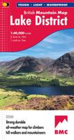
"The best Lake District map I have ever seen. The 1:40,000 scale provides clear, detailed information to one of the most popular hill walking areas in Britain." Sir Chris Bonington, mountaineer. A new generation of tough polyethylene maps. These maps are a leap forward in technical excellence. Tough, durable and 100% waterproof they are compact - not the great bulky package you get with a laminated map - and light to carry. This all weather British Mountain Map for climbers, hill wallkers, mountaineers and mountain bikers is published by HARVEY in co-operation with the British Mountaineering Council. The Lake District's famous mountains and fells on a single map, colour shading for easy identification of hills and valleys and detailed crag information for climbers. The reverse side of the map includes detailed 1:20000 enlargements of Scafell, Gable, Bowfell, Langdale Pikes and Pillar, a Geological map of the Lake District, mountain incident and first aid advice.
31,95

Klanten-reviews van Wandelkaart Knoydart / Kintail & Glen Affric | Harvey Maps

Er zijn nog geen beoordelingen voor dit productBen jij de eerste die een review plaatst?

Meer over Wandelkaart Knoydart / Kintail & Glen Affric | Harvey Maps

Productomschrijving

"Clarity is the hallmark of this map. It covers magnificently honed peaks set above western seas and lochs, inviting exploration of one of Scotland's superlative and remote mountain regions", the late Irvine Butterfield, author of The High Mountains.   Detailed map of ‘Britain's last wilderness’ at 1:40,000 scale.   Includes Kintail and Glen Affric.   Detailed crag information for climbers.   Includes 43 Munros, 21 Corbetts and 7 Grahams.   Knoydart & Kintail, seventh in this highly successful & innovative British Mountain Map series, is a long awaited title. It is the only detailed map to cover this famous wilderness area on one sheet. This all weather map for climbers, hillwalkers, mountaineers & mountain bikers includes 43 Munros & 21 Corbetts. It is printed on polyethylene which is durable, tearproof & 100% waterproof. Colour shading is used for easy identification of hills & valleys & the map weighs less than half the weight of a laminated map. There is also an extension covering Glen Affric.

Productinformatie

    Verken gerelateerde categorieën

    Webshop.nl maakt gebruik van cookies. Ga je verder op onze website, ga dan akkoord met het plaatsen van cookies en de verwerking van deze data door ons en vermelde partners.