Wandelkaart Karakoram | TerraQuest

0
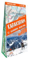
Een serie speciaal ontworpen voor liefhebbers van grote reizen en bergwandelingen. Een gedetailleerde schaal en complete toeristische informatie om u te helpen bij het plannen van uw trekking. Dankzij het gelamineerde oppervlak en het flex-vouwen, zullen de Trekking-kaarten van TerraQuest je overal begeleiden, zelfs in de meest extreme omstandig...

Verkopers met dit product

Verkoper
Bezorging
Prijs
DeZwerver.nl logo
DeZwerver.nl
niet bekend
20,95

Anderen bekeken ook

Nieuw
Wandelgids Maroc (Franstalig) | Rother Bergverlag
cartes de randonnée détaillées profils d’altitude informatifs traces GPS à télécharger La « magie de l’Orient » commence à quelques miles nautiques seulement de l’Europe : au Maroc, là où l’Atlantique et la Méditerranée se rencontrent.Le royaume du Maroc n’enchante pas seulement par ses parfums exotiques, ses villes et ses villages dignes des Mille et Une Nuits, mais aussi par une nature spectaculaire et un éventail insoupçonné de randonnées possibles entre la côte et la haute montagne.Le guide de randonnées Rother « Maroc » présente 52 itinéraires variés – des randonnées passionnantes d’une demi-journée aux entreprises de plusieurs jours dans des paysages encore intacts.Les randonneurs à la recherche de sensations fortes en haute montagne y trouveront leur compte, tout comme les randonneurs amateurs pour qui l’expérience culturelle et la beauté de la nature sont primordiales. Les montagnes du Rif, au caractère méditerranéen et aux reliefs sauvages, et les roches karstiques du Moye…
20,50
Nieuw
Wandelkaart Fagaras | TerraQuest
De kracht zit hem in het feit dat deze kaart in delen is geplastificeerd en daardoor ook - ondanks de plastic laag - makkelijk in delen is te vouwen. Deze kaart is gericht op het wandelen met de ingetekende wandelroutes in rood en groen.  Terraquest say 'TerraQuest maps are designed and developed primarily for tourists preparing for treks to remote corners of the world. Our proven map laminating technology allows you to freely use the maps even in harsh conditions, while appreciating the clear and easy-to-read information compiled by our team of qualified cartographers. The distinctive feature of terraQuest laminated maps is the manufacturing method. Due to a special lamination process and patented map joining techniques, the maps easily adjust to your choice of format , even for one-hand use only. They are exceptionally durable and may be folded repeatedly. You can also add and erase your own notes directly onto the map with an erasable pen without damage to the map'
18,50
Wandelkaart Trekking map Madeira | TerraQuest
De kracht zit hem in het feit dat deze kaart in delen is geplastificeerd en daardoor ook - ondanks de plastic laag - makkelijk in delen is te vouwen. Deze kaart is gericht op het wandelen met de ingetekende wandelroutes in rood en groen.  Terraquest say 'TerraQuest maps are designed and developed primarily for tourists preparing for treks to remote corners of the world. Our proven map laminating technology allows you to freely use the maps even in harsh conditions, while appreciating the clear and easy-to-read information compiled by our team of qualified cartographers. The distinctive feature of terraQuest laminated maps is the manufacturing method. Due to a special lamination process and patented map joining techniques, the maps easily adjust to your choice of format , even for one-hand use only. They are exceptionally durable and may be folded repeatedly. You can also add and erase your own notes directly onto the map with an erasable pen without damage to the map'
12,50
Wandelkaart Trekking map Central Pyrenees - Pyreneeën | TerraQuest
Uitstekende wandelkaart van een deel van de Pyreneën. Alle noodzakelijke gegevens staan er op, de kaart is gebaseerd op topografische kaarten en voorzien van ingetekende wandelroutes. De kaart is geplastificeerd. Voor een uitsnede welk gebied deze kaart dekt. This is the 1:50,000 trekking map for the Central Pyrenees covering Lourdes, Trebons and Capvern on the north edge of the map and down to Monte Perdido in the south.   Terraquest say 'TerraQuest maps are designed and developed primarily for tourists preparing for treks to remote corners of the world. Our proven map laminating technology allows you to freely use the maps even in harsh conditions, while appreciating the clear and easy-to-read information compiled by our team of qualified cartographers. The distinctive feature of terraQuest laminated maps is the manufacturing method. Due to a special lamination process and patented map joining techniques, the maps easily adjust to your choice of format , even for one-hand use only. …
18,50
Wandelkaart Trekking map Rila - Pirin | TerraQuest
De kracht zit hem in het feit dat deze kaart in delen is geplastificeerd en daardoor ook - ondanks de plastic laag - makkelijk in delen is te vouwen. Deze kaart is gericht op het wandelen met de ingetekende wandelroutes in rood en groen. Op de ene kant staat het Pirin geberhte en op de andere zijde her Rila gebergte.   Terraquest say 'TerraQuest maps are designed and developed primarily for tourists preparing for treks to remote corners of the world. Our proven map laminating technology allows you to freely use the maps even in harsh conditions, while appreciating the clear and easy-to-read information compiled by our team of qualified cartographers. The distinctive feature of terraQuest laminated maps is the manufacturing method. Due to a special lamination process and patented map joining techniques, the maps easily adjust to your choice of format , even for one-hand use only. They are exceptionally durable and may be folded repeatedly. You can also add and erase your own notes dire…
18,50
Nieuw
Wandelkaart Trekking map Annapurna Dhaulagiri | TerraQuest
De kracht zit hem in het feit dat deze kaart in delen is geplastificeerd en daardoor ook - ondanks de plastic laag - makkelijk in delen is te vouwen. Deze kaart is gericht op de trekkings in het gebied die nauwkeurig staan ingetekend, zo ook de mogelijke campsites onderweg.  Terraquest say 'TerraQuest maps are designed and developed primarily for tourists preparing for treks to remote corners of the world. Our proven map laminating technology allows you to freely use the maps even in harsh conditions, while appreciating the clear and easy-to-read information compiled by our team of qualified cartographers. The distinctive feature of terraQuest laminated maps is the manufacturing method. Due to a special lamination process and patented map joining techniques, the maps easily adjust to your choice of format , even for one-hand use only. They are exceptionally durable and may be folded repeatedly. You can also add and erase your own notes directly onto the map with an erasable pen withou…
18,50
Nieuw
Wandelkaart Trekking map Drakensbergen - Zuid Afrika | TerraQuest
Geplastificeerde trekking-kaart. Relatief zeer gedetailleerd. Het Ukhahlamba Park ligt op de grens van Zuid-Afrika en Lesotho met de hoogste berg en het meest interessante gebied van de Draak. Met wandelroutes, toeristische info, GPS coordinaten in WGS-84. Hiking map of the Drakensberg in the Ukhahlamba Park, on the South Africa and Lesotho border. Waterproof and tear resistant map published by Terraquest. The map is double-sided and covers the park in two overlapping sections. Coverage extends north-west to include the Royal Natal National Park. The map covers the entire Ukhahlamba Park - the highest in the Drakensberg area.   The map is distinguished by its topographical accuracy (contour) and the detailed content focused on tourism (symbols show locations of hotels, mountain refuges and campsites, bivouac and picnic places, restaurants, car parks and petrol stations, medical facilities, viewpoints, etc...) The map shows rural roads and footpaths, and highlights trekking trails indi…
18,50
Nieuw
Campergids Le Maroc en camping car | Gandini
Mieux que quiconque, le peintre Eugène Delacroix avait su saisir, dès le milieu du XIXe siècle, les formidables couleurs de ce pays et sa grande leçon de vie. Imaginez toutes les nuances de la palette du peintre et vous appréhenderez alors celle de ce pays, tout particulièrement au printemps et en automne.   Le Maroc, c’est le dépaysement et l’émerveillement à notre porte. Pays accueillant, aux paysages variés, toujours très francophone, parfois hors du temps, si proche et si différent de nous… Idéal pour la découverte en couple, en famille, entre amis. Chaque année, des milliers de touristes se rendent dans ce merveilleux pays et, pour une grande partie d'entre-eux, le visitent sans faire appel aux structures traditionnelles d'organisation de voyages, avec leur propre véhicule. Ce guide du Maroc s'adresse à eux, leur proposant toute une palette de lieux et de circuits routiers extraordinaires, pour en faire ce que Jacques Gandini appelle des DPM, des « Dévoreurs de Pays Magnifique » …
30,95
Nieuw
Wandelkaart Tour de l'Oisans et des Écrins GR54 | Didier Richard
De hele GR5-4 op 1 pocket-sized kaart. Toeristische informatie en outdoor aktiviteiten zijn gemarkeerd op de kaart, GR-paden zijn duidelijk zichtbaar, wegen en sporen worden ook getoond en de kaart is compatible met GPS. Dat is alles in een superhandig klein formaar van 11,5 x 7,5 cm!   Avec le Grand Tour des Écrins, retrouvez toutes les offres ditinérance que vous offre le Parc national des Écrins. À lassaut des cols daltitude du GR®54 ou sur les pentes douces des Balcons des Écrins vous pourrez parcourir les sentiers de ce massif exceptionnel à votre rythme, en famille ou entre amis, sur deux jours ou quinze...   Dans cette carte sont présentés et tracés, le tout complété par les coordonnées utiles pour organiser son séjour : Le GR® 54 Tour de l'Oisans et des Écrins Dans les pas des pionniers, lui seul mène au pied des sommets mythiques des Alpes du Sud : La Meije, la barre des Écrins, Le Sirac 190 kilomètres à parcourir, 14 cols et 12 000 mètres de dénivelé positif, c'est un parcou…
12,95
Nieuw
Wandelkaart 51 Alt Emporda | Editorial Alpina
Zeer gedetailleerde wandelkaart van een klein gebied. Met ingetekende wandelroutes en andere informatie. Spaanstalig, maar uitstekende kaart. Coordinaten zijn weergegeven, dus GPS compatible met UTM grid.    Dit is een 2-delige kaartenset. Op de topografische wandelkaart worden o.a. berghutten, campings aangeduid en hoogtelijnen, ingetekende wandelroutes en de GR paden (doorgaande langeafstandswandelpaden). De kaart is inclusief een Spaanstalig boekje met extra informatie over aanwezige voorzieningen en enkele routes.   Gebied: Roses, Cadaques, el Port de la Selva, Figueres, Banyoles, Castello d'Empuries, l'Escala, Llanca, Portbou, la Jonquera, Empuriabrava, Costoja, la Vajol, Borrassa, Santa Pau, Sadernes, Tortellá, Basalú, Peralada, Castellfollit de la Roca, Sant Llorenc de Cerdans / Saint-Laurent-de-Cerdans, Arles-sur-Tech, Cervera / Cerbère, Ceret, Biure, Banyuls-sur-Mer / Banyuls de la Marenda.   The Alt Empordà is a region of great contrasts of the northern Catalonia: the c…
19,95

Klanten-reviews van Wandelkaart Karakoram | TerraQuest

Er zijn nog geen beoordelingen voor dit productBen jij de eerste die een review plaatst?

Meer over Wandelkaart Karakoram | TerraQuest

Productomschrijving

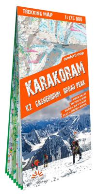
Een serie speciaal ontworpen voor liefhebbers van grote reizen en bergwandelingen. Een gedetailleerde schaal en complete toeristische informatie om u te helpen bij het plannen van uw trekking. Dankzij het gelamineerde oppervlak en het flex-vouwen, zullen de Trekking-kaarten van TerraQuest je overal begeleiden, zelfs in de meest extreme omstandigheden. U kunt uw eigen notities op de kaarten maken en ze wissen zonder de kaarten te beschadigen.   Belangrijke kenmerken:  • Rijk aan toeristische informatie (trekking routes, toeristische infrastructuur, natuurlijke bezienswaardigheden en andere interessante sites) • Het reliëf wordt plastisch voorgesteld met behulp van schaduwtechnieken • GPS compatibel, er wordt gebruik gemaakt van het WGS84 systeem • Legende in 6 talen: Engels, Frans, Duits, Spaans, Italiaans, Pools   Terraquest say 'TerraQuest maps are designed and developed primarily for tourists preparing for treks to remote corners of the world. Our proven map laminating technology allows you to freely use the maps even in harsh conditions, while appreciating the clear and easy-to-read information compiled by our team of qualified cartographers. The distinctive feature of terraQuest laminated maps is the manufacturing method. Due to a special lamination process and patented map joining techniques, the maps easily adjust to your choice of format , even for one-hand use only. They are exceptionally durable and may be folded repeatedly. You can also add and erase your own notes directly onto the map with an erasable pen without damage to the map'     Cette carte de trek de la chaîne du Karakoram au Pakistan offrant un grand confort d'utilisation a été préparée spécialement pour les personnes actives partant en trek dans cette région. Il s'agit de l'une des rares cartes présentant la partie principale de la chaîne du Karakoram avec les sommets dépassant les 8000 m du K2, du Broad Peak, du Gasherbrum, ainsi que le tracé de la célèbre route du Karakoram. La carte est fabriquée selon le système Comfort! Map de l'entreprise ExpressMap (P) et couverte de laminage, ce qui assure une longévité plus élevée et un plus grand confort d'utilisation même dans les conditions atmosphériques les plus difficiles sur les sentiers. Elle comprend une légende rédigée en six langues : anglais, allemand, français, espagnol, italien et polonais.   Caractéristiques de la carte :   - résistance et confort d'utilisation ;   - riche contenu touristique : on y a indiqué notamment les parcours de trek, les curiosités naturelles, l'infrastructure touristique et bien d'autres points de repère intéressants ;   - ombrage montrant le relief ;   - conformité au GPS – coordonnées géographiques dans le système WGS-84.   Cette publication est parue dans le cadre de la série de cartes de trek de l'éditeur terraQuest, qui a gagné la confiance de millions d'adeptes d'expéditions de trek en Europe et sur d'autres continents.   La série des cartes de trek terraQuest a été créée pour ceux qui aiment les voyages lointains et les lieux difficilement accessibles. Une vaste étendue couverte, une grande échelle et un riche contenu aident à bien préparer son périple. Grâce à leur laminage recto-verso, les cartes peuvent être utilisées même dans les conditions extrêmes de montagne.    
Verken gerelateerde categorieën

Webshop.nl maakt gebruik van cookies. Ga je verder op onze website, ga dan akkoord met het plaatsen van cookies en de verwerking van deze data door ons en vermelde partners.