Wandelkaart - Kaart The South Downs Way Map Booklet | Cicerone

0
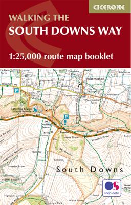
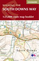
All the mapping you need to complete the 100 mile (160km) South Downs Way National Trail, between Eastbourne and Winchester. With easy walking on ancient trackways, the route features wooded areas, river valleys and attractive villages and is rich in natural, geological and historical interest. This booklet of Ordnance Survey 1:25,000 Explorer map...

Verkopers met dit product

Verkoper
Bezorging
Prijs
DeZwerver.nl logo
DeZwerver.nl
2,95
18,50

Anderen bekeken ook

Wandelkaart - Kaart The South Downs Way Map Booklet | Cicerone
All the mapping you need to complete the 100 mile (160km) South Downs Way National Trail, between Eastbourne and Winchester. With easy walking on ancient trackways, the route features wooded areas, river valleys and attractive villages and is rich in natural, geological and historical interest. This booklet of Ordnance Survey 1:25,000 Explorer maps has been designed for convenient use on the trail.   It shows the full and up-to-date line of the route along with the relevant extract from the OS Explorer map legend, and can be used when walking the trail in either direction. Conveniently sized for slipping into a jacket pocket or the top of a rucksack, it comes in a clear PVC sleeve. An accompanying Cicerone guidebook - The South Downs Way - describes the full route in both directions and includes lots of other practical and historical information, for those who prefer a written guide.   The guidebook INCLUDES a copy of this map booklet.
18,50
Wandelgids Walking the North Downs Way Map Booklet | Cicerone
All the mapping you need to walk the 130 mile (208km) North Downs Way National Trail between Farnham and Dover. One of the easier National Trails, it can be comfortably walked in 11-12 days and includes an optional detour via Canterbury.   This map booklet contains all the OS 1:25,000 Explorer mapping you need to walk the route, saving the space, weight and expense of multiple map sheets. Conveniently sized to slip in a jacket pocket or rucksack top, it comes in a clear PVC sleeve.   NOTE An accompanying Cicerone guidebook - The North Downs Way - describes the full route from West to East with lots of other practical and historical information. The accompanying guidebook INCLUDES a copy of this map booklet.
13,95
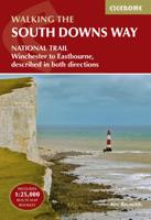
Wandelgids South Downs Way | Cicerone
Uitstekende wandelgids van dit geweldige gebied. goed beschreven met veel praktische informatie om de route te kunnen lopen, inclusief een apart boekje met zeer gedetaileerde kaarten. The South Downs Way National Trail is a 100 mile (160km) walk between Eastbourne and Winchester, staying within the glorious South Downs National Park for its entire length. Presented here in 12 stages of up to 12 miles (19km), the route is described in both east-west and west-east. A waymarked trail with very few stiles, it can be walked at any time of year and makes a good introduction to long-distance walking. Step-by-step route descriptions are illustrated with extracts from OS 1:50,000 mapping for every stage, and a separate, conveniently sized booklet with 1:25,000 maps for the entire route is included. The guide provides detailed practical information on getting to the trail, and facilities and accommodation en route. The South Downs Way offers easy walking on ancient and historical tracks, and sh…
24,95
Wandelgids South West Coast Path Map Booklet | Cicerone
A booklet of all the mapping needed to walk the South West Coast Path between Minehead and St Ives. Covering the northern section of this 1014km (630 mile) National Trail along the north Devon and Cornish coastline.   The full route is shown on 1:25,000 OS maps Route passes through Lynmouth, Westward Ho!, Clovelly, Bude, Padstow, Newquay The map booklet can be used to walk the path in either direction Sized to easily fit in a jacket pocket The relevant extract from the OS Explorer map legend is included An accompanying Cicerone guidebook – The South West Coast Path – is also available
19,50
Wandelkaart The Coast to Coast Map Booklet | Cicerone
All the mapping you need to complete the 185-mile (296km) unwaymarked Coast to Coast Walk from St Bees in Cumbria to Robin Hood's Bay, North Yorkshire.   This booklet of Ordnance Survey 1:25,000 Explorer maps has been designed for convenient use on the trail. It shows the full line of the Coast to Coast Walk, along with the relevant extract from the OS Explorer map legend. It can be used when walking the trail west-east or east-west, and includes low-level and high-level options between Keld and Reeth. Conveniently sized for slipping into a jacket pocket or top of a rucksack, it comes in a clear PVC sleeve.   This booklet accompanies Cicerone's guidebook to the Coast to Coast Walk by Terry Marsh. The map booklet is INCLUDED with the guidebook.
13,95
Wandelatlas South West Coast Path Map Booklet - Vol 3 | Cicerone
This booklet of Ordnance Survey 1:25,000 Explorer maps shows the full line of the section of the National Trail between Plymouth and Poole, providing all the mapping you need to walk the trail in either direction. It is conveniently sized for slipping into a jacket pocket or top of a rucksack. Two separate booklets cover the route from Minehead to St Ives and from St Ives to Plymouth.   The map booklets accompany the Cicerone guidebook - The South West Coast Path - which describes the full National Trail in 45 stages, with lots of other practical information and local points of interest. The South West Coast Path is Britain's longest National Trail, stretching some 630 miles (1014km) between Minehead in Somerset and Poole in Dorset.  
17,95
Wandelatlas Hadrian's Wall Path Map Booklet | Cicerone
All the mapping you need to walk the 84 mile (135km) Hadrian's Wall Path from Bowness-on-Solway in Cumbria to Wallsend, Newcastle. This booklet of Ordnance Survey 1:25,000 Explorer maps has been designed for convenient use on the trail. It shows the full and up-to-date line of the Hadrian's Wall Path, along with the relevant extract from the OS Explorer map legend. It can be used when walking the trail west-east or east-west, and includes an extension to the east coast at South Shields. It is conveniently sized for slipping into a jacket pocket or top of a rucksack. This booklet is included with the Cicerone guidebook to Hadrian's Wall Path National Trail.
17,95
Wandelgids Walking the Pembrokeshire Coast Path map booklet | Cicerone
A booklet of all the mapping needed to walk the Pembrokeshire Coast Path National Trail between Amroth near Tenby and St Dogmaels by Cardigan. Covering 290km (180 miles) and over 10,500m of ascent, this trail takes around 2 weeks to complete. The full route is shown on 1:25,000 OS maps The map booklet can be used to walk the trail in either direction Sized to easily fit in a jacket pocket or rucksack The relevant extract from the OS Explorer map legend is includedHigh tide and military range closure alternate routes are providedAn accompanying Cicerone guidebook – Walking the Pembrokeshire Coast Path is also available, which includes a copy of this map booklet   Both native Lancastrians, Dennis and Jan Kelsall have long held a passion for countryside and hill walking. Since their first Cicerone title was published in 1995, they have written and illustrated around 35 guides covering some of Britain’s most popular walking areas and have become regular contributors to various outdoor ma…
15,95
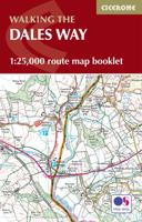
Wandelatlas The Dales Way Map Booklet | Cicerone
Heel handig bedacht van uitgever Cicerone: een boekje dat dienst doet als atlas met alle topografische kaarten die je nodig hebt voor het lopen van de Dales Way. Past goed in binnenzak of broekzak. Map of the 79 mile (127km) Dales Way through the Yorkshire Dales between Ilkley and Bowness-on-Windermere. This booklet is included with the Cicerone guidebook and shows the full route on OS 1:25K maps. One of the most gentle multi-day walks in Britain, it passes through Grassington, Kettlewell, Dent, Sedbergh and Staveley.
10,50
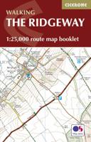
Wandelatlas Ridgeway Map Booklet | Cicerone
Heel handig bedacht van uitgever Cicerone: een boekje dat dienst doet als atlas met alle topografische kaarten die je nodig hebt voor het lopen van de Ridgeway. Past goed in binnenzak of broekzak. Map of the 87 mile (139km) Ridgeway National Trail through the south of England from Avebury in Wiltshire to Ivinghoe Beacon in Buckinghamshire. This booklet is included with the Cicerone guidebook to the trail, and shows the full route on Ordnance Survey 1:25,000 maps. Presented in 12 stages in the guidebook, the trail typically takes 6-8 days.
11,50

Klanten-reviews van Wandelkaart - Kaart The South Downs Way Map Booklet | Cicerone

Er zijn nog geen beoordelingen voor dit productBen jij de eerste die een review plaatst?

Meer over Wandelkaart - Kaart The South Downs Way Map Booklet | Cicerone

Productomschrijving

All the mapping you need to complete the 100 mile (160km) South Downs Way National Trail, between Eastbourne and Winchester. With easy walking on ancient trackways, the route features wooded areas, river valleys and attractive villages and is rich in natural, geological and historical interest. This booklet of Ordnance Survey 1:25,000 Explorer maps has been designed for convenient use on the trail.   It shows the full and up-to-date line of the route along with the relevant extract from the OS Explorer map legend, and can be used when walking the trail in either direction. Conveniently sized for slipping into a jacket pocket or the top of a rucksack, it comes in a clear PVC sleeve. An accompanying Cicerone guidebook - The South Downs Way - describes the full route in both directions and includes lots of other practical and historical information, for those who prefer a written guide.   The guidebook INCLUDES a copy of this map booklet.

Productinformatie

    Verken gerelateerde categorieën

    Webshop.nl maakt gebruik van cookies. Ga je verder op onze website, ga dan akkoord met het plaatsen van cookies en de verwerking van deze data door ons en vermelde partners.