Wandelkaart Isle of Wight Walking Map | Heritage House

0
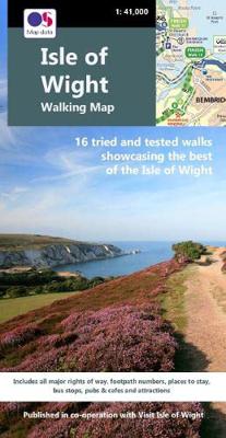
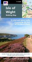
Produced in co-operation with Visit Isle of Wight using Ordnance Survey cartography under licence, this second edition of our double-sided walking map shows all the major rights of way across the Island together with 16 colour-coded long distance walks. Fully checked on foot by a local walker, and showing all the relevant footpath numbers, these i...

Verkopers met dit product

Verkoper
Bezorging
Prijs
DeZwerver.nl logo
DeZwerver.nl
2,95
10,50

Anderen bekeken ook

Wandelkaart Isle of Wight Walking Map | Heritage House
Produced in co-operation with Visit Isle of Wight using Ordnance Survey cartography under licence, this second edition of our double-sided walking map shows all the major rights of way across the Island together with 16 colour-coded long distance walks. Fully checked on foot by a local walker, and showing all the relevant footpath numbers, these include the popular coastal path broken into six manageable sections; Yar River Trail; Worsley Trail; Warrior Trail; Bembridge Trail; Hamstead Trail; Nunwell Trail; Stenbury Trail; Freshwater Way; Tennyson Trail; and the Shepherd’s Trail.   For each walk a choice of bus stops and car parks are shown at each end of the route as well as along the way, enabling walkers to plan their journeys. The Southern Vectis bus route map is also included together with a range of other useful information including pubs and cafes, viewpoints, ferry routes, visitor attractions and walker-friendly accommodation. 
10,50
Wandelkaart Isle of Wight | Discovery Walking Guides
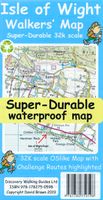
Goede scheur- en watervaste wandelkaart. Isle of Wight Walkers' Map at 32k scale with challenge routes and walking trails highlighted. OS 50k scale mapping is expanded in size to produce a 32k map. The OS features, text and logos are now 50% larger making them much easier to read under outdoor conditions.   Isle of Wight Challenge Route (66 miles) is specially highlighted in green and white so that the route stands out against the OS background map. Then we add the Earl Mountbatten Hospice's Walk (26.5 miles) highlighted in gold and white. A large range of gps surveyed walking trails are then highlighted in grey and white.   The result is an easy to read `OSlike' map with walking trails specially highlighted. We then split the island into East (cover side) and West (reverse side) with a ten mile common overlap to the two sides; meaning you will only have to turn the map over if you are undertaking the longest Challenge or Earl Mountbatten routes. The result is a double sided 840mm by …
15,95
Wandelkaart - Topografische kaart OL29 OS Explorer Map Isle of Wight | Ordnance Survey
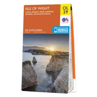
Een van de beste detailkaarten die er op de wereld gemaakt worden: zeer gedetailleerd, prachtig helder kleurgebruik, veel topografische aspecten en - zeer belangrijk - allerlei toeristische en recreatieve aspecten zijn ingetekend. De perfecte kaart voor vakantie en vrije tijd: wandelen, fietsen of gewoon de omgeving verkennen. Door de grootte van de kaart, voor- en achterzijde, bestrijkt het een behoorlijk groot gebied! These highly detailed maps show all the administrative boundaries, settlements as small as isolated farms, road network down to unfenced roads and country tracks, and field boundaries (hedges and drystone walls) which make navigation across the countryside much easier. Steep gradients on roads are indicated. Various landmarks, eg. powerlines, archaeological sites, windmills, churches and lighthouses are shown, and additional graphics indicate natural terrain features such as cliffs, scree, mud and vegetation variations. Contour interval is 5 metres in the lower parts o…
19,50
Wandelkaart - Topografische kaart 29 OS Explorer Map | Active Isle of Wight | Ordnance Survey
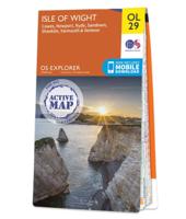
Een van de beste detailkaarten die er op de wereld gemaakt worden: zeer gedetailleerd, prachtig helder kleurgebruik, veel topografische aspecten en - zeer belangrijk - allerlei toeristische en recreatieve aspecten zijn ingetekend. De perfecte kaart voor vakantie en vrije tijd: wandelen, fietsen of gewoon de omgeving verkennen. Door de grootte van de kaart, voor- en achterzijde, bestrijkt het een behoorlijk groot gebied!   These highly detailed maps show all the administrative boundaries, settlements as small as isolated farms, road network down to unfenced roads and country tracks, and field boundaries (hedges and drystone walls) which make navigation across the countryside much easier. Steep gradients on roads are indicated. Various landmarks, eg. powerlines, archaeological sites, windmills, churches and lighthouses are shown, and additional graphics indicate natural terrain features such as cliffs, scree, mud and vegetation variations. Contour interval is 5 metres in the lower parts…
25,95
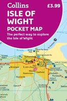
Wegenkaart - landkaart Pocket Map Isle of Wight | Collins
Handzame wegenkaart voor  Isle of Wight. Handy little full-colour map of the Isle of Wight. Detailed mapping and tourist information of the whole island.   With its stunning sea views and beautiful beaches, the Isle of Wight has a distinct identity. Discover this unique area with this handy pocket map.   Main features of this map include:   Clear mapping at a scale of 2.3 miles to 1 inch / 1.5 km to 1 cm Main tourist attractions located and described Places to stay, cafes/restaurants, golf courses are all highlighted on the map Essential travel information Index to places of interest and place names Essential for those planning a trip around the Isle of Wight.
7,95
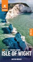
Reisgids Isle of Wight | Rough Guides
Een kleinere versie in zakformaat van de grotere versies van de Rough Guides. Als altijd weer vol met goede informatie over cultuur en praktische zaken. Achterin een kaart van de stad. This expert-curated guide book to Isle of Wight shines a spotlight on a more unusual British break, with a wealth of practical information on what to see and do. Each area or neighbourhood featured in this Isle of Wight travel guide is explored in-depth with detailed coverage of the points of interest, shops, restaurants, cafes and bars on offer. Excursions to surrounding areas give plenty of options for those looking to enjoy a longer stay. This Isle of Wight guide book has been fully updated post-COVID-19.   The Pocket Rough Guide to Isle of Wight covers: Cowes and around, Newport and around, Ryde and around, The east coast, The south coast, Ventnor to Blackgang, Brighstone to Alum Bay, Yarmouth and around.   Inside this travel guide to Isle of Wight you will find:   RECOMMENDATIONS FOR EVERY TYPE OF …
13,95
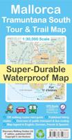
Wandelkaart Tour & Trail Mallorca - Tramuntana South | Discovery Walking Guides
For your best adventures, use the best map. Water-proof, split-proof, tear-proof, adventure-proof. Mallorca's Tramuntana South Tour & Trail Super-Durable Map is simply the toughest, most accurate, easy-to-read, easy-to-use multi-purpose map that you can get.   Whether you plan to walk, or explore southern Tramuntana by car or the bus, this is the map for you. A large 960mm by 694mm double sided map sheet covers southern half of Serra de Tramuntana at 1:30,000 scale. This 8th edition sees a significant upgrade from the previous Mallorca North & Mountains Tour & Trail Map, as we have split Serra de Tramuntana in two halves to produce TWO much more detailed maps of larger scale, now also including all the popular tourist resorts on the southern coast.   This map covers a continuous area from Tramuntana's southern-most point Cap de Cala Figuera, including all the coastal resorts such as Magaluf, Santa Ponca and Peguera, with Port d'Andratx and Sa Dragonera islet also covered, all the way …
18,95
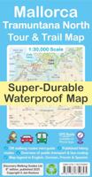
Wandelkaart Tour & Trail Mallorca - Tramuntana North | Discovery Walking Guides
Let op: deze kaart dekt het noordelijke deel van Mallorca.   For your best adventures, use the best map. Water-proof, split-proof, tear-proof, adventure-proof. Mallorca's Tramuntana North Tour & Trail Super-Durable Map is simply the toughest, most accurate, easy-to-read, easy-to-use multi-purpose map that you can get.   Whether you plan to walk, or explore northern Tramuntana by car or the bus, this is the map for you. A large 960mm by 694mm double sided map sheet covers northern half of Serra de Tramuntana at 1:30,000 scale. This 8th edition sees a significant upgrade from the previous Mallorca North & Mountains Tour & Trail Map, as we have split Serra de Tramuntana in two halves to produce TWO much more detailed maps of larger scale.   This map covers a continuous area from Tramuntana's northern-most Cap de Formentor, including all the coastal resorts such as Port de Pollenca and Port d'Alcudia, all the way to Soller and Deia at the opposite end of the map (for the area from S…
18,95
Wandelgids Walk! La Gomera | Discovery Walking Guides
La Gomera is the ultimate get-away-from-it-all island: easy-going, unspoilt, friendly, isolated from the hustle and bustle of modern living, and so laid back it’s virtually supine - even the volcanoes have been dormant for millions of years. The walks, however, are a bit more energetic. For the new 4th edition of Walk! La Gomera Charles Davis has teamed up with Jan Kostura. Jan brings his wide experience and passion for the Canaries, checking, re-walking and revising existing routes, and adding a couple of his own adventures, including a new Top Three Gomeran walk. Two routes have been dropped as having become too dangerous, but the good news is that many of the more harum-scarum walks have been improved through path clearing and the addition of railings to the vertiginous stretches. Other good news is that the devastating forest fires of 2012 have proved not nearly as damaging as we feared, leaving most of our itineraries unscathed. In short, there is every reason to take off and ex…
17,50
Wandelkaart Tour & Trail Fuerteventura | Discovery Walking Guides
For your best adventures, use the best map. Water-proof, split-proof, tear-proof, adventure-proof. Fuerteventura Tour & Trail Super-Durable Map is simply the toughest, most accurate, easy to read, easy to use multipurpose map that you can get.   A large 960mm by 640mm double sided map sheet covers Fuerteventura at 1:65,000 scale and includes also Isla de Lobos. A generous overlap and two extra mini-maps of the whole Fuerteventura reduce the need of turning the map in use. Whether you plan to walk, or discover the island by car or the bus, this is the map for you.   New for the 3rd edition is a summary of Fuerteventura bus system with an overview of bus lines. Bus stops along with actual bus numbers are then highlighted in the map to help you see where each bus runs. Those relying on a hire car will appreciate kilometre markers seen along the roads plotted each kilometre in the map, aiding you track progress and show where you are.   Also new is a summary and a mini-guide to main touri…
16,95

Klanten-reviews van Wandelkaart Isle of Wight Walking Map | Heritage House

Er zijn nog geen beoordelingen voor dit productBen jij de eerste die een review plaatst?

Meer over Wandelkaart Isle of Wight Walking Map | Heritage House

Productomschrijving

Produced in co-operation with Visit Isle of Wight using Ordnance Survey cartography under licence, this second edition of our double-sided walking map shows all the major rights of way across the Island together with 16 colour-coded long distance walks. Fully checked on foot by a local walker, and showing all the relevant footpath numbers, these include the popular coastal path broken into six manageable sections; Yar River Trail; Worsley Trail; Warrior Trail; Bembridge Trail; Hamstead Trail; Nunwell Trail; Stenbury Trail; Freshwater Way; Tennyson Trail; and the Shepherd’s Trail.   For each walk a choice of bus stops and car parks are shown at each end of the route as well as along the way, enabling walkers to plan their journeys. The Southern Vectis bus route map is also included together with a range of other useful information including pubs and cafes, viewpoints, ferry routes, visitor attractions and walker-friendly accommodation. 

Productinformatie

    Verken gerelateerde categorieën

    Webshop.nl maakt gebruik van cookies. Ga je verder op onze website, ga dan akkoord met het plaatsen van cookies en de verwerking van deze data door ons en vermelde partners.