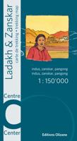
Wandelkaart India - Ladakh Zanskar - Centre | Editions Olizane

0
Goede wandelkaart van het centrale deel van Ladakh Zanskar (Leh - Padum - Pangong). De wandelkaart is geschikt voor GPS. Central Ladakh and Zanskar: Indus - Zanskar - Pangong area in a series of excellent topographic trekking maps from the Geneva based Editions Olizane on light, waterproof and tear-resistant plastic paper. Each map is double-sided...

Verkopers met dit product

Verkoper
Bezorging
Prijs
DeZwerver.nl logo
DeZwerver.nl
2,95
19,95

Anderen bekeken ook

Wandelkaart India - Ladakh Zanskar - Zuid | Editions Olizane
Goede wandelkaart van het Noordelijke deel van Ladakh Zanskar (Upper Zanskar - Darsha Tsomorir). De wandelkaart is geschikt voor GPS. Southern Ladakh and Zanskar: Upper Zanskar - Rupshu area in a series of excellent topographic trekking maps from the Geneva based Editions Olizane on light, waterproof and tear-resistant plastic paper. Each map is double-sided, covering a large area of 90km x 240km. The maps have exceptionally clear cartography with contours at 100m intervals, enhanced by relief shading, additional spot heights for peaks and passes, plus colouring indicating glaciers, marshes, protected zones and forested or cultivated areas. Population centres are graded into towns, villages, hamlets and settlements and names of local regions are shown. Roads, tracks and numerous trails are clearly highlighted and symbols indicate various places of interest: forts, palaces and ruins: religious sites; old trade routes; caves and hot springs; checkpoints and military posts, etc. The maps…
19,95
Wandelkaart India - Ladakh Zanskar - Noord | Editions Olizane
Goede wandelkaart van het Noordelijke deel van Ladakh Zanskar (Nubra - Lower Ladakh). De wandelkaart is geschikt voor GPS. Northern Ladakh and Zanskar: Brog-Yul - Nubra - Shyog area in a series of excellent topographic trekking maps from the Geneva based Editions Olizane on light, waterproof and tear-resistant plastic paper. Each map is double-sided, covering a large area of 90km x 240km. The maps have exceptionally clear cartography with contours at 100m intervals, enhanced by relief shading, additional spot heights for peaks and passes, plus colouring indicating glaciers, marshes, protected zones and forested or cultivated areas. Population centres are graded into towns, villages, hamlets and settlements and names of local regions are shown. Roads, tracks and numerous trails are clearly highlighted and symbols indicate various places of interest: forts, palaces and ruins: religious sites; old trade routes; caves and hot springs; checkpoints and military posts, etc. The maps have a U…
19,95
Wandelgids Trekking in Ladakh | Cicerone
Cicerone wandelgids van Ladakh met acht uitdagende trekkingen.    This trekking guidebook gives detailed descriptions of eight different treks across the Ladakh, Zanskar and Markha Valley in northern India. Ranging from moderate difficulty to very demanding, each trek is broken down into multiple stages, and has information on difficulty, available accommodation and access, as well as the many combinations and alternative routes open to exploration.    Known as Little Tibet; for both its landscape and culture, Ladakh lies at the northern tip of India. The region is bisected by the great River Indus and neighbours Tibet and Kashmir. This quiet corner of the Himalaya has developed a strong trekking culture over recent years for adventurous trekkers. Trekking in this remote, high-altitude region is extremely challenging, as paths are not signed and there are only a limited number of villages. However, its magnificent landscape (a huge area full of limitless trekking possibilities), ho…
33,95
Wegenkaart - landkaart - Wandelkaart India: Ladakh & Zanskar | Editions Olizane
Afgedrukt op Polyart-papier dat water- en scheurbestendig is. Een nieuwe algemene kaart van Ladakh & Zanskar op een schaal van 1:300.000, die een algemene oriëntatie mogelijk maakt voor gebruikers die geen gedetailleerde kaart nodig hebben voor trektochten. Culturele bezienswaardigheden (kloosters, tempels, gompas, forten, enz.) zijn duidelijk aangegeven. Fietsers en mountainbikers, die steeds talrijker worden in deze gebieden, vinden alle wegen en paden die voor hen toegankelijk zijn. De kaart is recto verso gedrukt op plastic en onverscheurbaar papier.   De kaart bevat precieze GPS-coördinaten. Ladakh blijft al enkele jaren een bijzonder populaire bestemming. Deze algemene kaart is essentieel voor alle reizigers om ter plaatse te kunnen oriënteren en de topografie van de omgeving te begrijpen. De kaart vult de al bestaande gedetailleerde bladen (1:150.000 noord/centrum/zuid) aan die Ladakh-Zanskar bestrijken.
19,95
Wandelkaart A15 Sarrabus da Costa Rei a Porto Corallo | Abies
Sarrabus is a territory that is not known by everybody yet. Here lies its charm and this has made possible to keep this environmental area out of big building speculations and also out of history. In fact it preserves little traces of the past, and paradoxically the remains from the prehistoric age are more meaningful than those back to more recent times. We can find traces from the most remote past not far from the State Road SS125, that from Muravera goes to Costa Rei, by visiting the nuraghe Murtas, the nuraghe S’Aqua Secis and the megalithic complexes of Scalas and Cuili Piras. They are about ten menhirs, almost fully intact, arranged in groups and fixed in the ground in the original orthostatic position. They have been put in relation with the position of the sun and the moon, at dawn and at sunset. In fact they were used as a very precise astronomic calendar but also for religious purposes since they represented both the masculine divinity and the fertility according to the wors…
12,95
Reisgids Ladakh - Jammu - Kashmir | Bradt Travel Guides
Voor vele landen net zo goed, zo niet beter dan de Planet. Beduidend soberder uitgevoerd, maar ook met veel informatie voor backpackers en met veel kaartmateriaal. Een aanrader!. This new, thoroughly revised third edition of Bradt's Ladakh, Jammu and the Kashmir Valley remains the only standalone English-language guide available to this stunning region of mountain wilderness and lush valleys. Although Ladakh is becoming an ever more popular destination, Zanskar, the Kashmir Valley and Jammu are still off the beaten path, attracting only the more adventurous foreign tourist, so their treasure trove of natural and cultural wonders awaits your discovery.   Ladakh, Zanskar and the Kashmir Valley have long astounded intrepid visitors with their epic Himalayan beauty. Thousands of years of history sit side by side with vibrant modern communities; spectacular natural landscapes ripe for exploration are dotted with all manner of architectural curiosities. This guidebook is the ideal compan…
29,95
Reisgids Explore Ladakh | Ountravela
This adventure guide is an invitation to explore the wildest corners of the Indian Himalayas by motorbike, 4x4 or bicycle. Ladakh is a region brimming with a thousand years worth of Tibetan Buddhist culture. It is also home to incredible and well-preserved natural landscapes. You will discover another side to India and cross the highest passes in the world, taking you from picturesque valleys to vast plateaux. Halfway between a tourist guide and a road-book, "Explore Ladakh" is the ideal tool to embark on a journey off the beaten track ! Explore unexplored trails and the region's must-see sites (Lake Pangong and Tso Moriri, the Nubra and Zanskar valleys, etc.). All you need to know before your trip : What time of year to go ? How to get a visa for India ? How to access restricted areas ? What budget should you allow for ? What health and safety precautions to take ? 30 pages of maps and field data to help you build your itinerary. 12 of the most beautiful routes in the region are plot…
32,95
Wandelkaart 69 Serra de Tramuntana + GR-221 | Editorial Alpina
Kaartenset van 4 kaarten op stevig papier voor de hele Serra de Tramuntana met de GR221. Zeer gedetailleerde wandelkaart van een klein gebied. Met ingetekende wandelroutes en andere informatie. Spaanstalig, maar uitstekende kaart. Coordinaten zijn weergegeven, dus GPS compatible met UTM grid.    Op de topografische wandelkaart worden o.a. berghutten, campings aangeduid en hoogtelijnen, ingetekende wandelroutes en de GR paden (doorgaande langeafstandswandelpaden). De kaart is inclusief een Spaanstalig boekje met extra informatie over aanwezige voorzieningen en enkele routes.   Gebied: Andratx, Sóller, Estellencs, Banyalbufar, Lluc, Orient, Sa Calobra, Pollenca, Alcúdia, Deià, Valldemossa, Peguera, Puig Major, Puig Roig, Tomir, Puig de n'Ali, Puig de Galatzó.   Mallorca’s Serra de Tramuntana mountains presented by Editorial Alpina at 1:25,000 on a set of four light, contoured and GPS compatible maps with an overprint for local hiking trails, GR221 long-distance route, sites for various …
28,95
Wandelkaart A06 Siniscola | Abies
Siniscola area at 1:25,000 in a series of contoured maps from Ed. Abies. Overprint highlights campsites and agriturismo accommodation, climbing sites, wild sheep and bird watching sites and archaeological remains. This title has no UTM grid. Main series at 1:60,000 (Nos. 1 to 12) The maps have contours at 100m intervals and colouring for woodlands and maquis shrubland. Local trails are highlighted, with additional overprint for selected hiking, mountain bike and kayaking routes listed on the reverse of the maps with brief notes and grading for the degree of difficulty. All the maps have a UTM grid for GPS users. Very extensive range of symbols highlight numerous places of interest and tourist facilities, including campsites and caravan parks, beaches, sport and recreational sites, archaeological remains and nuraghi, etc. The maps also indicate places where typical local products can be purchased. On the reverse each title has descriptions of its main places of interest, beaches, etc…
12,95
Wandelkaart NS504 Upper and Lower Dolpa - Dolpo | Himalayan Maphouse
Goede duidelijk leesbare  map voor trekkings in Dolpo. Van Juphal en Jejargaon in het westen tot Kagbeni in Mustang aan de oostkant van de kaart. De trekkingroutes staat goed ingetekend. Shey Phoksundo National Park staat er ook geheel op.  Large area centred on Dho Tarap, lying between the Upper and Lower Dolpa regions, in the Nepa Maps series which provides extensive coverage of trekking areas of Nepal on detailed contoured maps with trekking routes and hiking trails, huts and camp sites, local places of interest and other tourist information.   Cartography is based on the country’s topographic survey, with contours usually at 40m or 50m intervals, enhanced by relief shading, colouring and graphics to show various features of the terrain, including glaciers, forested or cultivated areas, etc. Numerous peaks, with additional spot heights, plus names of glaciers and mountain ranges are prominently shown. The network of rivers, streams and lakes is shown in great detail, with many smal…
12,95

Klanten-reviews van Wandelkaart India - Ladakh Zanskar - Centre | Editions Olizane

Er zijn nog geen beoordelingen voor dit productBen jij de eerste die een review plaatst?

Meer over Wandelkaart India - Ladakh Zanskar - Centre | Editions Olizane

Productomschrijving

Goede wandelkaart van het centrale deel van Ladakh Zanskar (Leh - Padum - Pangong). De wandelkaart is geschikt voor GPS.

Central Ladakh and Zanskar: Indus - Zanskar - Pangong area in a series of excellent topographic trekking maps from the Geneva based Editions Olizane on light, waterproof and tear-resistant plastic paper. Each map is double-sided, covering a large area of 90km x 240km. The maps have exceptionally clear cartography with contours at 100m intervals, enhanced by relief shading, additional spot heights for peaks and passes, plus colouring indicating glaciers, marshes, protected zones and forested or cultivated areas. Population centres are graded into towns, villages, hamlets and settlements and names of local regions are shown.

Roads, tracks and numerous trails are clearly highlighted and symbols indicate various places of interest: forts, palaces and ruins: religious sites; old trade routes; caves and hot springs; checkpoints and military posts, etc.

The maps have a UTM grid and latitude/longitude margin ticks at intervals of 9’. Map legend in English and French. Also provided is a glossary of geographical and cultural local terms.


Productinformatie

    Verken gerelateerde categorieën

    Webshop.nl maakt gebruik van cookies. Ga je verder op onze website, ga dan akkoord met het plaatsen van cookies en de verwerking van deze data door ons en vermelde partners.