Wandelkaart Gomk, Kapuyt, Martiros & Artavan - Vayots Dzor | Cartisan

0
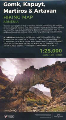
Detailed topographical map of the trail network connecting the villages of Gomk, Kapuyt, Martiros and Artavan in the Vayots Dzor province, central Armenia. The map includes the long-distance Transcaucasian Trail, 15 additional loop trails and day-hikes, and many other regional attractions. Attractions: Martiros waterfall, Martirosants rock-hewn mo...

Verkopers met dit product

Verkoper
Bezorging
Prijs
DeZwerver.nl logo
DeZwerver.nl
niet bekend
16,95

Anderen bekeken ook

Wandelkaart 01 Jasper National Park & Maligne Lake | Gem Trek Maps
Scheur- en Watervast papier Gem Trek’s JASPER AND MALIGNE LAKE MAP map is designed for outdoor enthusiasts looking to explore the section of Jasper National Park near the town and out to Maligne Lake. Whether you are touring along the roads or heading into the backcountry, you’ll find the waterproof and tear-resistant Jasper & Maligne Lake Map to be an invaluable tool.   This map features detailed cartography, accurate hiking trails with distances, and details such as campgrounds, equestrian routes, picnic areas, and fire lookouts. On the back of the map are trail descriptions and photos of 18 recommended day hikes, four overnight or multi-day trips, and six classic mountain bike rides. Each of these described trails is referenced and colour-coded to the map on the front. Also on the back is contact information for Jasper National Park, as well for as the three backcountry lodges located in the Tonquin Valley and on the Skyline Trail.   Jasper & Maligne Lake Map Coverage The Jas…
16,95
Wandelkaart Dilijan National Park - Hiking Topo Map Armenia | Cartisan
Detailed topographical map of Dilijan National Park and the surrounding area, highlighting available hiking routes including the long-distance Transcaucasian Trail and Janapar Trail, as well as the official national park trail network and many more regional attractions. Attractions: Dilijan city, Parz Lake, Gosh Lake, Aghjka Berd fortress, Mantash fortress. Monasteries: Haghartsin, Goshavank, Aghavnavank, Jukhtakvank, Matosavank Villages: Gosh, Kalavan, Hovk, Khachardzan. 5 % of each map sold is used to maintaine the local trail network
16,95
Nieuw
Wandelkaart - Topografische kaart 744 Adirondack Park - Northville - Raquette Lake | National Geographic
Prachtige geplastificeerde kaart van het bekende nationaal park. Met alle recreatieve voorzieningen als campsites, maar ook met topografische details en wandelroutes ed. Door uitgekiend kleurgebruik zeer prettig in gebruik. Scheur en watervast! National Geographic's Trails Illustrated map of Adirondack Park Northville/Raquette Lake is a two-sided, waterproof, topographic trail map designed to meet the needs of outdoor enthusiasts with unmatched durability and detail. This map was created in cooperation with the Adirondack Mountain Club and is loaded with valuable recreation information for boating, hiking, fishing, sailing, cycling, ice fishing, skiing, and snowmobiling. Trails and major roads are clearly distinguished, from the picturesque foothills to the northern peaks and around lakes of all sizes. Campgrounds, climbing areas, marinas, and museums are labeled and easy to find and boundaries for park lands, wilderness, primitive, forest, and protected areas are clearly marked. Disc…
17,95
Fietskaart 01 Cycling guides Cornwall | Goldeneye
Our maps are double-sided, printed on an A2 sheet with a concertina fold. This allows for easy folding and folding, and an ease of access to the mapping. The material is rain and tear-resistant. Our early maps were designed at the scale of 2 miles to 1 inch/1:126,720. The later designs along with digitalisation are 1: 100,000. We were encouraged by the Cycle Touring Club to convert our cartography toward the cycle market (to replace the out-of-print Bartholomew series). As time and the series progressed we have added more data: The National Cycle Network routes, Regional Routes, and Traffic-Free Family Routes, as and when they are developed. These routes are in addition to the Circular Routes Goldeneye Commissioned at the outset of our publishing schedule. We are also adding to new editions; bike shops, cycle hire, and tea rooms, along with the tourist attractions already featured. Our plan is to make available digital versions for cell phones and tablets and to update, on an annual b…
15,95
Nieuw
Wandelkaart - Topografische kaart 745 Adirondack Park - Old Forge - Oswegatchie | National Geographic
Prachtige geplastificeerde kaart van het bekende nationaal park. Met alle recreatieve voorzieningen als campsites, maar ook met topografische details en wandelroutes ed. Door uitgekiend kleurgebruik zeer prettig in gebruik. Scheur en watervast! National Geographic's Trails Illustrated map of Adirondack Park Old Forge/Oswegatchie is a two-sided, waterproof, topographic trail map designed to meet the needs of outdoor enthusiasts with unmatched durability and detail. This map was created in cooperation with the Adirondack Mountain Club and is loaded with valuable recreation information, no matter the season. Trails and major roads are clearly distinguished, along with canoe access and snowmobile trails. Places of interest, including the Cranberry Lake 50 Trail, campgrounds, and fishing easements, are labeled and easy to find. The map also features color coded boundaries for parklands, primitive, forest, and private property. Discover the Adirondack's wild, rugged and beautiful terrain, w…
17,95
Nieuw
Wandelkaart 05 Banff National Park and Mt. Assiniboine | Gem Trek Maps
This map covers the most popular hiking and mountain biking terrain in Banff National Park, from Lake Louise in the north to the south end of Banff National Park, plus all of Mt. Assiniboine Provincial Park. All of the day hikes in and around Banff townsite are covered on this map, such as Tunnel Mountain, Sundance Canyon, Bow Falls to the Hoodoos, Johnston Canyon, Castle Mountain Lookout and the network of trails at Sunshine Village. As well, the popular, multi-day hiking and equestrian loops to Egypt Lake, Shadow Lake and the Sawback Trail up through Mystic Pass are shown in their entirety.   You also get full coverage of the access routes in and out of Mt. Assiniboine Provincial Park via Sunshine Meadows and Citadel Pass, or via Bryant Creek from the Mt. Shark trailhead in Kananaskis Country.   Mountain biking enthusiasts can choose from more than ten trails, ranging from easy pedals around the townsite to longer outings such as Goat Creek Trail, Lake Minnewanka, and the Banff Trai…
17,95
Nieuw
Wandelkaart 14 Lake O'Hara | Gem Trek Maps
Mooie, gedetailleerde kaart uit de serie van Gem Trek Hiking map-guides, van het gebied Lake O'Hara.   Gem Trek's Lake O'Hara Map is a hiking and recreation map for the Lake O'Hara region of Yoho National Park in the Canadian Rockies.   Gem Trek's 1:20,000 Lake O'Hara Map is designed for visitors looking to explore one of the finest backcountry destinations in all of the Canadian Rockies. This map features detailed cartography, accurate hiking trails, and all the most significant natural features of the region. On the back are detailed descriptions of the most popular hiking trails with special emphasis given to the Lake O'Hara Alpine Circuit. Reaching Lake O'Hara, in Yoho National Park, requires advance planning and we help you with information needed to get to the destination, as well as lodge and campground details.   Map specs   Edition: 6th Scale: 1:20,000 Folded size: 4.5 x 9.5 inches Flat size: 18 x 24 inches Paper: Regular 80lb stock paper   Map coverage   This map covers the …
9,95
Nieuw
Wandelkaart 316 Folegandros | Terrain maps
Gedetailleerde wegenkaart en wandelkaart met alle kleine wegen, wandelpaden, hoogtelijnen en toeristische informatie aangegeven. Alle tekst is tweetalig in Engels en Grieks en de waterproof kaart is geschikt voor gebruik met GPS. This is a great map because: First and foremost, it’s the only existing GIS map of Folegandros, which makes it the only truly accurate and GPS compatible map of the island.  It comes in the detailed scale of 1:20,000, showing everything with great clarity, and it is made with data collected 100% through field survey.  The entire trail network of Folegandros is shown for the first time, with impeccable accuracy. All trails are measured in kilometers, so you can estimate the duration of your hike. On the back side, the island’s 5 best hikes are presented in detail. These are also distinctly labeled on the map so you can easily locate them.  It is printed on Polyart material, making it totally waterproof and rip-proof. You can fold it and unfold it a hundred…
11,95
Wandelkaart - Topografische kaart OL32 OS Explorer Map Winchester | Ordnance Survey
Met zijn 4cm voor 1 km (2 ½ cm voor 1 mijl) schaal, is de OS Explorer kaartenserie de ideale en meest gedetailleerde kaartenreeks voor mensen die graag outdoor-activiteiten zoals fietsen, wandelen, paardrijden, klimmen en watersporten. Deze kaart is nog gedetailleerder dan de 'gewone' Landranger maps. Voor- en achterzijde bedrukt! Zeker op de moors en andere natuurgebieden van onschatbare waarden met echt alle aspecten van het landschap op de kaart ingetekend. Zeer goede detailkaart met topografische ondergrond. Hierop zijn toeristische symbolen van bezienswaardigheden ingetekend, daarnaast staan bijvoorbeeld campings en jeugdherbergen vermeld en - voor wandelaars het belangrijkst - alle right of way paden en Lange afstands Wandelpaden zijn er op te vinden. De ideale kaart voor het wandelen in Engeland, Wales of Schotland.   Map sheet OL 32 in the OS Explorer map series is the ideal map for days out in the Winchester area. Winchester, capital of England in Saxon times is a beautiful c…
19,50
Nieuw
Wandelkaart 06 Canmore & Kananaskis Village | Gem Trek Maps
This map covers some of the most popular terrain for hikers and mountain bikers in Kananaskis Country - Bow Valley Provincial Park, the Canmore area, the Smith-Dorrien/Spray Lakes area south to Mount Shark trailhead, Barrier Lake, and the Kananaskis Village area from Ribbon Creek south to Galatea Lakes trailhead.   Updated trails on this sixth edition include those on both sides of the Bow Valley, including the Highline Trail and its connectors on the south side of Highway 1, and the Benchlands trails on the north side of Highway 1. The new snowshoe trails in the Ribbon Creek area have also been added. And for those of you who have been asking, the relief shading is back, and the map is printed on waterproof material.   Other classic trails covered on this map include Grassi Lakes, Yamnuska, Ha Ling, Lady Macdonald, Barrier Lake Lookout, Mt. Allen via Centennial Ridge (the highest maintained trail in the Canadian Rockies), Ribbon Falls and Ribbon Lake, Lillian and Galatea lakes, Karst…
18,95

Klanten-reviews van Wandelkaart Gomk, Kapuyt, Martiros & Artavan - Vayots Dzor | Cartisan

Er zijn nog geen beoordelingen voor dit productBen jij de eerste die een review plaatst?

Meer over Wandelkaart Gomk, Kapuyt, Martiros & Artavan - Vayots Dzor | Cartisan

Productomschrijving

Detailed topographical map of the trail network connecting the villages of Gomk, Kapuyt, Martiros and Artavan in the Vayots Dzor province, central Armenia. The map includes the long-distance Transcaucasian Trail, 15 additional loop trails and day-hikes, and many other regional attractions.

Attractions: Martiros waterfall, Martirosants rock-hewn monastery, Old Martiros church complex, Chumov lake, Gomk ruined church, Gomk khachkar chapel, Kapuyt basalt arch & cliffside khachkars, Iron age metal refining site, Akhta ruined village, Hayeli lake, Andranik`s fortress. 5 % of each map sold is used to maintaine the local trail network.

Verken gerelateerde categorieën

Webshop.nl maakt gebruik van cookies. Ga je verder op onze website, ga dan akkoord met het plaatsen van cookies en de verwerking van deze data door ons en vermelde partners.