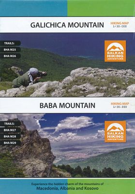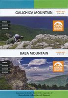
Wandelkaart Galichica Mountain - Baba Mountain | Balkan Hiking Adventures

0
Galichica Mountain en Baba Mountain Gedetailleerde wandelkaart met hoogtelijnen, ingetekende wandelpaden, rondwandelingen. Op de achterzijde van de kaart staat informatie van het gebied, met kleurenfoto's en beschreven wandelingen. Engelstalig.  Met coordinaten, handig want de kaart is niet altijd naar het noorden gericht! Trails BHA M25 - BHA M26...

Verkopers met dit product

Verkoper
Bezorging
Prijs
DeZwerver.nl logo
DeZwerver.nl
2,95
14,95

Anderen bekeken ook

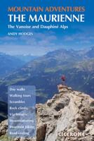
Klimgids - Klettersteiggids Innsbruck Mountain Adventures | Cicerone
Guidebook to 60 exciting summer mountain adventures in Innsbruck, Austria. Guide includes: alpine mountaineering routes, overnight hut trips, adventure hikes and multi-pitch scrambles, day walks, rock climbing routes, via ferratas, mountain biking trails, road cycling routes, city and trail running, plus mountain activities and walks for families. With easy access and a wide range of facilities, stunning Alpine scenery and a wonderful choice of activities on offer, Innsbruck - capital of Austria's Tyrol region - is an ideal base for an outdoor holiday. This multi-activity guide is packed with recommendations to help you get the most out of a trip. It details 60 different excursions, including short walks, hut-to-hut walks, adventure walks and scrambles, Alpine mountaineering, sport climbing, via ferrata, road cycling, mountain biking, city and trail running and family activities. The trips range from gentle strolls to adrenalin-filled mountain adventures, suitable only for those with…
23,95
Klimgids - Klettersteiggids Chamonix Mountain Adventures | Cicerone
This is a comprehensive guidebook to the many outdoor activities available in the mountains surrounding Chamonix in the French Alps. Routes include walking, mountain biking, road cycling, via ferratas, rock climbing and mountaineering. There is something for everyone, from families to veteran mountain adventurers.   The Chamonix valley in the Haute Savoie region of the French Alps is a perfect base for a whole range of alpine adventures. The routes in this guide range from short walks and cycle rides for the whole family to long mountaineering routes to the highest summits, including Mont Blanc. Activities covered in detail include walks, treks, mountaineering routes, road cycling, MTBing, rock climbing, bouldering and via ferratas, all within easy reach of Chamonix – with suggestions for other outdoor options in the valley, too, from rafting to paragliding. Whether you and your holiday companions are adrenalin junkies or Alpine ramblers, or a mixture of both, there’s plenty to keep e…
21,95
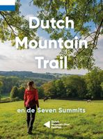
Wandelgids Dutch Mountain Trail | Stichting Moving Mountains
The Dutch Mountain Trail: Nederlands Enige echte bergwandeltocht! De Seven Summits zijn de zeven steilste bergtoppen van Zuid-Limburg. Beklim ze allemaal in de spannendste rondwandelingen met de meeste bergbeleving! De Dutch Mountain Trail is een ruige wandeltocht van ruim 100 km die de Seven Summits met elkaar verbindt. Loop van station Eygelshoven (Kerkrade) naar station Maastricht over een route waar het echte berggevoel nooit ver weg is. Alpenweides, snelstromende beken, rots- wanden en natuurlijk spectaculaire vergezichten: ze zullen je uitdagen en in vervoering brengen tijdens deze trail.    
19,95
Wandelkaart 200 Rocky Mountain National Park | National Geographic
Zeer gedetailleerde wandel- en trekkingkaart voor het Rocky Mountain Nationaal Park in Colorado. Met ingetekende wandelroutes, afstanden, kampeerplekken en toeristische informatie en vele handige tips. GPS geschikt door UTM Grid. Water en scheurvast. Coverage includes Rocky Mountain National Park, Arapaho and Roosevelt National Forest, Never Summer Wilderness, Arapaho National Recreation Area, and the cities of Granby and Estes Park. Revisions to this map include easy-to-read trail mileage and markers, hiking-only and hike and horse trails are easily distinguished, Federal, State and Private lands are clearly marked, the Continental Divide Trail is highlighted, and the map is keyed to the updated Rocky Mountain National Park Dayhiker's Guide. Includes UTM grids for use with your GPS unit.
16,95
Wandelgids - Klimgids - Klettersteiggids Costa Blanca Mountain Adventures | Cicerone
A multi-activity guide to outdoor adventure in Spain's Costa Blanca, with 60 route suggestions covering ridge scrambles, via ferrata, canyoning, sport climbing, trad climbing, hiking, trail running, and mountain biking. Many routes require climbing experience, although they vary in difficulty, with options suitable for a range of abilities. There are few destinations in Europe where you can enjoy typical 'summer' outdoor pursuits in the middle of winter. However, Spain's Costa Blanca is one such place and the range and quality of activities on offer is outstanding. This multi-activity guide presents a handpicked selection of 60 ridge routes, via ferratas, canyons, sport-climbing crags, trad-climbing crags, hikes, trail runs and road-cycling routes to inspire keen adventurers to explore the region's striking ridges, peaks, crags and barrancos (canyons). A broad spectrum of activities is covered - although since many of the routes involve climbing skills and rope-work, the guide is part…
24,95
Wandelkaart - Topografische kaart 702 Cedar Mountain - Pine Valley Mountain - Dixie National Forest | National Geographic
Prachtige geplastificeerde kaart van het bekende nationaal park. Met alle recreatieve voorzieningen als campsites, maar ook met topografische details en wandelroutes ed. Door uitgekiend kleurgebruik zeer prettig in gebruik. Scheur en watervast! Coverage includes Dixie National Forest, Ashdown Gorge Wilderness, Cedar Breaks National Monument, Brian Head, Navajo Lake, Haycock Mountain, Panguitch Lake, Long Valley Junction and Duck Creek. Includes UTM grids for use with your GPS unit.
17,95
Wandelkaart - Topografische kaart 747 Green Mountain National Forest North - Moosalamoo NRA - Rutland | National Geographic
Prachtige geplastificeerde kaart van het bekende nationaal park. Met alle recreatieve voorzieningen als campsites, maar ook met topografische details en wandelroutes ed. Door uitgekiend kleurgebruik zeer prettig in gebruik. Scheur en watervast! National Geographic's Green Mountain National Forest North Trails Illustrated topographic map is the most comprehensive available for outdoor enthusiasts of all types. Designed to be easy-to-read, yet highly detailed – this map includes a comprehensive road and trail network distinguishing between major, secondary and 4x4 roads, hiking, horse, biking, multi-use and non-motorized winter trails. All forest roads are labeled with their official road number and trails are clearly identified with their given name. Land management boundaries are color-coded showing National Forest, Ranger District, Wilderness Areas, Conservation Areas and more, plus the locations of private land within the Green Mountain National Forest. The renowned Appalachian Trai…
17,95
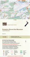
Wandelkaart Ruapehu - Round the Mountain | NewTopo NZ
Een kaartenserie van NewTopoNZ van vrijwel alle nationale parken, meerdaagse tochten en belangrijke wandelgebieden in Nieuw Zeeland. We hebben een selectie van de kaarten op voorraad.    Het zijn bijzonder leesbare kaarten met een helder kaartbeeld in goede kleurstelling. Alle belangrijke topografische details kun je er op terugvinden: hoogtelijnen, bergtoppen, stromen en rivieren, vegatatietype, gletsjers. De kaarten zijn bruikbaar samen met GPS.    Daarnaast is er toeristische informatie toegevoegd in de vorm van symbolen (zoals bruggen, stranden, watertaxi's, uitzichtspunten en parkeerplaatsen) en staan campings en hutten aangeduid. De wandelroutes zijn ingetekend met een rode lijn, verschillend naar gemarkeerd en ongemarkeerd, zelfs afstanden tussen hutten worden vaak vermeld.    This map shows the tramping route circumnavigating Mount Ruapehu in Tongariro National Park and its unique volcanic mountain environment at a scale where all features can be identified increasing both the…
9,95
Wandelgids 1509 Topographic Map Guide Appalachian Trail - Schaghticoke Mountain to East Mountain | National Geographic
Wandelgids/wandelatlas met weinig tekst, maar goede kaarten van een gedeelte van de Appalachian Trail Each A.T. Topographic Map Guide includes detailed topographic maps at a detail of 1 inch = 1 mile. Each page is centered on the A.T. and overlaps with the adjacent pages so there is little chance of getting lost. Along the bottom of each page is a trail profile that shows the distance between shelters, camping areas, and trail access points. The map and trail profile provide a step by step visual guide to hiking the trail, mile by rugged mile. The Topographic Map Guide is built for all levels of hiking enthusiasts, from the day tripper to the multi month 'thru-hiker'. The front pages of the printed Topographic Map Guide include resupply information, town inset maps, camping options, and much more. The Schaghticoke Mountain to East Mountain Topographic Map Guide makes a perfect traveling companion when traversing the Connecticut and Massachusetts sections of the Appalachian Trail (A.T.…
16,95

Klanten-reviews van Wandelkaart Galichica Mountain - Baba Mountain | Balkan Hiking Adventures

Er zijn nog geen beoordelingen voor dit productBen jij de eerste die een review plaatst?

Meer over Wandelkaart Galichica Mountain - Baba Mountain | Balkan Hiking Adventures

Productomschrijving

Galichica Mountain en Baba Mountain

Gedetailleerde wandelkaart met hoogtelijnen, ingetekende wandelpaden, rondwandelingen. Op de achterzijde van de kaart staat informatie van het gebied, met kleurenfoto's en beschreven wandelingen. Engelstalig. 

Met coordinaten, handig want de kaart is niet altijd naar het noorden gericht!

Trails BHA M25 - BHA M26 - BHA M27 - BHA M28- BHA M29

Productinformatie

    Verken gerelateerde categorieën

    Webshop.nl maakt gebruik van cookies. Ga je verder op onze website, ga dan akkoord met het plaatsen van cookies en de verwerking van deze data door ons en vermelde partners.