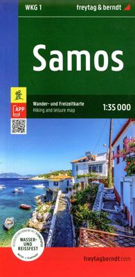
Wandelkaart G1 Samos | Freytag & Berndt

0
Introducing the Samos Hiking and Leisure Map – your essential guide to exploring the stunning landscapes of Samos Island.   Discover detailed information on hiking trails across Samos, allowing you to plan your adventures with ease and learn about key attractions along the way.   Samos beckons hikers with its captivating diversity – from towering ...

Verkopers met dit product

Verkoper
Bezorging
Prijs
DeZwerver.nl logo
DeZwerver.nl
2,95
14,95

Anderen bekeken ook

Wandelkaart 2 Cinque Terre - Portofino | Freytag & Berndt
Goede wandelkaart van het beroemde Cinque Terre. Fietsroutes, wandelroutes en enkele mountainbike-tochten staan er op ingetekend. GPS - bruikbaar.   Explore the Italian coastline known as Cinque Terre and the fishing village of Portofino with this Freytag & Berndt travel set. Inside the plastic sleeve, you will find a hiking and leisure map; as well as a guide. The best way to plan your trip, prepare your itinerary, and to travel independently on this region. As with all Freytag & Berndt maps, the cartography is clear and detailed with the topography shown with relief shading with plenty of spot heights.   The hiking and leisure map includes an inset of the village of Portofino. Tourist information is marked clearly using a range of icons and markings. Tourist information displayed includes:   Roadways, footpaths, bridle paths, railway, shipping routes, moutain biking paths and hiking trails Restaurants, churches, and other buildings of interest Camping sites, caves, golf courses, inf…
13,95
Wandelkaart Tour & Trail Gran Canaria | Discovery Walking Guides
Goede, scheur- en watervaste, wandelkaart van Gran Canaria.   Gran Canaria Tour & Trail Super-Durable Map covers the whole island at 50,000 scale  in a double sided map sheet of North and South with a generous overlap common to both North and South map sheets.   For the best adventures, use the best map.  Gran Canaria is a large island of dramatic landscapes. Gran Canaria Tour & Trail Super-Durable Map (50k scale) is a large 960mm by 700mm double sided map sheet which folds to its 235mm by 120mm pocket size. A special concertina map fold makes the map easy to unfold and refold in use.  Super-Durable means water-proof and tear-proof, simply wipe clean with a damp cloth if your map gets dirty. This map has a "2 Year Guarantee" covering adventurous use.   Gran Canaria North is on one side with South on the reverse side, while a generous common overlap minimises your map turning.    Now in its 5th edition Gran Canaria Tour & Trail Super-Durable Map, 50k scale, is the result o…
15,95
Wandelkaart 331 Samos | Terrain maps
Gedetailleerde wegenkaart en wandelkaart met alle kleine wegen, wandelpaden, hoogtelijnen en toeristische informatie aangegeven. Alle tekst is tweetalig in Engels en Grieks en de waterproof kaart is geschikt voor gebruik met GPS. This is a great map because: • It is waterproof and rip-proof. You can fold and unfold it a thousand times, fold it in irregular ways, dunk it in the sea or leave it out in the rain. This map is indestructible! • It is the first time the island’s entire coastline is mapped. Cartography was done with TERRAIN’s specially equipped and staffed cartographic vessel. This means that you can locate all beaches of the island, down to the tiniest cove! In fact, the special features of every single beach are recorded: whether it is sandy or pebbled, whether it features natural tree shade, water, a beach bar or organized water sports, whether the seabed in front of the beach is sandy or rocky (so that you will know where to anchor). • It features the most complete road n…
11,95
Wegenkaart - landkaart Corsica - Korsika | Freytag & Berndt
Deze bijzonder gedetailleerde Freytag & Berndt Wegenkaart van Corsica is aan één kant geprint en heeft een schaal van 1:150.000. Op deze kaart staan o.a. fietsroutes, lange afstandswandelpaden, toeristische wegen en bezienwaardigheden aangegeven. In de omslag van de kaart is een apart boekje geniet met een korte beschrijving van de TOP 10 van bezienswaardigheden, een uitgebreide index en plattegrondjes van enkele toeristische plaatsen. Explore the Mediterranean island of Corsica with this Freytag & Berndt single-sided road and leisure map. The best way to plan your trip, prepare your itinerary, and to travel independently on this region. As with all Freytag & Berndt maps, the cartography is clear and detailed with the topography shown with relief shading with plenty of spot heights.   This map features a full map of the island. Using Freytag & Berndt's icon system, important tourist information is shown. You will see icons for tourist information such as:   Picturesque towns and panor…
14,95
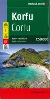
Wegenkaart - landkaart Corfu - Korfoe | Freytag & Berndt
Goede wegenkaart van Corfu, die ook behoorlijk veel detail weergeeft als het gaat om wandelpaden, fietsbare wegen en met veel symbolen voor toeristische bezienswaardigheden. De berijdbare wegen zijn goed weergeven, zowel de hoofdwegen als provinciale en lokale wegen; wegnummers worden vermeld. Afstanden tussen plaatsen zijn in kilometers op de kaart ingetekend, daarnaast worden ook op belangrijke plekken benzinepompen gemarkeerd. In het kaartbeeld wordt door middel van schaduw het reliëf weergegeven en soms enkele punten in het landschap met de daadwerkelijke hoogte. Provinciegrenzen zijn goed terug te vinden, nationale parken en reservaten ook. Met allerhande symbolen worden toeristische bezienswaardigheden weergegeven als monumenten, historisch belangrijke plekken en uitzichtpunten. In bepaalde plaatsen zijn hotels en campings te vinden, luchthavens, treinverbindingen en havens vindt u er ook op! Explore Corfu, the second largest of the Ionian Islands located in Greece; with this Fr…
14,95
Wandelgids Samos Hiking Guide | Terrain maps
Engelstalige wandeligds voor het Griekse eiland Samos. Met 32 wandelingen voor zowel de beginnende als gevorderde wandelaars. Samos island is a hiker’s paradise! Hundreds of kilometres of forest trails and cobbled paths crossing through a beautiful countryside link many of the most interesting places of the island: traditional villages and monasteries, mountain tops and impressive ridges, remote beaches and ancient ruins. Lush landscapes and amazing ocean views alternate for a most rewarding experience. Through 32 well-designed hikes for both the casual stroller and the adventurous hiker, this hiking guidebook aims to help you discover the most authentic face of Samos island.    THIS GUIDEBOOK CONTAINS:  Detailed step-by- step descriptions of a total of 32 hikes and walks More than 150 color photos to inspire your trip An introduction to the Samian landscape, flora and fauna Maps based on the most up-to- date TERRAIN hiking map of Samos
20,95
Wandelkaart Tour & Trail Mallorca - Tramuntana South | Discovery Walking Guides
For your best adventures, use the best map. Water-proof, split-proof, tear-proof, adventure-proof. Mallorca's Tramuntana South Tour & Trail Super-Durable Map is simply the toughest, most accurate, easy-to-read, easy-to-use multi-purpose map that you can get.   Whether you plan to walk, or explore southern Tramuntana by car or the bus, this is the map for you. A large 960mm by 694mm double sided map sheet covers southern half of Serra de Tramuntana at 1:30,000 scale. This 8th edition sees a significant upgrade from the previous Mallorca North & Mountains Tour & Trail Map, as we have split Serra de Tramuntana in two halves to produce TWO much more detailed maps of larger scale, now also including all the popular tourist resorts on the southern coast.   This map covers a continuous area from Tramuntana's southern-most point Cap de Cala Figuera, including all the coastal resorts such as Magaluf, Santa Ponca and Peguera, with Port d'Andratx and Sa Dragonera islet also covered, all the way …
18,95
Wandelkaart Tour & Trail Mallorca - Tramuntana North | Discovery Walking Guides
Let op: deze kaart dekt het noordelijke deel van Mallorca.   For your best adventures, use the best map. Water-proof, split-proof, tear-proof, adventure-proof. Mallorca's Tramuntana North Tour & Trail Super-Durable Map is simply the toughest, most accurate, easy-to-read, easy-to-use multi-purpose map that you can get.   Whether you plan to walk, or explore northern Tramuntana by car or the bus, this is the map for you. A large 960mm by 694mm double sided map sheet covers northern half of Serra de Tramuntana at 1:30,000 scale. This 8th edition sees a significant upgrade from the previous Mallorca North & Mountains Tour & Trail Map, as we have split Serra de Tramuntana in two halves to produce TWO much more detailed maps of larger scale.   This map covers a continuous area from Tramuntana's northern-most Cap de Formentor, including all the coastal resorts such as Port de Pollenca and Port d'Alcudia, all the way to Soller and Deia at the opposite end of the map (for the area from S…
18,95
Wegenkaart - landkaart Nieuw Zeeland - New Zealand | Freytag & Berndt
Gedetailleerde, tweezijdige landkaart van Nieuw Zeeland, prima geschikt voor planning en rondtrekken. De berijdbare wegen zijn goed weergeven, zowel de hoofdwegen als provinciale en lokale wegen; wegnummers worden vermeld. Afstanden tussen plaatsen zijn in kilometers op de kaart ingetekend, daarnaast worden ook op belangrijke plekken benzinepompen gemarkeerd. In het kaartbeeld wordt door middel van schaduw het reliëf weergegeven en soms enkele punten in het landschap met de daadwerkelijke hoogte. Provinciegrenzen zijn goed terug te vinden, nationale parken en reservaten ook. Met allerhande symbolen worden toeristische bezienswaardigheden weergegeven als monumenten, historisch belangrijke plekken, uitzichtpunten, hotels en campings. Ook luchthavens, treinverbindingen en havens vindt u er op!   Explore New Zealand with this Freytag & Berndt map. The best way to plan your trip, prepare your itinerary, and to travel independently in this country. As with all Freytag & Berndt maps the car…
14,95
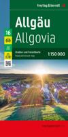
Wegenkaart - landkaart 16 Allgäu | Freytag & Berndt
Een aangepaste versie van de Duitse provinciekaarten van Freytag & Berndt: duidelijk veel meer toegespitst op de toeristische aspecten van de streek.   Deze bijzonder gedetailleerde Freytag & Berndt Wegenkaart van Allgäu is aan één kant geprint en heeft een schaal van 1:150.000. Op deze kaart staan o.a. campings, toeristische wegen en bezienwaardigheden aangegeven.    Nu met een digitaal boekje en index - toegang tot alle informatie snel en gemakkelijk op uw mobiele telefoon!     With the Allgau road map on a scale of 1:150,000, holidaymakers traveling by car, motorbike or caravan can easily find their way around. The dense road network is depicted precisely, distances and tourist destinations in the Allgau are shown on the map.   Information about the Allgäu car map   Scale 1:150,000 Tourist information Campsites and pitches Top Tips Location register with postal codes Downtown map Format: 124 x 86 cm The best car map for the Allgau Whether hiking, cycling, water sports …
14,95

Klanten-reviews van Wandelkaart G1 Samos | Freytag & Berndt

Er zijn nog geen beoordelingen voor dit productBen jij de eerste die een review plaatst?

Meer over Wandelkaart G1 Samos | Freytag & Berndt

Productomschrijving

Introducing the Samos Hiking and Leisure Map – your essential guide to exploring the stunning landscapes of Samos Island.   Discover detailed information on hiking trails across Samos, allowing you to plan your adventures with ease and learn about key attractions along the way.   Samos beckons hikers with its captivating diversity – from towering peaks like Mount Kerkis and deep gorges such as Kakoperato Gorge, to remote forests waiting to be explored. This Mediterranean hiking paradise boasts picturesque villages, hidden monasteries, ancient city walls, and medieval fortresses.   Key Features of the Samos Hiking and Leisure Map:   Scale 1:35,000 Extensive network of hiking trails Tourist information highlights Includes the Rother App for digital map access Waterproof and tear-resistant Dimensions: 99 x 61 cm Explore confidently with the linked free version of the Rother App, offering a digital map of Samos' complete hiking network and sample tours (free registration required).   Designed for all weather conditions, the Samos Hiking Map is printed on specially waterproof and durable paper, ensuring reliable navigation even in challenging environments.   Environmentally conscious production: Crafted from 80% ground limestone, this map minimizes resource consumption compared to traditional paper, reducing water, wood, and energy usage significantly.   Printed in Austria, the Samos Hiking and Leisure Map is your trusted companion for discovering the natural wonders and cultural treasures of this enchanting Greek island.

Productinformatie

    Verken gerelateerde categorieën

    Webshop.nl maakt gebruik van cookies. Ga je verder op onze website, ga dan akkoord met het plaatsen van cookies en de verwerking van deze data door ons en vermelde partners.