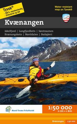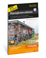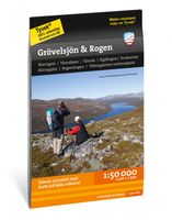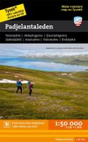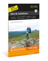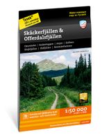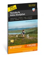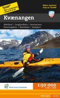
Wandelkaart Fjällkartor 1:50.000 Kvænangen | Noorwegen | Calazo

0
Hiking map at 1/50,000 published by Calazo. This map is part of Calazo's series of modern maps with unique richness of detail based on new data obtained from aircraft laser scanning. This series covers all the most popular mountain areas, with DNT and private cabins, marked hiking routes and is designed for year round use with marked winter routes...

Verkopers met dit product

Verkoper
Bezorging
Prijs
DeZwerver.nl logo
DeZwerver.nl
2,95
22,50

Anderen bekeken ook

Wandelkaart - Topografische kaart 254 Chilkoot Trail | National Geographic
Prachtige geplastificeerde kaart van het nationaal park. Met alle recreatieve voorzieningen als campsites, maar ook met topografische details en wandelroutes ed. Door uitgekiend kleurgebruik zeer prettig in gebruik. Scheur en watervast!   National Geographic's Trails Illustrated map for Chilkoot Trail in Klondike Gold Rush National Historic Park in the Alaskan panhandle is perfect for hiking, camping, and wildlife viewing in this scenic, rugged frontier. Created in partnership with local land management agencies, this expertly researched map features key areas of interest including Chilkoot Trail National Historic Site; portions of the Klondike Highway; Happy Camp; Taiya Inlet; the town of Skagway; Klondike Gold Rush National Historical Park; Skagway River; Dyea; and Deep, Bennett, Crater, Long, and Lindeman lakes.   The print map includes insets of historic routes to the Klondike gold fields, Historic Dyea, and Skagway Historic District with some of the prominent gold rush-era bui…
16,95
Wandelkaart 07 Kananaskis Lakes | Gem Trek Maps
Waterproof and tear-resistant hiking and recreation map for the Kananaskis Lakes region of the Canadian Rockies   Gem Trek's Kananaskis Lakes Map is designed for hikers and outdoor enthusiasts looking to explore the south-central portion of Kananaskis Country immediately south of our Canmore and Kananaskis Village Map. Whether you are touring along the roads or heading into the backcountry, you'll find the waterproof and tear-resistant Kananaskis Lakes Map to be an invaluable tool.   This map features detailed cartography, accurate hiking trails with distances, and details such as logging roads, campgrounds, equestrian routes, picnic areas, and fire lookouts. On the back are descriptions of the most popular hiking trails, as well details of services such as campgrounds and visitor centres.   – Map scale: 1:50,000 – Sheet size: 27 x 39 inches – Folded size: 4.5 x 9.5 inches   Map Coverage   The Kananaskis Lakes Map covers Peter Lougheed Provincial Park, located off Highway 40 south of …
18,95
Wandelkaart 2 Cinque Terre - Portofino | Freytag & Berndt
Goede wandelkaart van het beroemde Cinque Terre. Fietsroutes, wandelroutes en enkele mountainbike-tochten staan er op ingetekend. GPS - bruikbaar.   Explore the Italian coastline known as Cinque Terre and the fishing village of Portofino with this Freytag & Berndt travel set. Inside the plastic sleeve, you will find a hiking and leisure map; as well as a guide. The best way to plan your trip, prepare your itinerary, and to travel independently on this region. As with all Freytag & Berndt maps, the cartography is clear and detailed with the topography shown with relief shading with plenty of spot heights.   The hiking and leisure map includes an inset of the village of Portofino. Tourist information is marked clearly using a range of icons and markings. Tourist information displayed includes:   Roadways, footpaths, bridle paths, railway, shipping routes, moutain biking paths and hiking trails Restaurants, churches, and other buildings of interest Camping sites, caves, golf courses, inf…
13,95
Wandelkaart - Topografische kaart OL51 OS Explorer Map Atholl | Ordnance Survey
Met zijn 4cm voor 1 km (2 ½ cm voor 1 mijl) schaal, is de OS Explorer kaartenserie de ideale en meest gedetailleerde kaartenreeks voor mensen die graag outdoor-activiteiten zoals fietsen, wandelen, paardrijden, klimmen en watersporten. Deze kaart is nog gedetailleerder dan de 'gewone' Landranger maps. Voor- en achterzijde bedrukt! Zeker op de moors en andere natuurgebieden van onschatbare waarden met echt alle aspecten van het landschap op de kaart ingetekend. Zeer goede detailkaart met topografische ondergrond. Hierop zijn toeristische symbolen van bezienswaardigheden ingetekend, daarnaast staan bijvoorbeeld campings en jeugdherbergen vermeld en - voor wandelaars het belangrijkst - alle right of way paden en Lange afstands Wandelpaden zijn er op te vinden. De ideale kaart voor het wandelen in Engeland, Wales of Schotland.   Covering part of the Cairngorms National Park, and including ten of the Munros OS Explorer Map OL 51 is a rugged area with few roads or marked paths. This map rep…
19,50
Wandelkaart 08 Bragg Creek and Sheep Valley | Gem Trek Maps
Gem Trek’s BRAGG CREEK & SHEEP VALLEY MAP is for hikers and outdoor enthusiasts looking to explore Kananaskis Country west and south of Bragg Creek. Whether you are touring along the roads or heading into the backcountry, you’ll find the waterproof and tear-resistant Bragg Creek & Sheep Valley Map to be an invaluable tool.   This map features detailed cartography, accurate hiking trails with distances, and details such as logging roads, campgrounds, equestrian routes, picnic areas, and fire lookouts.   On the back of the Bragg Creek & Sheep Valley Map are detailed descriptions of 20 hiking trails colour-coded by region, eight mountain bike trails, as well details of services such as campgrounds and visitor centres.   Bragg Creek & Sheep Valley Map Coverage The Bragg Creek & Sheep Valley Map covers a large chunk of the eastern portion of Alberta’s Kananaskis Country. The map centres on the Elbow Valley, which is accessed from the village of Bragg Creek, a short drive southwest of Calga…
18,95
Wandelkaart - Topografische kaart OL32 OS Explorer Map Winchester | Ordnance Survey
Met zijn 4cm voor 1 km (2 ½ cm voor 1 mijl) schaal, is de OS Explorer kaartenserie de ideale en meest gedetailleerde kaartenreeks voor mensen die graag outdoor-activiteiten zoals fietsen, wandelen, paardrijden, klimmen en watersporten. Deze kaart is nog gedetailleerder dan de 'gewone' Landranger maps. Voor- en achterzijde bedrukt! Zeker op de moors en andere natuurgebieden van onschatbare waarden met echt alle aspecten van het landschap op de kaart ingetekend. Zeer goede detailkaart met topografische ondergrond. Hierop zijn toeristische symbolen van bezienswaardigheden ingetekend, daarnaast staan bijvoorbeeld campings en jeugdherbergen vermeld en - voor wandelaars het belangrijkst - alle right of way paden en Lange afstands Wandelpaden zijn er op te vinden. De ideale kaart voor het wandelen in Engeland, Wales of Schotland.   Map sheet OL 32 in the OS Explorer map series is the ideal map for days out in the Winchester area. Winchester, capital of England in Saxon times is a beautiful c…
19,50
Wandelkaart - Topografische kaart 51 OS Explorer Map | Active Atholl / Glen Tilt / Beinn Dearg | Ordnance Survey
Met zijn 4cm voor 1 km (2 ½ cm voor 1 mijl) schaal, is de OS Explorer kaartenserie de ideale en meest gedetailleerde kaartenreeks voor mensen die graag outdoor-activiteiten zoals fietsen, wandelen, paardrijden, klimmen en watersporten.   Deze kaart is nog gedetailleerder dan de 'gewone' Landranger maps. Voor- en achterzijde bedrukt! Zeker op de moors en andere natuurgebieden van onschatbare waarden met echt alle aspecten van het landschap op de kaart ingetekend. Zeer goede detailkaart met topografische ondergrond. Hierop zijn toeristische symbolen van bezienswaardigheden ingetekend, daarnaast staan bijvoorbeeld campings en jeugdherbergen vermeld en - voor wandelaars het belangrijkst - alle right of way paden en Lange afstands Wandelpaden zijn er op te vinden. De ideale kaart voor het wandelen in Engeland, Wales of Schotland.   Covering part of the Cairngorms National Park, and including ten of the Munros OS Explorer Map OL 51 is a rugged area with few roads or marked paths. This map r…
25,95
Wandelkaart 17 Banff - Egypt Lake | Gem Trek Maps
Mooie, gedetailleerde kaart uit de serie van Gem Trek Hiking map-guides. Helder kleurgebruik en met de beste / mooiste wandelroutes, hikes en interessante plaatsen erop aangegeven. Gem Trek’s 1:50,000-scale BANFF–EGYPT LAKE MAP covers the most popular hiking trails in the immediate area of the town of Banff in more detail than our Banff & Mount Assiniboine Map.   The Banff–Egypt Lake Map features detailed cartography, accurate hiking trails with distances, and details such as side trips and backcountry campgrounds. For road travellers, it includes viewpoints, picnic areas, and campgrounds.   On the back of the map are trail descriptions of 17 recommended day hikes and four classic multi-day trips, all referenced to the map on the front. Also on the back is a list of trails recommended for early season, birdwatching, wildflowers, waterfalls, expansive views, awe-inspiring scenery, alpine meadows and rainy days. Included are contact numbers for visitor centres and backcountry booki…
17,95
Wandelkaart 01 Jasper National Park & Maligne Lake | Gem Trek Maps
Scheur- en Watervast papier Gem Trek’s JASPER AND MALIGNE LAKE MAP map is designed for outdoor enthusiasts looking to explore the section of Jasper National Park near the town and out to Maligne Lake. Whether you are touring along the roads or heading into the backcountry, you’ll find the waterproof and tear-resistant Jasper & Maligne Lake Map to be an invaluable tool.   This map features detailed cartography, accurate hiking trails with distances, and details such as campgrounds, equestrian routes, picnic areas, and fire lookouts. On the back of the map are trail descriptions and photos of 18 recommended day hikes, four overnight or multi-day trips, and six classic mountain bike rides. Each of these described trails is referenced and colour-coded to the map on the front. Also on the back is contact information for Jasper National Park, as well for as the three backcountry lodges located in the Tonquin Valley and on the Skyline Trail.   Jasper & Maligne Lake Map Coverage The Jas…
16,95
Wandelkaart - Topografische kaart 32 OS Explorer Map | Active Winchester / New Alresford | Ordnance Survey
Met zijn 4cm voor 1 km (2 ½ cm voor 1 mijl) schaal, is de OS Explorer kaartenserie de ideale en meest gedetailleerde kaartenreeks voor mensen die graag outdoor-activiteiten zoals fietsen, wandelen, paardrijden, klimmen en watersporten.   Deze kaart is nog gedetailleerder dan de 'gewone' Landranger maps. Voor- en achterzijde bedrukt! Zeker op de moors en andere natuurgebieden van onschatbare waarden met echt alle aspecten van het landschap op de kaart ingetekend. Zeer goede detailkaart met topografische ondergrond. Hierop zijn toeristische symbolen van bezienswaardigheden ingetekend, daarnaast staan bijvoorbeeld campings en jeugdherbergen vermeld en - voor wandelaars het belangrijkst - alle right of way paden en Lange afstands Wandelpaden zijn er op te vinden. De ideale kaart voor het wandelen in Engeland, Wales of Schotland.   Map sheet OL 32 in the OS Explorer map series is the ideal map for days out in the Winchester area. Winchester, capital of England in Saxon times is a beautiful…
25,95

Klanten-reviews van Wandelkaart Fjällkartor 1:50.000 Kvænangen | Noorwegen | Calazo

Er zijn nog geen beoordelingen voor dit productBen jij de eerste die een review plaatst?

Meer over Wandelkaart Fjällkartor 1:50.000 Kvænangen | Noorwegen | Calazo

Productomschrijving

Hiking map at 1/50,000 published by Calazo. This map is part of Calazo's series of modern maps with unique richness of detail based on new data obtained from aircraft laser scanning. This series covers all the most popular mountain areas, with DNT and private cabins, marked hiking routes and is designed for year round use with marked winter routes and marked groomed ski runs.  

Verken gerelateerde categorieën

Webshop.nl maakt gebruik van cookies. Ga je verder op onze website, ga dan akkoord met het plaatsen van cookies en de verwerking van deze data door ons en vermelde partners.