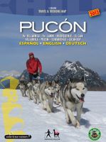
Wandelkaart - Fietskaart Pucón | Viachile Editores

0
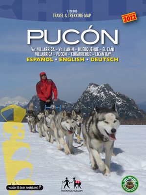
  Completely revised and up-to-date map of the Villarrica – Pucón area. For drivers, hikers and mountainbikers, with a list of the best hikes, a city map of Pucón, a register of tourism providers in Pucón, pictures of the most beautiful attractions and drawings of the local fauna. Information in three languages (English-German-Spanish). Map sheet ...

Verkopers met dit product

Verkoper
Bezorging
Prijs
DeZwerver.nl logo
DeZwerver.nl
2,95
18,95

Anderen bekeken ook

Wandelkaart - Fietskaart Pucón | Viachile Editores
  Completely revised and up-to-date map of the Villarrica – Pucón area. For drivers, hikers and mountainbikers, with a list of the best hikes, a city map of Pucón, a register of tourism providers in Pucón, pictures of the most beautiful attractions and drawings of the local fauna. Information in three languages (English-German-Spanish). Map sheet 70 x 100 cm: Detailed, georeferenced representation (WGS-84) of the area between the lakes Colico, Caburgua, Villarrica, Calafquén and Tromén, wth National parks Huerquehue, Villarrica and El Cañi containing Villarrica (2853 m), Quetrupillán (2350 m) and Lanín (3725 m) volcanoes. Hiking. climbing and biking routes, thermal baths, campsites and lodgings. Scale: 1:100,000 City Map Pucón, including all accommodations, restaurants, agencies and other services.
18,95
Wandelkaart - Fietskaart NP Torcal de Antequera | Editorial Penibetica
Een zeer uitgebreide wandel- en fietskaart van het nationale park Torcal of Antequera met een gidsje met beschreven wandelroutes van variërende lengte. Op de kaart worden hoogtelijnen, plaatselijke voorzieningen, wandel- en fietsroutesmeegenomen. GPS compatible.   two separate maps, both with a UTM grid and latitude/longitude margin ticks at 1' intervals, but no overprint for cycling routes. One map at 1:30,000 (68x77cm) is centred on the Laguna de Fuente de Piedra and extends to Alameda in the north-east to Campillos in the south west. A small inset shows the Lagunas de Archidona which lie further to the east. The other map at 1:25,000 (65x48cm) covers the Torcal de Antequera Natural Park and includes Villanueva de la Conception in the south and part of Antequera in the north. The booklet is in English.
12,95
Wandelkaart - Fietskaart 72 Noord Mallorca | Editorial Alpina
Formentor - Pinar - Ferrutx - Pollenca - Alcudia - Arta - Capdepera   Kaart met wandel-, MTB- en fietsroutes. Bijgevoegd is een boekje met in het Duits en Engels een korte beschrijving van een aantal van deze routes.   This is an area of great natural beauty, with protected areas - the Parque Natural de la Sierra Levante and the Natural Park of Albufereta.    The map includes the GR 221, all marked trails, mountain bike routes and bike paths, as well as location of all tourist services.
16,95
Wandelkaart - Fietskaart Ridgeway | Harvey Maps
Mooie, duidelijke kaart van de Ridgeway in Engeland. Geplastificeerd met veel extra informatie en uitsnedes van de route.    Leap forward in technical excellence. Tough, light and 100% wateproof   Compact and light - the map itself weighs just 60gms - a third of the weight of a laminated map, and much less bulky. And you can fold or refold it time and again, or stuff it in your back pocket and it won't fall to pieces.   Shows the entire route on one sheet.   From Overton Hill near Avebury in Wiltshire to Ivinghoe Beacon, east of Tring in Hertfordshire 137km (85 miles).   Suitable for walkers, cyclists and horseriders.   Information on finding accommodation, camping, food. Directions to the start. Also Ranger Service contact numbers and enlargements of towns/villages showing facilities available and tips on weather and clothing   Detailed mapping, full legend. National Grid - can be used with GPS. 1:40,000 scale. Waterproof. Supplied in clear plastic pocket     What the press says: '..…
25,95
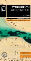
Wandelkaart - Fietskaart - Wegenkaart - landkaart 448 Western Crete - Kreta West | Terrain maps
Gedetailleerde wegenkaart en wandelkaart met alle kleine wegen, wandelpaden, hoogtelijnen en toeristische informatie aangegeven. Alle tekst is tweetalig in Engels en Grieks en de waterproof kaart is geschikt voor gebruik met GPS. Terrain’s map of Western Crete provides travelers with everything they need:    Scale of 100.000, which attributes all the information with clarity and in detail.  Map data processed within a GIS environment, resulting in great accuracy.  Double coordinate system, WGS 84 and ΕΓΣΑ 87, completely compatible with GPS.  It is printed on Polyart material, making it totally waterproof and rip-proof. You can fold it and unfold it a hundred times, fold it in irregular ways, dunk it in the sea or leave it out in the rain. This map is indestructible!  Clear symbols, easily readable fonts, rich colors and excellent arrangement of every element make the map extremely friendly to the user.  Unique wealth of information. Every village, every road (including their dis…
12,50
Wandelkaart - Fietskaart - Wegenkaart - landkaart 450 Eastern Crete - Kreta Oost | Terrain maps
Gedetailleerde wegenkaart en wandelkaart met alle kleine wegen, wandelpaden, hoogtelijnen en toeristische informatie aangegeven. Alle tekst is tweetalig in Engels en Grieks en de waterproof kaart is geschikt voor gebruik met GPS. Terrain’s map of Eastern Crete provides travelers with everything they need:  Scale of 100.000, which attributes all the information with clarity and in detail.  Map data processed within a GIS environment, resulting in great accuracy.  Double coordinate system, WGS 84 and ΕΓΣΑ 87, completely compatible with GPS.  It is printed on Polyart material, making it totally waterproof and rip-proof. You can fold it and unfold it a hundred times, fold it in irregular ways, dunk it in the sea or leave it out in the rain. This map is indestructible!  Clear symbols, easily readable fonts, rich colors and excellent arrangement of every element make the map extremely friendly to the user.  Unique wealth of information. Every village, every road (including their dista…
12,50
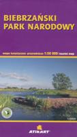
Wandelkaart - Fietskaart - Wegenkaart - landkaart Biebrza National Park | Cartomedia
Wandelkaart  Biebrza National Park 1:100.000 en 1:50.000 met praktische informatie en wandelideeën.   Hiking, cycling, and horse riding paths are highlighted, as well as special educational trails. Along the Biebrza and its tributaries the map shows kayaking routes and marks stretches where fishing is prohibited. Symbols indicate various types of accommodations, including campsites, B&Bs and youth hostels, restaurants and bars, bike and kayak/canoe rentals, nature observation towers, sport and recreational facilities, etc. The map has no geographical coordinates. Map legend includes English. Insets at 1:50,000 show the two main marches in greater detail, plus the areas around the villages of Goniadz and Wizna. Also included is an inset showing the physical geography of the region around the national park. On the reverse, extensive text, in Polish, describes numerous hiking, cycling and water trails, places of interest, etc, including a suggested itinerary for a 7-day visit to the area…
9,95
Wandelkaart - Fietskaart - Wegenkaart - landkaart 449 Central Crete - Kreta centraal | Terrain maps
Gedetailleerde wegenkaart en wandelkaart met alle kleine wegen, wandelpaden, hoogtelijnen en toeristische informatie aangegeven. Alle tekst is tweetalig in Engels en Grieks en de waterproof kaart is geschikt voor gebruik met GPS. Terrain’s map of Central Crete provides travelers with everything they need:  Scale of 100.000, which attributes all the information with clarity and in detail.  Map data processed within a GIS environment, resulting in great accuracy.  Double coordinate system, WGS 84 and ΕΓΣΑ 87, completely compatible with GPS.  It is printed on Polyart material, making it totally waterproof and rip-proof. You can fold it and unfold it a hundred times, fold it in irregular ways, dunk it in the sea or leave it out in the rain. This map is indestructible!  Clear symbols, easily readable fonts, rich colors and excellent arrangement of every element make the map extremely friendly to the user.  Unique wealth of information. Every village, every road (including their dista…
12,50
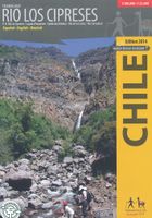
Wandelkaart Rio los Cipreses - Chili | Viachile Editores
Hiking map of the National Preserve Rio Los Cipreses east of Rancagua, developed by the Institute for Cartography at the Dresden Technical University. Overview map1:100,000 showing the whole preserve with the Laguna Piuquenes and several 4,000 meter summits, being El Palomo volcano the highest with 4860 m. Detail map 1:25,000 of the preserve’s entrance area. GPS compatible, with hiking routes, level curves every 50 m, mountain huts, lodgings and campsites. Landscape pictures and drawings of the local fauna. English - German - Spanish.
18,95
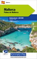
Wandelkaart - Fietskaart Mallorca | Kümmerly & Frey
Outdoor map for hiking, or for cycling. This map indicates all the possibilities for your hobbies. Digital mapping of high quality printed on waterproof and indich paper.   Contour line. Indication of peaks, valleys, types of vegetation etc. The hiking trails and mountain bike paths are highlighted. Another strong point, you can download your free map on your smartphone. With the exact GPS location on the map, you always know where you are exactly. Legend in English and German.  
13,50

Klanten-reviews van Wandelkaart - Fietskaart Pucón | Viachile Editores

Er zijn nog geen beoordelingen voor dit productBen jij de eerste die een review plaatst?

Meer over Wandelkaart - Fietskaart Pucón | Viachile Editores

Productomschrijving


Completely revised and up-to-date map of the Villarrica – Pucón area. For drivers, hikers and mountainbikers, with a list of the best hikes, a city map of Pucón, a register of tourism providers in Pucón, pictures of the most beautiful attractions and drawings of the local fauna. Information in three languages (English-German-Spanish). Map sheet 70 x 100 cm: Detailed, georeferenced representation (WGS-84) of the area between the lakes Colico, Caburgua, Villarrica, Calafquén and Tromén, wth National parks Huerquehue, Villarrica and El Cañi containing Villarrica (2853 m), Quetrupillán (2350 m) and Lanín (3725 m) volcanoes. Hiking. climbing and biking routes, thermal baths, campsites and lodgings. Scale: 1:100,000 City Map Pucón, including all accommodations, restaurants, agencies and other services.

Productinformatie

    Verken gerelateerde categorieën

    Webshop.nl maakt gebruik van cookies. Ga je verder op onze website, ga dan akkoord met het plaatsen van cookies en de verwerking van deze data door ons en vermelde partners.