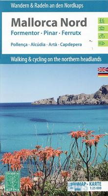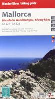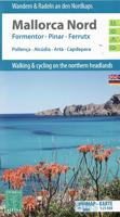
Wandelkaart - Fietskaart 72 Noord Mallorca | Editorial Alpina

0
Formentor - Pinar - Ferrutx - Pollenca - Alcudia - Arta - Capdepera   Kaart met wandel-, MTB- en fietsroutes. Bijgevoegd is een boekje met in het Duits en Engels een korte beschrijving van een aantal van deze routes.   This is an area of great natural beauty, with protected areas - the Parque Natural de la Sierra Levante and the Natural Park of Al...

Verkopers met dit product

Verkoper
Bezorging
Prijs
DeZwerver.nl logo
DeZwerver.nl
2,95
16,95

Anderen bekeken ook

Wandelkaart 71 Mallorca - Caps del Nord (noordoosten) | Editorial Alpina
Kaartenset van 2 losse kaarten in één. Zeer gedetailleerde wandelkaart van een deel van de Mallorca. Met ingetekende wandelroutes en andere informatie. Spaanstalig, maar uitstekende kaart. Met symbolen voor campings, hutten. Coordinaten zijn weergegeven, dus GPS compatible met UTM grid. Gebied: Pollenca, Alcúdia, Artà, Capdepera, Cala Mesquida, Alcanada, Cap de Formentor, Cap de Pinar, Cap de Ferrutx, Cap de Vermell, Cap des Freu, Cap de Cataluny, Cap de Menorca. This is an area of great natural beauty, with protected areas - the Parque Natural de la Sierra Levante and the Natural Park of Albufereta.    The map includes the GR 221, all marked trails, mountain bike routes and bike paths, as well as location of all tourist services.
19,95
Reisgids Mini Rough Guide Mallorca | Rough Guides
This pocket-sized travel guide to Mallorca is a convenient, quick-reference companion to discovering what to do, what to see and how to get around the destination. It covers top attractions like Palma Cathedral, Cala Deia, Platja de Formentor and Coves del Drac, as well as hidden gems, including Estellencs and Colonia de Sant Jordi. Our Mallorca guide book will save you time and enhance your exploration of this fascinating region.   This Mallorca travel guide has been fully updated post-COVID-19. This Mini Rough Guide to MALLORCA covers: Palma, Sineu, Petra, Serra de Tramuntana, Soller, Estellencs, Banyalbufar, Deia, Fornalutx, Valldemossa, Lluc, Pollenca, Port de Pollenca, Port d'Alcudia, Peninsula de Formentor, Serres de Llevant, Cala Ratjada, Porto Petro, Arta. In this guide book to Mallorca you will find: RECOMMENDATIONS FOR EVERY TYPE OF TRAVELLER Experiences selected for every kind of trip to Mallorca, from cultural explorations in Sineu to family activities in child-friendly pl…
12,50
Nieuw
Wandelkaart 51 Alt Emporda | Editorial Alpina
Zeer gedetailleerde wandelkaart van een klein gebied. Met ingetekende wandelroutes en andere informatie. Spaanstalig, maar uitstekende kaart. Coordinaten zijn weergegeven, dus GPS compatible met UTM grid.    Dit is een 2-delige kaartenset. Op de topografische wandelkaart worden o.a. berghutten, campings aangeduid en hoogtelijnen, ingetekende wandelroutes en de GR paden (doorgaande langeafstandswandelpaden). De kaart is inclusief een Spaanstalig boekje met extra informatie over aanwezige voorzieningen en enkele routes.   Gebied: Roses, Cadaques, el Port de la Selva, Figueres, Banyoles, Castello d'Empuries, l'Escala, Llanca, Portbou, la Jonquera, Empuriabrava, Costoja, la Vajol, Borrassa, Santa Pau, Sadernes, Tortellá, Basalú, Peralada, Castellfollit de la Roca, Sant Llorenc de Cerdans / Saint-Laurent-de-Cerdans, Arles-sur-Tech, Cervera / Cerbère, Ceret, Biure, Banyuls-sur-Mer / Banyuls de la Marenda.   The Alt Empordà is a region of great contrasts of the northern Catalonia: the c…
19,95
Nieuw
Wandelkaart Cabo de Gata / Nijar | Editorial Alpina
Zeer gedetailleerde wandelkaart van een klein gebied. Met ingetekende wandelroutes en andere informatie. Spaanstalig, maar uitstekende kaart. Coordinaten zijn weergegeven, dus GPS compatible met UTM grid.    Op de topografische wandelkaart worden o.a. berghutten, campings aangeduid en hoogtelijnen, ingetekende wandelroutes en de GR paden (doorgaande langeafstandswandelpaden).  Cabo da Gata-Níjar Natural Park in an extensive and very popular series of walking maps from Editorial Alpina covering the Pyrenees, Catalonia and other selected hiking areas in Spain, including Picos de Europa, Sierra Nevada and parts of Andalucía, Majorca, etc. Scales vary from 1:50,000 to 1:10,000, with the majority of the titles at 1:25,000. The maps have contours, usually at 20m or 10m intervals, with additional hill shading and spot heights. An overprint highlights hiking trails, long-distance footpaths, campsites, mountain huts, refuges, etc. Many maps also show climbing sites, potholing caves, mountain b…
17,95
Nieuw
Wandelkaart Tour & Trail Mallorca - Tramuntana South | Discovery Walking Guides
For your best adventures, use the best map. Water-proof, split-proof, tear-proof, adventure-proof. Mallorca's Tramuntana South Tour & Trail Super-Durable Map is simply the toughest, most accurate, easy-to-read, easy-to-use multi-purpose map that you can get.   Whether you plan to walk, or explore southern Tramuntana by car or the bus, this is the map for you. A large 960mm by 694mm double sided map sheet covers southern half of Serra de Tramuntana at 1:30,000 scale. This 8th edition sees a significant upgrade from the previous Mallorca North & Mountains Tour & Trail Map, as we have split Serra de Tramuntana in two halves to produce TWO much more detailed maps of larger scale, now also including all the popular tourist resorts on the southern coast.   This map covers a continuous area from Tramuntana's southern-most point Cap de Cala Figuera, including all the coastal resorts such as Magaluf, Santa Ponca and Peguera, with Port d'Andratx and Sa Dragonera islet also covered, all the way …
18,95
Wandelkaart Tour & Trail Mallorca - Tramuntana North | Discovery Walking Guides
Let op: deze kaart dekt het noordelijke deel van Mallorca.   For your best adventures, use the best map. Water-proof, split-proof, tear-proof, adventure-proof. Mallorca's Tramuntana North Tour & Trail Super-Durable Map is simply the toughest, most accurate, easy-to-read, easy-to-use multi-purpose map that you can get.   Whether you plan to walk, or explore northern Tramuntana by car or the bus, this is the map for you. A large 960mm by 694mm double sided map sheet covers northern half of Serra de Tramuntana at 1:30,000 scale. This 8th edition sees a significant upgrade from the previous Mallorca North & Mountains Tour & Trail Map, as we have split Serra de Tramuntana in two halves to produce TWO much more detailed maps of larger scale.   This map covers a continuous area from Tramuntana's northern-most Cap de Formentor, including all the coastal resorts such as Port de Pollenca and Port d'Alcudia, all the way to Soller and Deia at the opposite end of the map (for the area from S…
18,95
Nieuw
Fietskaart 75 Bike Mallorca | Editorial Alpina
Handige geplastificeerde fietskaart van Mallorca, met ingetekende routes, helder kaartbeeld en extra informatie aan de hand van symbolen.   This is a waterproof, folded map to the cycling Mecca of Mallorca. The scale is 1:100,000 and has English description.    Bike shops are listed and bike-friendly taxi services. Other practical information includes average gradient symbols; routes graded for light/medium/heavy traffic; roads in bad repair; specific bike lanes; unpaved/dirt tracks. Suggested tours are highlighted, ranging from 36km to 110km, including height profiles.   Mountain bike routes are also marked on the map, most of which are unpaved and quite easy to follow.
9,95
Fietskaart 14 Cycling guides Suffolk | Goldeneye
To be confronted with the variety and complexity of the cycling routes, trails and paths in Suffolk can be a bewildering experience.  For it appears that the Suffolk County Council and the three District Councils are all trying hard to promote their areas. This is indeed encouraging for the growth of cycling, but it can be confusing.  Our purpose is to provide clear, easy to use and easy to follow, cycling maps, and to illustrate these in a comprehensive form.    Suffolk must be one of the most charming of counties to explore by bicycle. When Al Churcher delivered his routes to us at Goldeneye we couldn’t keep him quiet, such was his enthusiasm and wonder at Suffolk’s country lanes and byways. He has cycled all over the UK, Canada, Mallorca, New Zealand and Sicily, but Suffolk remained a firm favourite.    The inland scenery is not spectacular for the county’s main glory lies with its attractive villages; the local architecture jealously preserved from modern depredation. There is an …
15,95
Fietskaart Cycling guides Exmoor - North Devon | Goldeneye
Scheur- en watervast foetskaart van Exmoor en Noord Devon met ingetekende fietsroutes.   Our maps are double-sided, printed on an A2 sheet with a concertina fold. This allows for easy folding and folding, and an ease of access to the mapping. The material is rain and tear-resistant. Our early maps were designed at the scale of 2 miles to 1 inch/1:126,720. The later designs along with digitalisation are 1: 100,000. We were encouraged by the Cycle Touring Club to convert our cartography toward the cycle market (to replace the out-of-print Bartholomew series). As time and the series progressed we have added more data: The National Cycle Network routes, Regional Routes, and Traffic-Free Family Routes, as and when they are developed. These routes are in addition to the Circular Routes Goldeneye Commissioned at the outset of our publishing schedule. We are also adding to new editions; bike shops, cycle hire, and tea rooms, along with the tourist attractions already featured. Our plan is to …
12,95

Klanten-reviews van Wandelkaart - Fietskaart 72 Noord Mallorca | Editorial Alpina

Er zijn nog geen beoordelingen voor dit productBen jij de eerste die een review plaatst?

Meer over Wandelkaart - Fietskaart 72 Noord Mallorca | Editorial Alpina

Productomschrijving

Formentor - Pinar - Ferrutx - Pollenca - Alcudia - Arta - Capdepera   Kaart met wandel-, MTB- en fietsroutes. Bijgevoegd is een boekje met in het Duits en Engels een korte beschrijving van een aantal van deze routes.   This is an area of great natural beauty, with protected areas - the Parque Natural de la Sierra Levante and the Natural Park of Albufereta.    The map includes the GR 221, all marked trails, mountain bike routes and bike paths, as well as location of all tourist services.

Verken gerelateerde categorieën

Webshop.nl maakt gebruik van cookies. Ga je verder op onze website, ga dan akkoord met het plaatsen van cookies en de verwerking van deze data door ons en vermelde partners.