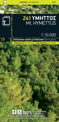
Wandelkaart - Fietskaart 241 Mt. Hymettus - Imittos | Terrain maps

0
Gedetailleerde wandelkaart en fietskaart met alle kleine wegen, wandelpaden, hoogtelijnen en toeristische informatie aangegeven. Alle tekst is tweetalig in Engels en Grieks en de waterproof kaart is geschikt voor gebruik met GPS....

Verkopers met dit product

Verkoper
Bezorging
Prijs
DeZwerver.nl logo
DeZwerver.nl
2,95
11,95

Anderen bekeken ook

Wandelkaart 321 Alonissos | Terrain maps
Gedetailleerde wegenkaart en wandelkaart met alle kleine wegen, wandelpaden, hoogtelijnen en toeristische informatie aangegeven. Alle tekst is tweetalig in Engels en Grieks en de waterproof kaart is geschikt voor gebruik met GPS. De uitgever: THIS IS THE BEST MAP OF ALONNISOS BECAUSE: • It is the only GIS map of Alonnisos made with data collected 100% through field survey. • It shows the entire trail network of Alonnisos, with impeccable accuracy. All trails are measured in kilometers so you can estimate the duration of your hike. On the back side 16 of the island’s hikes are presented in detail, also distinctly labeled on the map so you can easily locate them. • It includes maps of the neighboring islands of Peristera and Kyra Panaghia, with fully mapped coastline (all beaches are shown). • It includes a detailed town plan of Patitiri, in the scale of 1:5.500 as well as a map of the National Marine Park region. • It is printed on Polyart plastic “paper”, making it totally waterproof …
11,95
Wandelkaart 320 Skopelos | Terrain maps
Gedetailleerde wegenkaart en wandelkaart met alle kleine wegen, wandelpaden, hoogtelijnen en toeristische informatie aangegeven. Alle tekst is tweetalig in Engels en Grieks en de waterproof kaart is geschikt voor gebruik met GPS. De uitgever: THIS IS THE BEST MAP OF SKOPELOS, BECAUSE: • It is the only GIS map of Skopelos made with data collected 100% through field survey. • It features the most complete road network, with scenic routes marked in green. • It is printed on Polyart plastic “paper”, making it totally waterproof and rip-proof. You can fold it and unfold it a hundred times, fold it in irregular ways, dunk it in the sea or leave it out in the rain. This map is indestructible! • It shows more trails than any other map of Skopelos, with absolute accuracy. All trails are measured in kilometers, so you can estimate the duration of your hike. On the back side the 7 best hiking routes are presented in detail. These are also distinctly labeled on the map so you can easily locate th…
11,95
Wandelkaart 359 Hydra | Terrain maps
Gedetailleerde wegenkaart en wandelkaart met alle kleine wegen, wandelpaden, hoogtelijnen en toeristische informatie aangegeven. Alle tekst is tweetalig in Engels en Grieks en de waterproof kaart is geschikt voor gebruik met GPS. De uitgerver: THIS IS THE BEST MAP OD HYDRA, BECAUSE: • It comes in the detailed scale of 1:20.000, showing everything with great clarity. • It is made with data collected 100% through field survey. • It shows all the trails of the island, measured in kilometers so that you can estimate the duration of your hike. On the back side of the map you ‘ll find detailed descriptions of 4 of the best hikes in Hydra. These are distinctly labeled on the map, so you can easily locate them. • It is printed on Polyart plastic “paper”, making it totally waterproof and rip-proof. You can fold it and unfold it a hundred times, fold it in irregular ways, dunk it in the sea or leave it out in the rain. This map is indestructible! • The island’s entire coastline is mapped for th…
11,95
Wandelkaart 331 Samos | Terrain maps
Gedetailleerde wegenkaart en wandelkaart met alle kleine wegen, wandelpaden, hoogtelijnen en toeristische informatie aangegeven. Alle tekst is tweetalig in Engels en Grieks en de waterproof kaart is geschikt voor gebruik met GPS. This is a great map because: • It is waterproof and rip-proof. You can fold and unfold it a thousand times, fold it in irregular ways, dunk it in the sea or leave it out in the rain. This map is indestructible! • It is the first time the island’s entire coastline is mapped. Cartography was done with TERRAIN’s specially equipped and staffed cartographic vessel. This means that you can locate all beaches of the island, down to the tiniest cove! In fact, the special features of every single beach are recorded: whether it is sandy or pebbled, whether it features natural tree shade, water, a beach bar or organized water sports, whether the seabed in front of the beach is sandy or rocky (so that you will know where to anchor). • It features the most complete road n…
11,95
Wandelkaart 315 Ios | Terrain maps
Gedetailleerde wegenkaart en wandelkaart met alle kleine wegen, wandelpaden, hoogtelijnen en toeristische informatie aangegeven. Alle tekst is tweetalig in Engels en Grieks en de waterproof kaart is geschikt voor gebruik met GPS. This is a great map because: It is the first GIS map of the island, meaning that this is the first time Ios is mapped with a topographic precision in proportion to the map scale.  It is waterproof and rip-proof. You can fold and unfold it a thousand times, fold it in irregular ways, dunk it in the sea or leave it out in the rain. This map is indestructible!  It is remarkably detailed, at a scale nearly twice as large as the competition’s, which makes everything crystal clear!  It is the first time the island’s entire coastline is mapped. Cartography was done with TERRAIN’s specially equipped and staffed cartographic vessel. This means that you can locate all beaches of the island, down to the tiniest cove! In fact, the special features of every single b…
11,95
Wandelkaart 307 Andros | Terrain maps
Gedetailleerde wegenkaart en wandelkaart met alle kleine wegen, wandelpaden, hoogtelijnen en toeristische informatie aangegeven. Alle tekst is tweetalig in Engels en Grieks en de waterproof kaart is geschikt voor gebruik met GPS. This is a great map because: It is waterproof and rip-proof. You can fold and unfold it a thousand times, fold it in irregular ways, dunk it in the sea or leave it out in the rain. This map is indestructible!  It is the first time the island’s entire coastline is mapped. Cartography was done with TERRAIN’s specially equipped and staffed cartographic vessel. This means that you can locate all beaches of the island, down to the tiniest cove! In fact, the special features of every single beach are recorded: whether it is sandy or pebbled, whether it features natural tree shade, water, a beach bar or organized water sports, whether the seabed in front of the beach is sandy or rocky (so that you will know where to anchor).  It indicates the boundaries of NATURA…
11,95
Wandelkaart 341 Symi | Terrain maps
Gedetailleerde wegenkaart en wandelkaart met alle kleine wegen, wandelpaden, hoogtelijnen en toeristische informatie aangegeven. Alle tekst is tweetalig in Engels en Grieks en de waterproof kaart is geschikt voor gebruik met GPS. This is a great map because: For starters, it is the only map of Symi! No other cartographer had bothered creating a map of this remote Greek island in the Dodecanese … Finally, TERRAIN and SKAI created the first reliable map of Symi using GIS technology.  It is waterproof and rip-proof. You can fold and unfold it a thousand times, fold it in irregular ways, dunk it in the sea or leave it out in the rain. This map is indestructible!  It is remarkably detailed, as the 1:20.000 scale makes everything crystal clear!  It is the first time the island’s entire coastline is mapped. Cartography was done with TERRAIN’s specially equipped and staffed cartographic vessel. This means that you can locate all beaches of the island, down to the tiniest cove! In fact, th…
11,95
Wandelkaart 351 Lefkada | Terrain maps
Gedetailleerde wegenkaart en wandelkaart met alle kleine wegen, wandelpaden, hoogtelijnen en toeristische informatie aangegeven. Alle tekst is tweetalig in Engels en Grieks en de waterproof kaart is geschikt voor gebruik met GPS. This is a great map because: It is waterproof and rip-proof. You can fold and unfold it a thousand times, fold it in irregular ways, dunk it in the sea or leave it out in the rain. This map is indestructible!  It features a map of the city including all important points of interest.    NOTE: Due to technical and other difficulties during the expedition, the coastline of Lefkada was not mapped by TERRAIN’s cartographic vessel. In this first edition of the map of Lefkada beaches were recorded by the cartographers of the ground team, hence some beaches accessible only by sea may not appear on the map.
11,95
Wandelkaart - Fietskaart - Wegenkaart - landkaart 450 Eastern Crete - Kreta Oost | Terrain maps
Gedetailleerde wegenkaart en wandelkaart met alle kleine wegen, wandelpaden, hoogtelijnen en toeristische informatie aangegeven. Alle tekst is tweetalig in Engels en Grieks en de waterproof kaart is geschikt voor gebruik met GPS. Terrain’s map of Eastern Crete provides travelers with everything they need:  Scale of 100.000, which attributes all the information with clarity and in detail.  Map data processed within a GIS environment, resulting in great accuracy.  Double coordinate system, WGS 84 and ΕΓΣΑ 87, completely compatible with GPS.  It is printed on Polyart material, making it totally waterproof and rip-proof. You can fold it and unfold it a hundred times, fold it in irregular ways, dunk it in the sea or leave it out in the rain. This map is indestructible!  Clear symbols, easily readable fonts, rich colors and excellent arrangement of every element make the map extremely friendly to the user.  Unique wealth of information. Every village, every road (including their dista…
12,50

Klanten-reviews van Wandelkaart - Fietskaart 241 Mt. Hymettus - Imittos | Terrain maps

Er zijn nog geen beoordelingen voor dit productBen jij de eerste die een review plaatst?

Meer over Wandelkaart - Fietskaart 241 Mt. Hymettus - Imittos | Terrain maps

Productomschrijving

Gedetailleerde wandelkaart en fietskaart met alle kleine wegen, wandelpaden, hoogtelijnen en toeristische informatie aangegeven. Alle tekst is tweetalig in Engels en Grieks en de waterproof kaart is geschikt voor gebruik met GPS.

Verken gerelateerde categorieën

Webshop.nl maakt gebruik van cookies. Ga je verder op onze website, ga dan akkoord met het plaatsen van cookies en de verwerking van deze data door ons en vermelde partners.