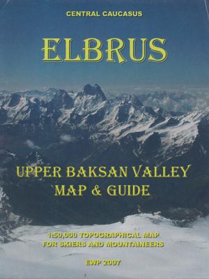
Wandelkaart Elbrus | EWP

0
Gebiedskaart van de Elbrus regio voor bergsporters. Met extra informatie op de achterzijde. A concise map and guide for moutaineers and skiers of the Upper Baskan Valley in the Caucasus. Includes information on access, accomodation, climate, flora & fauna, geology, history, permits & visas, ski routes and summits etc. 1:50,000 - 4 colour topograph...

Verkopers met dit product

Verkoper
Bezorging
Prijs
DeZwerver.nl logo
DeZwerver.nl
niet bekend
2,95
19,95

Anderen bekeken ook

Wandelkaart Elbrus | EWP
Gebiedskaart van de Elbrus regio voor bergsporters. Met extra informatie op de achterzijde. A concise map and guide for moutaineers and skiers of the Upper Baskan Valley in the Caucasus. Includes information on access, accomodation, climate, flora & fauna, geology, history, permits & visas, ski routes and summits etc. 1:50,000 - 4 colour topographical map of upper Baksan Valley 1:1,000,000 - Road map Panorama of main ridge from Priut 11 Panorama of main ridge from the Iryk Valley
19,95
Wandelkaart trekkingmap Elbrus | Climbing-map
Topographic climbing map; village map of Terskol, Cheget and Azau; general map 1:670'000; panorama map; description of climbing routes; route profile; vegetation illustrations, climatic diagram; GPS- information. Sprachen: Englisch, Deutsch, Russisch   Inhalt: Topografische Bergsteigerkarte, Dorfpläne Terskol, Cheget und Azau, Übersichtskarte 1:670'000, Panorama, Routenbeschreibungen, Streckenprofil, Vegetation, Klimadiagramm, GPS-Informationen.   Details: Vorderseite: + Topografische Karte Elbrus im Massstab 1:50.000 + Legende + Panoramabild + GPS Points + Dorfplan Azau   Rückseite: + Übersichtskarte 1:670.000  + Panoramaübersicht  + Elbrus-Chronik  + Streckenprofil  + Dorfplan Terskol  + Dorfplan Cheget  + Beschreibung der Aufstiegsrouten in 3 Sprachen  + Routenskizzen von Süd und Nord  + Flora-Übersicht  + nützliche allgemeine Informationen  + Koordinatensystem: WGS 84 / UTM - Netz      Idee:  Wer als Bergsteiger oder Trekkingtourist weltweit unterwegs ist, stellt bald einmal fest,…
21,95
Wandelkaart - Topografische kaart Fann Mountains | EWP
Het Fann-gebergte maakt deel uit van het westelijke Pamir-Alay-gebergte in de provincie Sughd in Tadzjikistan, tussen het Zarafshan-gebergte in het noorden en het Gissar-gebergte in het zuiden.    This is one of a series of topographic maps of the mountain ranges of Central Asia.  The map is at a scale of 1:100,000 (1cm = 1km) and contours are shown at 50m intervals with master contours every 200m.  There are two smaller maps on the reverse, one at 1:100,000 of the ridges, passes, summits and glaciers and one at 1:5,000,000 showing the area covered within the map in it's location within Central Asia.   The reverse of the map is the guide which includes the following:   Location Geology and Relief Climate Glaciation Rivers and lakes Altitude Zoning Mountains and Passes Fauna History Population and language Guides and Donkeys Accommodation and food Conservation and Rubbish/Garbage Countryside and Traditions Useful local works in Russian and Tajik Access, Visas and Permits Useful Contact…
19,95
Wandelkaart 08 Bragg Creek and Sheep Valley | Gem Trek Maps
Gem Trek’s BRAGG CREEK & SHEEP VALLEY MAP is for hikers and outdoor enthusiasts looking to explore Kananaskis Country west and south of Bragg Creek. Whether you are touring along the roads or heading into the backcountry, you’ll find the waterproof and tear-resistant Bragg Creek & Sheep Valley Map to be an invaluable tool.   This map features detailed cartography, accurate hiking trails with distances, and details such as logging roads, campgrounds, equestrian routes, picnic areas, and fire lookouts.   On the back of the Bragg Creek & Sheep Valley Map are detailed descriptions of 20 hiking trails colour-coded by region, eight mountain bike trails, as well details of services such as campgrounds and visitor centres.   Bragg Creek & Sheep Valley Map Coverage The Bragg Creek & Sheep Valley Map covers a large chunk of the eastern portion of Alberta’s Kananaskis Country. The map centres on the Elbow Valley, which is accessed from the village of Bragg Creek, a short drive southwest of Calga…
18,95
Wandelkaart HE Tinerhir (Marokko) | EWP
Deze kaart maakt deel uit van meerdere gedetailleerde topografische kaarten van het Atlas Gebergte en de daaraan grenzende woestijnen. Elke kaart heeft lokale toeristische info op de achterzijde en is in het Frans en Engels beschreven   Hoogte in hoogtelijnen met 40m interval en een aantal punten. Verdere vermelding van terreinsoort, vegetatie, waterpunten, kliffen, duinen, ravijnen, zoutpannen etc. Bij wegen onderscheid in onverhard, verhard en tracks. Bebouwing, vliegvelden, stations, elektrische leidingen. Voor sommige passen is er een indicatie wanneer deze begaanbaar is.   De uitgever EWP meldt dat deze kaarten geschikt zijn voor het gebruik van GPS: "The main grid drawn over the mapping is based on the Kronstadt system which related closely to the UTM system, and which the publishers assure us is suitable for a GPS set to UTM or MGRS".
19,95
Wandelkaart HI Ouarzazate (Marokko) | EWP
Deze kaart maakt deel uit van meerdere gedetailleerde topografische kaarten van het Atlas Gebergte en de daaraan grenzende woestijnen. Elke kaart heeft lokale toeristische info op de achterzijde en is in het Frans en Engels beschreven   Hoogte in hoogtelijnen met 40m interval en een aantal punten. Verdere vermelding van terreinsoort, vegetatie, waterpunten, kliffen, duinen, ravijnen, zoutpannen etc. Bij wegen onderscheid in onverhard, verhard en tracks. Bebouwing, vliegvelden, stations, elektrische leidingen. Voor sommige passen is er een indicatie wanneer deze begaanbaar is.   De uitgever EWP meldt dat deze kaarten geschikt zijn voor het gebruik van GPS: "The main grid drawn over the mapping is based on the Kronstadt system which related closely to the UTM system, and which the publishers assure us is suitable for a GPS set to UTM or MGRS".
19,95
Wandelkaart HC Marrakech (Marokko) | EWP
Deze kaart maakt deel uit van meerdere gedetailleerde topografische kaarten van het Atlas Gebergte en de daaraan grenzende woestijnen. Elke kaart heeft lokale toeristische info op de achterzijde en is in het Frans en Engels beschreven   Hoogte in hoogtelijnen met 40m interval en een aantal punten. Verdere vermelding van terreinsoort, vegetatie, waterpunten, kliffen, duinen, ravijnen, zoutpannen etc. Bij wegen onderscheid in onverhard, verhard en tracks. Bebouwing, vliegvelden, stations, elektrische leidingen. Voor sommige passen is er een indicatie wanneer deze begaanbaar is.   De uitgever EWP meldt dat deze kaarten geschikt zijn voor het gebruik van GPS: "The main grid drawn over the mapping is based on the Kronstadt system which related closely to the UTM system, and which the publishers assure us is suitable for a GPS set to UTM or MGRS".
19,95
Wandelkaart HJ Sarhro Central (Marokko) | EWP
Deze kaart maakt deel uit van meerdere gedetailleerde topografische kaarten van het Atlas Gebergte en de daaraan grenzende woestijnen. Elke kaart heeft lokale toeristische info op de achterzijde en is in het Frans en Engels beschreven   Hoogte in hoogtelijnen met 40m interval en een aantal punten. Verdere vermelding van terreinsoort, vegetatie, waterpunten, kliffen, duinen, ravijnen, zoutpannen etc. Bij wegen onderscheid in onverhard, verhard en tracks. Bebouwing, vliegvelden, stations, elektrische leidingen. Voor sommige passen is er een indicatie wanneer deze begaanbaar is.   De uitgever EWP meldt dat deze kaarten geschikt zijn voor het gebruik van GPS: "The main grid drawn over the mapping is based on the Kronstadt system which related closely to the UTM system, and which the publishers assure us is suitable for a GPS set to UTM or MGRS".
19,95

Klanten-reviews van Wandelkaart Elbrus | EWP

Er zijn nog geen beoordelingen voor dit productBen jij de eerste die een review plaatst?

Meer over Wandelkaart Elbrus | EWP

Productomschrijving

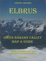
Gebiedskaart van de Elbrus regio voor bergsporters. Met extra informatie op de achterzijde.

A concise map and guide for moutaineers and skiers of the Upper Baskan Valley in the Caucasus. Includes information on access, accomodation, climate, flora & fauna, geology, history, permits & visas, ski routes and summits etc.

1:50,000 - 4 colour topographical map of upper Baksan Valley
1:1,000,000 - Road map
Panorama of main ridge from Priut 11
Panorama of main ridge from the Iryk Valley

Productinformatie

    Verken gerelateerde categorieën

    Webshop.nl maakt gebruik van cookies. Ga je verder op onze website, ga dan akkoord met het plaatsen van cookies en de verwerking van deze data door ons en vermelde partners.