Wandelkaart Dingle Peninsula | Harvey Maps

0
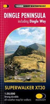
The whole of the Dingle Peninsula on one lightweight, waterproof map at the popular 1:30,000 scale.   Includes Mount Brandon and the entire Brandon Group of mountains in the west of the Peninsula.   To the east, the Slieve Mish mountains are also shown.   The map also shows the Dingle Way - a 179km long distance walking route around the edge of th...

Verkopers met dit product

Verkoper
Bezorging
Prijs
DeZwerver.nl logo
DeZwerver.nl
2,95
25,50

Anderen bekeken ook

Wandelkaart Dingle Peninsula | Harvey Maps
The whole of the Dingle Peninsula on one lightweight, waterproof map at the popular 1:30,000 scale.   Includes Mount Brandon and the entire Brandon Group of mountains in the west of the Peninsula.   To the east, the Slieve Mish mountains are also shown.   The map also shows the Dingle Way - a 179km long distance walking route around the edge of the Peninsula that starts and finishes in Tralee. The route is highlighted in red.   The Blasket Islands are also shown at 1:50,000 scale. Popular for day trips, these uninhabited islands are the most westerly point of Europe.   Placenames in English and Gaeilge / Gaelic.   Archaeological sites and walls and fences in farmland are clearly marked.
25,50
Wandelkaart Arrochar Alps | Harvey Maps
Covers a large area yet is handily compact. Pocket perfect!   Includes Beinn Ime, Ben Vorlich and the Cobbler (Ben Arthur).   Detailed map for hillwalkers of the western part of the Loch Lomond and Trossachs National Park at the magic scale of 1:40,000.   Includes 5 Munros, 10 Corbetts and 13 Grahams.   The Arrochar Alps are a group of mountains located around the head of Loch Long, Loch Fyne, and Loch Goil, near the villages of Arrochar and Lochgoilhead, on the Cowal Peninsula in Argyll and Bute, Scotland. The mountains are especially popular with hillwalkers, due to their proximity and accessibility from Glasgow.   The Ultramap is fully detailed, genuine, original HARVEY mapping. To provide the biggest area on the smallest, lightest sheet, the Ultramap is printed double sided. The ingenious folding pattern allows you to open the Ultramap directly to any part, and either side, of the sheet. The two sides are aligned, so when you reach the edge of the Ultramap sheet you simply flip it…
20,95
Wandkaart Korean Peninsula Noord- en Zuid Korea, 59 x 91 cm | National Geographic
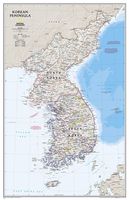
Amid increasingly combative rhetoric from Pyongyang, North Korea, do you know where its underground nuclear test site or missile launch centers are located? Are you aware that the South Korean government has begun a program to move its federal offices and personal from Seoul to a new location? National Geographic's new Korean Peninsula map provides this and much more information about this conflicted peninsula.   National Geographic Maps' Korean Peninsula wall map is one of the most authoritative maps of the Koreas. The peninsula's rugged terrain is expertly depicted in shaded relief, including the elevation of prominent mountains and ocean depths in meters. This new edition clearly portrays both countries and uses the latest system for transcribing South Korean place-names from the Korean alphabet. In great detail, it delineates the latest administrative divisions of both countries along the historic demarcation line between the two Koreas. The map also portrays the transportation gr…
31,95
Wandkaart 20740 Korean Peninsula Noord- en Zuid Korea, 59 x 91 cm | National Geographic
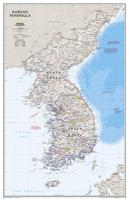
Amid increasingly combative rhetoric from Pyongyang, North Korea, do you know where its underground nuclear test site or missile launch centers are located? Are you aware that the South Korean government has begun a program to move its federal offices and personal from Seoul to a new location? National Geographic's new Korean Peninsula map provides this and much more information about this conflicted peninsula.   National Geographic Maps' Korean Peninsula wall map is one of the most authoritative maps of the Koreas. The peninsula's rugged terrain is expertly depicted in shaded relief, including the elevation of prominent mountains and ocean depths in meters. This new edition clearly portrays both countries and uses the latest system for transcribing South Korean place-names from the Korean alphabet. In great detail, it delineates the latest administrative divisions of both countries along the historic demarcation line between the two Koreas. The map also portrays the transportation gr…
25,95
Wandelgids The Dingle Way | Rucksack Readers
The Dingle Way runs for 114 miles (183 km) around Ireland’s beautiful Dingle Peninsula. It starts and finishes in Tralee, accessible by train or bus from Dublin and from Kerry Airport. The complete walk takes most people eight days, but it can easily be shortened.   The Dingle Way follows country lanes, quiet roads and cliff-top paths, punctuated by long stretches of glorious beach walking. It offers spectacular seascapes and mountain views. The peninsula is rich in wildlife, archaeology and charming Irish pubs.   The guidebook’s fourth edition has been revised for 2023, with updated mapping showing route alterations, additional Gaelic placenames, factual updates and fresh photos. It is in our pocket-friendly rainproof format with robust perfect binding.
22,50
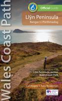
Wandelatlas Wales Coast Path Llyn Peninsula Map | Northern Eye Books
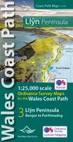
Enhanced, large scale (1: 25,000) Ordnance Survey mapping in a handy atlas format with all the mapping you need to walk a complete circuit of the Anglesey section of the Wales Coast Path.   Continuous OS mapping covering the complete route from Bangor to Porthmadog. Contains coastal extracts from large scale Explorer maps 253 and 254.   The Llyn Peninsula Ordnance Survey mapping book is part of a series of map atlases covering the whole of the 870-mile long Wales Coast Path. The enhanced OS 1:25,000 maps are accurate, up-to-date and reliable. Additional map symbols show tea shops, cafes, extra parking, and public toilets.   A brief introduction to the Llyn Peninsula includes a fascinating photo mosaic highlighting notable views, places of interest and wildlife you’ll meet along the way. There is also a section of detailed Useful Information at the back of the atlas.   Laminated flapped covers showing Wales Coast Path signs and waymarkers, route details and map symbols make these atlas…
13,95
Stadsplattegrond - Wegenkaart - landkaart Quebec City & Gaspe Peninsula | ITMB
Een degelijke kaart aan twee kanten bedrukt. Aan de ene zijde een plattegrond van Quebec stad, schaal 1:10.000. En aan de andere zijde een wegenkaart, schaal 1:750.000, van Gaspe schiereiland met aanduidingen van o.a. nationale parken, vliegveld, benzinepomp, dirt-roads. ITMB is pleased to be introducing yet another brand new title to our line. Quebec City is one of the oldest urban areas in North America, having been continuously occupied since 1608 (unfortunately, the first attempt at settlement, in 1606, failed through poor planning, and all the settlers perished). QC is also the only completely walled city in North America and the city streets within the walls have barely changed in 400 years. The city is also linguistically unique in being almost completely French Canadian in language (Montreal is much more Anglophiled). The city was the capital of French Canada until General Wolfe and the British army arrived in 1759. The British were able to climb the cliffs protecting the city…
13,95
Wandelkaart - Topografische kaart 772 Delmarva Peninsula | National Geographic
Prachtige geplastificeerde kaart van het bekende nationaal park. Met alle recreatieve voorzieningen als campsites, maar ook met topografische details en wandelroutes ed. Door uitgekiend kleurgebruik zeer prettig in gebruik. Scheur en watervast! The new Delmarva Trails Illustrated regional topographic recreation map covers all major recreation areas for the Peninsula and Chesapeake Bay region. This beautifully designed map includes all state parks, state wildlife areas, national wildlife areas and key recreation access points. Locations for camping, boating, canoeing/kayaking, hunting, biking/greenways, and fishing are displayed. Highlights include Blackwater and Chincoteague National Wildlife Refuges, Assateague Island National Seashore, Cape Henlopen State Park, and Maryland's Eastern Shore. This map will be an essential trip planning tool, road map, and on-the-ground guide for accessing Delmarva Peninsula's public lands. Includes UTM grids for use with your GPS unit.
17,95
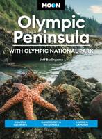
Reisgids Moon Olympic Peninsula | Moon Travel Guides
Charming small towns, verdant rainforests, rocky coastline, and mountain meadows: experience the surreal beauty and endless adventure of the Pacific Northwest with Moon Olympic Peninsula. Inside you'll find: Flexible itineraries, from a weekend in Olympic National Park to a week-long tour of the peninsula, for outdoors enthusiasts, families with kids, and more Must-see highlights and unique experiences: Tour the oldest lighthouse on the Puget Sound, explore Kurt Cobain's hometown, or immerse yourself in the region's rich maritime history. Dig for a dinner of fresh razor clams in the wet coastal sand and savor fresh-caught Dungeness crab. Stroll through a fragrant lavender farm, shop for handcrafted goods, or peruse small-town galleries for local art. Sample one-of-a-kind red blends and fruit wines or kick back with a local brew and some jazz music The best hikes of the Olympic Peninsula: Find your adventure with hike descriptions, directions, difficulty ratings, and elevation g…
22,50

Klanten-reviews van Wandelkaart Dingle Peninsula | Harvey Maps

Er zijn nog geen beoordelingen voor dit productBen jij de eerste die een review plaatst?

Meer over Wandelkaart Dingle Peninsula | Harvey Maps

Productomschrijving

The whole of the Dingle Peninsula on one lightweight, waterproof map at the popular 1:30,000 scale.   Includes Mount Brandon and the entire Brandon Group of mountains in the west of the Peninsula.   To the east, the Slieve Mish mountains are also shown.   The map also shows the Dingle Way - a 179km long distance walking route around the edge of the Peninsula that starts and finishes in Tralee. The route is highlighted in red.   The Blasket Islands are also shown at 1:50,000 scale. Popular for day trips, these uninhabited islands are the most westerly point of Europe.   Placenames in English and Gaeilge / Gaelic.   Archaeological sites and walls and fences in farmland are clearly marked.

Productinformatie

    Verken gerelateerde categorieën

    Webshop.nl maakt gebruik van cookies. Ga je verder op onze website, ga dan akkoord met het plaatsen van cookies en de verwerking van deze data door ons en vermelde partners.