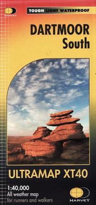
Wandelkaart Dartmoor Zuid | Harvey Maps

0
Covers a large area yet is handily compact. Pocket perfect!   Detailed map for runners and walkers of the south section of Dartmoor National Park at the magic scale of 1:40,000.   Features Dartmoor's famous Tors and archaeological sites include standing stones, stone circles and ancient travel routes are also shown.   Click here to view map covera...

Verkopers met dit product

Verkoper
Bezorging
Prijs
DeZwerver.nl logo
DeZwerver.nl
2,95
19,50

Anderen bekeken ook

Wandelkaart Dartmoor Noord | Harvey Maps
Covers a large area yet is handily compact. Pocket perfect!   Detailed map for runners and walkers of the north section of Dartmoor National Park at the magic scale of 1:40,000.   Features Dartmoor's famous Tors including Haytor Rocks, Yes Tor and High Willhays.   Archaeological sites include standing stones, stone circles and ancient travel routes are also shown.   Fully detailed genuine HARVEY mapping Includes Rights of Way Use without a map case: tough and 100% waterproof Opens directly to either side of the sheet
19,50
Wandelkaart Dartmoor Zuid | Harvey Maps
The whole of Dartmoor on two Maps. Dartmoor's famous Tors including Haytor Rocks and Yes Tor. The format gives more mapping on the sheet without making the map heavy and bulky. The fold has been developed to allow you to open directly to any part, and either side of the sheet easily - no more struggling in the wind. The clarity of the mapping has been improved to enable more people to read it without their glasses. The map is uncluttered by information irrelevant to the walker. The precise contouring and delicate hill shading give an immediate picture of the ground. Less than half the weight of a laminated map. GPS compatible Experience the satisfaction of fine navigation with the Superwalker XT25 now printed on our 100% waterproof and almost indestructible paper, whatever the weather!
24,95
Wandelkaart Dartmoor Noord | Harvey Maps
The whole of Dartmoor on two Maps. Dartmoor's famous Tors including Haytor Rocks and Yes Tor. The format gives more mapping on the sheet without making the map heavy and bulky. The fold has been developed to allow you to open directly to any part, and either side of the sheet easily no more struggling in the wind. The clarity of the mapping has been improved to enable more people to read it without their glasses. The map is uncluttered by information irrelevant to the walker. The precise contouring and delicate hill shading give an immediate picture of the ground. Less than half the weight of a laminated map. GPS compatible. Experience the satisfaction of fine navigation with the Superwalker XT25 now printed on our 100% waterproof and almost indestructible paper, whatever the weather!
24,95
Wandelkaart Dartmoor | Harvey Maps
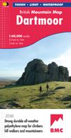
"This inspiring new map will help walkers and climbers explore Dartmoor's wild granite landscapes, and, like the granite, is virtually indestructible." Sir Ranulph Fiennes, adventurer and explorer.   Dartmoor, the latest title in the highly successful and innovative British Mountain Map series, is the only really detailed map for walking to cover this famous area on one sheet. XT40 - A new generation of tough polyethylene maps. These maps are a leap forward in technical excellence. Tough, durable, and 100% waterproof, they are compact - not the great bulky package you get with a laminated map - and light to carry. This all - weather British Mountain Map for climbers, hill - walkers, mountaineers and mountain bikers is published by HARVEY in co-operation with the British Mountaineering Council. The colourful geological map on the back gives understanding of the land form and was specially designed by the British Geological Survey. Colour shading is also used for easy identification of …
29,95
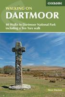
Wandelgids Walking on Dartmoor | Cicerone
A guidebook to 39 day walks and one two-day Ten Tors challenge across the Dartmoor National Park and its surrounding area. The guide contains low-level shorter walks and higher level more strenuous and challenging routes, therefore there's a walk suitable for all abilities, allowing you to explore all of what Devon's national park has to offer. Each walk contains a detailed route description, 1:50,000 OS maps and colour photography, alongside practical information on public transport links and refreshment stops on each walk.   Dartmoor, a National Park since 1951, is wild, and at times isolated. Its a land of blanket bogs and grass moors dotted with fascinating tors, old stone clapper bridges, tree-shaded river valleys and a diverse range of wildlife. Our ancestors have left behind a fascinating treasure trove from intriguing stone rows to fascinating stones circles and burial cairns to hut circles.   There are also the stark ruins of Dartmoor's mining heritage, picturesque villages a…
20,95
Wandelgids Walk! Dartmoor | Discovery Walking Guides
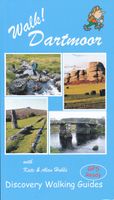
Engelstalige wandelgids voor Dartmoor, met uitgebreide beschrijvingen van wandelroutes, routekaartjes, praktische informatie zoals bussen en accommodatie. Kate and Alan Hobbs have reviewed and refreshed their Walk! Dartmoor classic guide book for its new 2016 edition. 40 fully detailed walking routes with OS maps and gps waypoints for you to enjoy adventuring on Dartmoor. Walk! Dartmoor with Kate and Alan Hobbs covers walks of varying length across Dartmoor - from the dramatic high moors, gentle riversides, idyllic country lanes, unspoilt villages, to sites of ancient archaeology and former industries, and all with spectacular views.   This user friendly illustrated guide has a summary of walking routes and is rated by time, effort, distance and hills, as well as the availability of refreshments en route and the vertigo risk.Each walk is described in full and there are timings listed in the book to help with navigation and progress. Walk! Dartmoor contains a 1:40,000 scale Ordnance Su…
19,95
Fietskaart Dartmoor | Harvey Maps
New map for cycling on Dartmoor and the surrounding area.   2 maps in one: one side mountain biking the other side for cycle touring   Tried and tested cycle routes   Side 1 is a detailed map of Dartmoor showing graded mountain bike routes. Covers the whole of the National Park. Scale 1:40,000   Side 2 for touring cycling shows the whole area from Exeter to Plymouth at 1:60,000 scale with recommended cycle-friendly routes shown.   All paths and tracks where cyclists have a legal or permitted right to ride are shown.   Routes have been graded and colour-coded by cyclists so that you can easily identify the paths that will suit your ability and mood   Produced in cooperation with the National Park Authority.   Includes cycling in the Tamar Valley and Haldon Forest Park  
26,95
Wandelkaart Arrochar Alps | Harvey Maps
Covers a large area yet is handily compact. Pocket perfect!   Includes Beinn Ime, Ben Vorlich and the Cobbler (Ben Arthur).   Detailed map for hillwalkers of the western part of the Loch Lomond and Trossachs National Park at the magic scale of 1:40,000.   Includes 5 Munros, 10 Corbetts and 13 Grahams.   The Arrochar Alps are a group of mountains located around the head of Loch Long, Loch Fyne, and Loch Goil, near the villages of Arrochar and Lochgoilhead, on the Cowal Peninsula in Argyll and Bute, Scotland. The mountains are especially popular with hillwalkers, due to their proximity and accessibility from Glasgow.   The Ultramap is fully detailed, genuine, original HARVEY mapping. To provide the biggest area on the smallest, lightest sheet, the Ultramap is printed double sided. The ingenious folding pattern allows you to open the Ultramap directly to any part, and either side, of the sheet. The two sides are aligned, so when you reach the edge of the Ultramap sheet you simply flip it…
19,50
Wandelkaart Snowdonia Zuid | Harvey Maps
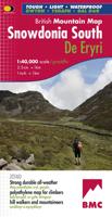
"The 1:40,000 scale used by British Mountain Maps is excellent for hill walking. These maps provide clear, detailed information." Sir Chris Bonington, mountaineer.   The key mountains of Southern Snowdonia on one map at 1:40,000 scale.   Includes Cadair Idris, the Arans and Arenig Fawr.   Snowdonia South is the latest title in the highly successful and innovative British Mountain Map series. It adjoins existing title, Snowdonia and covers the very popular Cadair Idris, the Rhinogs, the Arans and Arenig Fawr. Printed on polyethylene this map is durable, tearproof and 100% waterproof. Colour shading is used for easy identification of the hills and valleys. The map is also less than half of the weight of a laminated map. The reverse side of the map includes a map extension south to Aberdovey, a geological map, mountain incident, first aid and navigation advice. Local phone numbers and website addresses are also listed.
29,95
Wandelkaart Loch Monar | Harvey Maps
40 years’ experience have gone into HARVEY’s most creative new series. Slim and light, the Ultramap covers a large area and yet is handily compact. Pocket perfect!   The Ultramap covers a large area yet is small enough to slip in a pocket The Ultramap is fully detailed genuine original HARVEY mapping. The Ultramap is tough and 100% waterproof. Use it without a map case, whatever the weather! To provide the biggest area on the smallest lightest sheet, the Ultramap is printed double sided. The ingenious folding pattern allows you to open the Ultramap directly to any part, and either side, of the sheet The two sides are aligned, so when you reach the edge of the Ultramap sheet you simply flip it over without re-folding. There’s an overlap as well, so you can map read continuously The magic scale of 1:40,000 enables the Ultramap to provide all the detail you would expect to find on a large scale walking map, including rights of way and boundaries Plastic pocket for protection
19,50

Klanten-reviews van Wandelkaart Dartmoor Zuid | Harvey Maps

Er zijn nog geen beoordelingen voor dit productBen jij de eerste die een review plaatst?

Meer over Wandelkaart Dartmoor Zuid | Harvey Maps

Productomschrijving

Covers a large area yet is handily compact. Pocket perfect!   Detailed map for runners and walkers of the south section of Dartmoor National Park at the magic scale of 1:40,000.   Features Dartmoor's famous Tors and archaeological sites include standing stones, stone circles and ancient travel routes are also shown.   Click here to view map coverage   Fully detailed genuine HARVEY mapping Includes Rights of Way Use without a map case: tough and 100% waterproof Opens directly to either side of the sheet

Productinformatie

    Verken gerelateerde categorieën

    Webshop.nl maakt gebruik van cookies. Ga je verder op onze website, ga dan akkoord met het plaatsen van cookies en de verwerking van deze data door ons en vermelde partners.