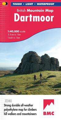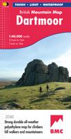
Wandelkaart Dartmoor | Harvey Maps

0
"This inspiring new map will help walkers and climbers explore Dartmoor's wild granite landscapes, and, like the granite, is virtually indestructible." Sir Ranulph Fiennes, adventurer and explorer.   Dartmoor, the latest title in the highly successful and innovative British Mountain Map series, is the only really detailed map for walking to cover ...

Verkopers met dit product

Verkoper
Bezorging
Prijs
DeZwerver.nl logo
DeZwerver.nl
2,95
29,95

Anderen bekeken ook

Wandelkaart Dartmoor | Harvey Maps
"This inspiring new map will help walkers and climbers explore Dartmoor's wild granite landscapes, and, like the granite, is virtually indestructible." Sir Ranulph Fiennes, adventurer and explorer.   Dartmoor, the latest title in the highly successful and innovative British Mountain Map series, is the only really detailed map for walking to cover this famous area on one sheet. XT40 - A new generation of tough polyethylene maps. These maps are a leap forward in technical excellence. Tough, durable, and 100% waterproof, they are compact - not the great bulky package you get with a laminated map - and light to carry. This all - weather British Mountain Map for climbers, hill - walkers, mountaineers and mountain bikers is published by HARVEY in co-operation with the British Mountaineering Council. The colourful geological map on the back gives understanding of the land form and was specially designed by the British Geological Survey. Colour shading is also used for easy identification of …
29,95
Wandelkaart Dartmoor Zuid | Harvey Maps
Covers a large area yet is handily compact. Pocket perfect!   Detailed map for runners and walkers of the south section of Dartmoor National Park at the magic scale of 1:40,000.   Features Dartmoor's famous Tors and archaeological sites include standing stones, stone circles and ancient travel routes are also shown.   Click here to view map coverage   Fully detailed genuine HARVEY mapping Includes Rights of Way Use without a map case: tough and 100% waterproof Opens directly to either side of the sheet
20,95
Wandelkaart Dartmoor Noord | Harvey Maps
Covers a large area yet is handily compact. Pocket perfect!   Detailed map for runners and walkers of the north section of Dartmoor National Park at the magic scale of 1:40,000.   Features Dartmoor's famous Tors including Haytor Rocks, Yes Tor and High Willhays.   Archaeological sites include standing stones, stone circles and ancient travel routes are also shown.   Fully detailed genuine HARVEY mapping Includes Rights of Way Use without a map case: tough and 100% waterproof Opens directly to either side of the sheet
20,95
Wandelkaart Dartmoor Zuid | Harvey Maps
The whole of Dartmoor on two Maps. Dartmoor's famous Tors including Haytor Rocks and Yes Tor. The format gives more mapping on the sheet without making the map heavy and bulky. The fold has been developed to allow you to open directly to any part, and either side of the sheet easily - no more struggling in the wind. The clarity of the mapping has been improved to enable more people to read it without their glasses. The map is uncluttered by information irrelevant to the walker. The precise contouring and delicate hill shading give an immediate picture of the ground. Less than half the weight of a laminated map. GPS compatible Experience the satisfaction of fine navigation with the Superwalker XT25 now printed on our 100% waterproof and almost indestructible paper, whatever the weather!
24,95
Wandelkaart Dartmoor Noord | Harvey Maps
The whole of Dartmoor on two Maps. Dartmoor's famous Tors including Haytor Rocks and Yes Tor. The format gives more mapping on the sheet without making the map heavy and bulky. The fold has been developed to allow you to open directly to any part, and either side of the sheet easily no more struggling in the wind. The clarity of the mapping has been improved to enable more people to read it without their glasses. The map is uncluttered by information irrelevant to the walker. The precise contouring and delicate hill shading give an immediate picture of the ground. Less than half the weight of a laminated map. GPS compatible. Experience the satisfaction of fine navigation with the Superwalker XT25 now printed on our 100% waterproof and almost indestructible paper, whatever the weather!
24,95
Fietskaart Dartmoor | Harvey Maps
New map for cycling on Dartmoor and the surrounding area.   2 maps in one: one side mountain biking the other side for cycle touring   Tried and tested cycle routes   Side 1 is a detailed map of Dartmoor showing graded mountain bike routes. Covers the whole of the National Park. Scale 1:40,000   Side 2 for touring cycling shows the whole area from Exeter to Plymouth at 1:60,000 scale with recommended cycle-friendly routes shown.   All paths and tracks where cyclists have a legal or permitted right to ride are shown.   Routes have been graded and colour-coded by cyclists so that you can easily identify the paths that will suit your ability and mood   Produced in cooperation with the National Park Authority.   Includes cycling in the Tamar Valley and Haldon Forest Park  
26,95
Wandelkaart Lake District | Harvey Maps
"The best Lake District map I have ever seen. The 1:40,000 scale provides clear, detailed information to one of the most popular hill walking areas in Britain." Sir Chris Bonington, mountaineer. A new generation of tough polyethylene maps. These maps are a leap forward in technical excellence. Tough, durable and 100% waterproof they are compact - not the great bulky package you get with a laminated map - and light to carry. This all weather British Mountain Map for climbers, hill wallkers, mountaineers and mountain bikers is published by HARVEY in co-operation with the British Mountaineering Council. The Lake District's famous mountains and fells on a single map, colour shading for easy identification of hills and valleys and detailed crag information for climbers. The reverse side of the map includes detailed 1:20000 enlargements of Scafell, Gable, Bowfell, Langdale Pikes and Pillar, a Geological map of the Lake District, mountain incident and first aid advice.
31,95
Wandelkaart White Peak | Harvey Maps
"British Mountain Maps are fit for purpose with great cartography, full of relevant information and include a geological map. Imagine a completely waterproof map that is lighter than paper and will remain reliable in any conditions. This is it." Mark Vallance, founder of Wild Country.   The hills and dales of the White Peak on a single map at 1:40,000 scale.   White Peak is the latest title in the successful British Mountain Map series. All of the White Peaks hills and dales on a single map, colour shading for easy identification of hills and valleys. Map extensions east to Matlock and north to Edale. Mark Vallance, founder of Wild Country said of this map, British Mountain Maps are fit for purpose with great cartography, full of relevent information and includes a geological map. Imagine a completely waterproof map that is lighter than paper and will remain readable in an conditions.... This is it. Printed on polyethylene, durable, tearproof and 100% waterproof. Weighs less than half…
29,95
Wandelkaart Brecon Beacons | Harvey Maps
"The Brecon Beacons have an irresistible draw and this is where I began my journey to the roof of the world. The breathtaking landscape provides challenges and adventures for all ages and abilities and this expertly designed map is the key to exploring it." Tori James, the first Welsh woman to climb Mount Everest Brecon Beacons - the latest edition to the popular British Mountain Map series. It covers 350 square mile of country - the only really detailed map to cover this whole area on one sheet. These maps are a leap forward in technical excellence. Tough, durable, and 100% waterproof, they are compact - not the great bulky package you get with a laminated map - and they are light to carry. This all weather British Mountain Map for climbers, hill walkers and mountaineers is published by HARVEY in co-operation with the British Mountaineering Council.
29,95
Wandelkaart Snowdonia Zuid | Harvey Maps
"The 1:40,000 scale used by British Mountain Maps is excellent for hill walking. These maps provide clear, detailed information." Sir Chris Bonington, mountaineer.   The key mountains of Southern Snowdonia on one map at 1:40,000 scale.   Includes Cadair Idris, the Arans and Arenig Fawr.   Snowdonia South is the latest title in the highly successful and innovative British Mountain Map series. It adjoins existing title, Snowdonia and covers the very popular Cadair Idris, the Rhinogs, the Arans and Arenig Fawr. Printed on polyethylene this map is durable, tearproof and 100% waterproof. Colour shading is used for easy identification of the hills and valleys. The map is also less than half of the weight of a laminated map. The reverse side of the map includes a map extension south to Aberdovey, a geological map, mountain incident, first aid and navigation advice. Local phone numbers and website addresses are also listed.
29,95

Klanten-reviews van Wandelkaart Dartmoor | Harvey Maps

Er zijn nog geen beoordelingen voor dit productBen jij de eerste die een review plaatst?

Meer over Wandelkaart Dartmoor | Harvey Maps

Productomschrijving

"This inspiring new map will help walkers and climbers explore Dartmoor's wild granite landscapes, and, like the granite, is virtually indestructible." Sir Ranulph Fiennes, adventurer and explorer.   Dartmoor, the latest title in the highly successful and innovative British Mountain Map series, is the only really detailed map for walking to cover this famous area on one sheet. XT40 - A new generation of tough polyethylene maps. These maps are a leap forward in technical excellence. Tough, durable, and 100% waterproof, they are compact - not the great bulky package you get with a laminated map - and light to carry. This all - weather British Mountain Map for climbers, hill - walkers, mountaineers and mountain bikers is published by HARVEY in co-operation with the British Mountaineering Council. The colourful geological map on the back gives understanding of the land form and was specially designed by the British Geological Survey. Colour shading is also used for easy identification of hills and valleys. Mountain incident, first aid and navigation advice as well as useful local numbers and website addresses are also on the reverse side of the map.

Productinformatie

    Verken gerelateerde categorieën

    Webshop.nl maakt gebruik van cookies. Ga je verder op onze website, ga dan akkoord met het plaatsen van cookies en de verwerking van deze data door ons en vermelde partners.