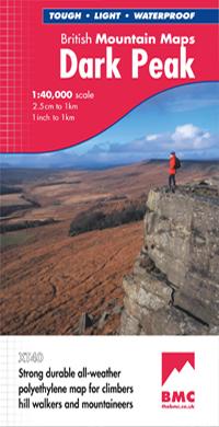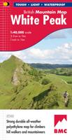
Wandelkaart Dark Peak | Harvey Maps

0
"The 1:40,000 scale used by British Mountain Maps is excellent for hill walking. These maps provide clear, detailed information." Sir Chris Bonington, mountaineer.   Detailed map of the Dark Peak’s famous Moorland Hills and Edges on a single sheet at 1:40,000 scale.   Detailed enlargement of the Kinder plateau. Map extension to Marsden.   As used ...

Verkopers met dit product

Verkoper
Bezorging
Prijs
DeZwerver.nl logo
DeZwerver.nl
2,95
29,95

Anderen bekeken ook

Nieuw
Wandelkaart Ben Nevis & Glen Coe | Harvey Maps
"This excellent Ben Nevis and Glen Coe map provides all the details needed for safe navigation on these iconic mountains". Cameron McNeish, outdoor writer and broadcaster.   Detailed map for hillwalkers and climbers of Ben Nevis and Glen Coe at 1:40,000 scale.   Section on navigation on Ben Nevis and detailed 1:15,000 enlargement of the summit with bad visibility descent route.   The map area includes 44 Munros, 14 Corbetts and 9 Grahams.     Serious map for serious mountains. The latest addition to the British Mountain Map series is a real heavyweight. Ben Nevis/Glencoe is the first Scottish title in this highly successful & innovative range. The map at 1:40000 has 43 Munros & 14 Corbetts on one sheet & is printed on polyethylene which is durable, tearproof & 100% waterproof. There is also colour shading for easy identification of hills and valleys & weighs less than half the weight of a laminated map. The reverse of the map has an enlargement of Ben Nevis summit, a Geological map, n…
29,95
Wandelkaart Lake District | Harvey Maps
"The best Lake District map I have ever seen. The 1:40,000 scale provides clear, detailed information to one of the most popular hill walking areas in Britain." Sir Chris Bonington, mountaineer. A new generation of tough polyethylene maps. These maps are a leap forward in technical excellence. Tough, durable and 100% waterproof they are compact - not the great bulky package you get with a laminated map - and light to carry. This all weather British Mountain Map for climbers, hill wallkers, mountaineers and mountain bikers is published by HARVEY in co-operation with the British Mountaineering Council. The Lake District's famous mountains and fells on a single map, colour shading for easy identification of hills and valleys and detailed crag information for climbers. The reverse side of the map includes detailed 1:20000 enlargements of Scafell, Gable, Bowfell, Langdale Pikes and Pillar, a Geological map of the Lake District, mountain incident and first aid advice.
31,95
Nieuw
Wandelkaart Snowdonia Zuid | Harvey Maps
"The 1:40,000 scale used by British Mountain Maps is excellent for hill walking. These maps provide clear, detailed information." Sir Chris Bonington, mountaineer.   The key mountains of Southern Snowdonia on one map at 1:40,000 scale.   Includes Cadair Idris, the Arans and Arenig Fawr.   Snowdonia South is the latest title in the highly successful and innovative British Mountain Map series. It adjoins existing title, Snowdonia and covers the very popular Cadair Idris, the Rhinogs, the Arans and Arenig Fawr. Printed on polyethylene this map is durable, tearproof and 100% waterproof. Colour shading is used for easy identification of the hills and valleys. The map is also less than half of the weight of a laminated map. The reverse side of the map includes a map extension south to Aberdovey, a geological map, mountain incident, first aid and navigation advice. Local phone numbers and website addresses are also listed.
29,95
Nieuw
Wandelkaart Knoydart / Kintail & Glen Affric | Harvey Maps
"Clarity is the hallmark of this map. It covers magnificently honed peaks set above western seas and lochs, inviting exploration of one of Scotland's superlative and remote mountain regions", the late Irvine Butterfield, author of The High Mountains.   Detailed map of ‘Britain's last wilderness’ at 1:40,000 scale.   Includes Kintail and Glen Affric.   Detailed crag information for climbers.   Includes 43 Munros, 21 Corbetts and 7 Grahams.   Knoydart & Kintail, seventh in this highly successful & innovative British Mountain Map series, is a long awaited title. It is the only detailed map to cover this famous wilderness area on one sheet. This all weather map for climbers, hillwalkers, mountaineers & mountain bikers includes 43 Munros & 21 Corbetts. It is printed on polyethylene which is durable, tearproof & 100% waterproof. Colour shading is used for easy identification of hills & valleys & the map weighs less than half the weight of a laminated map. There is also an extension covering…
29,95
Nieuw
Wandelkaart Snowdonia Noord | Harvey Maps
"The 1:40,000 scale used by British Mountain Maps is excellent for hill walking. These maps provide clear, detailed information." Sir Chris Bonington, mountaineer.   Snowdonia's key mountains on a single map.   Enlargements of Snowdon and Tryfan.   This map covers Snowdonia's key mountains on a single map. Colour shading is used for easy identification of the hills and valleys and the text is bi-lingual in Welsh and English. The reverse side of the map includes detailed 1:20,000 enlargements of Snowdon & Tryfan, a geological map of the area, mountain incident and first aid advice and useful local phone numbers and website addresses.
29,95
Nieuw
Wandelkaart Ben Nevis | Harvey Maps
HARVEY launch innovative new series: Ultramap XT40. 16 titles featuring in Trail magazine through spring 2016. 40 years experience have gone into HARVEY's most creative new series. The Ultramap covers a large area yet is small enough to slip in a pocket. Actual size 73mm x 152mm. The Ultramap is fully detailed genuine original HARVEY mapping. The Ultramap is tough and 100% waterproof. Use it without a map case, whatever the weather! To provide the biggest area on the smallest lightest sheet, the Ultramap is printed double sided. The ingenious folding pattern allows you to open the Ultramap directly to any part, and either side, of the sheet. The two sides are aligned, so when you reach the edge of the Ultramap sheet you simply flip it over without re-folding. There's an overlap as well, so you can map read continuously. The magic scale of 1:40,000 enables the Ultramap to provide all the detail you would expect to find on a large scale walking map, including rights of way and boundarie…
19,50
Nieuw
Wandelkaart Thames Path | Harvey Maps
Mooie, duidelijke kaart van het Thames Path in Engeland. Geplastificeerd met veel extra informatie en uitsnedes van de route.   Thames Path National Trail   The Thames Path follows the banks of the river for 184 miles (294KM) from the flood barrier at Woolwich in South East London to Kemble Gloucestershire. It is a long distance walking route, most of it cannot be cycled. The Trail passes through water meadows, historic towns & lovely villages. The path is flat which makes for easy walking. Jos Joslin National Trails Manager (Marketing & Projects) said of this map "Really beneficial to have the whole length of the Thames Path upstream of London on just one map. Clear mapping and useful information makes this a very practical map"   XT40 New generation of tough polyethylene maps   The HARVEY series of Long Distance Route maps is an established success. Now the advanced technology used in the creation of our best-selling British Mountain Maps is also applied to the route maps.   These m…
25,95
Nieuw
Wandelkaart 15 Canmore Up-Close | Gem Trek Maps
Waterproof and tear-resistant hiking and recreation map for the town of Canmore and surrounds in the Canadian Rockies.   Designed for both locals and visitors, Gem Trek’s 1:35,000 Canmore Up-Close Map is a detailed relief-shaded topographic map of Canmore and the Bow Valley area. This edition has been updated to show all new subdivisions and recent changes to the trail network. On the back of the Canmore Up-Close Map are descriptions of recommended sights and detailed descriptions of the best and most scenic hiking and biking trails, including the highlights of each trail, as well as distance, elevation gain and directions to the trailhead. Also on the back of the map is an inset map of downtown Canmore and colour photos.   Map specs   Edition: 2nd Scale: 1:35,000 Folded size: 4.5 x 9.5 inches Flat size: 18 x 24 inches Paper: Waterproof and tear-resistant   Map coverage   The Canmore Up-Close Map focuses on the town of Canmore in the Canadian Rockies. The map boundary extends along th…
13,95
Wandelkaart Rob Roy Way | Harvey Maps
Mooie, duidelijke kaart van de Rob Roy Way in Schotland. Geplastificeerd met veel extra informatie en uitsnedes van de route.    One of Scotland's Great Trails   Rob Roy Way is a walk across part of the Southern Highlands of Scotland taking in some of the most beautiful countryside in the UK. Starting from Drymen it goes north east to finish in Pitlochry. The Way is 77mls or 94 mls (124Km or 151Km) depending on your route choice. The tracks and paths you follow were used by Rob RoyMacGregor in the 17th & 18th centuries, other historical characters throughout the Jacobite uprisings and during the feuds between the local clans. Places you will pass through include Aberfoyle, Callander, Strathyre, Killin or Amulree and Aberfeldy. Lochs you will walk along include Venachar, Lubnaig and Tay passing by Ben Ledi, Ben Chonzie and Ben Lawers.   XT40 New generation of tough polyethylene maps   The HARVEY series of Long Distance Route maps is an established success. Now the advanced technology u…
25,95
Nieuw
Wandelkaart Dartmoor | Harvey Maps
"This inspiring new map will help walkers and climbers explore Dartmoor's wild granite landscapes, and, like the granite, is virtually indestructible." Sir Ranulph Fiennes, adventurer and explorer.   Dartmoor, the latest title in the highly successful and innovative British Mountain Map series, is the only really detailed map for walking to cover this famous area on one sheet. XT40 - A new generation of tough polyethylene maps. These maps are a leap forward in technical excellence. Tough, durable, and 100% waterproof, they are compact - not the great bulky package you get with a laminated map - and light to carry. This all - weather British Mountain Map for climbers, hill - walkers, mountaineers and mountain bikers is published by HARVEY in co-operation with the British Mountaineering Council. The colourful geological map on the back gives understanding of the land form and was specially designed by the British Geological Survey. Colour shading is also used for easy identification of …
29,95

Klanten-reviews van Wandelkaart Dark Peak | Harvey Maps

Er zijn nog geen beoordelingen voor dit productBen jij de eerste die een review plaatst?

Meer over Wandelkaart Dark Peak | Harvey Maps

Productomschrijving

"The 1:40,000 scale used by British Mountain Maps is excellent for hill walking. These maps provide clear, detailed information." Sir Chris Bonington, mountaineer.   Detailed map of the Dark Peak’s famous Moorland Hills and Edges on a single sheet at 1:40,000 scale.   Detailed enlargement of the Kinder plateau. Map extension to Marsden.   As used by Woodhead Mountain Rescue Team.   Tough, durable & 100% waterproof these virtually indestructible maps cover Dark Peak's moorland fells & edges on a single map. Colour shading for easy identification of hill's and valleys makes this the only map you will need to walk in the Peak District. There is also a detailed enlargement of the Kinder plateau on the reverse of the map as well as a geological map. Useful tips, phone numbers etc are also included.

Verken gerelateerde categorieën

Webshop.nl maakt gebruik van cookies. Ga je verder op onze website, ga dan akkoord met het plaatsen van cookies en de verwerking van deze data door ons en vermelde partners.