webshop.nl
Categorieën
  Sluiten

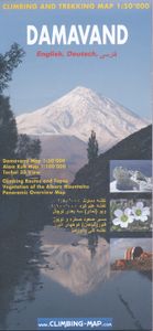
Wandelkaart Damavand - Alam Kuh - Tochal | Climbing-map

Uitstekende kaart om de Damavand, de hoogste berg van Iran, te beklimmen. Als trekkingmap en klimkaart is deze zeer geschikt. Met alle belangrijke topografische details ingetekend als hoogtelijnen (interval 1:40.000), ravijnen, wegennet en ingetekende wandelpaden en routes.Alle 3 belangrijkste routes (de Noord, Zuid en West route) staan duidelijk w...
22,95

Webshops met dit product

Webshop
Bezorging
Prijs

Anderen bekeken ook

Wandelkaart Damavand - Alam Kuh - Tochal | Climbing-map
Uitstekende kaart om de Damavand, de hoogste berg van Iran, te beklimmen. Als trekkingmap en klimkaart is deze zeer geschikt. Met alle belangrijke topografische details ingetekend als hoogtelijnen (interval 1:40.000), ravijnen, wegennet en ingetekende wandelpaden en routes.Alle 3 belangrijkste routes (de Noord, Zuid en West route) staan duidelijk weergegeven. Daarnaast staan de berghutten en campings er goed op.  Schaal 1:50.000 met een UTM grid en daardoor GPS compatible. De top van de berg wordt in een extra kaart afgebeeld met schaal 1:25.000.  - Double sided map - Relief shown by hill-shading and contours - Vegetation detailed - Routes to the summits with a profile of the course - Panoramic overview of the area - Damavand (1:50,000) et Alam Kuh (1:100,000) - Legend in English/German/Iranian - GPS compatible
22,95
Wandelkaart trekkingmap Aconcagua | Climbing-map
Gedetailleerde kaart voor de beklimming van de Aconcagua met op de ene zijde een detailkaart van het hoogste gedeelte met schaal 1:40.000 en op de andere zijde een trekkingmap van de omgeving met de berg in een schaal van 1:100.000. Topographic and thematic climbing map with useful information and illustrations: city map of Mendoza, village map of Puente del Inca, trekking map, description of climbing routes, climatic diagram, vegetation profile, GPS information. Inhalt: Topografische und thematische Bergsteigerkarte 1:40.000 mit diversen Abbildungen und nützlichen Informationen.   Details: Vorderseite: + Topografische Karte Aconcagua im Massstab 1:40.000 + Legende + Panoramabild + Plan Boulderblöcke   Rückseite: + Trekkingkarte 1:100.000  + Streckenprofil von Trekkings und Aufstiegen + Stadtplan Mendoza  + Dorfplan Puente del Inca  + Beschreibung der Aufstiegsrouten in 4 Sprachen  + Routenskizzen von 3 verschiedenen Seiten + Vegetationsstufenprofil  + nützliche allgemeine Informatione…
21,95
Wandelkaart Trekking map Aconcagua | TerraQuest
Gedetailleerde wandelkaart - trekking map van de Aconcagua en omgeving. Handig uitgevoerd: geplastificeerd maar toch makkelijk om te slaan en op te vouwen met de gewenste kant voor. De wandelroutes staan ingetekend, zo ook de berghutten en kampen. Dé kaart om de hoogste berg van Zuid Amerika te beklimmen. Laminated topographic map of Mount Aconcagua (Argentina) published by Terra Quest in 2013. Waterproof and tear-resistant, contoured and GPS compatible map, providing coverage of the Aconcagua Provincial Park with access from the road linking Punta de Vascas, Los Penitentes, Puente del Inca and the Cristo Redentor Tunnel crossing to Chile.   The map divides the area north/south with a good overlap between the sides, extending north to Cerro La Mano on the northern boundary of the park, and south of the road to include Cerro Panitentes. A hiking map characterized by topographic data (contours). An overprint highlights the approach routes to Aconcagua, indicating main trails and difficul…
18,50
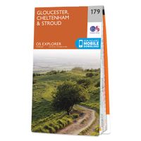
Wandelkaart - Topografische kaart 179 OS Explorer Map Gloucester, Chel
The essential map for outdoor activities in Gloucester, Cheltenham and Stroud. The OS Explorer Map is the Ordnance Survey's most detailed folding map and is recommended for anyone enjoying outdoor activities including walking, horse riding and off-road cycling. This map now comes with a digital version which you can download to your smartphone or tablet.Providing complete GB coverage, the OS Explorer map series details information essential in the great outdoors, including youth hostels, pubs and visitor information. Rights of way, fences, permissive paths and bridleways are clearly shown, ensuring you have the best information to get the most out of your time in the countryside. FeaturesCotswold Way Severn Way Gloucestershire Way Macmillan Way Wysis WayCotswold Way (National Trail) GloucesterCheltenhamGloucester Stroud1:25 000 scale (4 cm to 1 km - 2.5 inches to 1 mile) Met zijn 4cm voor 1 km (2 ½ cm voor 1 mijl) schaal, is de OS Explorer kaartenserie de ideale en meest gedetailleerde…
19,50
Wandelkaart trekkingmap Cotopaxi - Ecuador | Climbing-map
Gedetailleerde kaart voor de beklimming van de Cotopaxi  met schaal 1:40.000, op de achterkant een overzichtskaart met schaal 1:250.000. Topographic climbing map with useful information and illustrations: city map of Quito, general map 1:250'000, Avenida de los Volcanes, description of climbing routes, vegetation profile, climatic diagram, GPS- information.. Sprachen: Englisch, Deutsch, Spanisch Inhalt: Topografische Bergsteigerkarte, Stadtplan Quito, Übersichtskarte 1:250'000, Avenida de los Volcanes, Krokis 5 weiterer Vulkane, Routenbeschreibungen, Vegetationsprofil, Klimadiagramm, GPS-Informationen.   + Koordinatensystem: WGS 84 / UTM - Netz    Idee:  Wer als Bergsteiger oder Trekkingtourist weltweit unterwegs ist, stellt bald einmal fest, dass vielerorts kaum brauchbares topografisches Kartenmaterial existiert. Von touristisch bedeutenden Bergen gibt es zwar oftmals haufenweise Bücher und Reiseführer, die Qualität der erhältlichen topografischen Karten lässt aber zu wünschen übrig.…
21,95
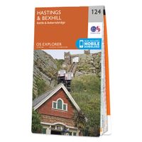
Wandelkaart - Topografische kaart 124 OS Explorer Map Hastings & Bexhi
Experience the history-rich countryside where the High Weald, an Area of Outstanding Natural Beauty, sweeps down to the shore where the fate of Britain was decided in 1066. Explore Battle and visit the actual spot where the Battle of Hastings took place, now a beautiful wildflower meadow dotted with the ruins of a grand abbey built in penance for the slaughter.  Visit the seaside towns of Hastings and Bexhill with their medieval Old Towns, Victorian and Edwardian seafronts and pavilions  Glimpse wild deer and boar roaming in the forests near Robertsbridge and Dartwell Reservoir in the High Weald  Walk or cycle in the footsteps of William the Conqueror on the 1066 Path, or start the Saxon Shore Way from Hastings to head north to Winchelsea  Met zijn 4cm voor 1 km (2 ½ cm voor 1 mijl) schaal, is de OS Explorer kaartenserie de ideale en meest gedetailleerde kaartenreeks voor mensen die graag outdoor-activiteiten zoals fietsen, wandelen, paardrijden, klimmen en watersporten. Deze kaart …
19,50
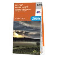
Wandelkaart - Topografische kaart 170 OS Explorer Map Abingdon, Wantag
Discover the Vale of White Horse, rolling hills dominated by the extraordinary, eponymous White Horse, an enigmatic Bronze Age chalk carving which can be seen for miles leaping across the hillside. Explore the historic market towns of Abingdon-on-Thames, dating back to Saxon times; Wantage, birthplace of King Alfred the Great; Wallingford and Faringdon, known for its 100-foot high folly tower.     Visit the iconic White Horse and the ancient landscape that surrounds it, including Uffington Castle and Dragon Hill, where St George slew the dragon  Follow streams flowing through the chalk uplands and discover unique locations like the Manger and its Giant Steps, remnants of the Ice Age  Walk, hike or cycle along the ancient Ridgeway through the wold or a number of other popular recreational paths including sections of the Thames Path, Lambourn Valley Way and Chiltern Way    Met zijn 4cm voor 1 km (2 ½ cm voor 1 mijl) schaal, is de OS Explorer kaartenserie de ideale en meest gedetaillee…
19,50

Klanten-reviews van Wandelkaart Damavand - Alam Kuh - Tochal | Climbing-map

Er zijn nog geen beoordelingen voor dit productBen jij de eerste die een review plaatst?

Meer over Wandelkaart Damavand - Alam Kuh - Tochal | Climbing-map

Productomschrijving

Uitstekende kaart om de Damavand, de hoogste berg van Iran, te beklimmen. Als trekkingmap en klimkaart is deze zeer geschikt. Met alle belangrijke topografische details ingetekend als hoogtelijnen (interval 1:40.000), ravijnen, wegennet en ingetekende wandelpaden en routes.Alle 3 belangrijkste routes (de Noord, Zuid en West route) staan duidelijk weergegeven. Daarnaast staan de berghutten en campings er goed op.  Schaal 1:50.000 met een UTM grid en daardoor GPS compatible. De top van de berg wordt in een extra kaart afgebeeld met schaal 1:25.000.  - Double sided map - Relief shown by hill-shading and contours - Vegetation detailed - Routes to the summits with a profile of the course - Panoramic overview of the area - Damavand (1:50,000) et Alam Kuh (1:100,000) - Legend in English/German/Iranian - GPS compatible
Webshop.nl maakt gebruik van cookies. Ga je verder op onze website, ga dan akkoord met het plaatsen van cookies en de verwerking van deze data door ons en vermelde partners.