webshop.nl
Categorieën
  Sluiten

Meer Harvey Maps
Meer Harvey Maps in Thrillers & fantasy boeken

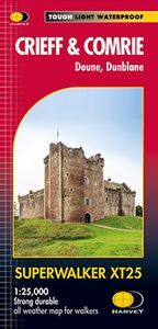
Wandelkaart Crieff & Comrie, Doune, Dunblane | Harvey Maps

Map covers the Munro, Ben Chonzie, popular Glen Artney, as well as the Braes of Doune and Doune Castle, which has featured in various film and television shows, such as Monty Python, Outlander and Game of Thrones.   Detailed map for hillwalkers at the popular 1:25,000 scale.   Core Paths (from the relevant Local Authorities) are shown.   Includes 1...
24,95

Webshops met dit product

Webshop
Bezorging
Prijs

Anderen bekeken ook

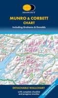
Wandelkaart Munro and Corbett Chart | Harvey Maps
Alle Munro's en Corbetts op 1 kaart!  First published in 1996 this current edition of our best selling chart used for monitoring and recording your progress in completing the Munros and Corbetts has been brought up to date to include the height revisions of 2009 and 2011 according to the Munro Society. It also includes the Grahams and the Donalds. It can be removed from the cover without damage and wall mounted. Based on the 1997 edition of Munro's Tables progress can be monitored filling in the targets or the symbols on the map and by recording the date of each ascent. The symbols have been updated to make them easier to read, and can now be identified clearly by the colour blind. This Munro map is a chart which shows and lists all Munros (mountains over 3000ft), Corbetts (over 2500ft), Grahams and Donalds (over 2000ft). A selection of other hills are named for information.   Size 880x1145mm.   Space for recording your date of ascent.   Target to fill in as you complete the challenge.
17,95
Wandelkaart Arrochar Alps | Harvey Maps
Covers a large area yet is handily compact. Pocket perfect!   Includes Beinn Ime, Ben Vorlich and the Cobbler (Ben Arthur).   Detailed map for hillwalkers of the western part of the Loch Lomond and Trossachs National Park at the magic scale of 1:40,000.   Includes 5 Munros, 10 Corbetts and 13 Grahams.   The Arrochar Alps are a group of mountains located around the head of Loch Long, Loch Fyne, and Loch Goil, near the villages of Arrochar and Lochgoilhead, on the Cowal Peninsula in Argyll and Bute, Scotland. The mountains are especially popular with hillwalkers, due to their proximity and accessibility from Glasgow.   The Ultramap is fully detailed, genuine, original HARVEY mapping. To provide the biggest area on the smallest, lightest sheet, the Ultramap is printed double sided. The ingenious folding pattern allows you to open the Ultramap directly to any part, and either side, of the sheet. The two sides are aligned, so when you reach the edge of the Ultramap sheet you simply flip it …
19,50
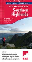
Wandelkaart Southern Highlands | Harvey Maps
"I've researched Scottish Guidebooks using HARVEY maps. They are the clearest, and the most accurate. They don't fall to pieces in the rain and the geology bits are pure bonus". Ronald Turnbull, author of Walking Loch Lomond and The Trossachs.   Detailed map of the Southern Highlands at 1:40,000 scale.   Map extensions of Ben Cruachan and Ben Vorlich.   This map shows 63 hills over 2,000 feet, including 25 Munros, 24 Corbetts and 14 Grahams.     This map covers an area dense with popular hills close to Central Scotland and easily accessed from the motorways. There are 63 popular hills over 2000', climbing crags are highlighted & named and the map covers most of Loch Lomond National Park. Printed on polyethylene the map is durable, tearproof and 100% waterproof. We use colour shading for easy identification of hills and valleys and the map is less than half the weight of a laminated map.
29,95
Wandelkaart Munro and Corbett Chart | Harvey Maps
Alle Munro's en Corbetts op 1 kaart!  First published in 1996 this current edition of our best selling chart used for monitoring and recording your progress in completing the Munros and Corbetts has been brought up to date to include the height revisions of 2009 and 2011 according to the Munro Society. It also includes the Grahams and the Donalds. It can be removed from the cover without damage and wall mounted. Based on the 1997 edition of Munro's Tables progress can be monitored filling in the targets or the symbols on the map and by recording the date of each ascent. The symbols have been updated to make them easier to read, and can now be identified clearly by the colour blind. This Munro map is a chart which shows and lists all Munros (mountains over 3000ft), Corbetts (over 2500ft), Grahams and Donalds (over 2000ft). A selection of other hills are named for information.   Size 880x1145mm.   Space for recording your date of ascent.   Target to fill in as you complete the challenge.
17,95
Wandelkaart Suilven / Stac Pollaidh / Lochinver | Harvey Maps
Detailed map for runners and walkers of Suilven and the surrounding area at the magic scale of 1:40,000. Covers a large area yet is handily compact. Pocket perfect! This is a fantastic and beautiful area, with Suilven at its centre. The map includes the two Munros of Ben More Assynt and Conival, as well as other famous mountains such as Cul Mor, Cul Beag, Canisp and Stac Pollaidh. Coverage is extended to the north with an inset of Quinag. The map shows 2 Munros, 8 Corbetts and 3 Grahams. Fully detailed genuine HARVEY mapping Use without a map case: tough and 100% waterproof Opens directly to either side of the sheet
19,50
Wandelkaart Loch Lomond & The Trossachs | Harvey Maps
Detailed Superwalker map for walkers of Loch Lomond & the Trossachs National Park at 1:25,000 scale. Includes Scotland?s most southerly Munro, Ben Lomond and an inset map for access to Ben Vorlich from Loch Earn. Ideal for The Great Trossachs Forest, Loch Katrine, Ben Ledi & Queen Elizabeth Forest Park. Includes 7 Munros, 7 Corbetts and 6 Grahams. Tough, light, durable and 100% waterproof Genuine, original, HARVEY mapping Opens directly to either side of the sheet Easy to re-fold
24,95

Klanten-reviews van Wandelkaart Crieff & Comrie, Doune, Dunblane | Harvey Maps

Er zijn nog geen beoordelingen voor dit productBen jij de eerste die een review plaatst?

Meer over Wandelkaart Crieff & Comrie, Doune, Dunblane | Harvey Maps

Productomschrijving

Map covers the Munro, Ben Chonzie, popular Glen Artney, as well as the Braes of Doune and Doune Castle, which has featured in various film and television shows, such as Monty Python, Outlander and Game of Thrones.   Detailed map for hillwalkers at the popular 1:25,000 scale.   Core Paths (from the relevant Local Authorities) are shown.   Includes 1 Munro, 2 Corbetts and 4 Grahams.

Productspecificaties

Artikelnummer(s)
Brand
Harvey Maps

Verken gerelateerde categorieën

Webshop.nl maakt gebruik van cookies. Ga je verder op onze website, ga dan akkoord met het plaatsen van cookies en de verwerking van deze data door ons en vermelde partners.