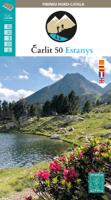
Wandelkaart Carlit 50 Estanys | Editorial Alpina

0
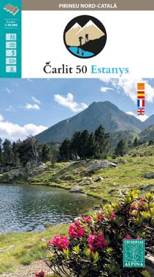
Ahead of us, more than 50 lakes scattered among 5 stages in the Carlit area, Puig Peric and La Bollosa. This circular trek has been conceived to explore in depth this sector of Pyrenees, without technical hindrances, with awesome landscapes, and crowning the highest summit in the Eastern Pyrenees: the Carlit (2.921 m). The stages cross Animal Rese...

Verkopers met dit product

Verkoper
Bezorging
Prijs
DeZwerver.nl logo
DeZwerver.nl
niet bekend
2,95
16,95

Anderen bekeken ook

Wandelkaart Carlit 50 Estanys | Editorial Alpina
Ahead of us, more than 50 lakes scattered among 5 stages in the Carlit area, Puig Peric and La Bollosa. This circular trek has been conceived to explore in depth this sector of Pyrenees, without technical hindrances, with awesome landscapes, and crowning the highest summit in the Eastern Pyrenees: the Carlit (2.921 m). The stages cross Animal Reservations, Natural Parks and locations with di erent degrees of environmental protection, due to the high ecologic value of its ora, fauna and landscapes.
16,95
Wandelkaart Ruta dels Estanys Amagats | Editorial Alpina
Zeer gedetailleerde wandelkaart van een klein gebied. Met ingetekende wandelroutes en andere informatie. Spaanstalig, maar uitstekende kaart. Coordinaten zijn weergegeven, dus GPS compatible met UTM grid.  Op de topografische wandelkaart worden o.a. berghutten, campings aangeduid en hoogtelijnen, ingetekende wandelroutes en de GR paden (doorgaande langeafstandswandelpaden). De kaart is inclusief een boekje met extra informatie over aanwezige voorzieningen en enkele routes   Dit is een kaart waar alles draait om de Ruta dels Estanys Amagats La Ruta dels Estanys Amagats is een meerdaagse huttentocht die je in 5 dagen kunt volbrengen als je een gemiddeld wandeltempo aanhoudt. Er zijn mensen die ervoor kiezen om tijdens de tocht ook nog enkele van de emblematische bergtoppen onderweg mee te pikken, zodat hij tegenwoordig ook vaak wordt aangeduid als 6-daagse tocht. De route is gelegen in de Pyreneeën, tussen de grote Cerdanya-vallei en de Franse grens en gaat ook een stukje de grens met A…
16,95
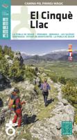
Wandelkaart El Cinque Llac | Editorial Alpina
Een topografische wandelkaart van de Spaanse Pyreneeen, net ten zuiden van Aiguestortes NP, een meerdaagse rondwandeling in een bepaald deel van de Spaanse Pyreneeen.   Gebied: La  Pobla de Segur - Peramea - Beranui - Les Iglesias Senterada - Estany de Montcortes   Op de topografische wandelkaart worden o.a. berghutten, campings aangeduid en hoogtelijnen, ingetekende wandelroutes en de GR paden (doorgaande langeafstandswandelpaden). De kaart is inclusief een Spaans/Frans/Engelstalig boekje met extra informatie over aanwezige voorzieningen en routes.   A total of 100 km in five stages, walking from one rural hostelry to the next with no weight on your shoulders – we take care of your luggage and take it on to your next stop – is the perfect way of discovering an evocative and unconventional side to the Pyrenees. It begins and ends in the town of La Pobla de Segur, less than 200 km from Barcelona, and travels through landscapes replete with stunning scenery and welcoming human warmth.
16,95
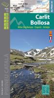
Wandelkaart Carlit - Bollosa | Editorial Alpina
Zeer gedetailleerde wandelkaart van een klein gebied. Met ingetekende wandelroutes en andere informatie. Spaanstalig, maar uitstekende kaart. Coordinaten zijn weergegeven, dus GPS compatible met UTM grid.    Op de topografische wandelkaart worden o.a. berghutten, campings aangeduid en hoogtelijnen, ingetekende wandelroutes en de GR paden (doorgaande langeafstandswandelpaden).    • Carpeta i mapa Excursionista • Escala: 1: 30.000 • Equidistància: 10 m • Corbes mestres: a 50 m • Informacions d’interès excursionista • Usos del sòl representats a 3 nivells • Quadrícula UTM amb divisions d’1 km • Compatible GPS   Ingetekend wandelroutes GR10 Haute Route Pyreneeen
17,95
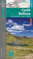
Wandelkaart Carlit - Bollosa | Editorial Alpina
Zeer gedetailleerde wandelkaart van een klein gebied. Met ingetekende wandelroutes en andere informatie. Spaanstalig, maar uitstekende kaart. Coordinaten zijn weergegeven, dus GPS compatible met UTM grid.    Op de topografische wandelkaart worden o.a. berghutten, campings aangeduid en hoogtelijnen, ingetekende wandelroutes en de GR paden (doorgaande langeafstandswandelpaden).    • Carpeta i mapa Excursionista • Escala: 1: 30.000 • Equidistància: 10 m • Corbes mestres: a 50 m • Informacions d’interès excursionista • Usos del sòl representats a 3 nivells • Quadrícula UTM amb divisions d’1 km • Compatible GPS   Ingetekend wandelroutes GR10 Haute Route Pyreneeen
16,95
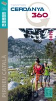
Wandelkaart Cerdanya 360 - territori | Editorial Alpina
Hiking Map and guide of the crossing of the 3 refuges of the Spanish publisher Alpina.   The crossing of the three shelters is a fantastic hike to discover unforgettable sites in the East Pyrenees. It allows to discover abundant wildlife, superb flowers, spectacular gorges, isolated lakes, beautiful forests and lifetime rivers. At the end of each step, you will experience one night's experience in a guarded refuge and resume forces for the next day. The total altitude of the crossing is more than 3,000 meters. For the more sports, the steps can be supplemented by the rise of the summits of the region: the peaks of Balandrau, Bastiments, Gra de Fajol, Gallinas, Torreneules and Puigmal, for a total altitude of more than 6,000 meters.   The regions of the Ripollès and Upper Conflent, east of the Pyrenees chain, offer a wild territory predominated by the high mountain. It is a very well preserved natural space with great biodiversity. It is in these isolated sites that the Ulldeter shelte…
16,95
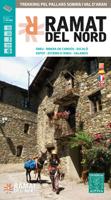
Wandelkaart Ramat del Nord | Editorial Alpina
Gedetailleerde wandelkaart van een meerdaagse tocht in de Spaanse Pyreneeen, veel detail op topografisch nivo met hoogtelijnen, schaduwwerking, hutten, paden etc.    Zeer gedetailleerde wandelkaart van een klein gebied. Met ingetekende wandelroutes en andere informatie. Spaanstalig, maar uitstekende kaart. Coordinaten zijn weergegeven, dus GPS compatible met UTM grid.    Op de topografische wandelkaart worden o.a. berghutten, campings aangeduid en hoogtelijnen, ingetekende wandelroutes en de GR paden (doorgaande langeafstandswandelpaden). De kaart is inclusief een Spaanstalig boekje met extra informatie over aanwezige voorzieningen en enkele routes.   Areu - Ginestarre - Ribera de Cardos - Estaron - Escal o - Espot - Jou - La Guingueta - Esterri d'Aneu - Slardu.   -wandelpaden ingetekend -schaal 1:50.000 (1 cm = 500 m) -hoogtelijnen -campings, berghutten, herberg, jeugherbergen -tankstations, parkeerplaatsen -locaties voor rotsklimmen, wandelen, lalnglaufen etc -GPS-compatibl…
16,95
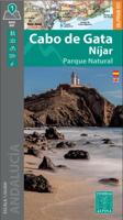
Wandelkaart Cabo de Gata / Nijar | Editorial Alpina
Zeer gedetailleerde wandelkaart van een klein gebied. Met ingetekende wandelroutes en andere informatie. Spaanstalig, maar uitstekende kaart. Coordinaten zijn weergegeven, dus GPS compatible met UTM grid.    Op de topografische wandelkaart worden o.a. berghutten, campings aangeduid en hoogtelijnen, ingetekende wandelroutes en de GR paden (doorgaande langeafstandswandelpaden).  Cabo da Gata-Níjar Natural Park in an extensive and very popular series of walking maps from Editorial Alpina covering the Pyrenees, Catalonia and other selected hiking areas in Spain, including Picos de Europa, Sierra Nevada and parts of Andalucía, Majorca, etc. Scales vary from 1:50,000 to 1:10,000, with the majority of the titles at 1:25,000. The maps have contours, usually at 20m or 10m intervals, with additional hill shading and spot heights. An overprint highlights hiking trails, long-distance footpaths, campsites, mountain huts, refuges, etc. Many maps also show climbing sites, potholing caves, mountain b…
17,95
Wandelkaart 51 Alt Emporda | Editorial Alpina
Zeer gedetailleerde wandelkaart van een klein gebied. Met ingetekende wandelroutes en andere informatie. Spaanstalig, maar uitstekende kaart. Coordinaten zijn weergegeven, dus GPS compatible met UTM grid.    Dit is een 2-delige kaartenset. Op de topografische wandelkaart worden o.a. berghutten, campings aangeduid en hoogtelijnen, ingetekende wandelroutes en de GR paden (doorgaande langeafstandswandelpaden). De kaart is inclusief een Spaanstalig boekje met extra informatie over aanwezige voorzieningen en enkele routes.   Gebied: Roses, Cadaques, el Port de la Selva, Figueres, Banyoles, Castello d'Empuries, l'Escala, Llanca, Portbou, la Jonquera, Empuriabrava, Costoja, la Vajol, Borrassa, Santa Pau, Sadernes, Tortellá, Basalú, Peralada, Castellfollit de la Roca, Sant Llorenc de Cerdans / Saint-Laurent-de-Cerdans, Arles-sur-Tech, Cervera / Cerbère, Ceret, Biure, Banyuls-sur-Mer / Banyuls de la Marenda.   The Alt Empordà is a region of great contrasts of the northern Catalonia: the c…
19,95
Wandelkaart 3mils.cat | Editorial Alpina
Gedetailleerde wandelkaart van een meerdaagse tocht in Catalonië, veel detail op topografisch niveau met hoogtelijnen, schaduwwerking, hutten, paden etc. Coördinaten zijn weergegeven, dus GPS compatible met UTM grid.  3mils.cat is a walk through a mountain to crown in a row on the road and all the peaks of 3000 meters of Catalonia , designed and documented by Jordi Puigneró i Ferrer.   The crossing has been designed to take in 10 stages of 6 hours on average every day, covering a total of about 125 km and an accumulated rise of about 10.000 meters.   Although it could be within days, this has not been thought through to compete but to enjoy. The route begins at the top of the Hill formally Molières or Mulleres and ends in Pic Rodó de Canalbona , crossing the beautiful valleys as Mollières, Besiberri and Boi , as well as sites of special protection such as the Parc Nacional d’Aigüestrotes-Sant MaMaurici and the Parc Natural de l’Alt Pirineu.   List of summits order of ascension:   • 1.…
16,95

Klanten-reviews van Wandelkaart Carlit 50 Estanys | Editorial Alpina

Er zijn nog geen beoordelingen voor dit productBen jij de eerste die een review plaatst?

Meer over Wandelkaart Carlit 50 Estanys | Editorial Alpina

Productomschrijving

Ahead of us, more than 50 lakes scattered among 5 stages in the Carlit area, Puig Peric and La Bollosa. This circular trek has been conceived to explore in depth this sector of Pyrenees, without technical hindrances, with awesome landscapes, and crowning the highest summit in the Eastern Pyrenees: the Carlit (2.921 m). The stages cross Animal Reservations, Natural Parks and locations with di erent degrees of environmental protection, due to the high ecologic value of its ora, fauna and landscapes.

Productinformatie

    Verken gerelateerde categorieën

    Webshop.nl maakt gebruik van cookies. Ga je verder op onze website, ga dan akkoord met het plaatsen van cookies en de verwerking van deze data door ons en vermelde partners.