Wandelkaart Cannock Chase | Harvey Maps

0
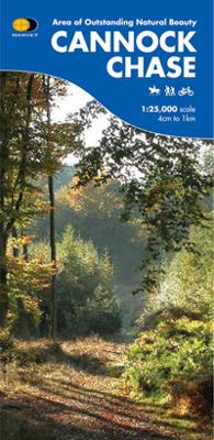
New 1:25,000 scale map of this popular area in the West Midlands. Ideal for walking, mountain biking and other outdoor activities. Made with support from the Cannock Chase Area of Outstanding Natural Beauty Sustainable Development Fund in cooperation with the National Navigation Award Scheme in memory of its founder, Peter Palmer. The map is detai...

Verkopers met dit product

Verkoper
Bezorging
Prijs
DeZwerver.nl logo
DeZwerver.nl
niet bekend
2,95
14,95

Anderen bekeken ook

Wandelkaart Cannock Chase | Harvey Maps
New 1:25,000 scale map of this popular area in the West Midlands. Ideal for walking, mountain biking and other outdoor activities. Made with support from the Cannock Chase Area of Outstanding Natural Beauty Sustainable Development Fund in cooperation with the National Navigation Award Scheme in memory of its founder, Peter Palmer. The map is detailed, and shows paths and tracks and some marked cycle routes; it also includes detailed contours, water features and so forth. Contains information about the area, its wildlife and plants and animals you can see there. Printed on waterproof paper and supplied in a plastic pocket.
14,95
Wandelkaart - Topografische kaart 244 OS Explorer Map Cannock Chase, Chasewater | Ordnance Survey
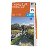
Met zijn 4cm voor 1 km (2 ½ cm voor 1 mijl) schaal, is de OS Explorer kaartenserie de ideale en meest gedetailleerde kaartenreeks voor mensen die graag outdoor-activiteiten zoals fietsen, wandelen, paardrijden, klimmen en watersporten. Deze kaart is nog gedetailleerder dan de 'gewone' Landranger maps. Voor- en achterzijde bedrukt! Zeker op de moors en andere natuurgebieden van onschatbare waarden met echt alle aspecten van het landschap op de kaart ingetekend. Zeer goede detailkaart met topografische ondergrond. Hierop zijn toeristische symbolen van bezienswaardigheden ingetekend, daarnaast staan bijvoorbeeld campings en jeugdherbergen vermeld en - voor wandelaars het belangrijkst - alle right of way paden en Lange afstands Wandelpaden zijn er op te vinden. De ideale kaart voor het wandelen in Engeland, Wales of Schotland.   These highly detailed maps show all the administrative boundaries, settlements as small as isolated farms, the road network down to unfenced roads and country tra…
19,50
Wandelkaart - Topografische kaart 244 OS Explorer Map | Active Cannock Chase / Chasewater | Ordnance Survey
Met zijn 4cm voor 1 km (2 ½ cm voor 1 mijl) schaal, is de OS Explorer kaartenserie de ideale en meest gedetailleerde kaartenreeks voor mensen die graag outdoor-activiteiten zoals fietsen, wandelen, paardrijden, klimmen en watersporten.   Deze kaart is nog gedetailleerder dan de 'gewone' Landranger maps. Voor- en achterzijde bedrukt! Zeker op de moors en andere natuurgebieden van onschatbare waarden met echt alle aspecten van het landschap op de kaart ingetekend. Zeer goede detailkaart met topografische ondergrond. Hierop zijn toeristische symbolen van bezienswaardigheden ingetekend, daarnaast staan bijvoorbeeld campings en jeugdherbergen vermeld en - voor wandelaars het belangrijkst - alle right of way paden en Lange afstands Wandelpaden zijn er op te vinden. De ideale kaart voor het wandelen in Engeland, Wales of Schotland.   These highly detailed maps show all the administrative boundaries, settlements as small as isolated farms, the road network down to unfenced roads and country t…
25,95
Wandelkaart Suilven / Stac Pollaidh / Lochinver | Harvey Maps
Detailed map for runners and walkers of Suilven and the surrounding area at the magic scale of 1:40,000. Covers a large area yet is handily compact. Pocket perfect! This is a fantastic and beautiful area, with Suilven at its centre. The map includes the two Munros of Ben More Assynt and Conival, as well as other famous mountains such as Cul Mor, Cul Beag, Canisp and Stac Pollaidh. Coverage is extended to the north with an inset of Quinag. The map shows 2 Munros, 8 Corbetts and 3 Grahams. Fully detailed genuine HARVEY mapping Use without a map case: tough and 100% waterproof Opens directly to either side of the sheet
20,95
Wandelkaart Dartmoor | Harvey Maps
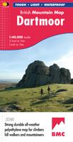
"This inspiring new map will help walkers and climbers explore Dartmoor's wild granite landscapes, and, like the granite, is virtually indestructible." Sir Ranulph Fiennes, adventurer and explorer.   Dartmoor, the latest title in the highly successful and innovative British Mountain Map series, is the only really detailed map for walking to cover this famous area on one sheet. XT40 - A new generation of tough polyethylene maps. These maps are a leap forward in technical excellence. Tough, durable, and 100% waterproof, they are compact - not the great bulky package you get with a laminated map - and light to carry. This all - weather British Mountain Map for climbers, hill - walkers, mountaineers and mountain bikers is published by HARVEY in co-operation with the British Mountaineering Council. The colourful geological map on the back gives understanding of the land form and was specially designed by the British Geological Survey. Colour shading is also used for easy identification of …
29,95
Wandelkaart Arrochar Alps | Harvey Maps
Covers a large area yet is handily compact. Pocket perfect!   Includes Beinn Ime, Ben Vorlich and the Cobbler (Ben Arthur).   Detailed map for hillwalkers of the western part of the Loch Lomond and Trossachs National Park at the magic scale of 1:40,000.   Includes 5 Munros, 10 Corbetts and 13 Grahams.   The Arrochar Alps are a group of mountains located around the head of Loch Long, Loch Fyne, and Loch Goil, near the villages of Arrochar and Lochgoilhead, on the Cowal Peninsula in Argyll and Bute, Scotland. The mountains are especially popular with hillwalkers, due to their proximity and accessibility from Glasgow.   The Ultramap is fully detailed, genuine, original HARVEY mapping. To provide the biggest area on the smallest, lightest sheet, the Ultramap is printed double sided. The ingenious folding pattern allows you to open the Ultramap directly to any part, and either side, of the sheet. The two sides are aligned, so when you reach the edge of the Ultramap sheet you simply flip it…
20,95
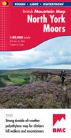
Wandelkaart North York Moors | Harvey Maps
"I’ve enjoyed and endured tough and challenging walks throughout the North York Moors, and this tough, durable, detailed map is the ideal companion and guide." Paddy Dillon, outdoor writer.   Detailed map of the North York Moors on one sheet at 1:40,000 scale.   Includes the popular North Yorkshire Moors Railway and the Lyke Wake Walk.     North York Moors on one sheet: This map covers around 560 square miles of country - the only detailed map to cover this whole area on one sheet. It also includes the popular North Yorkshire Moors Railway and the Lyke Wake Walk. There are also map extensions to Guisborough and east towards Scarborough. Being part of the British Mountain Map series this map is printed on polyethylene - light, durable, tearproof and 100% waterproof. Colour shading is used for easy identification of hills and valleys.
29,95
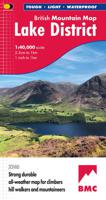
Wandelkaart Lake District | Harvey Maps
"The best Lake District map I have ever seen. The 1:40,000 scale provides clear, detailed information to one of the most popular hill walking areas in Britain." Sir Chris Bonington, mountaineer. A new generation of tough polyethylene maps. These maps are a leap forward in technical excellence. Tough, durable and 100% waterproof they are compact - not the great bulky package you get with a laminated map - and light to carry. This all weather British Mountain Map for climbers, hill wallkers, mountaineers and mountain bikers is published by HARVEY in co-operation with the British Mountaineering Council. The Lake District's famous mountains and fells on a single map, colour shading for easy identification of hills and valleys and detailed crag information for climbers. The reverse side of the map includes detailed 1:20000 enlargements of Scafell, Gable, Bowfell, Langdale Pikes and Pillar, a Geological map of the Lake District, mountain incident and first aid advice.
31,95
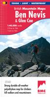
Wandelkaart Ben Nevis & Glen Coe | Harvey Maps
"This excellent Ben Nevis and Glen Coe map provides all the details needed for safe navigation on these iconic mountains". Cameron McNeish, outdoor writer and broadcaster.   Detailed map for hillwalkers and climbers of Ben Nevis and Glen Coe at 1:40,000 scale.   Section on navigation on Ben Nevis and detailed 1:15,000 enlargement of the summit with bad visibility descent route.   The map area includes 44 Munros, 14 Corbetts and 9 Grahams.     Serious map for serious mountains. The latest addition to the British Mountain Map series is a real heavyweight. Ben Nevis/Glencoe is the first Scottish title in this highly successful & innovative range. The map at 1:40000 has 43 Munros & 14 Corbetts on one sheet & is printed on polyethylene which is durable, tearproof & 100% waterproof. There is also colour shading for easy identification of hills and valleys & weighs less than half the weight of a laminated map. The reverse of the map has an enlargement of Ben Nevis summit, a Geological map, n…
29,95

Klanten-reviews van Wandelkaart Cannock Chase | Harvey Maps

Er zijn nog geen beoordelingen voor dit productBen jij de eerste die een review plaatst?

Meer over Wandelkaart Cannock Chase | Harvey Maps

Productomschrijving

New 1:25,000 scale map of this popular area in the West Midlands. Ideal for walking, mountain biking and other outdoor activities. Made with support from the Cannock Chase Area of Outstanding Natural Beauty Sustainable Development Fund in cooperation with the National Navigation Award Scheme in memory of its founder, Peter Palmer. The map is detailed, and shows paths and tracks and some marked cycle routes; it also includes detailed contours, water features and so forth. Contains information about the area, its wildlife and plants and animals you can see there. Printed on waterproof paper and supplied in a plastic pocket.

Productinformatie

    Verken gerelateerde categorieën

    Webshop.nl maakt gebruik van cookies. Ga je verder op onze website, ga dan akkoord met het plaatsen van cookies en de verwerking van deze data door ons en vermelde partners.