Wandelkaart Cairngorms & Lochnagar | Harvey Maps

0
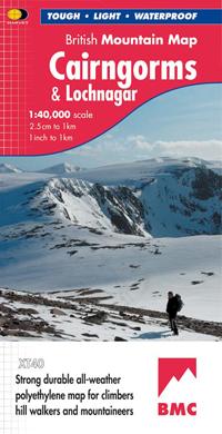
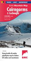
"Inspiring map of much of Scotland's newest National Park with masses of information for walkers, mountain bikers and mountaineers. And it is virtually indestructible." Nigel Williams, Head of Training, Glenmore Lodge.   Spectacular map of the Cairngorms high plateau and surrounding hills at 1:40,000 scale   Extension on reverse to cover Lochnagar...

Verkopers met dit product

Verkoper
Bezorging
Prijs
DeZwerver.nl logo
DeZwerver.nl
niet bekend
2,95
29,95

Anderen bekeken ook

Wandelgids Walking in the Cairngorms | Cicerone
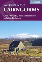
Uitstekende wandelgids, sommige meerdaags, voor dit uitdagende wandelgebied in Schotland. This guidebook contains over 100 routes for walking in the Scottish Cairngorms. It includes 18 Munro summits and smaller viewpoint hills. Walks range in length from 1 to 26 miles and are graded for difficulty.    For the adventurous there are the best of the area's rocky scrambles, and the classic through-routes including the Lairig Ghru. For those looking for a more gentle alternative, there are easy, sandy trails wandering among the tall pines and along the banks of the great rivers Spey, Nethy and Dee.    Britain's biggest mountain range is home to exceptional and varied scenery - from the ancient Caledonian forest to the granite plateau, the glacial glens and high corries where green lochans lie below great crags of the plateau rim.  Along with the main Cairngorm range between Speyside and Deeside, the guidebook covers Lochnagar. It includes practical information on snack stops, public …
20,95
Wandelkaart Discover Cairngorms National Park | Footprint maps
Since it was created in 2003 the Cairngorms National Park has provided the ultimate destination for visitors in the UK wanting to experience a unique mixture of wilderness and cultural heritage. At the heart of the Park are the magnificent Cairngorm Mountains, with five of the UK's highest mountains and some of the most impressive corries, it truly is a walker's paradise.   This double sided map and guide is the perfect companion to take when exploring the Cairngorms National Park. It's packed with information on how to get there, what to see and do - and where to go, once you're there.
12,95
Wandelkaart Knoydart / Kintail & Glen Affric | Harvey Maps
"Clarity is the hallmark of this map. It covers magnificently honed peaks set above western seas and lochs, inviting exploration of one of Scotland's superlative and remote mountain regions", the late Irvine Butterfield, author of The High Mountains.   Detailed map of ‘Britain's last wilderness’ at 1:40,000 scale.   Includes Kintail and Glen Affric.   Detailed crag information for climbers.   Includes 43 Munros, 21 Corbetts and 7 Grahams.   Knoydart & Kintail, seventh in this highly successful & innovative British Mountain Map series, is a long awaited title. It is the only detailed map to cover this famous wilderness area on one sheet. This all weather map for climbers, hillwalkers, mountaineers & mountain bikers includes 43 Munros & 21 Corbetts. It is printed on polyethylene which is durable, tearproof & 100% waterproof. Colour shading is used for easy identification of hills & valleys & the map weighs less than half the weight of a laminated map. There is also an extension covering…
29,95
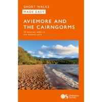
Wandelgids Aviemore and the Cairngorms | Ordnance Survey
Get outside in the Cairngorms, Britain’s largest national park, with ten tried-and-tested accessible walks along the Spey Valley. Discover ancient Caledonian woodland, beautiful lochs and sparkling rivers against a backdrop of snow-capped mountains, waiting for the whole family to enjoy.   Aviemore and the Cairngorms Short Walks Made Easy include:   - Explore Loch Garten and Loch Mallachie, an RSPB Reserve and a haven for ospreys, and pine woodland filled with rare wildlife - Follow the line of the Strathspey Railway and see steam trains chugging past from Aviemore to the ‘osprey village’ of Boat of Garten - Go for a woodland ramble through Glenmore Forest Park to glacial Loch Morlich, where you can stroll the red sands of the highest beach in Britain - Wander the enchanted shores of Loch an Eileen, where a ruined castle stands on the loch’s one island - Stroll through wildflower-rich meadows on the banks of the Calder and the Spey as you circle Newtonmore - See the iconic Old Packhor…
10,-
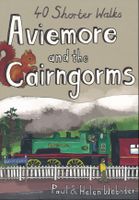
Wandelgids Aviemore and the Cairngorms | Pocket Mountains
Handige compacte wandelgids met 40 dagwandelingen. Deze gids bevat kleine kaartjes en leuke uitgebreide informatie over wat er langs de route te zien is. Goede wandelkaarten zijn echter we noodzakelijk voor deze tochten: de Ordnance Survey explorer maps of Landanger maps zijn zeer geschikt. 'Aviemore and the Cairngorms' features 40 shorter walks, including many perfect for families, stretching from the ancient region of Badenoch and the uppermost reaches of the Spey Valley, through the outdoor hub of Aviemore to Grantown and Tomintoul, then over Ballater and Royal Deeside to Braemar. Plaatsen in het boekje Abernethy Forest, An Lochan Uaine, Anagach Woods, Aviemore, Badenoch Way, Ballater, Balmoral Estate, Balnagowan Wood, Black Wood, Boat of Garten, Braemar, Bridge of Brown, Burn o’Vat, Cairngorm Club Bridge, Cairngorm Ski Centre, Calder Bridge, Carn Daimh, Carrbridge, Castle Roy, Coire an t-Sneachda, Colonel’s Bed, Coylumbridge, Craigellachie Woods, Craigendarroch, Craigmore Wood, Cr…
10,95
Wandelkaart Schiehallion / Ben Lawers & Glen Lyon | Harvey Maps
"I've spent most of my climbing career searching for new crags and bouldering areas and until Harvey Maps came along it was a process of trial and error. Their attention to detail is unmatched and they have led me successfully to all sorts of new adventures." Kevin Howett, Development Officer for the Mountaineering Council of Scotland and Author of 'Rock Climbing in Scotland' and SMC's 'Highland Outcrops' Guide.   Detailed map of 42 challenging Perthshire hills on one sheet at 1:40,000 scale.   Map extension covers Ben Chonzie.   Includes 27 Munros, 15 Corbetts and 4 Grahams   Schiehallion, Ben Lawers & Glen Lyon is the current new publication in this highly successful and innovative British Mountain Map Series. There are over 42 challenging Perthshire hills on this one sheet including 27 Munros and 15 Corbetts. Climbing Crags are highlighted & named. Climbing Crag route diagrams are also shown. Again this map is printed on polyethylene which is durable, tearproof & 100% waterproof. T…
29,95
Wandelkaart Torridon & Fisherfield | Harvey Maps
"HARVEY British Mountain Maps are a joy to use. The detail and accuracy make them my first choice when I am researching a route or just out on the hills for fun". Peter Macfarlane, outdoor writer and photographer.   Detailed map of the giants of Torridon and the remote hills of Fisherfield on one sheet at 1:40,000 scale.   Summit enlargements of Beinn Alligin, Beinn Eighe, Liathach and An Teallach.   Includes 18 Munros, 12 Corbetts and 9 Grahams.     The giants of Torridon and the remote hills of Fisherfields on one sheet. The map area includes 18 Munros and 12 Corbetts. There are also 1:15000 enlargements of An Teallach, Beinn Alligin, Beinn Eighe and Liathach on the reverse. Climbing crags are highlighted and climbing crag route diagrams are also included. Harvey British Mountain maps are a joy to use. The detail and accuracy make them my first choice when I am researching a route or out on the hills.
29,95

Klanten-reviews van Wandelkaart Cairngorms & Lochnagar | Harvey Maps

Er zijn nog geen beoordelingen voor dit productBen jij de eerste die een review plaatst?

Meer over Wandelkaart Cairngorms & Lochnagar | Harvey Maps

Productomschrijving

"Inspiring map of much of Scotland's newest National Park with masses of information for walkers, mountain bikers and mountaineers. And it is virtually indestructible." Nigel Williams, Head of Training, Glenmore Lodge.   Spectacular map of the Cairngorms high plateau and surrounding hills at 1:40,000 scale   Extension on reverse to cover Lochnagar and Glen Shee.   Climbing crag diagrams.   Includes 39 Munros, 13 Corbetts and 2 Grahams.

Productinformatie

    Verken gerelateerde categorieën

    Webshop.nl maakt gebruik van cookies. Ga je verder op onze website, ga dan akkoord met het plaatsen van cookies en de verwerking van deze data door ons en vermelde partners.