webshop.nl
Categorieën
  Sluiten

Meer Harvey Maps
Meer Harvey Maps in Reisgidsen & talen boeken

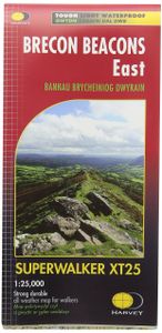
Wandelkaart Brecon Beacons Oost | Harvey Maps

0
Includes Pen y Fan and the Black Mountains.   Detailed map for hillwalkers of the western part of the Brecon Beacons National Park at the popular scale of 1:25,000.   NEW Superwalker XT25 of the Brecon Beacons. The Brecon Beacons National Park on 2 sheets. Revised and re-designed. Brecon Beacons EAST - The area covered on this sheet includes Pen y...

Webshops met dit product

Webshop
Bezorging
Prijs

Anderen bekeken ook

Wandelkaart Brecon Beacons Oost | Harvey Maps
Includes Pen y Fan and the Black Mountains.   Detailed map for hillwalkers of the western part of the Brecon Beacons National Park at the popular scale of 1:25,000.   NEW Superwalker XT25 of the Brecon Beacons. The Brecon Beacons National Park on 2 sheets. Revised and re-designed. Brecon Beacons EAST - The area covered on this sheet includes Pen y Fan and the Black Mountains. They have got everything. Genuine original HARVEY mapping at 1:25,000. Ideal for walking. Clear, easy to read. Easy to re-fold. Opens directly to either side of the sheet. Slim and flexible, light to carry, tearproof, durable AND, 100% waterproof as standard.
24,95
Wandelkaart Brecon Beacons West | Harvey Maps
Includes Pen y Fan, Foel Fraith, Fan Fawr and Fan Gyhirych.   Detailed map for hillwalkers of the western part of the Brecon Beacons National Park at the popular scale of 1:25,000.   New, Superwalker XT25 of the Brecon Beacons National Park on 2 sheets. Brecon Beacons WEST - This map covers Pen y Fan, Fforest Fawr and, the Black Mountain in the far west. Brecon Beacons National Park boasts a magnificent array of Old Red Sandstone peaks, open moorland and green valleys covering 500 square miles (1344 Square km) of beautiful mid-Wales countryside. Revised and re-designed they have got everything. Genuine original HARVEY mapping at 1:25,000. Ideal for walking. Clear, easy to read. Easy to re-fold, Opens directly to either side of the sheet. Slim and flexible. Light to carry. Tearproof, durable, AND - 100% waterproof as standard.
24,95
Wandelkaart Brecon Beacons West | Harvey Maps
Includes Pen y Fan, Foel Fraith, Fan Fawr and Fan Gyhirych.   Detailed map for hillwalkers of the western part of the Brecon Beacons National Park at the popular scale of 1:25,000.   New, Superwalker XT25 of the Brecon Beacons National Park on 2 sheets. Brecon Beacons WEST - This map covers Pen y Fan, Fforest Fawr and, the Black Mountain in the far west. Brecon Beacons National Park boasts a magnificent array of Old Red Sandstone peaks, open moorland and green valleys covering 500 square miles (1344 Square km) of beautiful mid-Wales countryside. Revised and re-designed they have got everything. Genuine original HARVEY mapping at 1:25,000. Ideal for walking. Clear, easy to read. Easy to re-fold, Opens directly to either side of the sheet. Slim and flexible. Light to carry. Tearproof, durable, AND - 100% waterproof as standard.
24,95
Wandelkaart Brecon Beacons | Harvey Maps
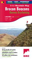
"The Brecon Beacons have an irresistible draw and this is where I began my journey to the roof of the world. The breathtaking landscape provides challenges and adventures for all ages and abilities and this expertly designed map is the key to exploring it." Tori James, the first Welsh woman to climb Mount Everest Brecon Beacons - the latest edition to the popular British Mountain Map series. It covers 350 square mile of country - the only really detailed map to cover this whole area on one sheet. These maps are a leap forward in technical excellence. Tough, durable, and 100% waterproof, they are compact - not the great bulky package you get with a laminated map - and they are light to carry. This all weather British Mountain Map for climbers, hill walkers and mountaineers is published by HARVEY in co-operation with the British Mountaineering Council.
29,95
Wandelgids Brecon Beacons | Northern Eye Books
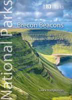
This good looking, modern walking book will take you on ten short circular themed walks across South Wales’ ever-popular Brecon Beacons National Park.   The Brecon Beacons was Britain’s 10th National Park, established in 1957 to preserve and highlight the unique landscape of the area. The Brecon Beacons are said to be named after the historical practice of lighting beacons of fire upon hilltops to forewarn neighbouring valleys of invasion.    The Brecon Beacons cover 1,344 square kilometres / 519 square miles with it’s spectacular waterfalls, valleys and expanse of hilly terrain; the Black Mountain to the west, the Fforest Fawr Geopark, Waterfall Country and the Pen y Fan range at the centre, and The Black Mountains to the east.   The variety of flora and fauna is as vast as the landscape. Rare sub-arctic, alpine plants thrive within this unique climate. Mammals you’re likely to spot include include wild mountain ponies, horseshoe bats, otters and water voles. Often seen birds of prey …
10,95
Wandelgids Walking on the Brecon Beacons | Cicerone
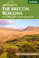
Uitstekende wandelgids van dit geweldige gebied. goed beschreven met veel praktische informatie om de route te kunnen lopen, inclusief redelijke kaarten. Guidebook to 45 graded circular walks in the Brecon Beacons National Park, perfect for those wishing to discover the diversity of the region, away from the crowds. The routes range from 4 to 24km and cover the north-eastern, eastern and south-western valleys and ridges, Fforest Fawr, Waterfall Country, the Black Mountain (Mynydd Du) and the Black Mountains (y Mynyddoedd Duon). Designed to include all the interesting facts an expert park ranger would provide, the guide contains a wealth of information about local geology, botany, archaeology, history, mythology, industrial heritage and environmental issues.   Clear route description is illustrated with 1:50,000 OS Landranger mapping, summary statistics are provided for each walk and handy tables make it easy to compare routes or choose according to points of interest.   A remarkably va…
20,95

Klanten-reviews van Wandelkaart Brecon Beacons Oost | Harvey Maps

Er zijn nog geen beoordelingen voor dit productBen jij de eerste die een review plaatst?

Meer over Wandelkaart Brecon Beacons Oost | Harvey Maps

Productomschrijving

Includes Pen y Fan and the Black Mountains.   Detailed map for hillwalkers of the western part of the Brecon Beacons National Park at the popular scale of 1:25,000.   NEW Superwalker XT25 of the Brecon Beacons. The Brecon Beacons National Park on 2 sheets. Revised and re-designed. Brecon Beacons EAST - The area covered on this sheet includes Pen y Fan and the Black Mountains. They have got everything. Genuine original HARVEY mapping at 1:25,000. Ideal for walking. Clear, easy to read. Easy to re-fold. Opens directly to either side of the sheet. Slim and flexible, light to carry, tearproof, durable AND, 100% waterproof as standard.

Productspecificaties

Artikelnummer(s)
Brand
Harvey Maps

Verken gerelateerde categorieën

Webshop.nl maakt gebruik van cookies. Ga je verder op onze website, ga dan akkoord met het plaatsen van cookies en de verwerking van deze data door ons en vermelde partners.